
Wildlife photography
Blog 318: Life at Laguna
Habitat Tours
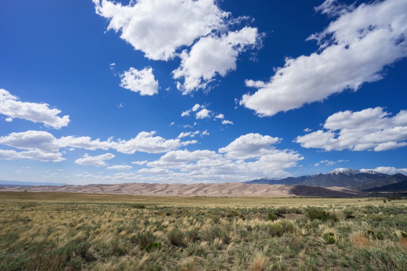
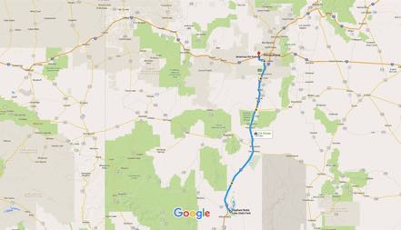
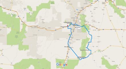
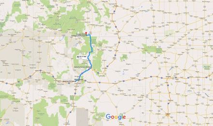
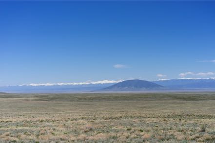
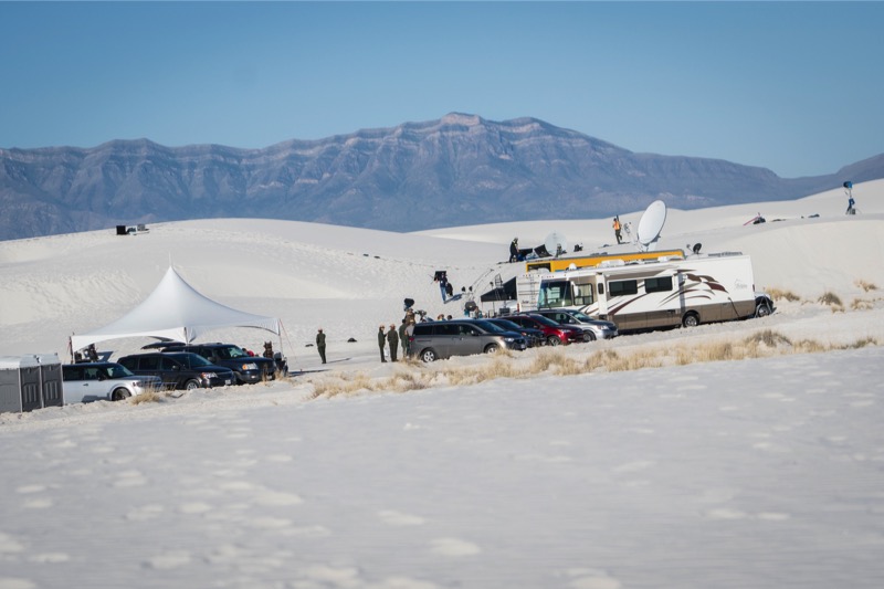
For five months we guided habitat tours at Laguna Atascosa Wildlife Refuge in far southeast Texas, close to Padre Island and an easy hour from Mexico. What a difference a year makes! Last year we volunteered here during a drought with most flora a grayish-brown color and huddled critters hanging close to the few sources of fresh water. This year all plants and trees are different shades of green with a rainbow of colors popping out of flowers like champagne just uncorked.
Questions Galore
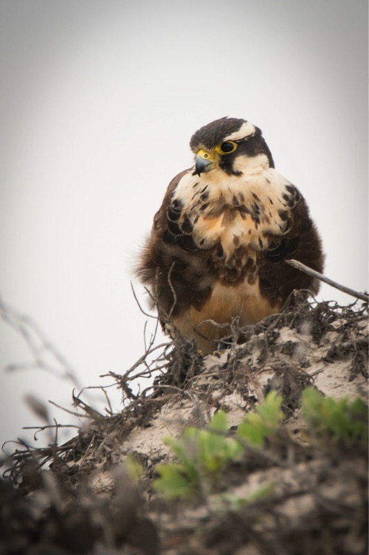
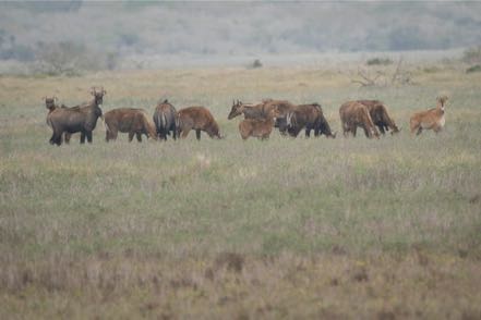
Depending on the day of the week, the time of day, and the phase of the moon, we addressed a variety of questions from guests—from visiting Winter Texans to lifelong Valley residents, students, biologists, geologists, sentimentologists, hydrologists, cardiologists (I just made that last one up) and on and on—science has a broad wingspan. We responded to questions about hydrological influence on bay salinity, wind generators’ impact on bird mortality, gestation periods of feral hogs, the eating habits of exotic nilgai, favorite diets of the Aplomado falcon, and how to best cook yucca blooms.
Different Kind of Place
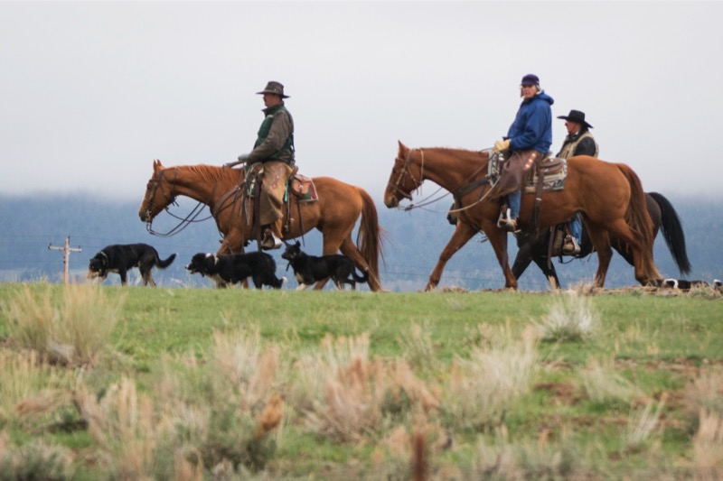
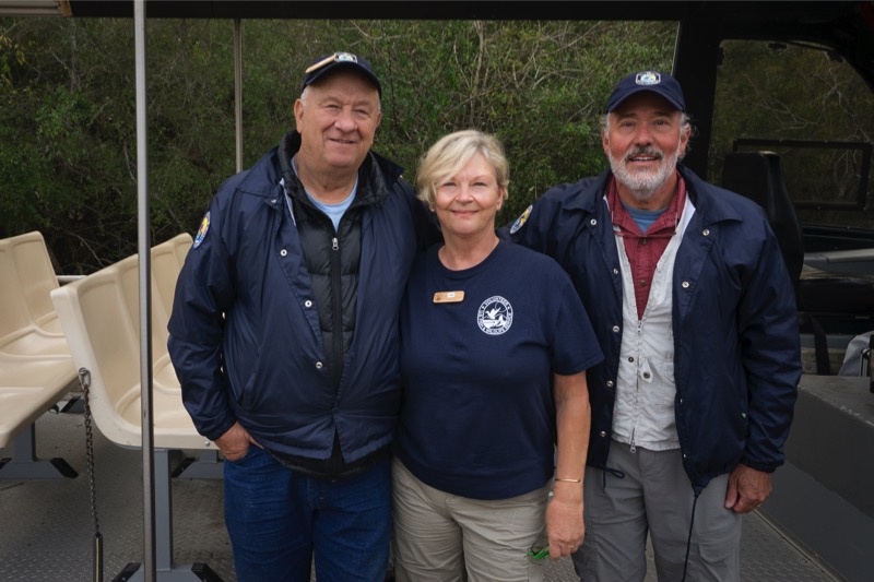
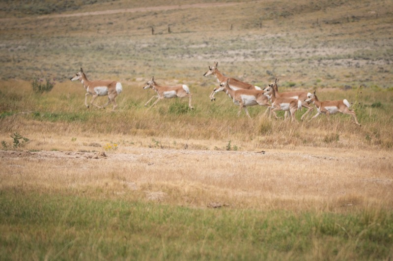
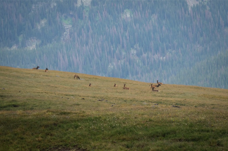
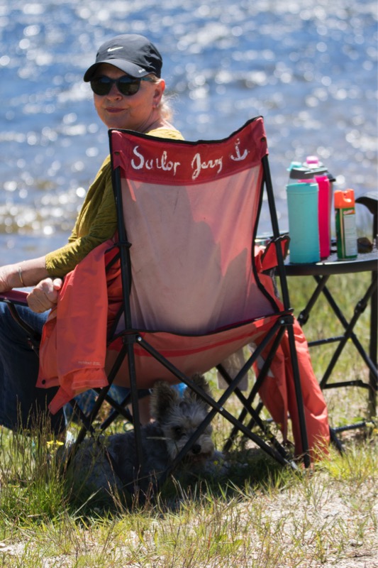
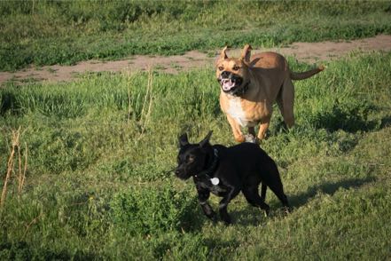
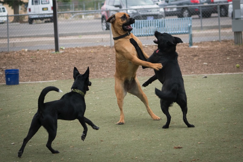
This is a wonderful place for nature lovers, with birds and critters flying, scooting, running, landing, hiding, kiting, loping, crawling, and swimming that you won’t see elsewhere in the US, and in most cases on the planet. We also rekindled friendships from last winter, plus we met lots of good folks on the staff, other volunteers, interns, and Friends of the refuge. A close-knit community with common goals and a shared purpose is tough to beat.
Recommendations
Spend a month (or two or three) at South Padre Island in the winter. Note: Try, try to avoid Spring Break. Spend time at Laguna Atascosa and the other wonderful nature locations in the Lower Rio Grande Valley. Hang at the beach, watch the dolphins, visit Sea Turtle Inc., and enjoy great Mexican (and TexMex) food. On chilly days check out the museums and the historical sites. Go to the birding centers even if you are not a birder. Take a deep dip of nature to cleanse the soul, relax the body, and ease the mind.
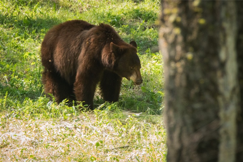
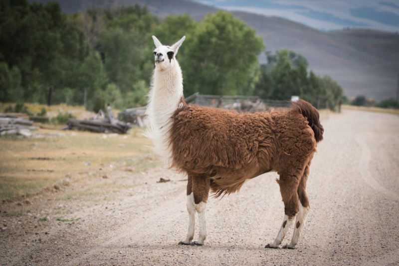
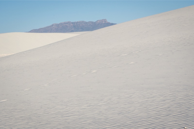
Last Photos from the Refuge
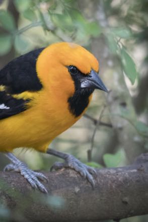
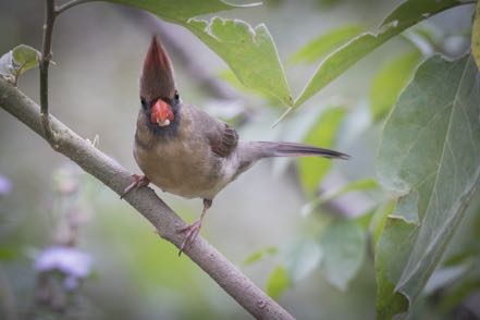
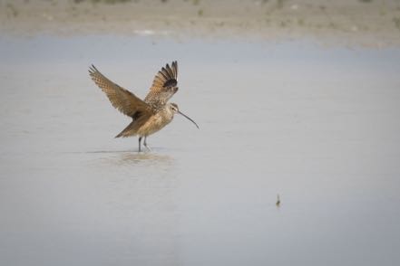
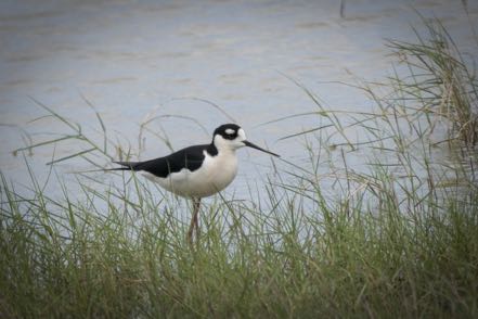
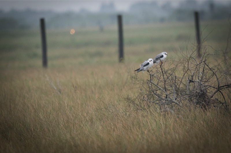
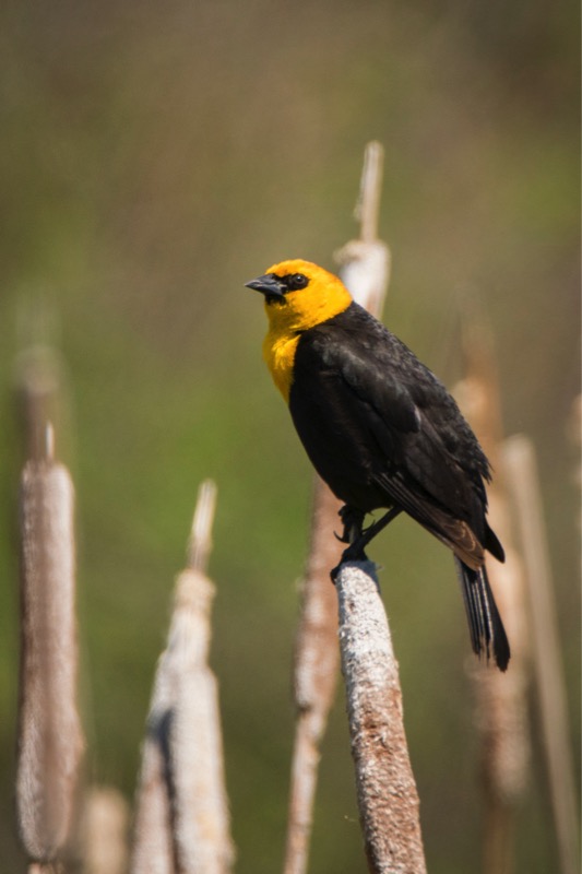
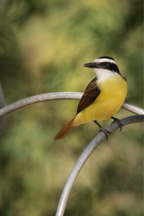
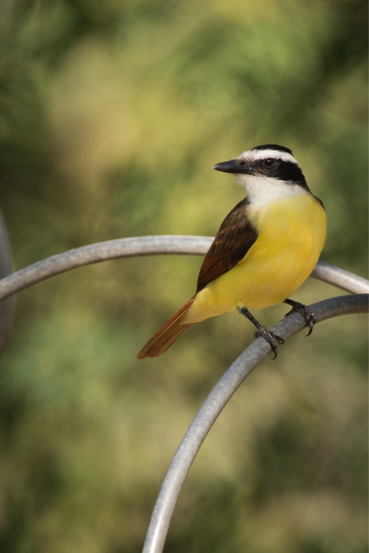
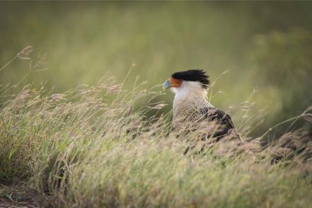
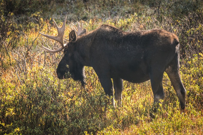
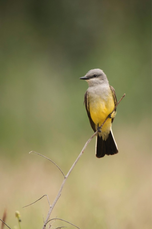
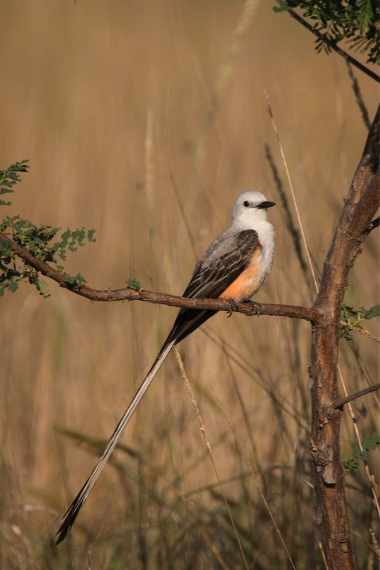
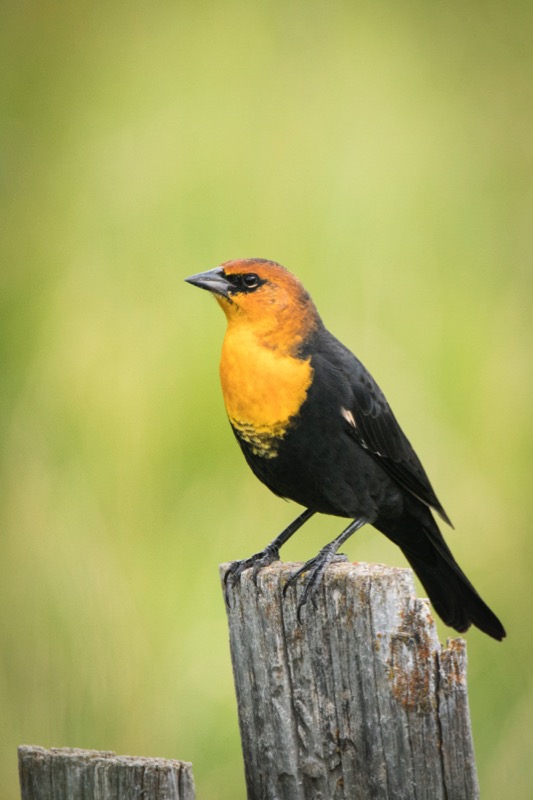
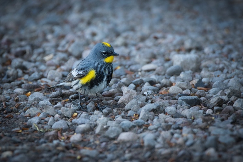
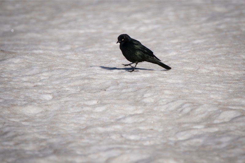
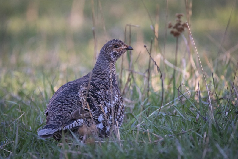
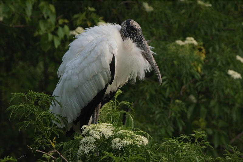
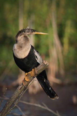
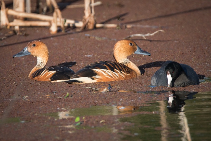
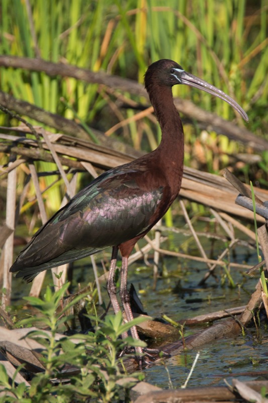
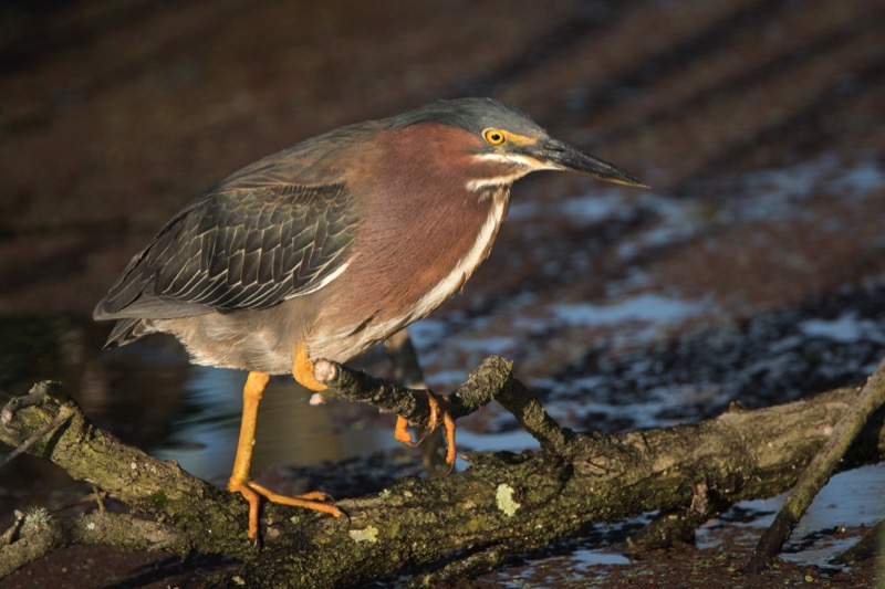
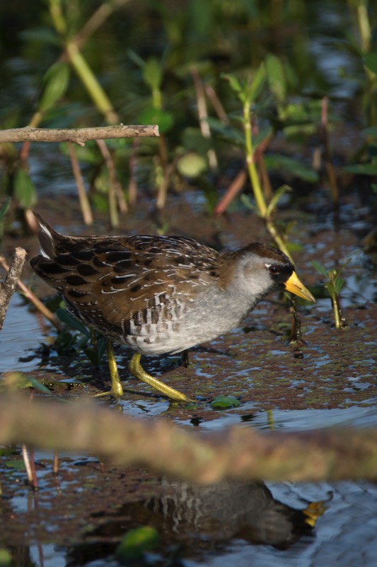
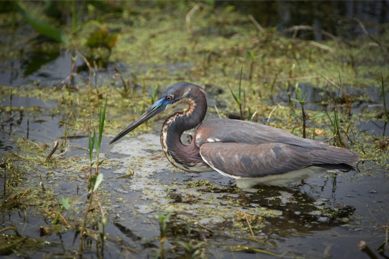
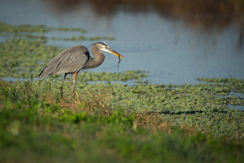
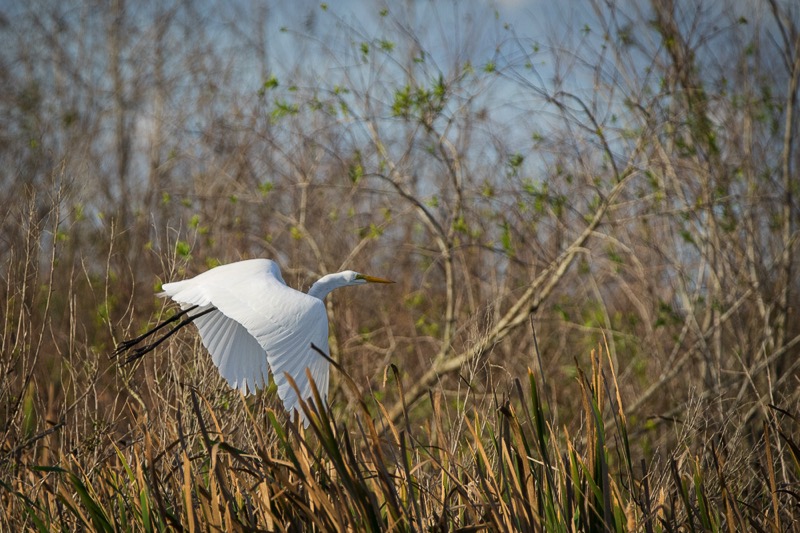
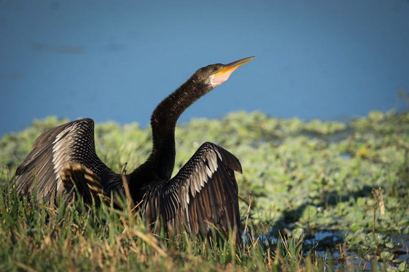
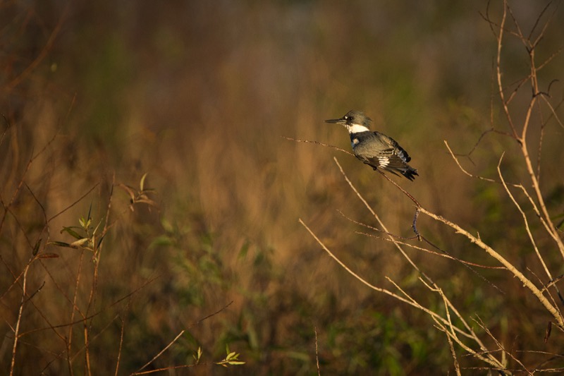
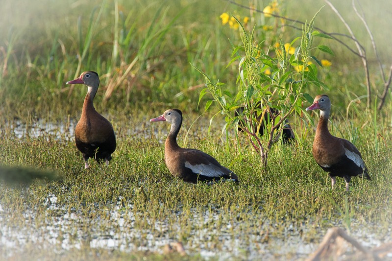
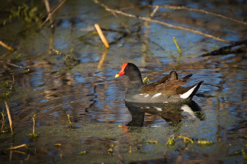
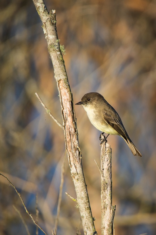
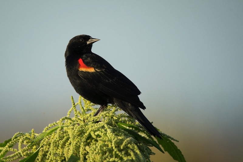
Birds
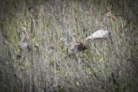
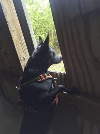
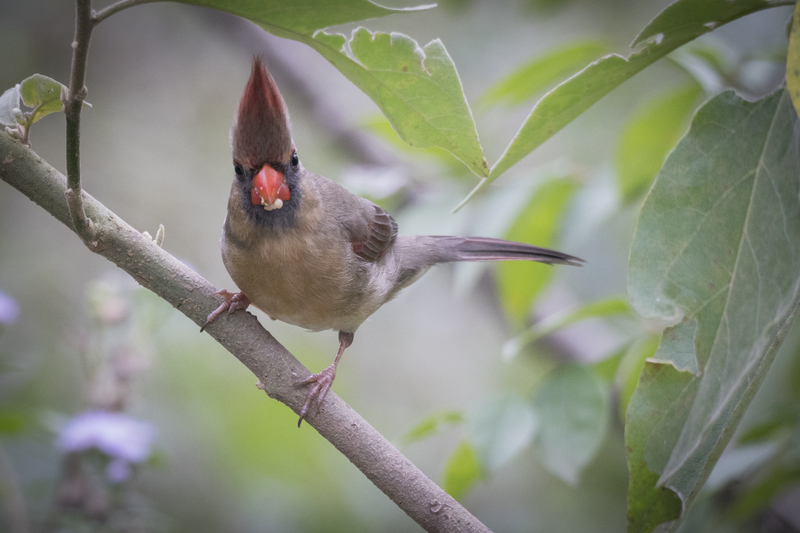
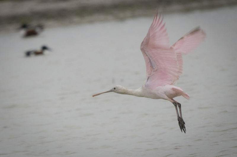
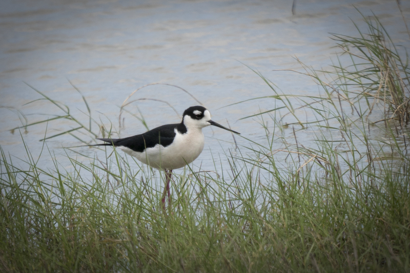
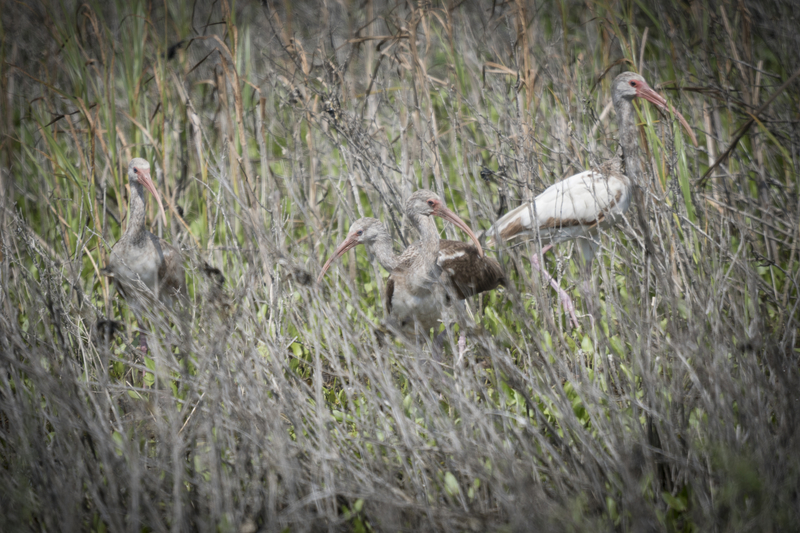
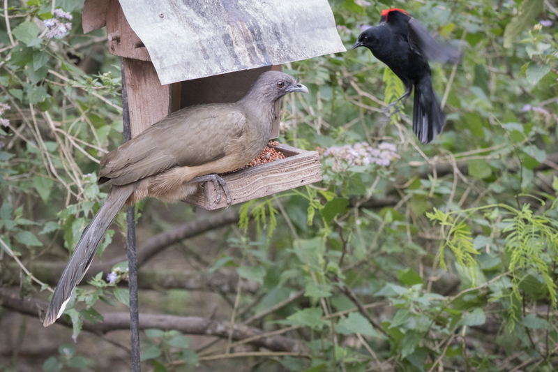
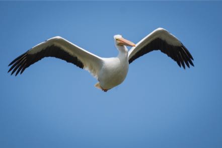
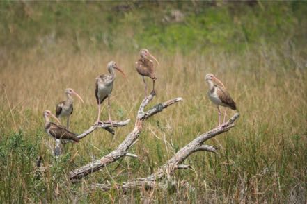
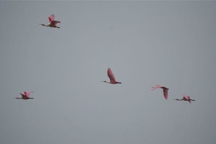
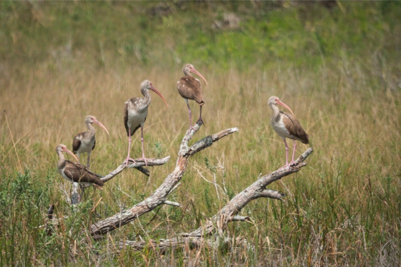
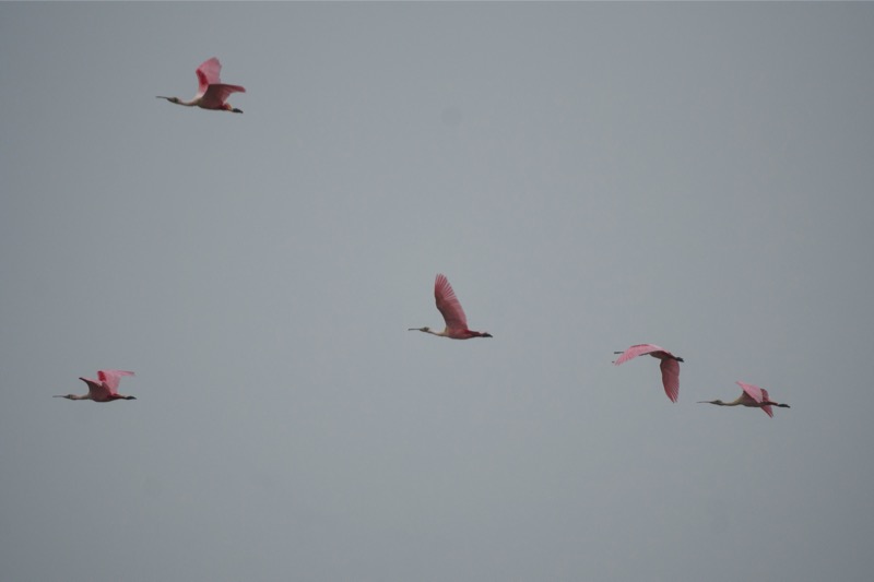
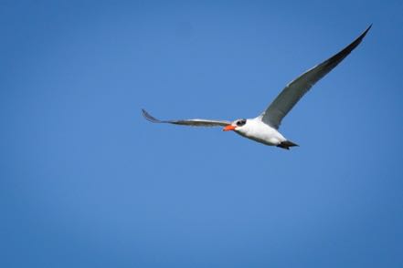
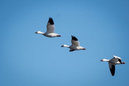
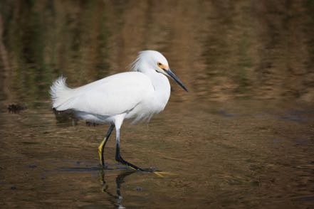
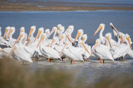
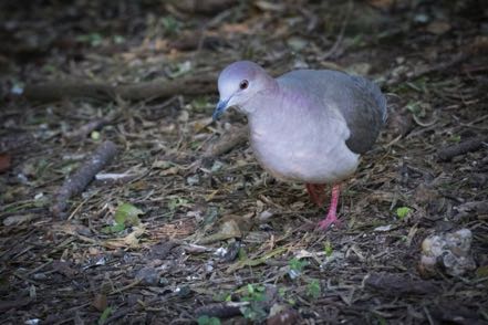
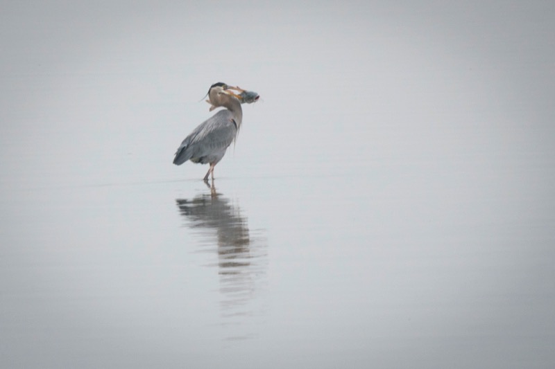
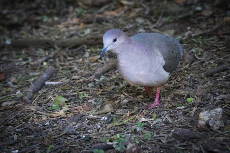
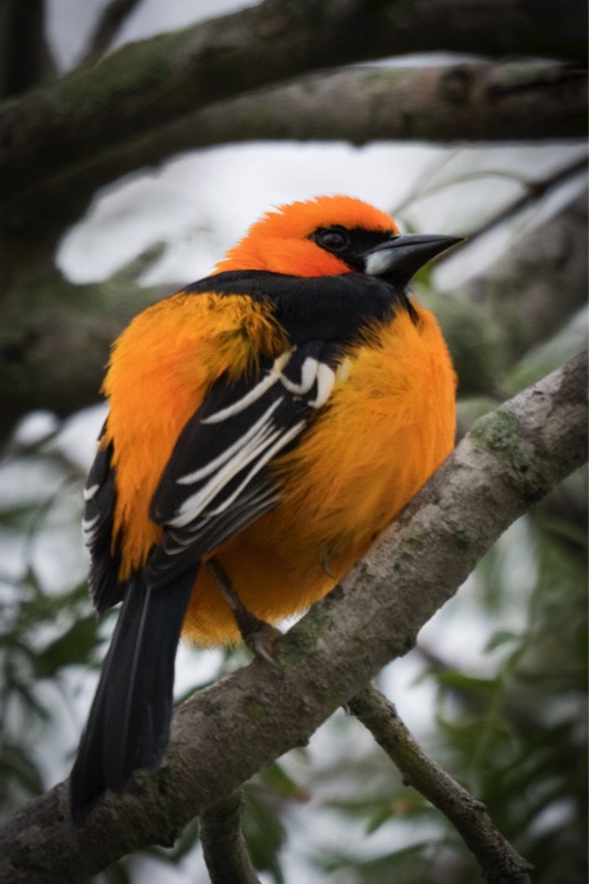
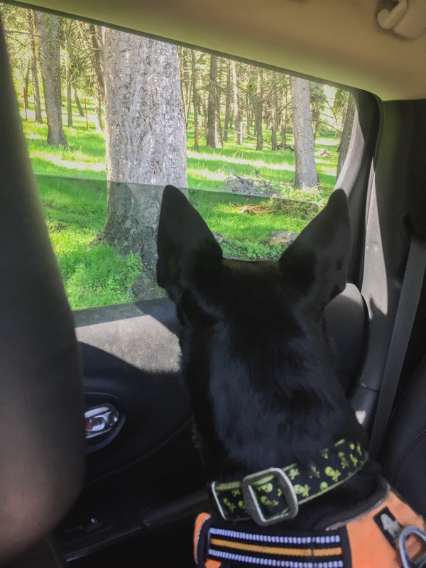
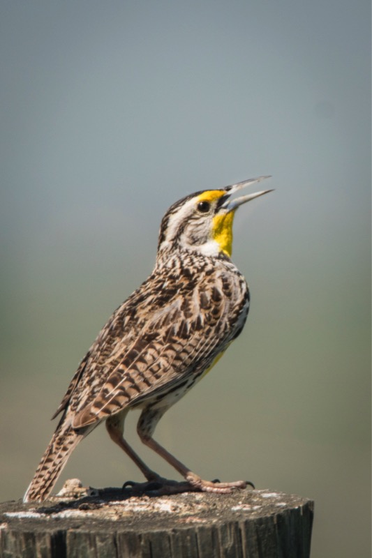
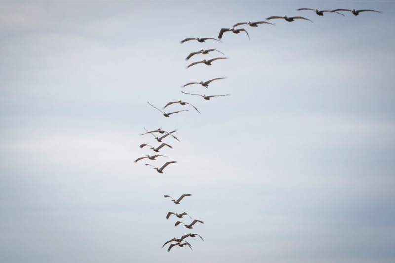
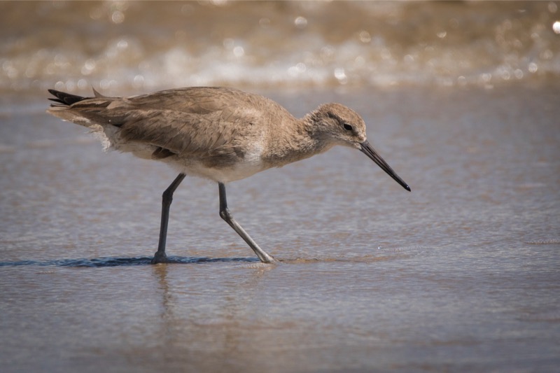
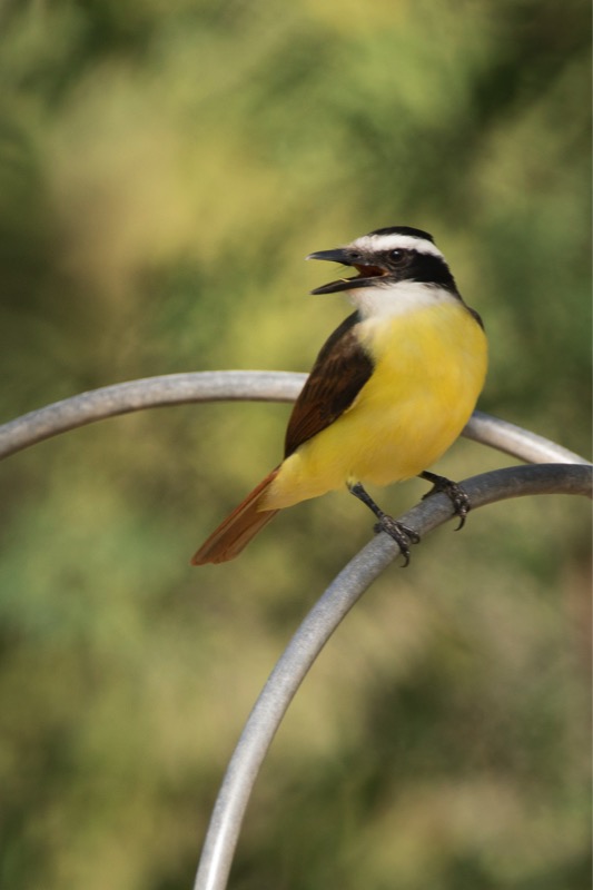
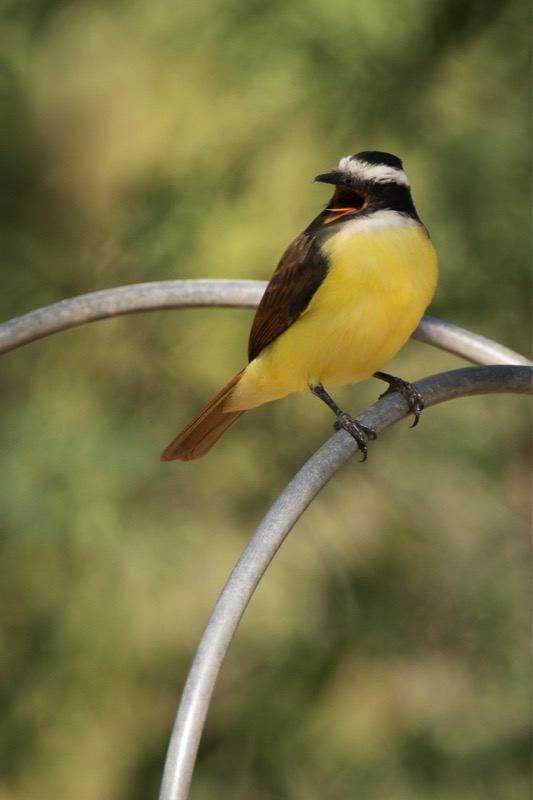
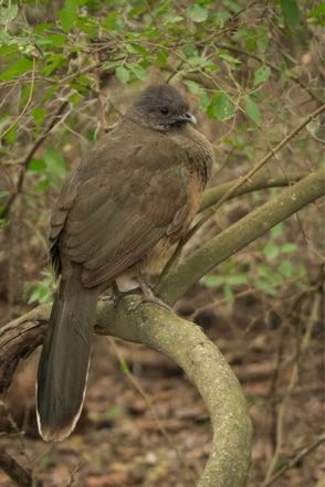
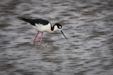
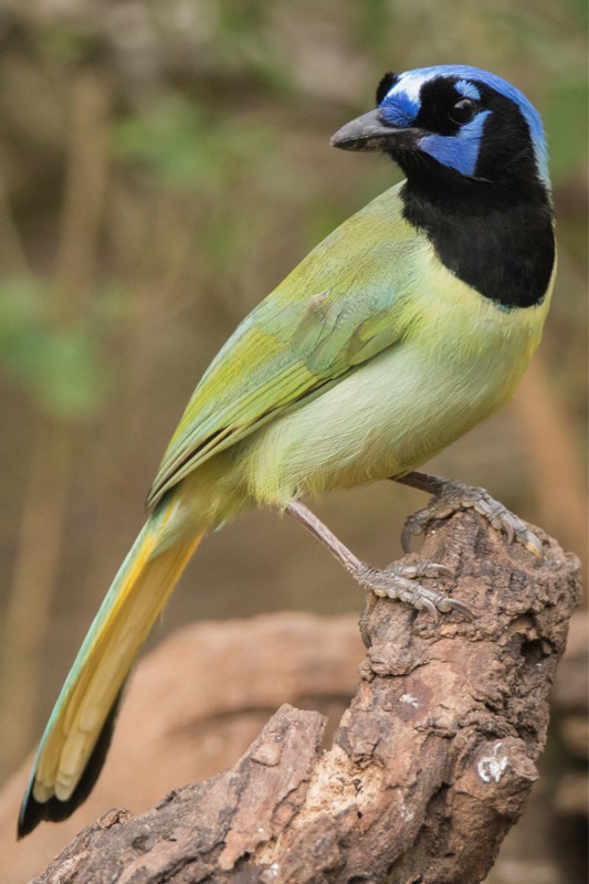
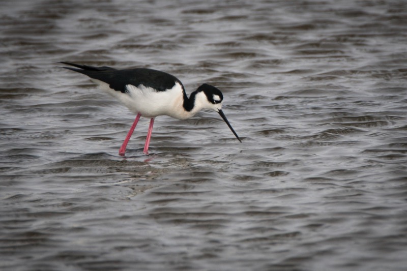
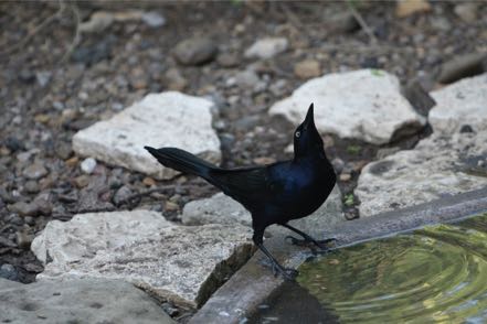
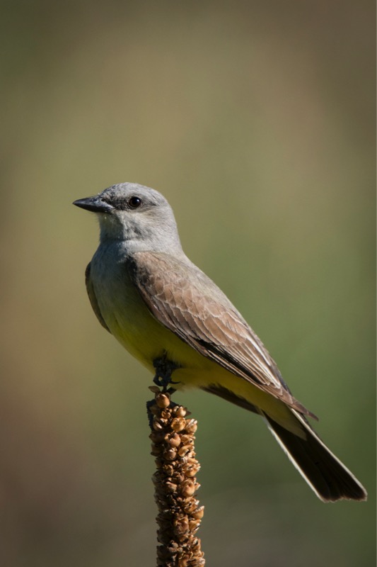
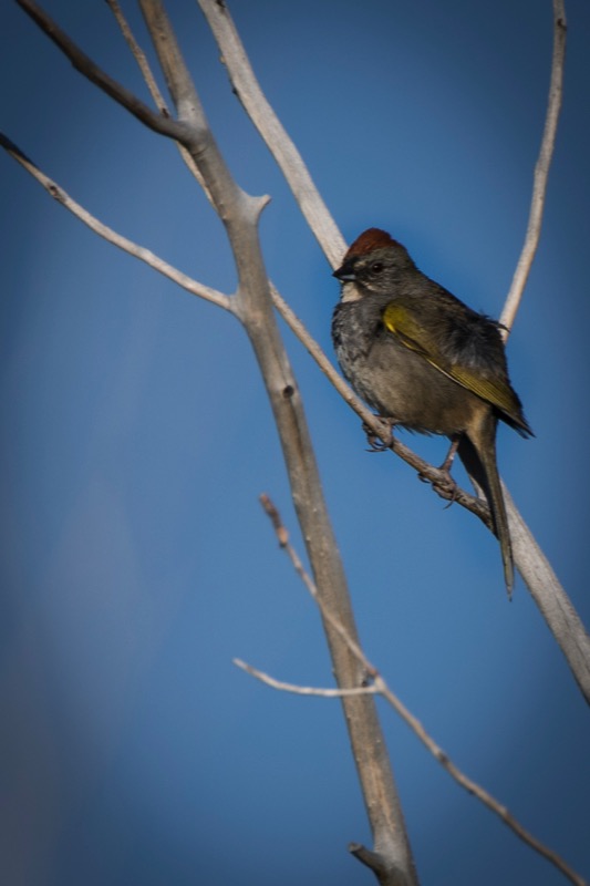
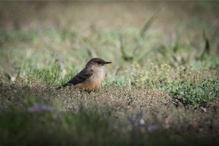
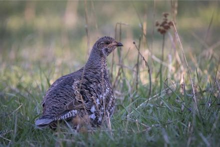
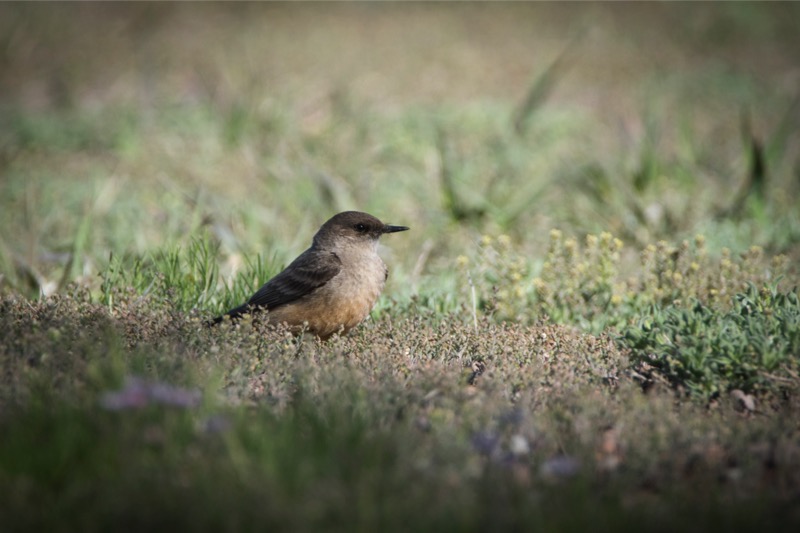
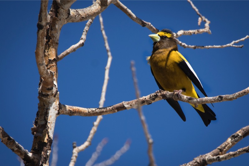
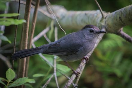
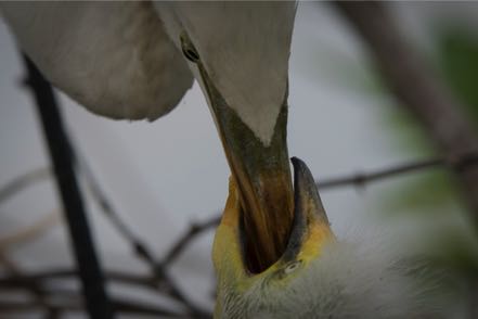
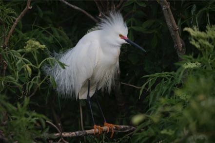
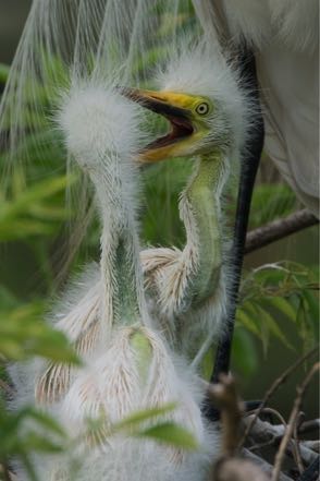
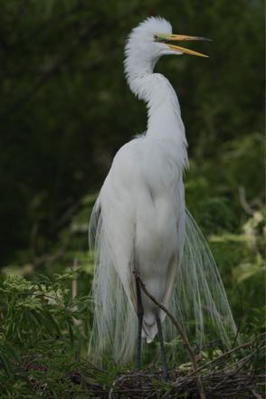
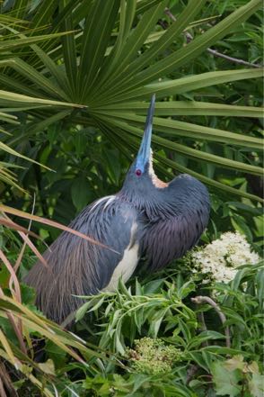
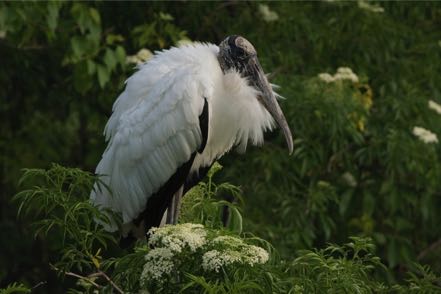
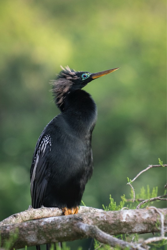
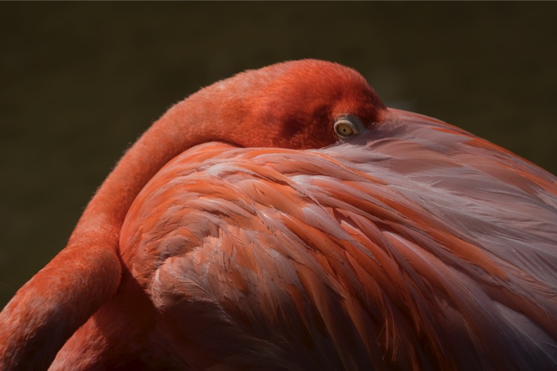
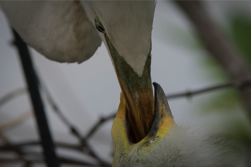
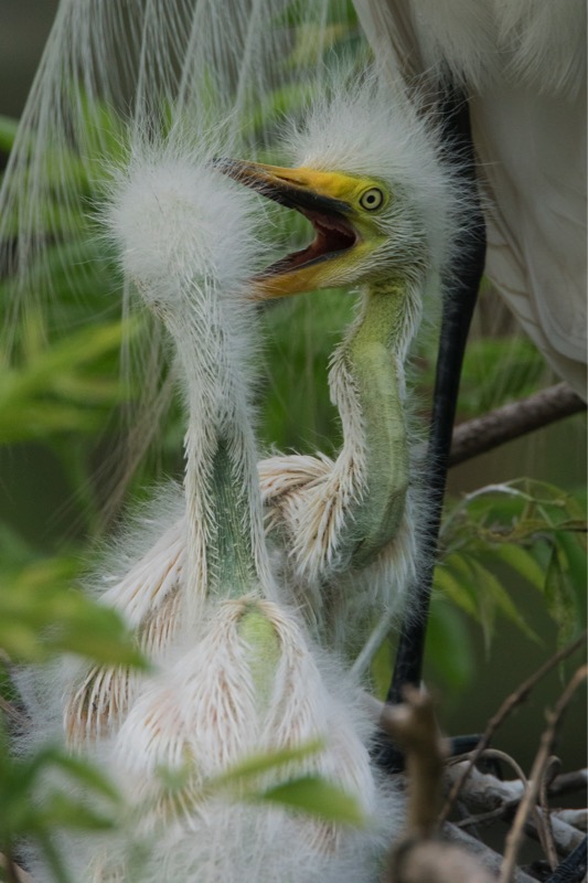
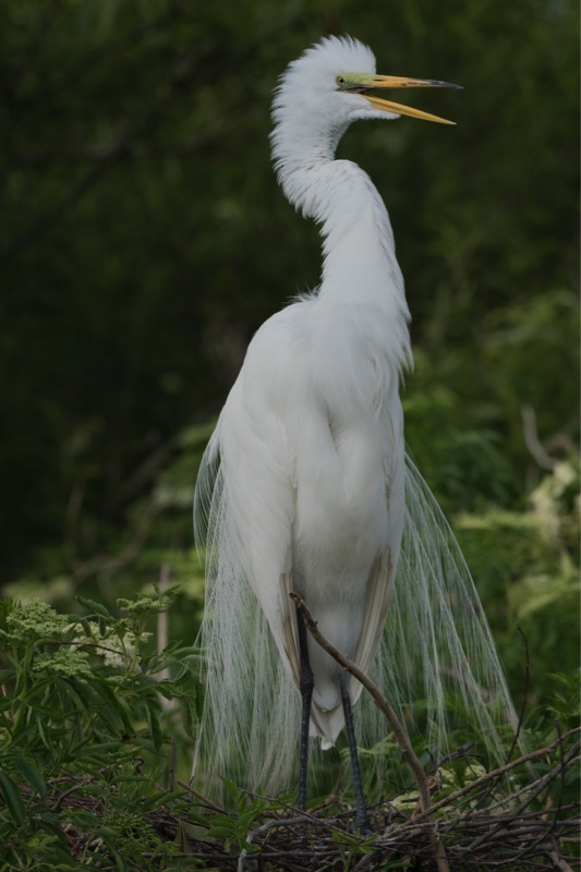
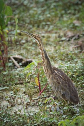
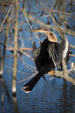
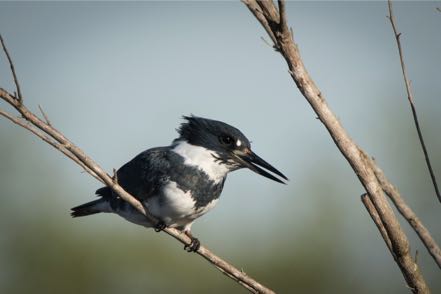
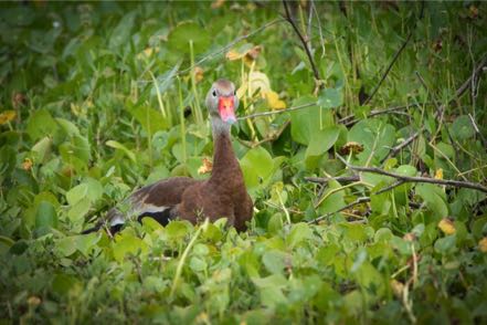
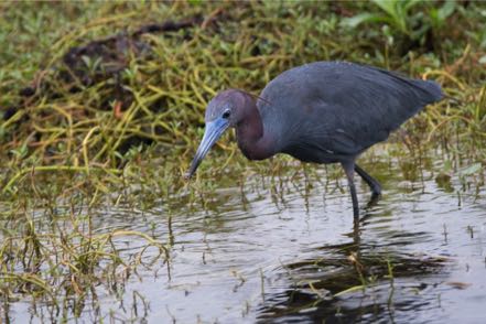
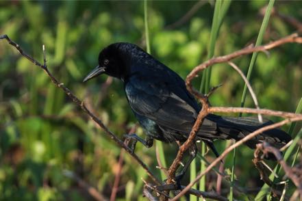
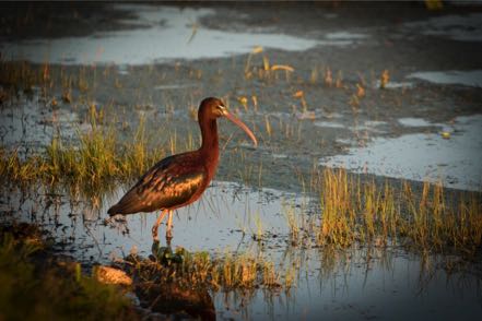
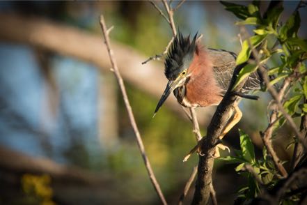
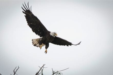
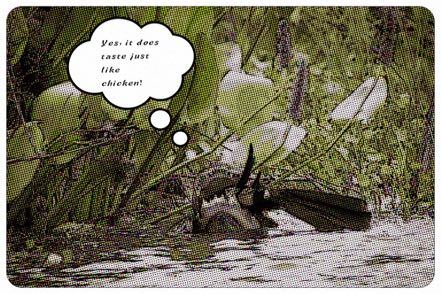
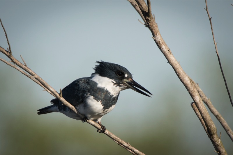
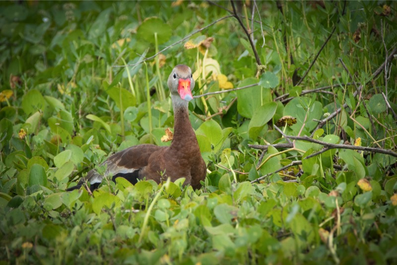
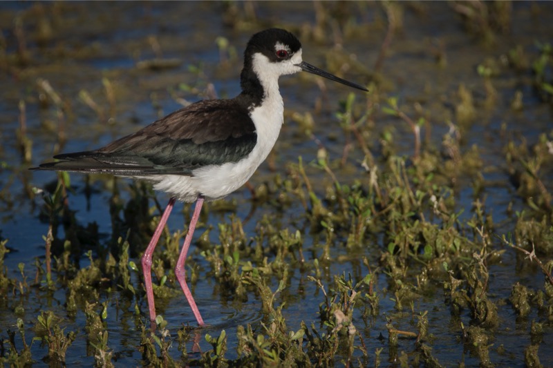
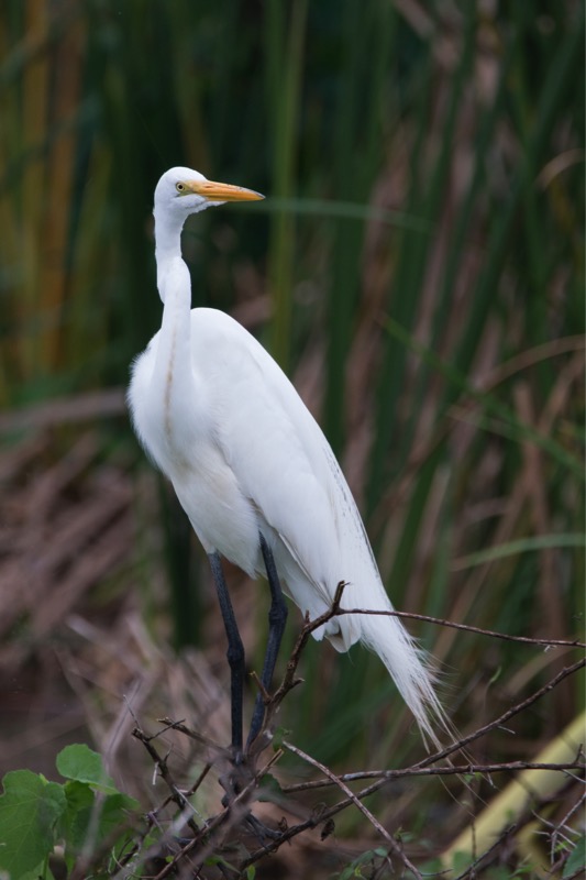
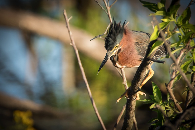
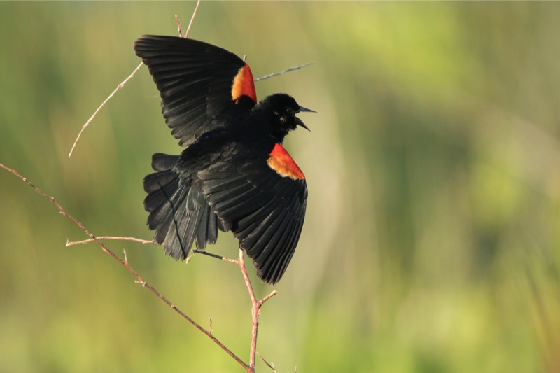
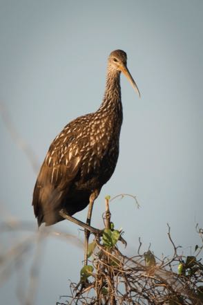
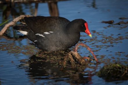
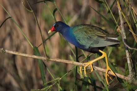
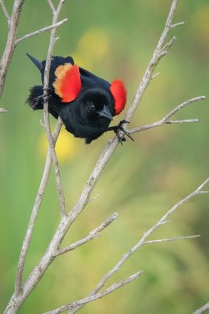
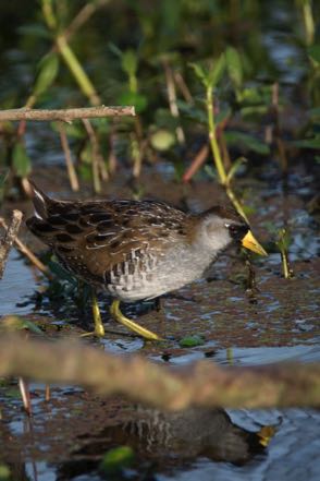
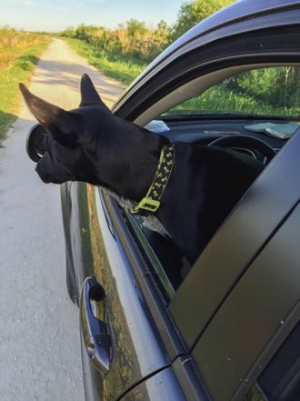
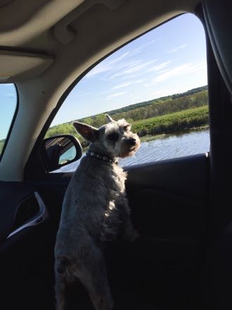
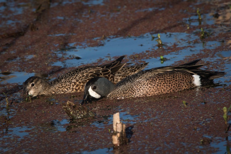
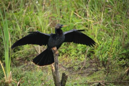
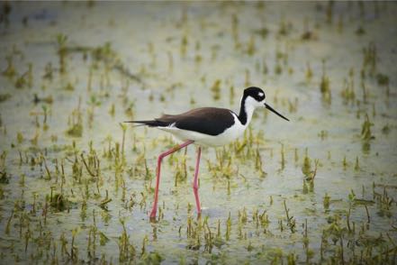
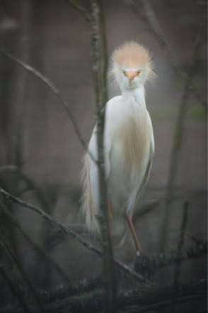
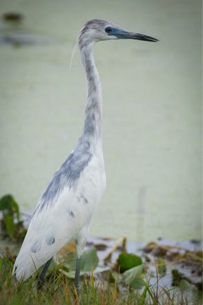
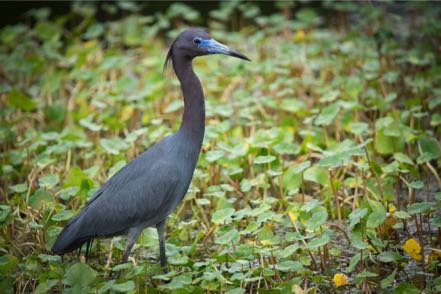
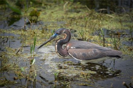
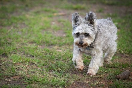
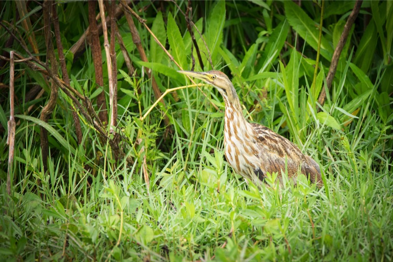
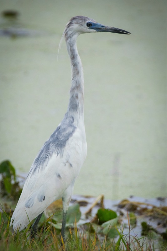
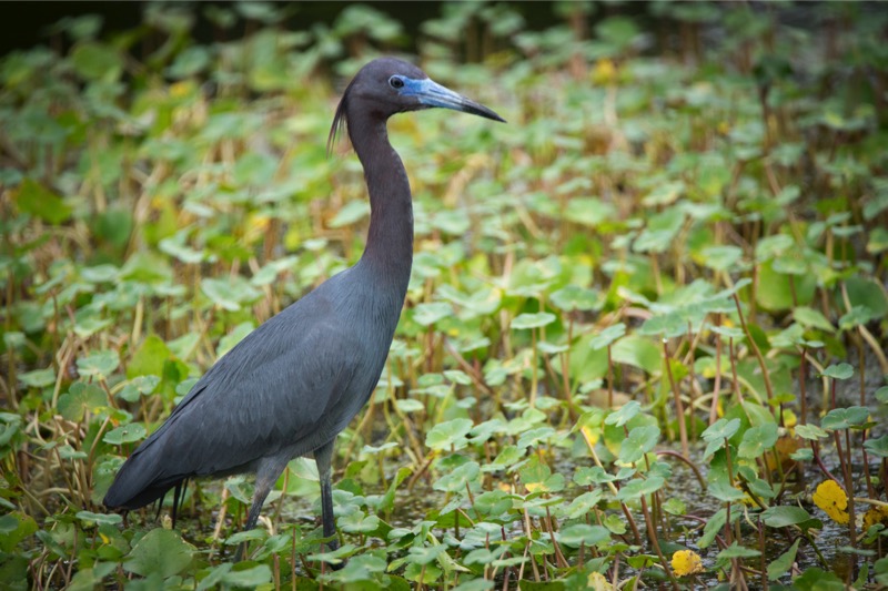
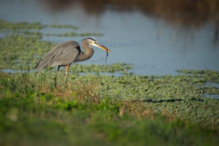
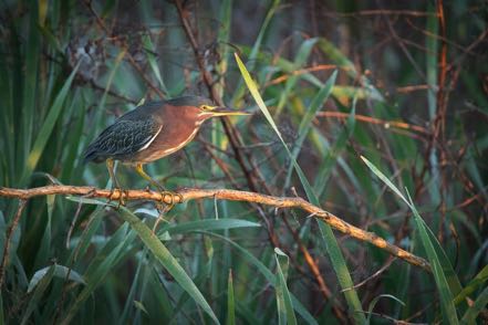
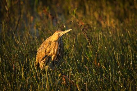
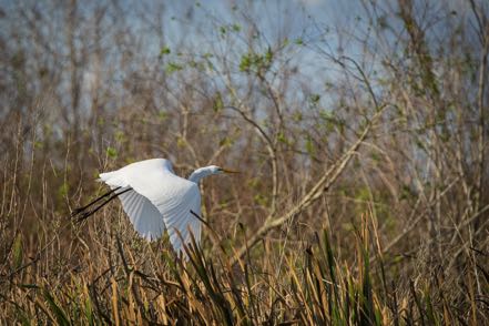
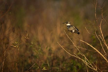
The refuge has a well-earned reputation as a mecca for birders and those who just appreciate the beauty of color in flight and the voices of jubilation. Here is a photo of the stunning Altamira oriole, a female cardinal sparkling in pretty light, a glowing pink roseate spoonbill in flight, the petite but classy stilt, a longed-bill curlew that had just landed (I wonder why they call them “long-billed?”), some immature white Ibis hanging out (as teenagers do), and a chacalaca and a red-winged blackbird eying each other at a feeder adjoining the photo blind. Not all bird lovers have just two legs—here is Jack checking the birds out (he prefers watching rabbits, but birds will do).


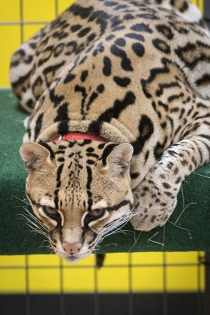
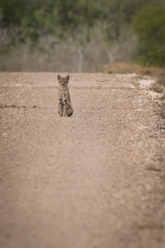
Ocelot Day
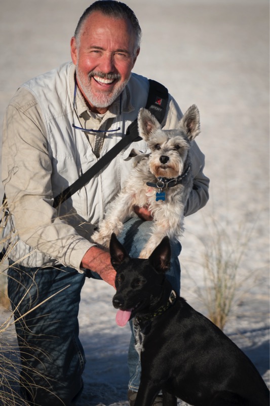
There are only two breeding populations of the crazy-rare Ocelot, and you guessed it, one of them is at Laguna Atascosa. Every year Gladys Porter Zoo helps to sponsor the Ocelot Conservation Day in Brownsville. This year two ocelots from the Texas zoo in Victoria came down to put on a show for kids and adults. Wonderful event that just about everyone from the refuge participated in, with Jan painting ocelot faces and me with the fun and easy job of playing photographer.

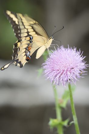
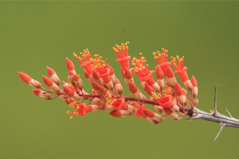
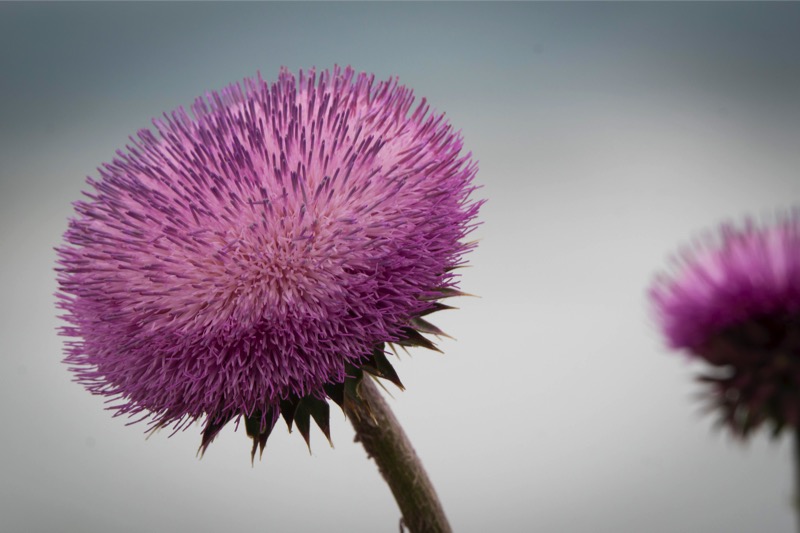
Flowering Flora
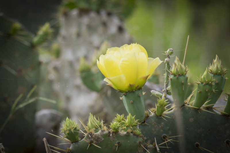
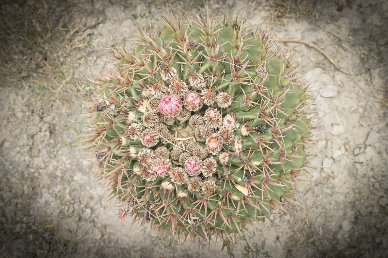
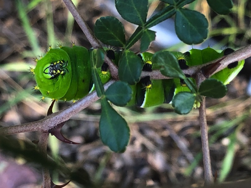
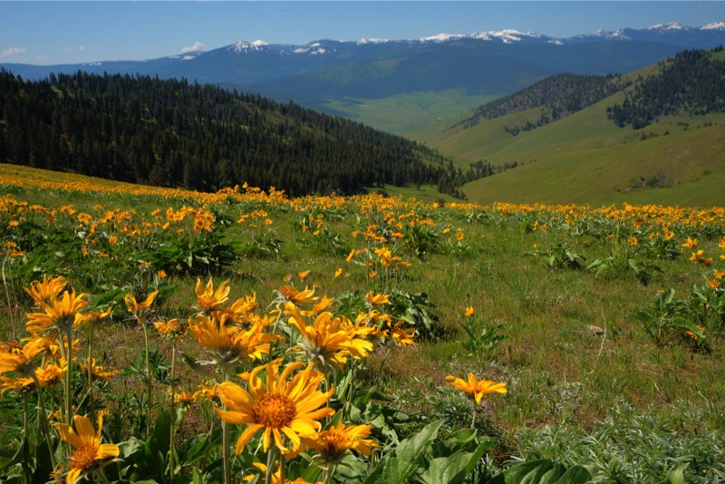
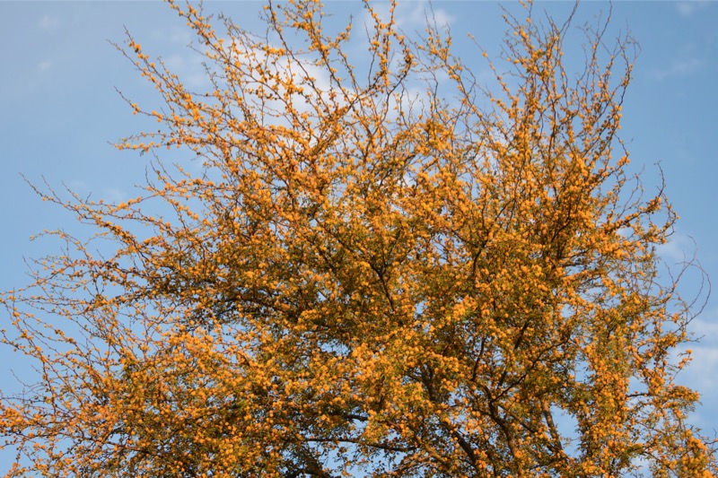
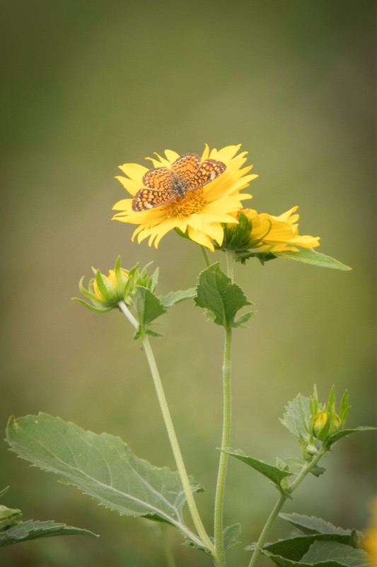
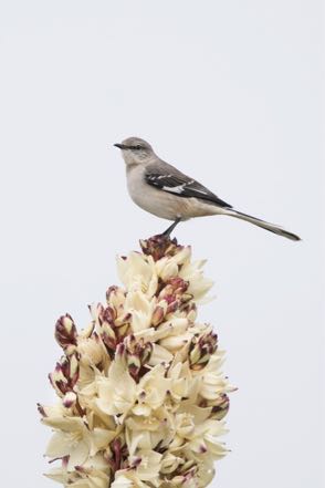
Just about everything with roots in ground has been showing with buds and blooms and flowers.


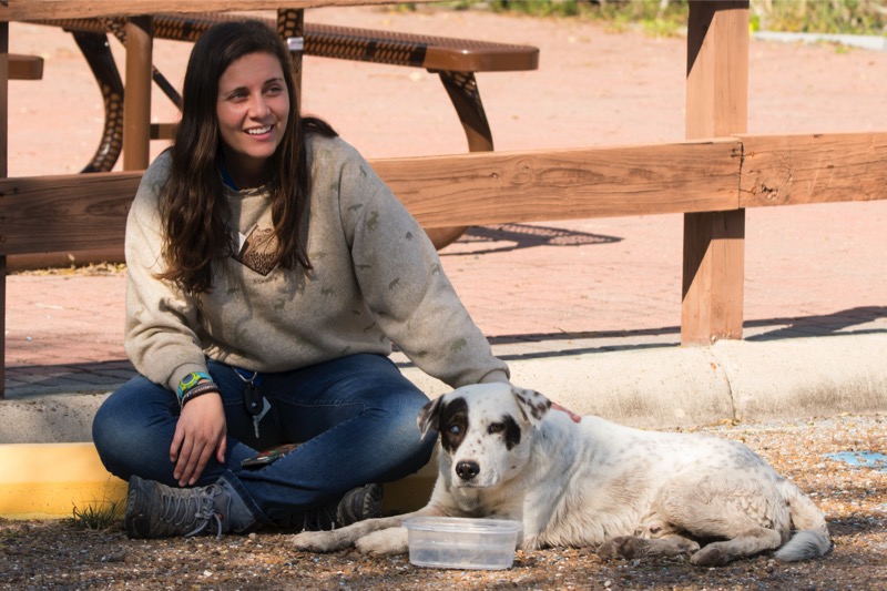
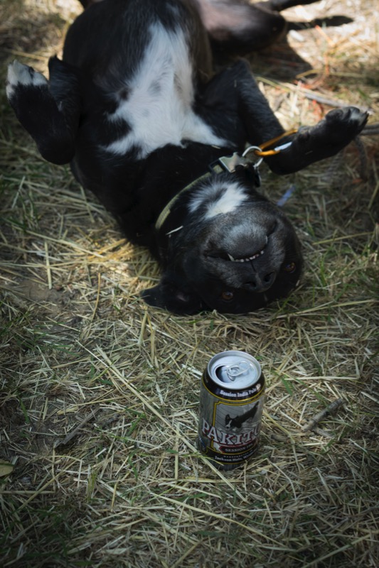
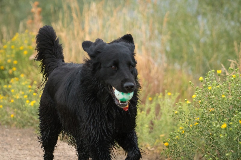
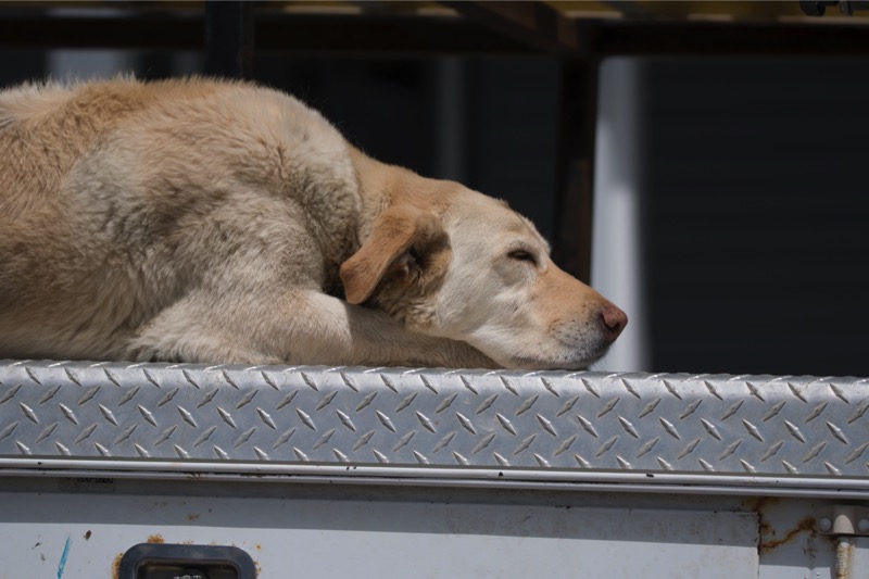
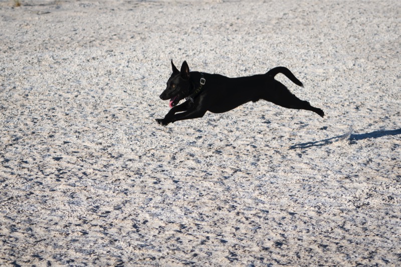
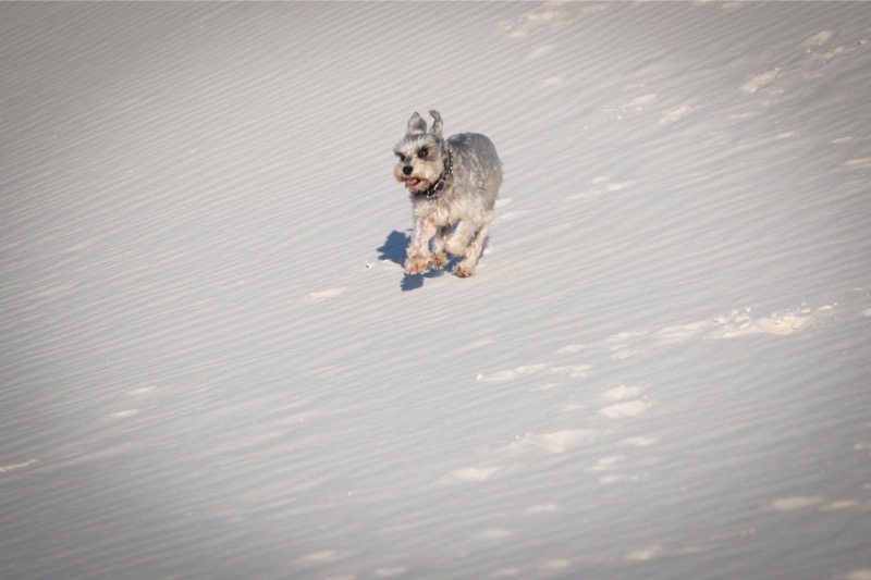
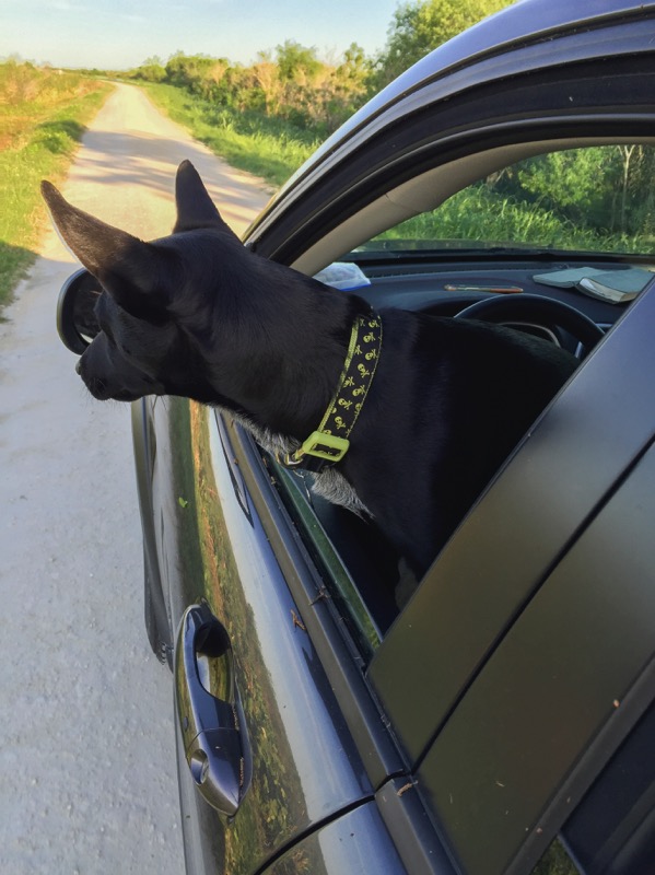
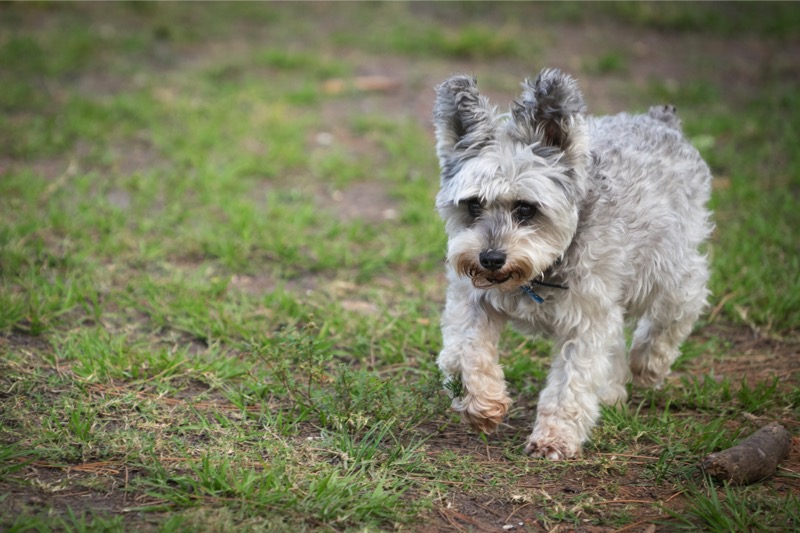
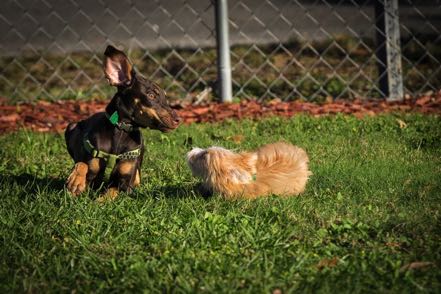
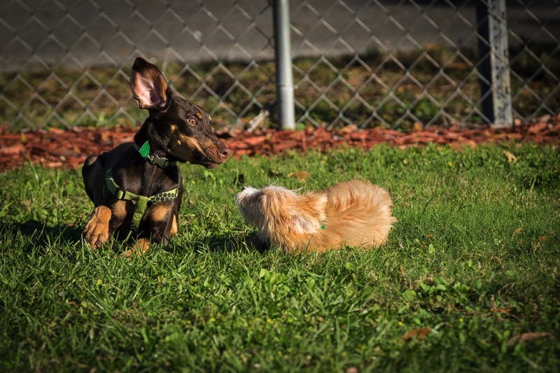
Rescue Pup
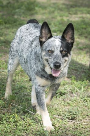
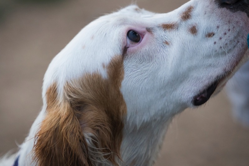
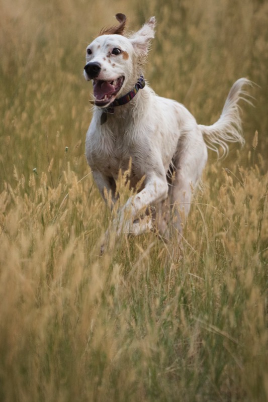
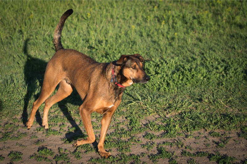
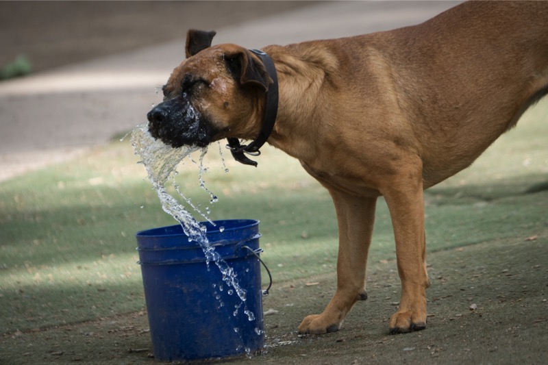
Our good friend, and a ranger, rescued a pregnant female dog at the refuge. Shy, skittish, and afraid, with love, affection, and little attention (especially from Jack!), she has flourished into a beautiful female called Momma.
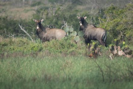
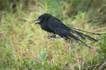
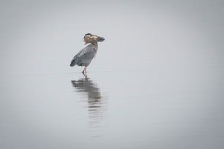
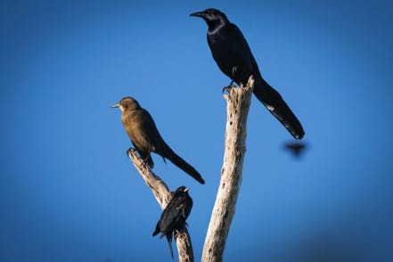
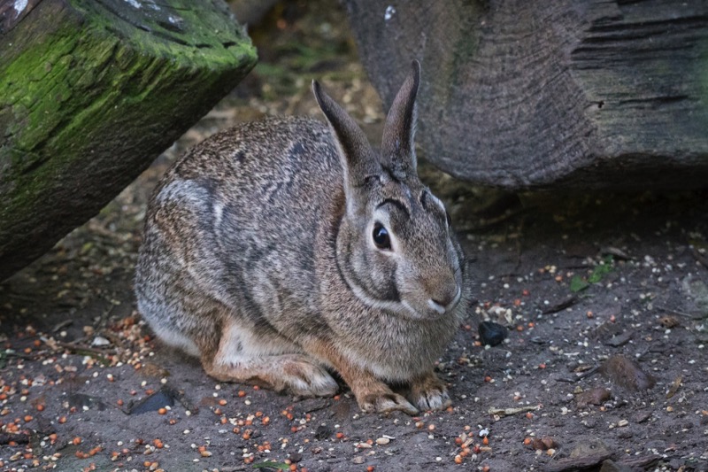
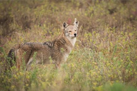
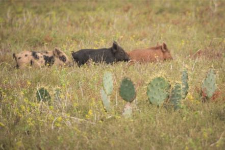
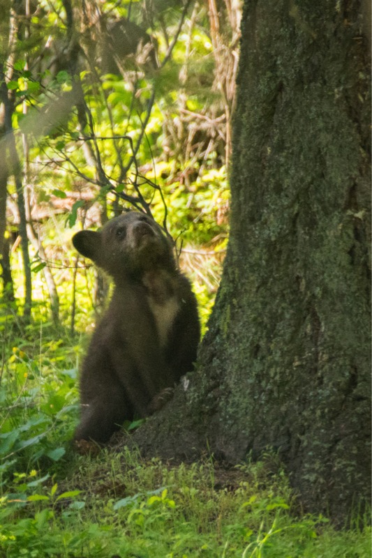
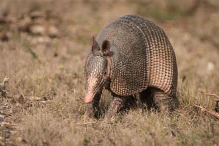
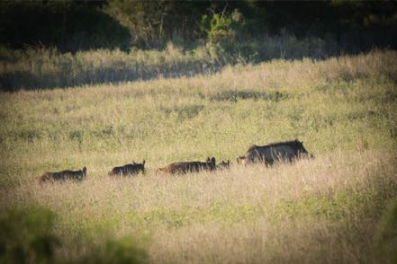
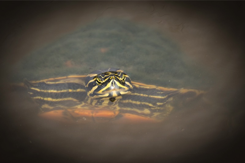
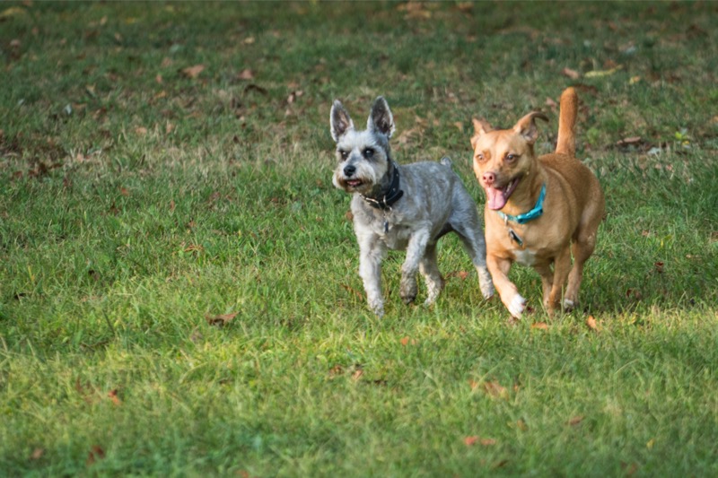
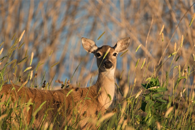
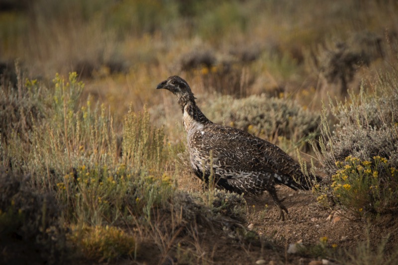
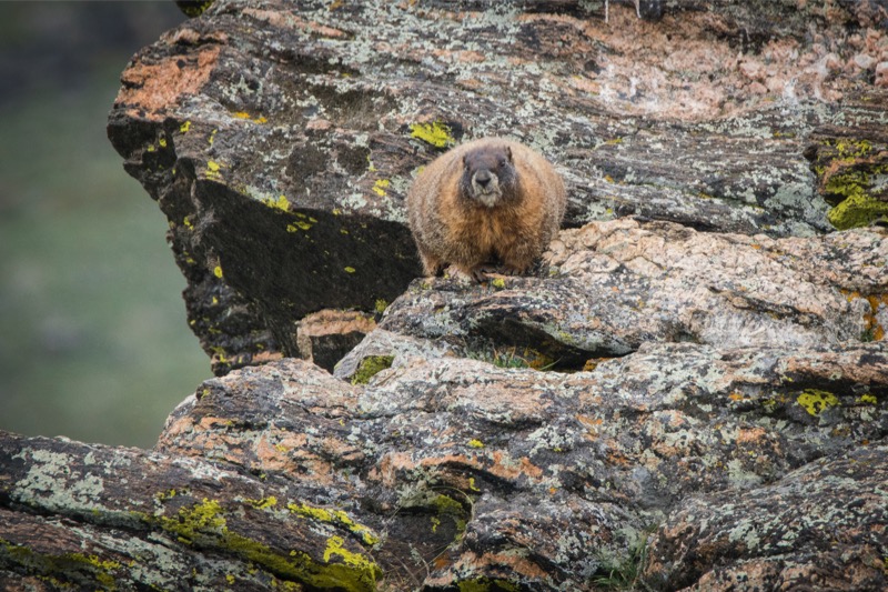
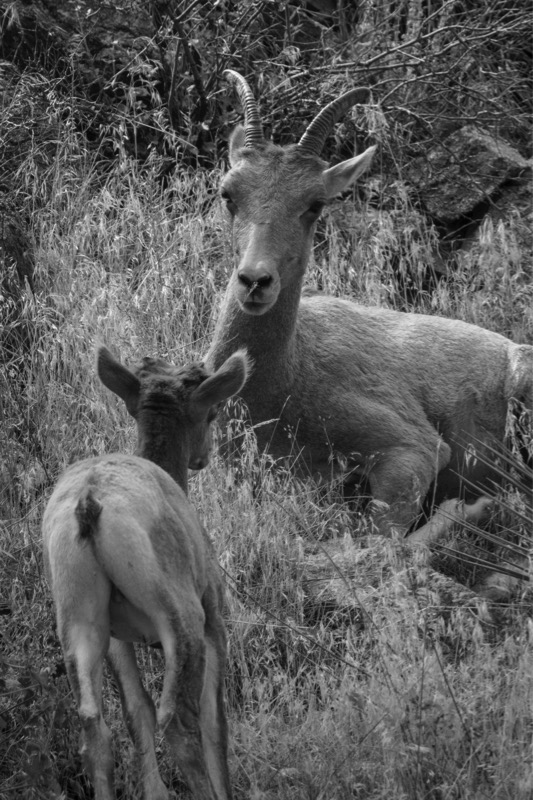
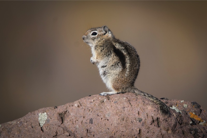
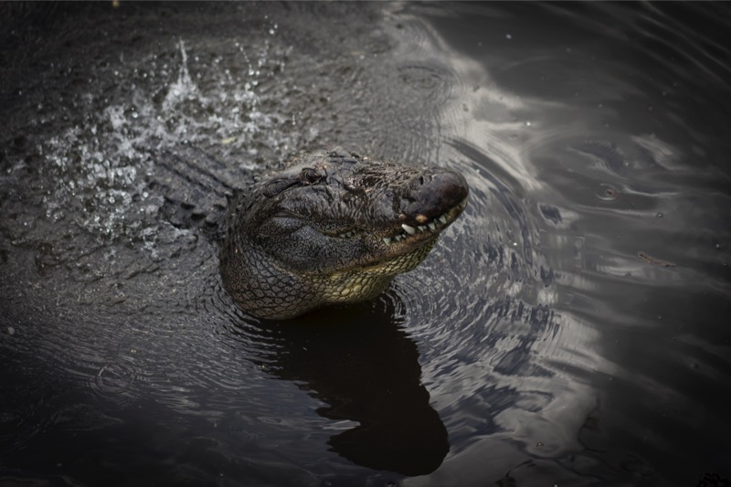
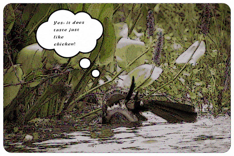
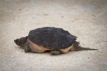
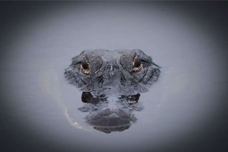
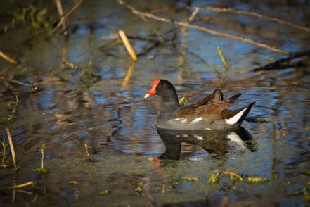
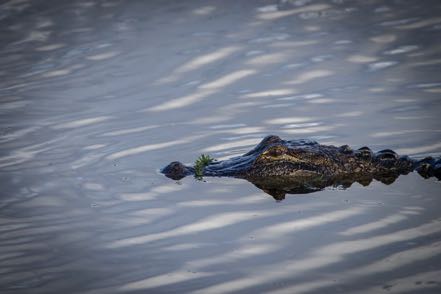
Critters
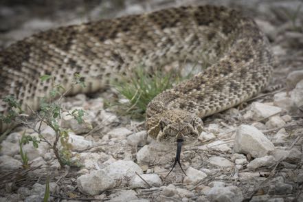
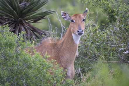
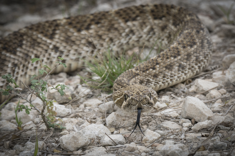
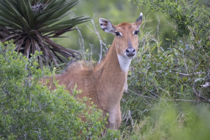
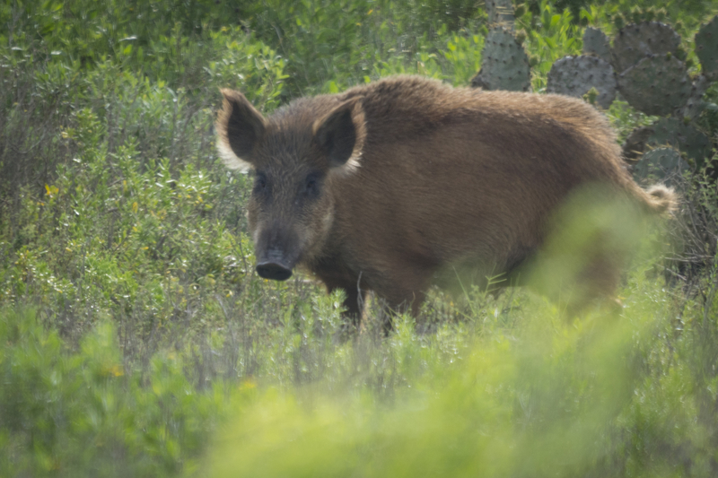
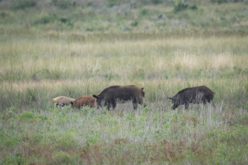
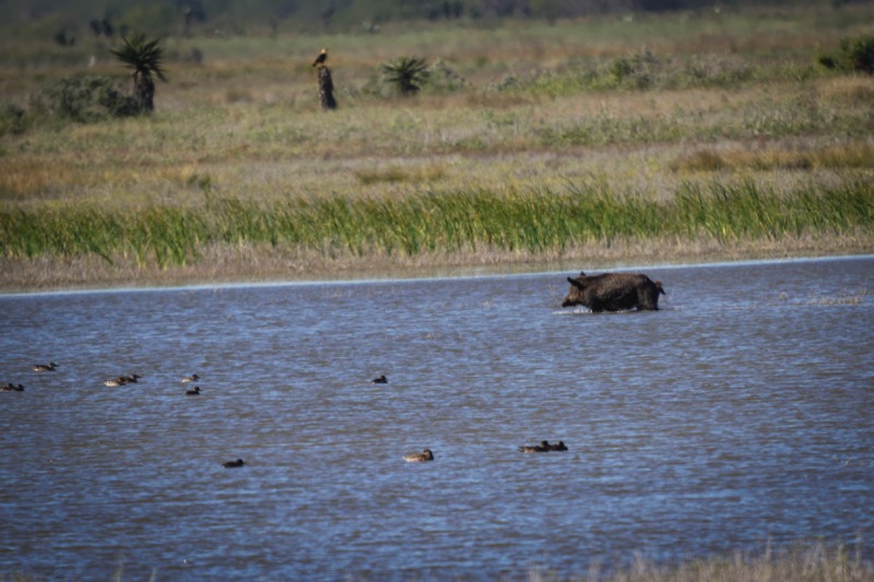
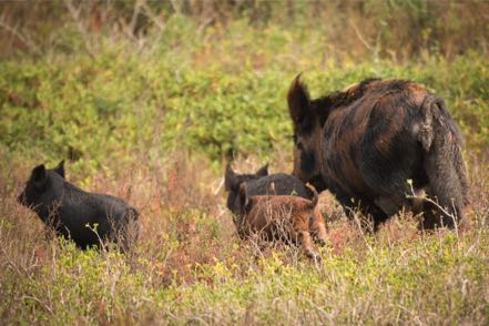
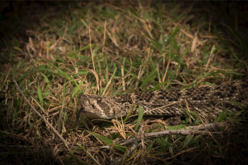
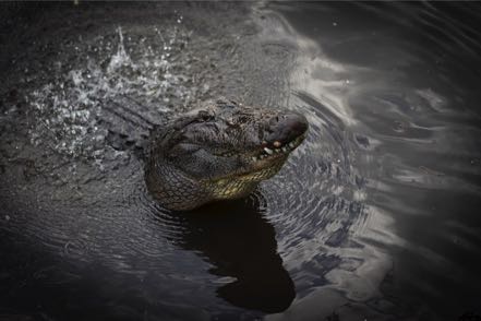
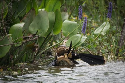
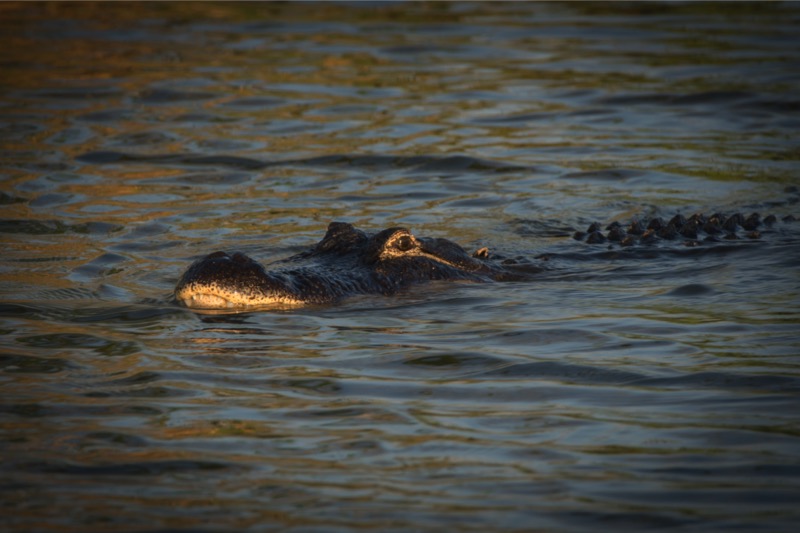
Finally, I end this blog with some critters. Here is a cute rattler, a sweet nilgai, and a wild hog.

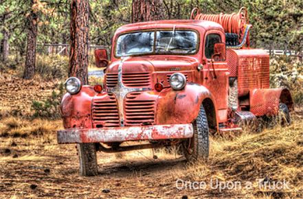
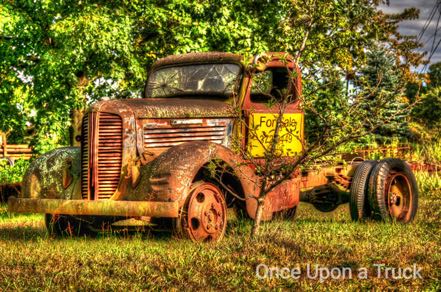
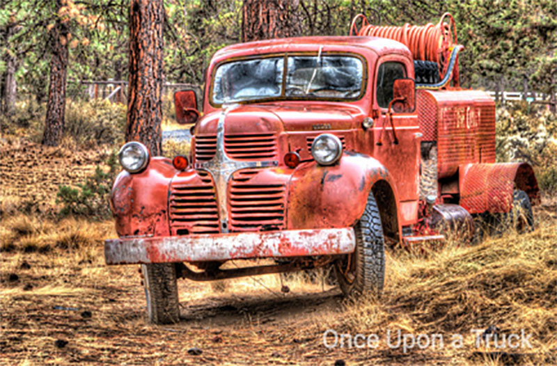
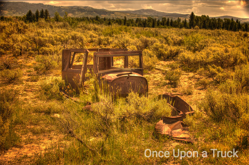
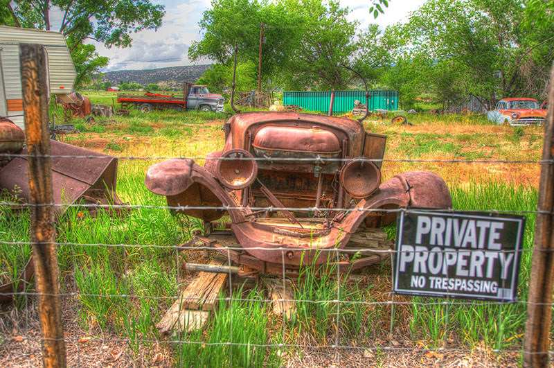
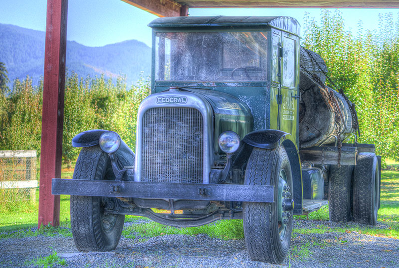
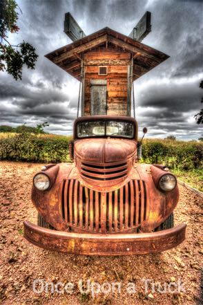
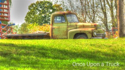
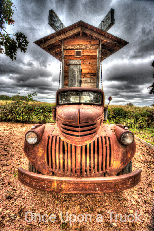
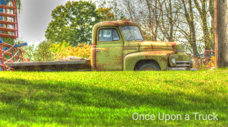
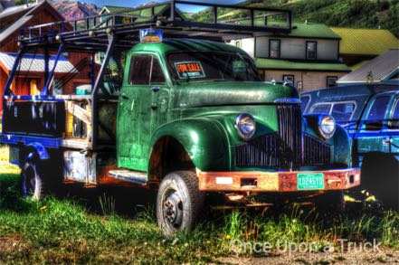
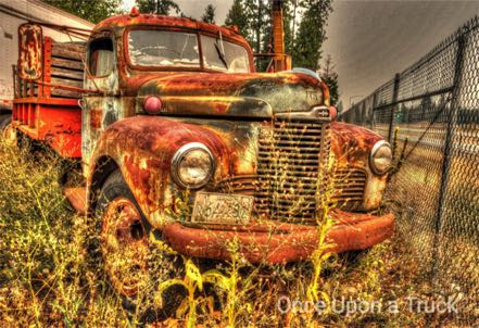
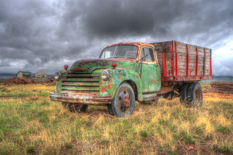
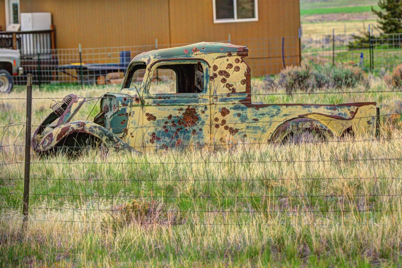
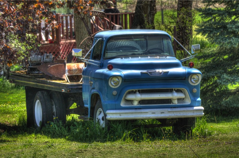
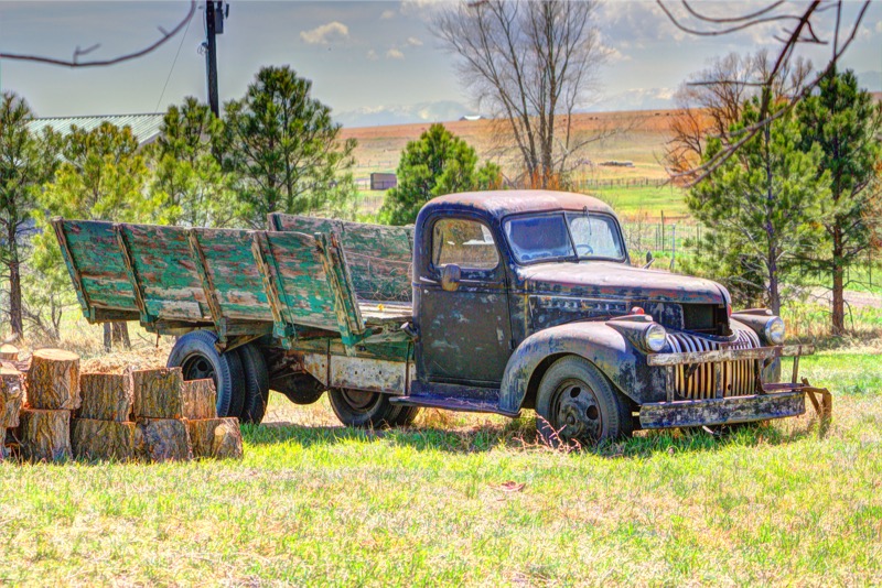
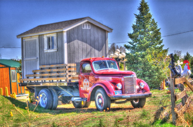
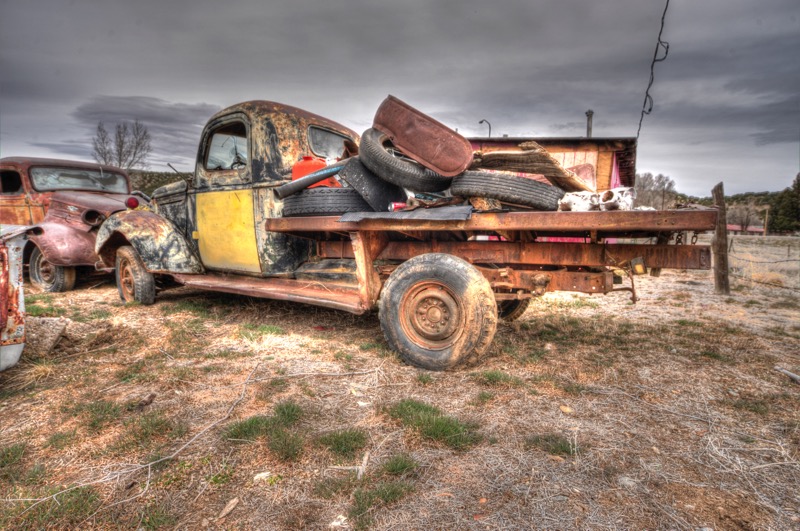
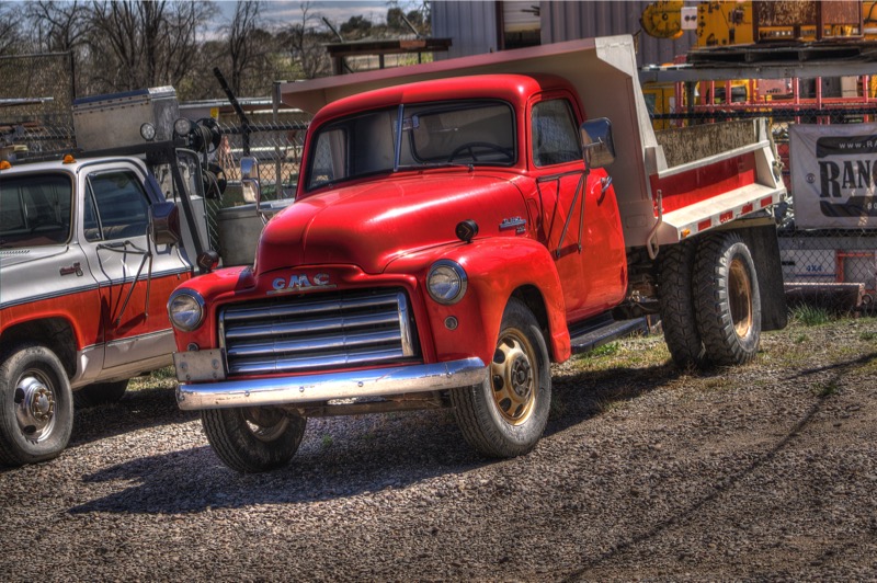
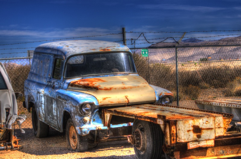
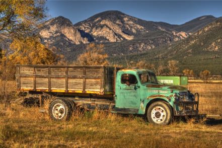
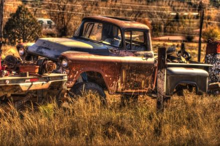
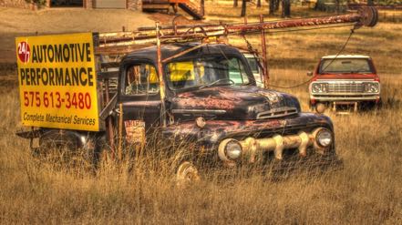
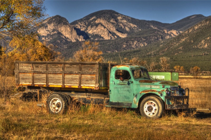
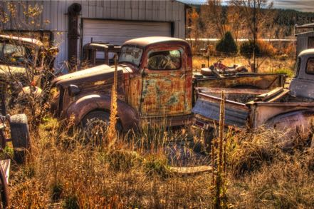
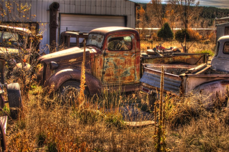
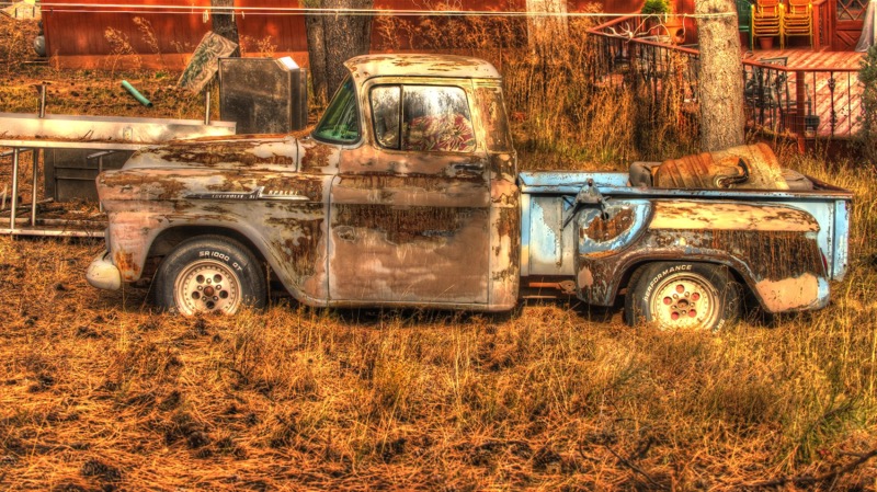
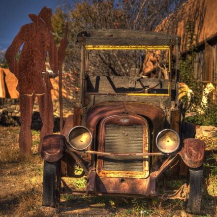
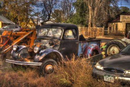
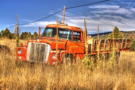
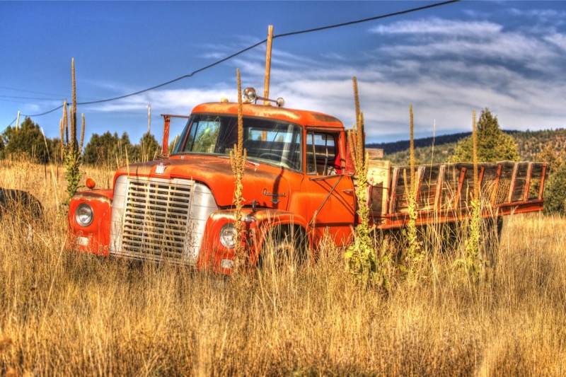
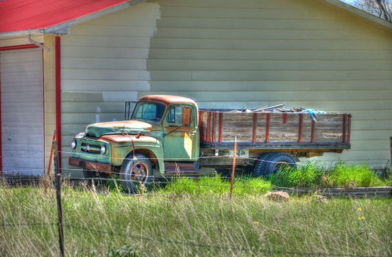
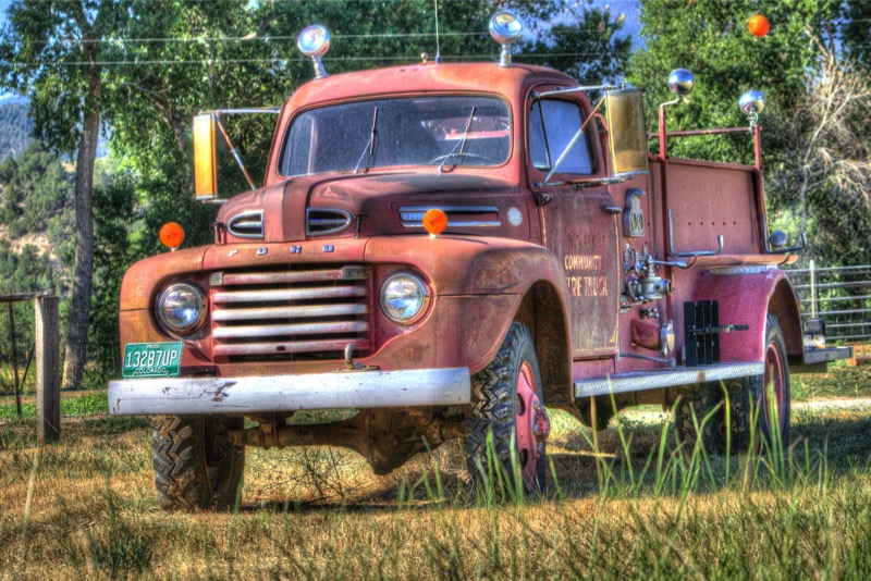
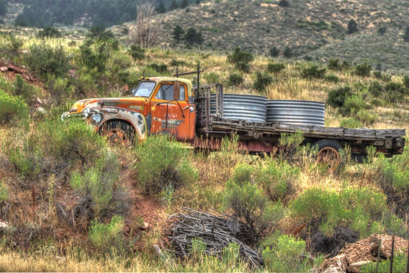
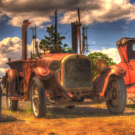
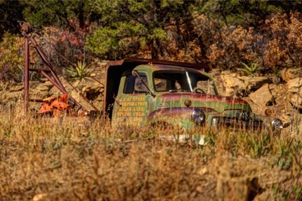
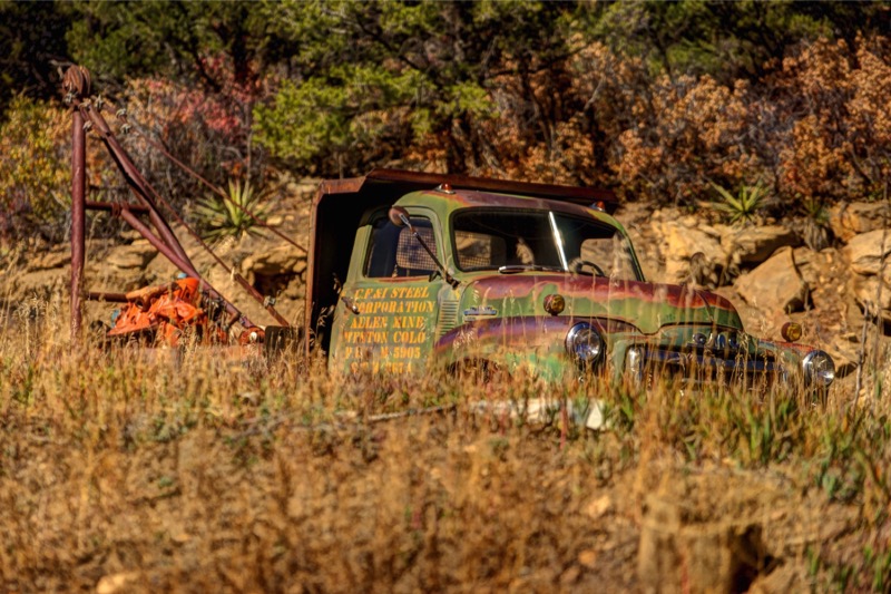
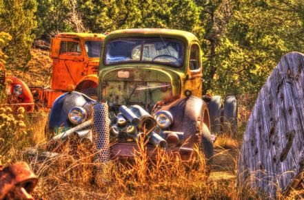
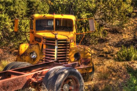
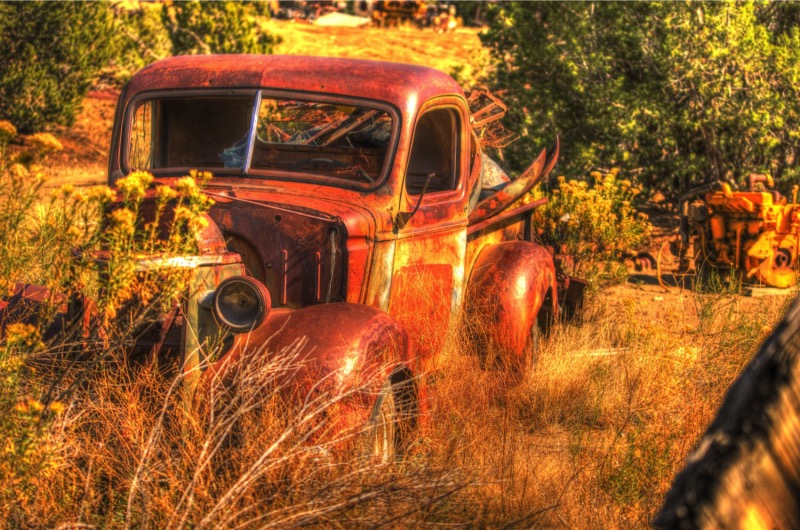
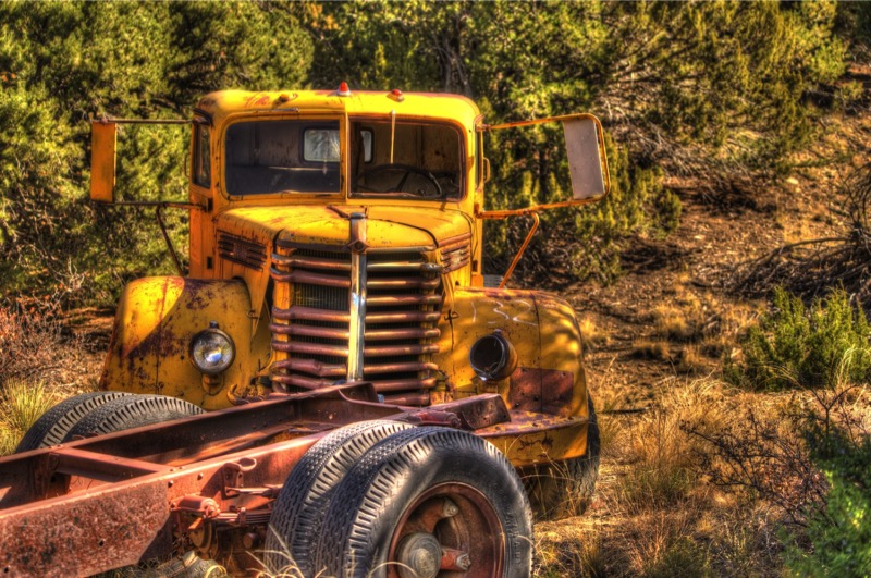
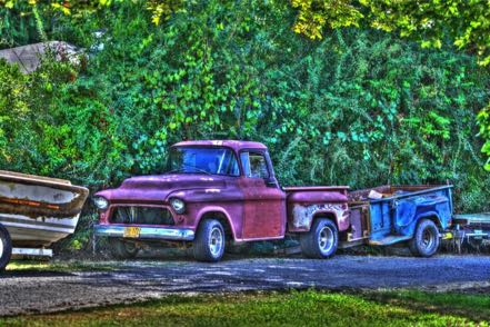
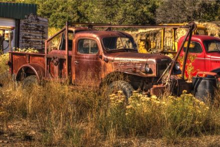
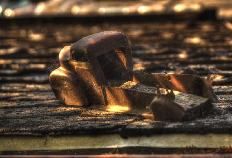
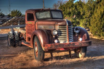
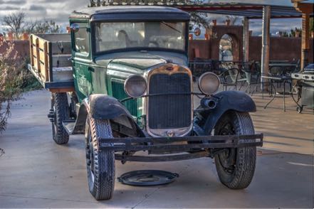
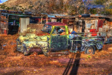
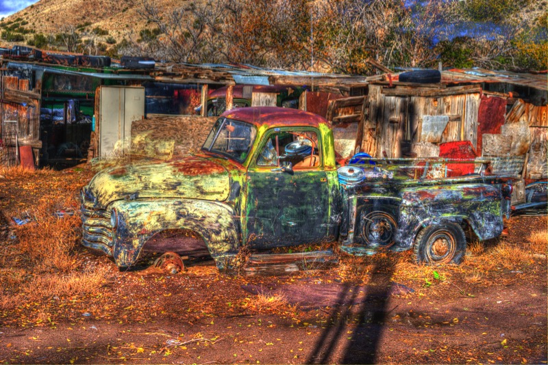
Old Trucks
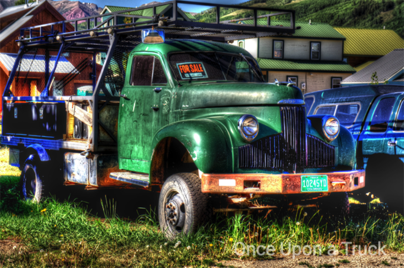
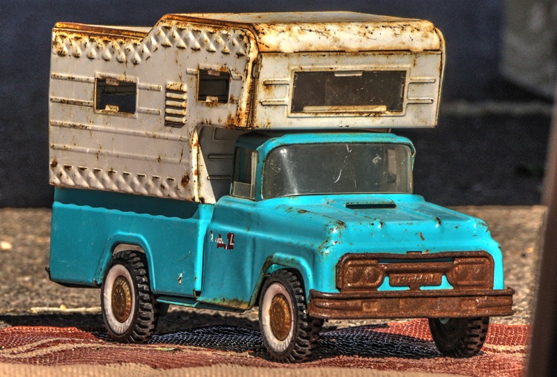
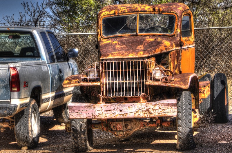
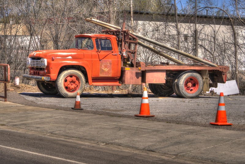
Meet Doris
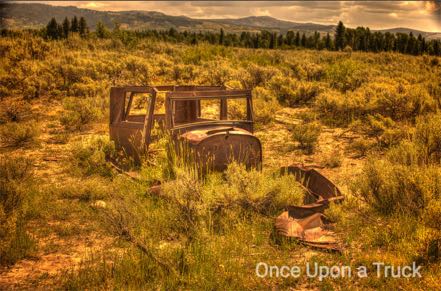
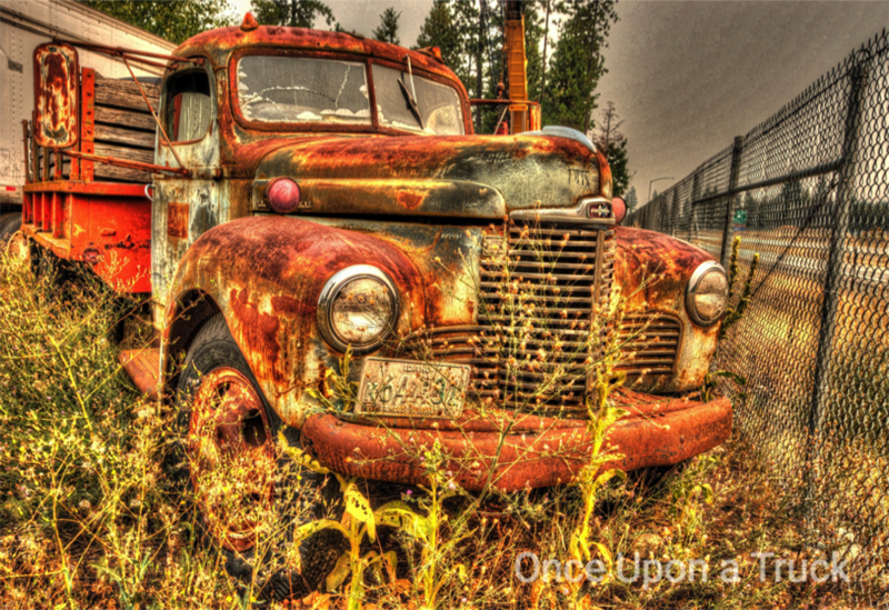
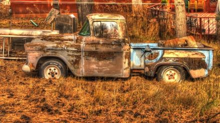
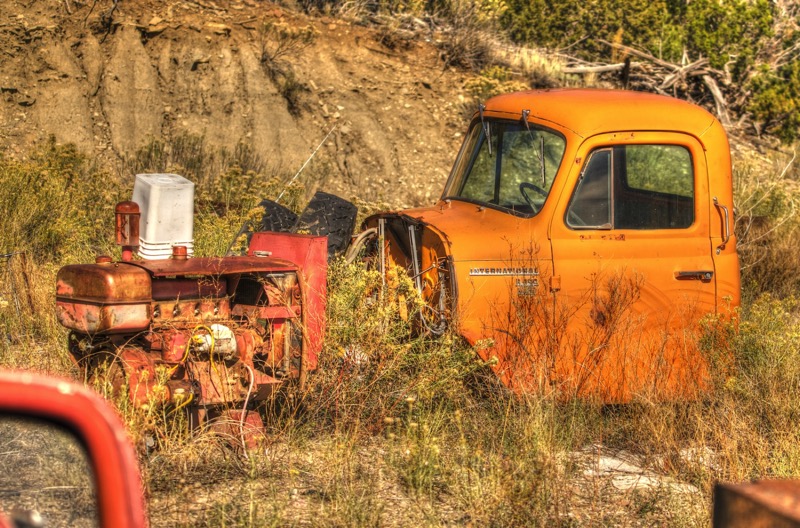
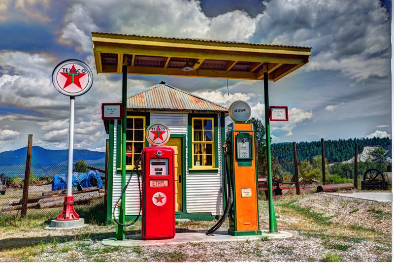
Meet Esmerelda
Meet Desert Rose
Check out www.onceuponatruck.com. Sign up for my What the Truck! blog, and get a sweet gal in your in-basket once a week.
See you next time.
For five months we guided habitat tours at Laguna Atascosa Wildlife Refuge in far southeast Texas, close to Padre Island and an easy hour from Mexico. What a difference a year makes! Last year we volunteered here during a drought with most flora a grayish-brown color and huddled critters hanging close to the few sources of fresh water. This year all plants and trees are different shades of green with a rainbow of colors popping out of flowers like champagne just uncorked.
Questions Galore
Depending on the day of the week, the time of day, and the phase of the moon, we addressed a variety of questions from guests—from visiting Winter Texans to lifelong Valley residents, students, biologists, geologists, sentimentologists, hydrologists, cardiologists (I just made that last one up) and on and on—science has a broad wingspan. We responded to questions about hydrological influence on bay salinity, wind generators’ impact on bird mortality, gestation periods of feral hogs, the eating habits of exotic nilgai, favorite diets of the Aplomado falcon, and how to best cook yucca blooms.
Different Kind of Place
This is a wonderful place for nature lovers, with birds and critters flying, scooting, running, landing, hiding, kiting, loping, crawling, and swimming that you won’t see elsewhere in the US, and in most cases on the planet. We also rekindled friendships from last winter, plus we met lots of good folks on the staff, other volunteers, interns, and Friends of the refuge. A close-knit community with common goals and a shared purpose is tough to beat.
Recommendations
Spend a month (or two or three) at South Padre Island in the winter. Note: Try, try to avoid Spring Break. Spend time at Laguna Atascosa and the other wonderful nature locations in the Lower Rio Grande Valley. Hang at the beach, watch the dolphins, visit Sea Turtle Inc., and enjoy great Mexican (and TexMex) food. On chilly days check out the museums and the historical sites. Go to the birding centers even if you are not a birder. Take a deep dip of nature to cleanse the soul, relax the body, and ease the mind.
Last Photos from the Refuge
Birds
The refuge has a well-earned reputation as a mecca for birders and those who just appreciate the beauty of color in flight and the voices of jubilation. Here is a photo of the stunning Altamira oriole, a female cardinal sparkling in pretty light, a glowing pink roseate spoonbill in flight, the petite but classy stilt, a longed-bill curlew that had just landed (I wonder why they call them “long-billed?”), some immature white Ibis hanging out (as teenagers do), and a chacalaca and a red-winged blackbird eying each other at a feeder adjoining the photo blind. Not all bird lovers have just two legs—here is Jack checking the birds out (he prefers watching rabbits, but birds will do).


Ocelot Day
There are only two breeding populations of the crazy-rare Ocelot, and you guessed it, one of them is at Laguna Atascosa. Every year Gladys Porter Zoo helps to sponsor the Ocelot Conservation Day in Brownsville. This year two ocelots from the Texas zoo in Victoria came down to put on a show for kids and adults. Wonderful event that just about everyone from the refuge participated in, with Jan painting ocelot faces and me with the fun and easy job of playing photographer.


Flowering Flora
Just about everything with roots in ground has been showing with buds and blooms and flowers.

Rescue Pup
Our good friend, and a ranger, rescued a pregnant female dog at the refuge. Shy, skittish, and afraid, with love, affection, and little attention (especially from Jack!), she has flourished into a beautiful female called Momma.
Critters
Finally, I end this blog with some critters. Here is a cute rattler, a sweet nilgai, and a wild hog.
Old Trucks
Meet Doris
Meet Esmerelda

Meet Desert Rose
Check out www.onceuponatruck.com. Sign up for my What the Truck! blog, and get a sweet gal in your in-basket once a week.
See you next time.
Blog 317: Whistling Duck and Soaring Spoonbills
Things continue to go smoothly here at the refuge. Here are a few pics from our tours.


Old Trucks
Meet Florence

Meet Harriet
Check out www.onceuponatruck.com. Sign up for my What the Truck! blog, and get a sweet gal in your in-basket once a week.
See you next time.


Old Trucks
Meet Florence
Meet Harriet
Check out www.onceuponatruck.com. Sign up for my What the Truck! blog, and get a sweet gal in your in-basket once a week.
See you next time.
Blog 316: Wild Hogs and Nilgai Nation
Government Reopened
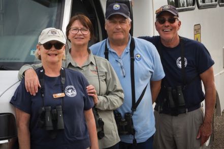
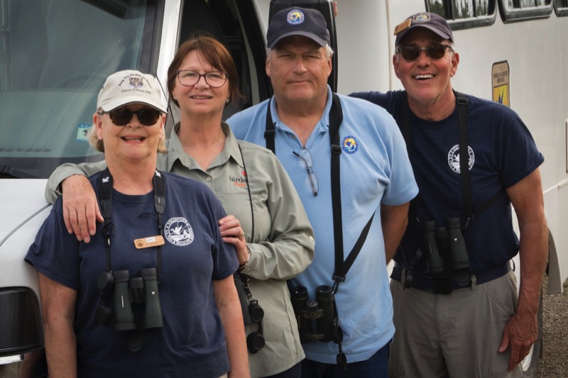
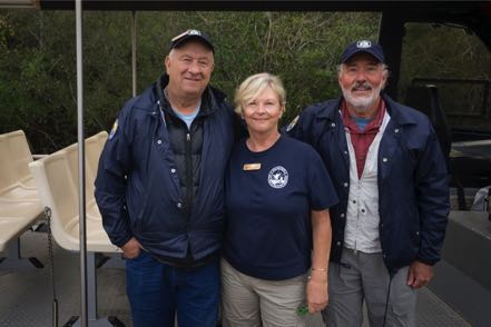
With the Washington stupidity ending (at least for a few days), life at the refuge is in full season mode. Decent weather (for the most part) has kept the Polar Vortex crowd of Winter Texans pouring in. Jan and I have been having a lot of fun leading habitat bus tours on three property locations. Here is a pic of us with our buddies Cathy and John.
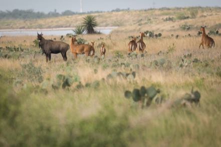
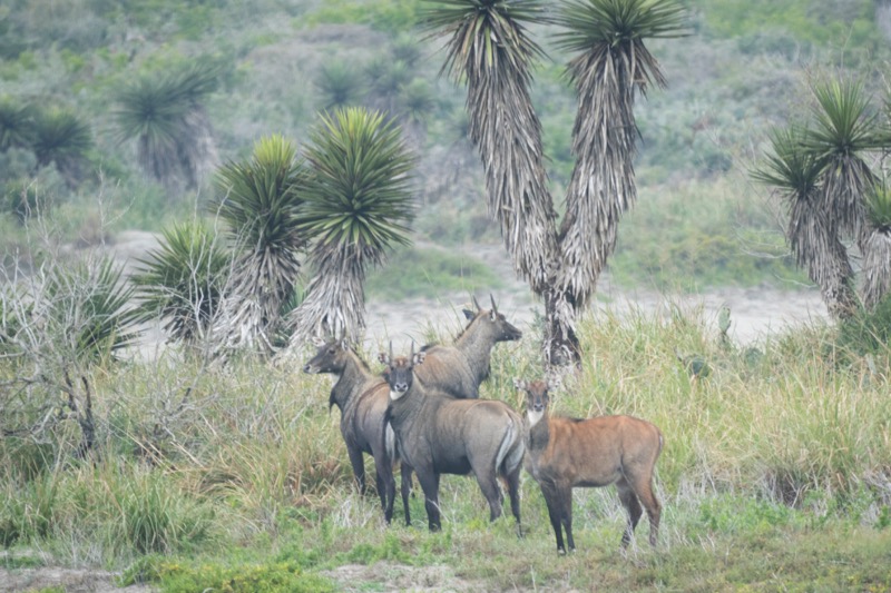
Nilgai Nation
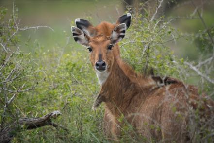
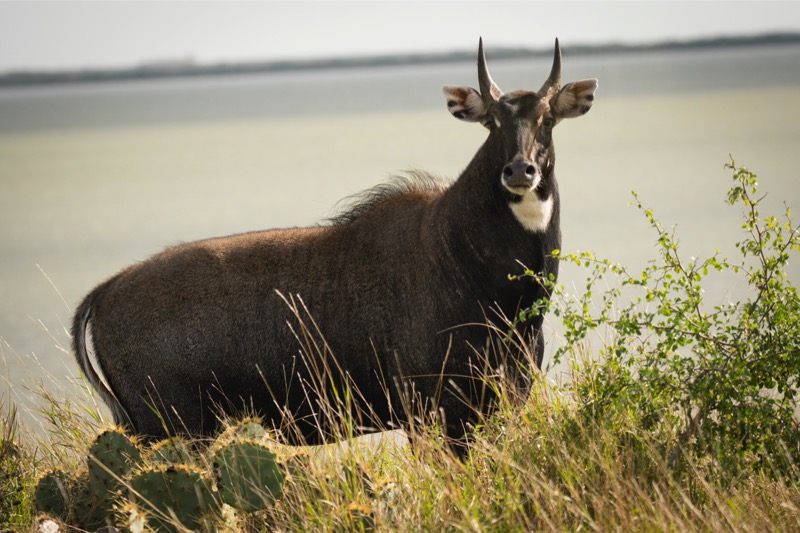
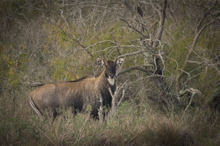
Nilgai are exotic antelopes native to India and Pakistan. The King Ranch brought them to Texas for game hunting and of course some escaped. Now there are about 1,000 of these magnificent creatures on the refuge. It is rut time for these critters, and they are putting on a show.


Janny Art
Jan has also been helping to beautify the refuge. Here are a couple of her works in the Visitor Center.

Critters on the Tour
Here are a few critter pics I have taken on the tour.


Old Trucks
Meet Marion
Meet Nina
Check out www.onceuponatruck.com. Sign up for my What the Truck! blog, and get a sweet gal in your in-basket once a week.
See you next time!
With the Washington stupidity ending (at least for a few days), life at the refuge is in full season mode. Decent weather (for the most part) has kept the Polar Vortex crowd of Winter Texans pouring in. Jan and I have been having a lot of fun leading habitat bus tours on three property locations. Here is a pic of us with our buddies Cathy and John.
Nilgai Nation
Nilgai are exotic antelopes native to India and Pakistan. The King Ranch brought them to Texas for game hunting and of course some escaped. Now there are about 1,000 of these magnificent creatures on the refuge. It is rut time for these critters, and they are putting on a show.
Janny Art
Jan has also been helping to beautify the refuge. Here are a couple of her works in the Visitor Center.

Critters on the Tour
Here are a few critter pics I have taken on the tour.


Old Trucks
Meet Marion
Meet Nina
Check out www.onceuponatruck.com. Sign up for my What the Truck! blog, and get a sweet gal in your in-basket once a week.
See you next time!
Blog 314: Lower Rio Grande Valley
Laguna Atascosa National Wildlife Refuge
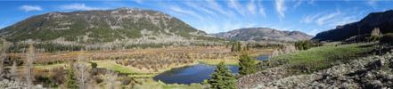
We have returned to our winter home of last year, to the distinct flora and fauna of the wild Laguna Atascosa, located about 40 minutes north of Brownsville and 40 minutes west of South Padre Island. Jan and I are habitat tour guides, sharing the unique beauty of one of the most biologically diverse areas of the world. This 100,000-acre refuge is one of the last undeveloped coastal areas on the planet. With over 400 species of birds, 400 species of plants, 40 types of mammals, 40 types of reptiles and amphibians, and over 100 species of butterflies. Enough stuff to keep a nature-lover busy for decades!
Some Pics
Here is the beautiful Altamira oriole—you should hear him sing.

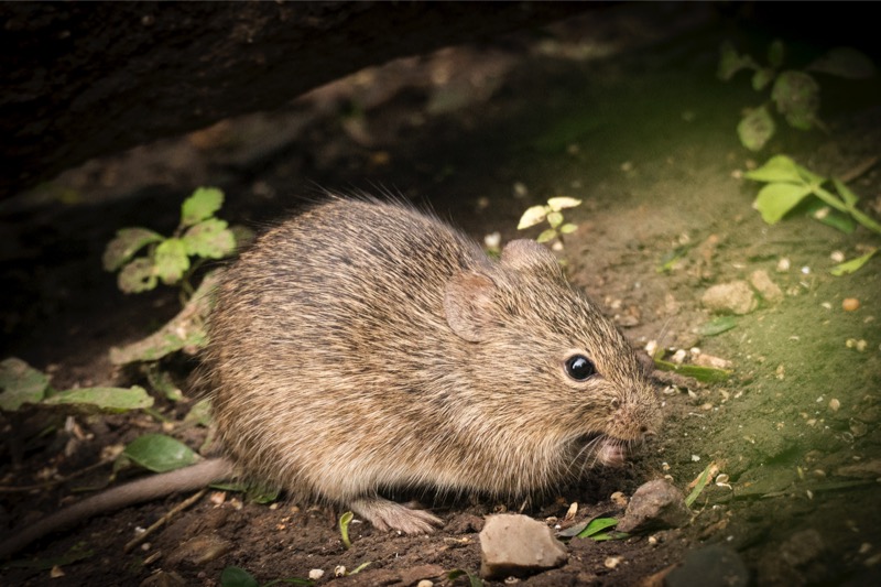
This cute little fellow is a cotton mouse—he lives near the Photo Blind.

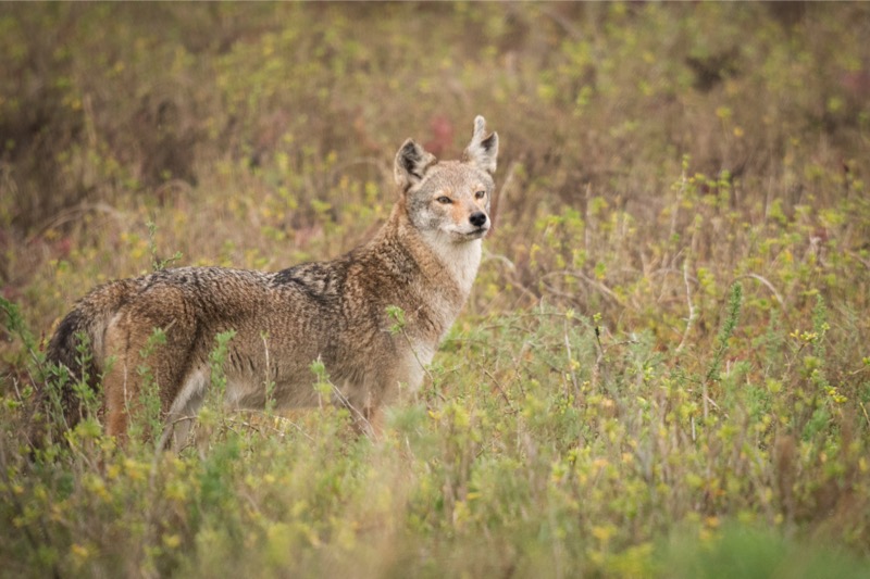
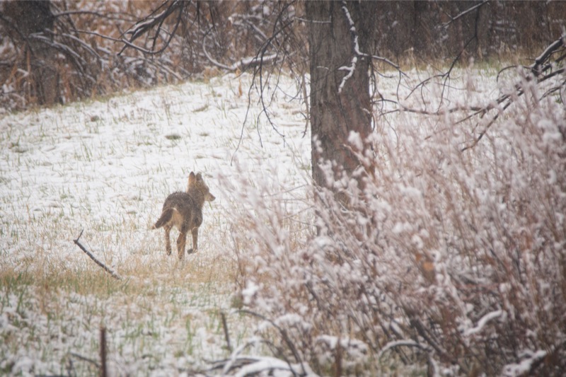
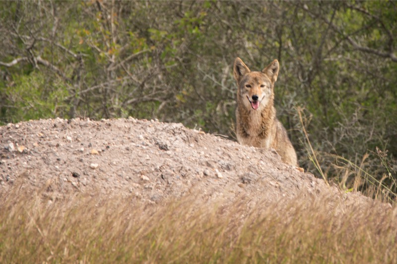
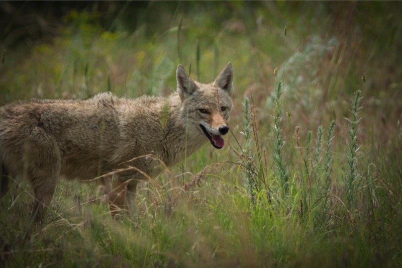
Lots of good things to eat here as this svelte coyote demonstrates.
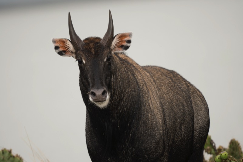
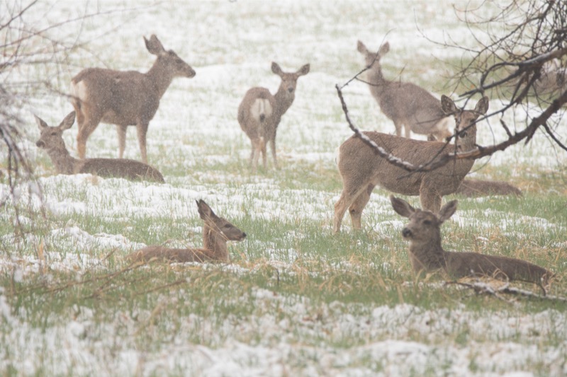
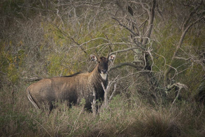
Here is a buck and a couple photos of an exotic nilgai male. This big guy loves to pose for the camera.

Yes, I know they are feral and quite destructive, but the three little pigs are still cute.
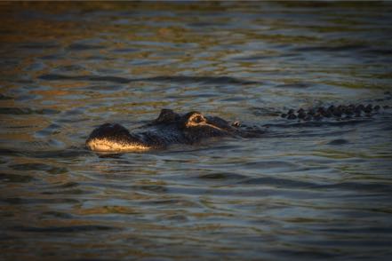
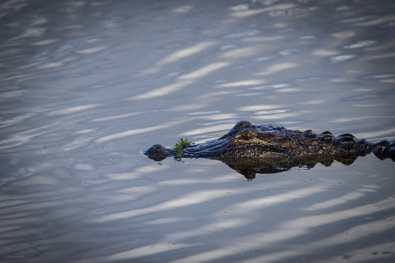
Boy, do the little boys like their gators.
Go Away
Here is a picture I took in Texas hill country close to election time and forgot about. It kind of gives you a flavor of the folks that live there! Note: Look close for the faded out “free beer” message.

Old Trucks
Meet Maureen
Meet Patricia
See more beauties like these at www.onceuponatruck.com. Sign up for my What the Truck! blog and get a sweet gal in your in-basket every week.
We have returned to our winter home of last year, to the distinct flora and fauna of the wild Laguna Atascosa, located about 40 minutes north of Brownsville and 40 minutes west of South Padre Island. Jan and I are habitat tour guides, sharing the unique beauty of one of the most biologically diverse areas of the world. This 100,000-acre refuge is one of the last undeveloped coastal areas on the planet. With over 400 species of birds, 400 species of plants, 40 types of mammals, 40 types of reptiles and amphibians, and over 100 species of butterflies. Enough stuff to keep a nature-lover busy for decades!
Some Pics
Here is the beautiful Altamira oriole—you should hear him sing.
This cute little fellow is a cotton mouse—he lives near the Photo Blind.
Lots of good things to eat here as this svelte coyote demonstrates.
Here is a buck and a couple photos of an exotic nilgai male. This big guy loves to pose for the camera.


Yes, I know they are feral and quite destructive, but the three little pigs are still cute.


Boy, do the little boys like their gators.

Go Away
Here is a picture I took in Texas hill country close to election time and forgot about. It kind of gives you a flavor of the folks that live there! Note: Look close for the faded out “free beer” message.

Old Trucks
Meet Maureen
Meet Patricia
See more beauties like these at www.onceuponatruck.com. Sign up for my What the Truck! blog and get a sweet gal in your in-basket every week.
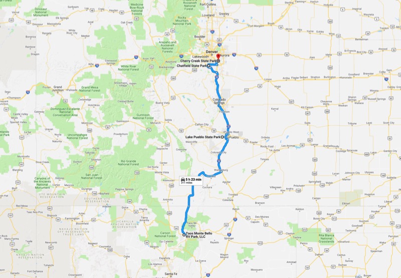
Blog 309: Byways, Bison, and Bears
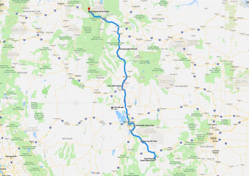
Jordanelle
It was a short and easy trip from Dead Horse Point State Park to Blue Cut RV Park in Helper, Utah. Not much going on in Helper, but it was a chance to regroup and plan the next legs of our journey. After two nights, we headed north again to spend five nights at Jordanelle State Park north of Heber City, Utah (about 30 miles east of Salt Lake City).
During our stay I had a quick gig in Irvine for a few days with a great bunch of people.
After Jordanelle, it was another easy journey to Pocatello, Idaho, where we spent one rainy night at the Buffalo Meadows RV Park, a part of the Ft. Hall Casino.
Dillon
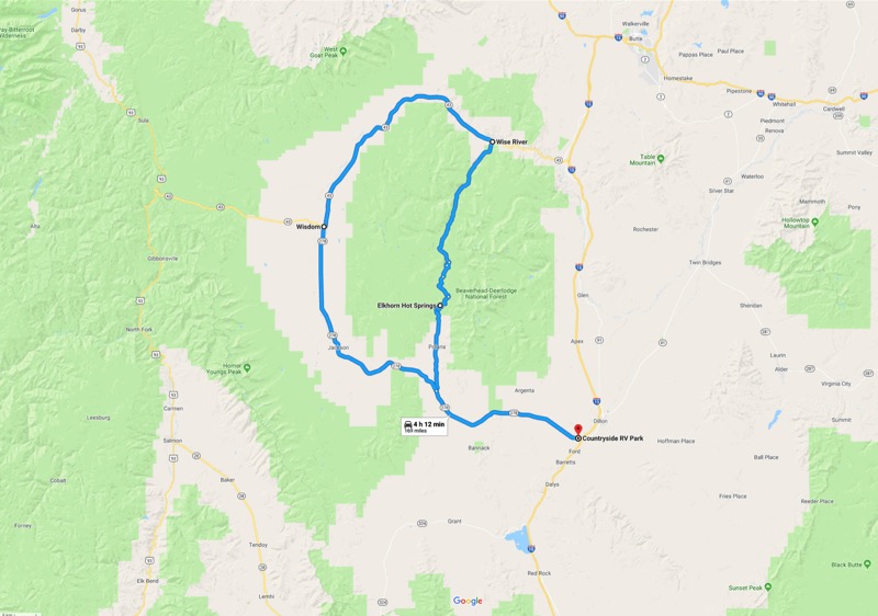
Next, we travelled to the Countryside RV Park just outside of Dillon, Montana. We have stayed in the Dillon area in the past, and it was enjoyable to come back to this picturesque area. I had planned a day trip that would take us on the Pioneer Scenic Byway through the Pioneer Mountains. We headed west on 278 and north on 73 through Polaris and up to Elkhorn Hot Springs. The plan was to continue all the way to Wise River, then head west on 43 through Fishtrap, at Wisdom take 278 east to Jackson, and then back to camp. Unfortunately, the road was closed at Elkhorn Hot Springs, so our only choice was to backtrack the way we came to our campground.
St. Regis
Continuing our northward journey, we next went to Campground St. Regis, a gorgeous and tidy place to stay next to St. Regis, Montana.
National Bison Range Day Trip
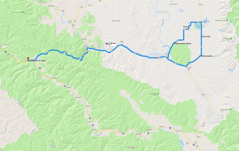
One morning we drove the picturesque 51 miles to the National Bison Range, with most of our journey on the National Bison Scenic Byway that parallels the Flathead River.
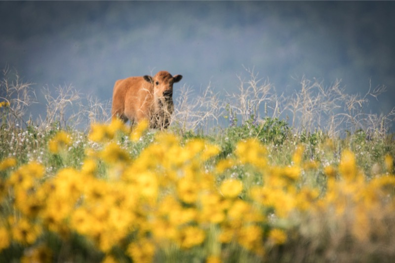
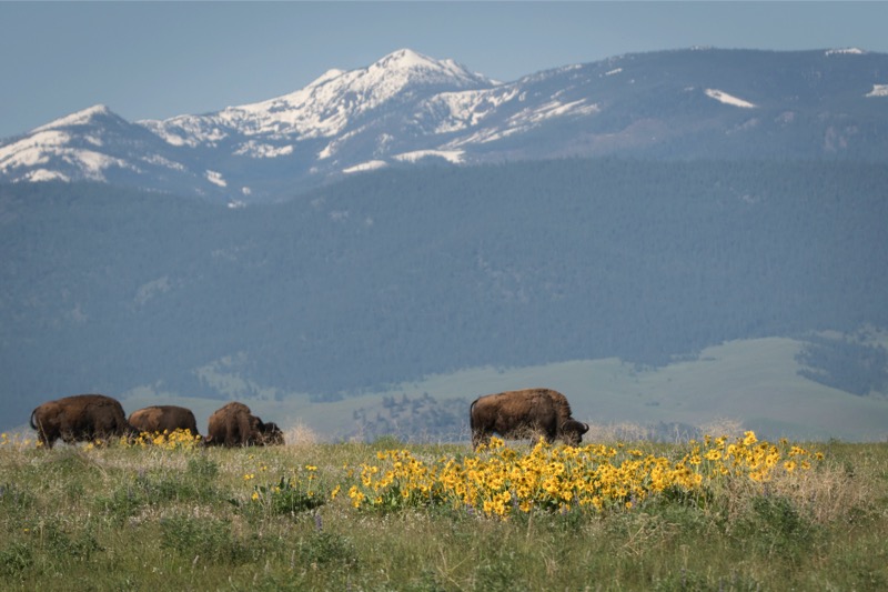
We had visited this national wildlife refuge a few years earlier and really enjoyed it. This trip was to prove even more impressive, as the heavy winter snowfall and the abundant spring rains kept everything a vibrant green that proved a brilliant contrast to the wildflowers and the snow-white peaks of the Mission Mountains.
Our prime goal was to see critters, and we were well rewarded. We saw bison, of course, pronghorn, deer, and a momma and baby bear. Mitzy enjoyed herself, as always, pointing out the different species to Jack. Especially fun was that Jack had his first bear sighting—he was in total awe as he speechlessly stared wide-eyed like a toddler opening Christmas presents.
We were extremely pleased with our critter findings, but there was more. The hills and valleys erupted wildflowers. It was like hoping for a pair, and drawing a full house.
Arrowleaf balsamroot covered the valleys like the golden robe of a Bishop giving high mass. We saw prairie smoke, shooting stars, penstemon, Rocky Mountain iris, lupine, Solomon’s plume, serviceberry bush, chokecherry, desert parsley, wild geranium, giant hyssop, baby tansy, and more, that shined like the multicolored jewels of a pirate’s treasure box. All the while, as we meandered up and down and over and across, we were serenaded by meadowlarks. Wonderful trip.
Old Trucks
Here are three old trucks from Montana.
That ends our “post-Texas holiday.” Now it is time for our next adventure.
Blog 307: Babysitting, and Standing, and Running…
Pueblo Lake State Park
Our drive from our campground in Taos to Pueblo State Park was uneventful, as was our stay. Only about 10 percent of this huge campground was open, and the main task of those of us camping/RVing was to stay warm. Jack loved his daily off-the-leash runs, though.
Chatfield State Park
After a couple of days, we headed north and parked at Chatfield Lake State Park. I said “parked” and not “camped,” as our G-kid babysitting duties ramped into gear. Kelly and Aaron had nine days in the UK planned, so we moved into their house to manage/guide/direct/cajole/influence/tolerate/beg our two grandkids. Get them up, feed them breakfast, make sure they have on clothes and clean faces, drive them to school, more of this and more of that, pick them up from school, transport them to football practice…lather, rinse, repeat. Wow, we were glad to see the tykes and happy to help Mom and Dad, but no tears were shed upon task completion.
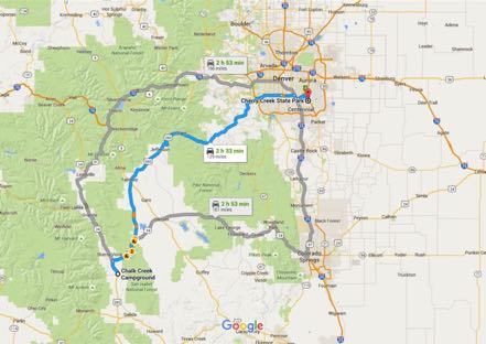
Cherry Creek State Park
After three days, we moved the coach to the east side of Denver. Had a very nice snowfall and the chance to take a few pics.
Old Trucks
See you next time.
Blog 304: Adios Laguna
Our tram tours ended, the work completed, and the gig was up. After four months in extreme SE Texas we pulled up stakes and plotted a new course. Our friends, Al and Carolyn, organized a farewell feast for us, and then we said our goodbyes and hit the road—time for the refugees to flee!
We took the tried and true trip to Harlingen, north on US 77, east on 70, north on 286, east on 357, and then east on 22 onto Padre Island. It rained most of the day with some occasional thunder and lightning, so we were happy that we found a site on the first-come, no-reservation Malaquite Campground overlooking the Gulf of Mexico.
Padre Island National Seashore
This national park stretches for 80 miles, ending at the Port Mansfield channel (no bridge). If you have 4-wheel drive, almost all of it is drivable. There are three very reasonably priced campgrounds in the park, plus open camping for free on the Gulf beach for 60 miles.
Walks on the Beach
From our site, we had a two-minute walk to the Gulf beach, where we were entertained by the antics of shore birds with the relentless murmur of seductive waves providing background music. Jack just loved his at least one-a-day runs through the sand.
Birding Trip
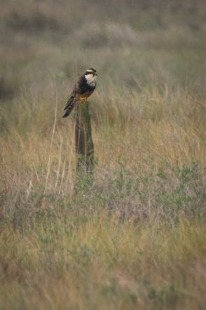
The park offered a free, two-hour birding tour which I participated in one morning. Just coming from a renowned birding area, I was pleased with the variety of birds we saw, especially the rare apolomado falcon.
Short Trips
We had the chance to explore most of the Park’s hot spots, and also took a daily 14-mile drive to the outskirts of Corpus Christi for Internet and Verizon connection. One time we headed north up to Mustang Island and Port Aransas, where they are in the middle of hurricane recovery.
Choke Canyon State Park
Soon it was time to head west, catching some of the beautiful wildflowers along the road through the west portion of Texas Hill Country. We stopped overnight at Rockin J RV Park in George West, and then on to Choke Canyon State Park. One of the nicest state parks we have ever stayed in—large sites with most all having a water view, easy water access, and lots of trails to explore.
Del Rio
After three pleasant days there, we headed west again, spending one night just outside of Del Rio at the Trav-L RV Park. Nothing fancy, just an overnighter to prepare and rest for our upcoming national park stay.
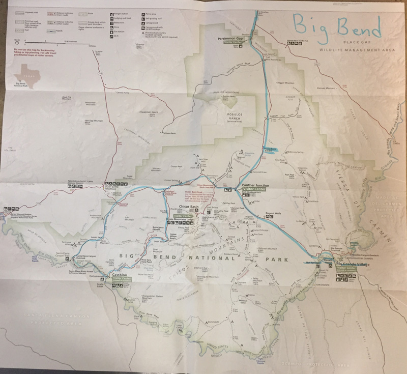
Big Bend National Park
We continued on 90 as it first headed north and then west over the Pecos River and through some gorgeous, but lonely countryside. Both traffic and winds were light, the road was (relatively) smooth, and the temperature mild—just about a perfect driving experience. We saw three javelinas roadside and one badger that stopped in the middle of the road, stared at us for 10 seconds then retreated back into the brush. After this pleasant journey we made it to our destination, Big Bend National Park. Once at the entrance, however, we still had 51 miles to go to get us to our Rio Grande Village campground. Here we dry camped with our good friends Kathie and Gary and their new canine sidekick, Tucker.
It had been four years since we visited the Park in a dry, windy November. Our March weather was much more pleasant with spring knocking on the door of the seasons. Cacti were showing their yellows and reds, and the vibrant ocotillo flowers added contrast to the mountain browns.
Campsite
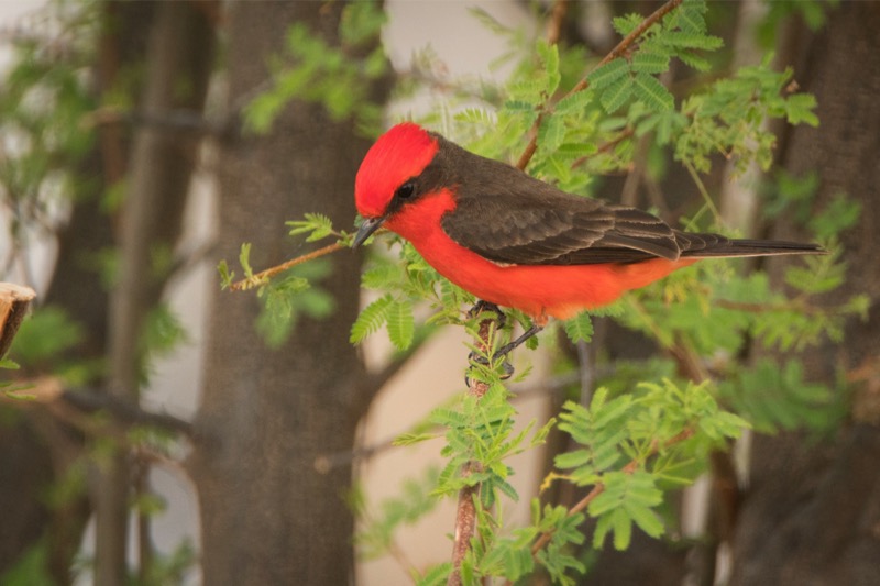
A pair of gorgeous vermillion flycatchers claimed the territory that our campsite was within. We saw both mates snagging flies and other insects out of the air, with the male doing double-duty, chasing his mate (it is that season, you know) and running off other males attempting to invade his domain.
Hikes
We had the chance to do a few nice hikes during our stay. The Nature Trail at the edge of our campground started along a marsh, headed up a rocky hill, and ended at the Rio Grande. We saw a swamp rat and had a pretty vista to gaze at. The Boquillas Trail was also quite pleasant—after some ups and downs, it ended again at a canyon with the Rio Grande running through it. The Hot Springs Trail was also nice, ending up with the springs adjoining the river.
Walking Birding Tour
We took a ranger-led, hour-and-a-half, walking birding tour just a mile from our campground. Perfect weather, an excellent interpreter, and lots of birds made for a great morning. We saw kestrels, woodpeckers, vultures, and the rare (not so common) common black hawk.
Day Drives
We loaded up the pups and headed off for a couple driving tours. One day driving to the dinosaur exhibit, another taking the 21 miles back to Panther Junction, and then heading southwest taking the Ross Maxwell Scenic Drive. After stopping for a picnic at Castolon, we headed west, stopping to view Santa Elena Canyon. We then took the road less traveled and looped back on Old Maverick Road, a rough gravel trek at 10-miles-an-hour to Panther Junction, and then another 21 miles back to camp.
A very interesting, pleasant, and peaceful four days.
Old Trucks
Finally found some old Texas trucks! Here is a good-looking toy truck and four others.
See you next time.
Blog 302: Home on the Range
All continues to go well at our winter home in far southeast Texas.
Quito Mazatlan
My friend John and I took a half-day trip to Quito Mazatlan over on the outskrits of McAllen. Here I took a 3-shot series of Kiscadees that was kind of fun.


The Tram Crew
Here is a shot of Jan and me with Dick, who drives us and up to 65 other passengers in the 90-foot tram along our 15-mile nature tour route.
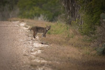
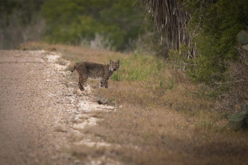
Bobcats
Out on a tour we found Bobby, a young bobcat sitting in the middle of the road. He watched us for a good five minutes before walking away when his Mom (I guess) strolled by after him.

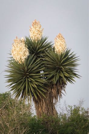
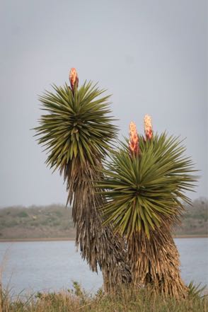
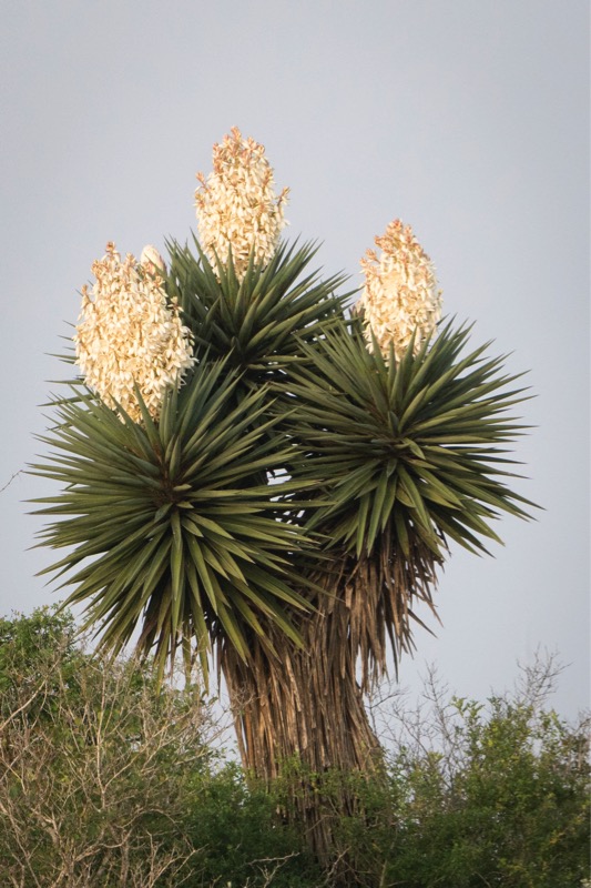
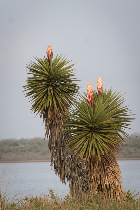
Blooming Yuccas
The yuccas have been in full bloom. Just gorgeous.
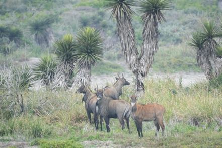
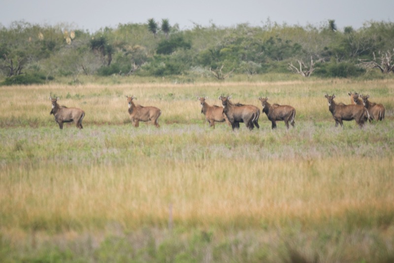
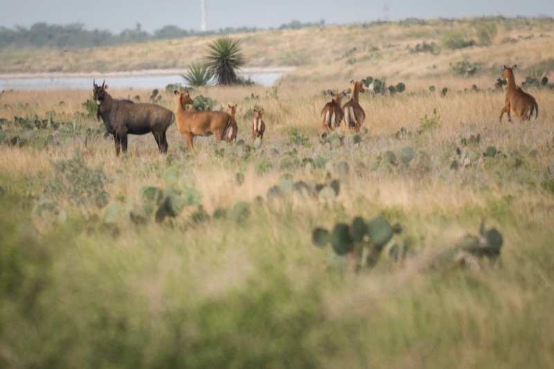
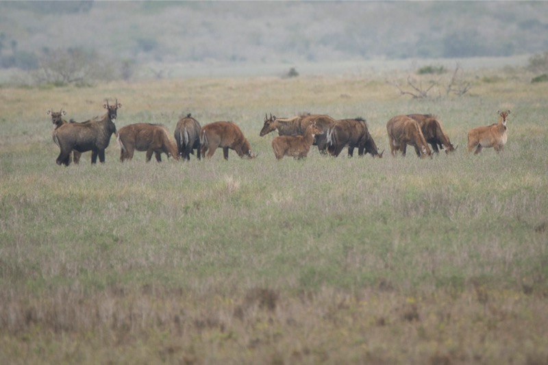
Nilgai
We have been seeing a lot of the exotic Nilgai, the antelope from India. Quite impressive creatures.

Other Pics
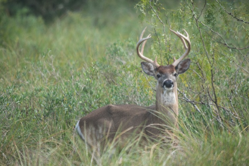
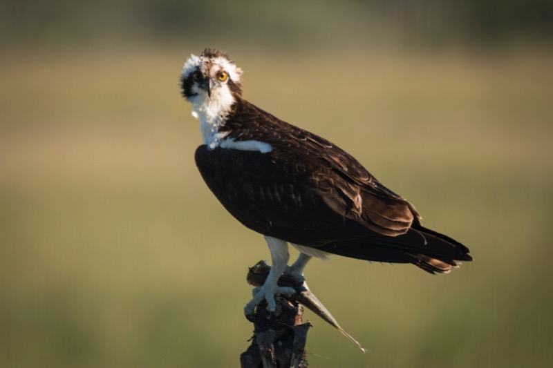
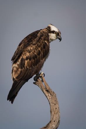
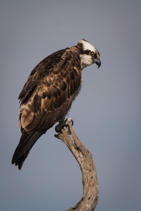
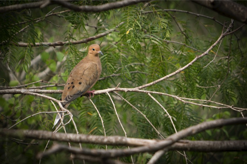
Here is an osprey, a white-tipped dove, and a white-tailed buck.

Old Trucks
Here are three old trucks from the Old Truck Reserve.
See you next time.
Quito Mazatlan
My friend John and I took a half-day trip to Quito Mazatlan over on the outskrits of McAllen. Here I took a 3-shot series of Kiscadees that was kind of fun.
The Tram Crew
Here is a shot of Jan and me with Dick, who drives us and up to 65 other passengers in the 90-foot tram along our 15-mile nature tour route.
Bobcats
Out on a tour we found Bobby, a young bobcat sitting in the middle of the road. He watched us for a good five minutes before walking away when his Mom (I guess) strolled by after him.
Blooming Yuccas
The yuccas have been in full bloom. Just gorgeous.

Nilgai
We have been seeing a lot of the exotic Nilgai, the antelope from India. Quite impressive creatures.
Other Pics
Here is an osprey, a white-tipped dove, and a white-tailed buck.

Old Trucks
Here are three old trucks from the Old Truck Reserve.


See you next time.
Blog 301: Return to the Sea
Turtle Release
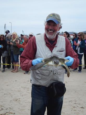
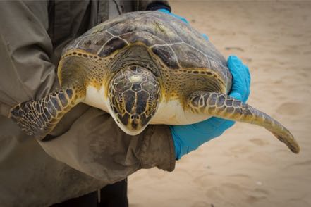
In my last blog I shared the details of the turtle rescue. Five days later, 50 surviving turtles were returned to the sea. Jan and I and several friends drove over to Padre Island to see this spectacle. We were especially anxious to see if "Barney," one of the four turtles we dipped from the deep, had survived the ordeal. We arrived a half hour before the scheduled event and had the chance to talk with several of the dedicated folks from Sea Turtle Inc.
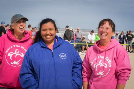
After chatting about our roles in the rescue, they invited me to participate in the release. This unexpected honor was a blast. Two of us chosen ones grabbed the big guys and walked them into waist-high water (human level), and then let go as our captured reptiles flipped their way back home. Yes! Barney made it! (His unique barnacle square on top of his head was a dead giveaway.)
Santa Ana NWR
Santa Ana National Wildlife Refuge is a sister refuge, west and south of us right on the Mexican border. Jan and I planned to be "mystery shoppers," checking out their refuge and comparing and contrasting it to Laguna Atascosa. We were especially interested in taking their tram tour so as to pick up a pointer or two. Alas, when we arrived, we learned that the tram driver was sick, and the tram was cancelled. So, we checked out their Visitor Center and walked a couple of their trails. Also got a nice picture of a chacalaca.
South Padre Island Birding and Nature Center
On another day a group of us drove over to the South Padre Island Birding and Nature Center. Great place to view birds, as a series of boardwalks gets you right up into the action.
Around the Refuge
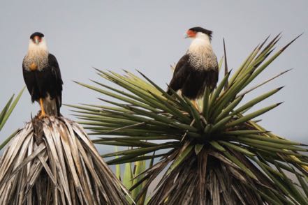
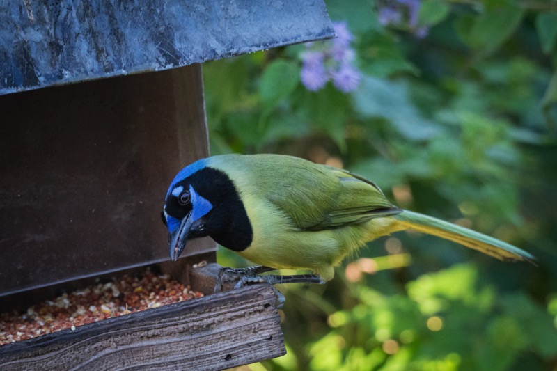
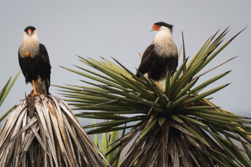
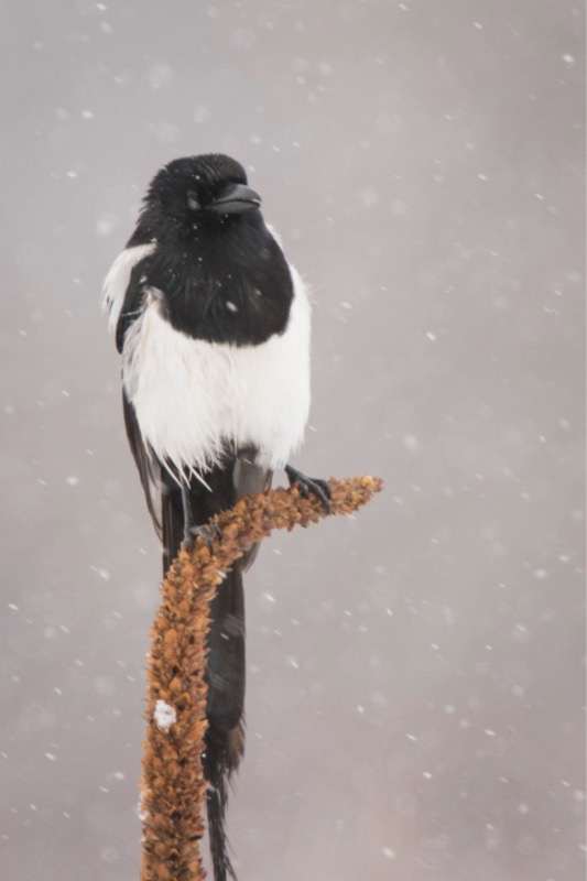
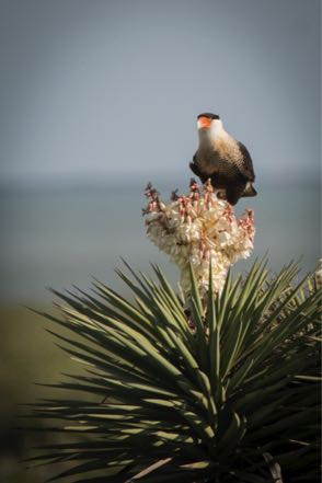
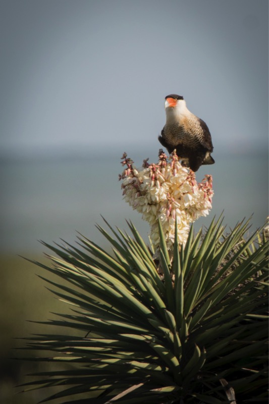
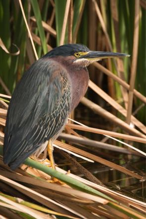
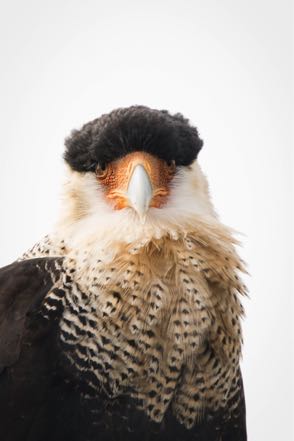
We continue to see lots of birds and critters on the tours and around the refuge. Here are some pics, including the rare aplomado falcon, a caracara, an armadillo, feral pigs, a green jay, a herd of nilgai, a stilt, and a rattlesnake that slithered across our yard, went under out Jeep, the headed over to rest by our neighbors.


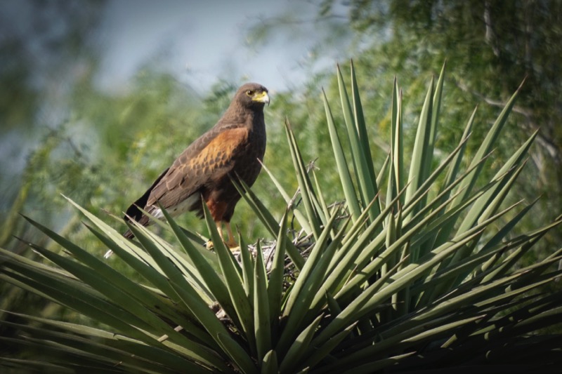
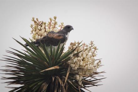
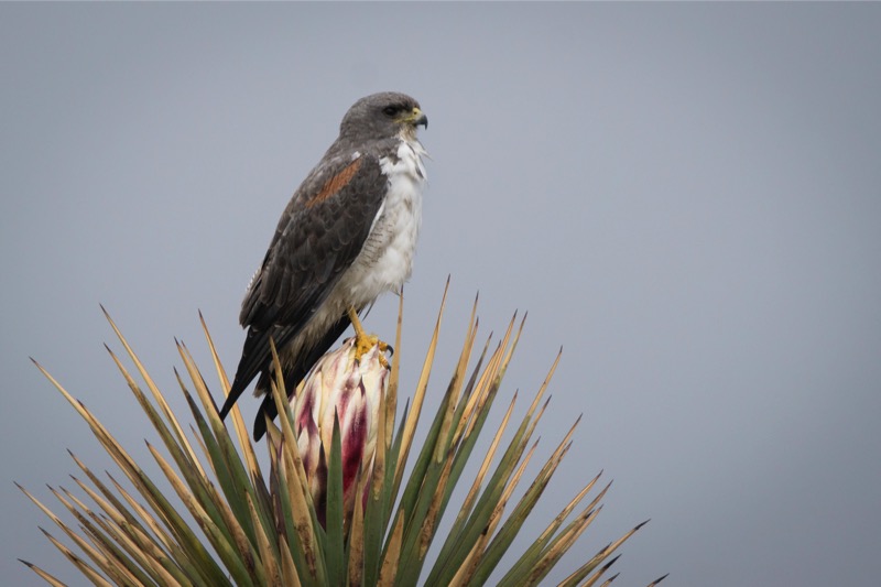
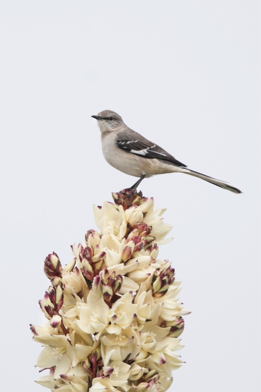
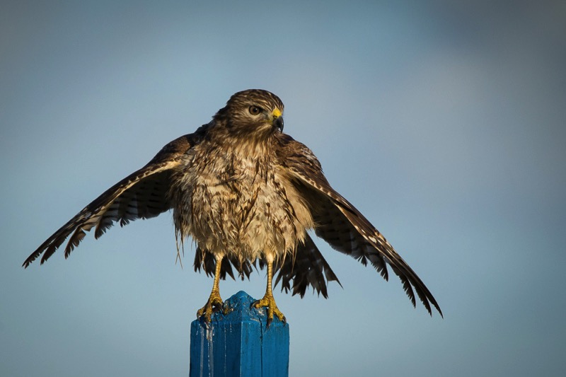
The yuccas are blooming all over, adding a nice touch of color to the browns and greens. Here is a photo of a white-tailed hawk atop a yucca flower.

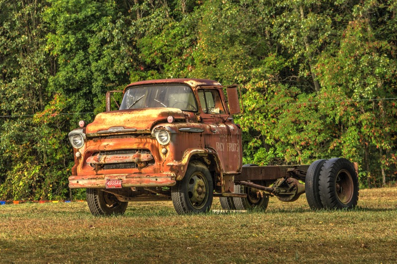
Old Trucks
Here are two old trucks from the Old Truck Reserve.
See you next time.
In my last blog I shared the details of the turtle rescue. Five days later, 50 surviving turtles were returned to the sea. Jan and I and several friends drove over to Padre Island to see this spectacle. We were especially anxious to see if "Barney," one of the four turtles we dipped from the deep, had survived the ordeal. We arrived a half hour before the scheduled event and had the chance to talk with several of the dedicated folks from Sea Turtle Inc.

After chatting about our roles in the rescue, they invited me to participate in the release. This unexpected honor was a blast. Two of us chosen ones grabbed the big guys and walked them into waist-high water (human level), and then let go as our captured reptiles flipped their way back home. Yes! Barney made it! (His unique barnacle square on top of his head was a dead giveaway.)


Santa Ana NWR
Santa Ana National Wildlife Refuge is a sister refuge, west and south of us right on the Mexican border. Jan and I planned to be "mystery shoppers," checking out their refuge and comparing and contrasting it to Laguna Atascosa. We were especially interested in taking their tram tour so as to pick up a pointer or two. Alas, when we arrived, we learned that the tram driver was sick, and the tram was cancelled. So, we checked out their Visitor Center and walked a couple of their trails. Also got a nice picture of a chacalaca.

South Padre Island Birding and Nature Center
On another day a group of us drove over to the South Padre Island Birding and Nature Center. Great place to view birds, as a series of boardwalks gets you right up into the action.

Around the Refuge
We continue to see lots of birds and critters on the tours and around the refuge. Here are some pics, including the rare aplomado falcon, a caracara, an armadillo, feral pigs, a green jay, a herd of nilgai, a stilt, and a rattlesnake that slithered across our yard, went under out Jeep, the headed over to rest by our neighbors.


The yuccas are blooming all over, adding a nice touch of color to the browns and greens. Here is a photo of a white-tailed hawk atop a yucca flower.
Old Trucks
Here are two old trucks from the Old Truck Reserve.
See you next time.
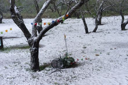
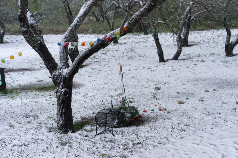
Blog 298: Let it Snow
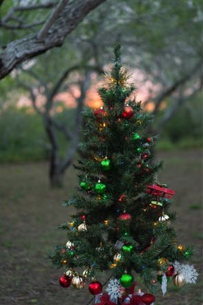
Oh, Christmas Tree
With lots of help from our young neighbor, John Harvey, we got our Christmas tree up, trimmed, and lighted. In South Texas, snow is something youngsters only see on TV—except for this year! Only the third snow in 125 years fell and, combined with the famous Texas wind, blew down our Monument to the Seasons. Oh well, it quickly warmed and the tree was restored (and bolstered by the addition of more bricks).
BRRRRRRRRR!
I took a short trip to the north country—visiting the Detroit area for work. Great client, but the weather was dreary, cold, and snowy—had an unexpected weather stayover in Dallas, but made it back to Brownsville eventually. Great to be back.
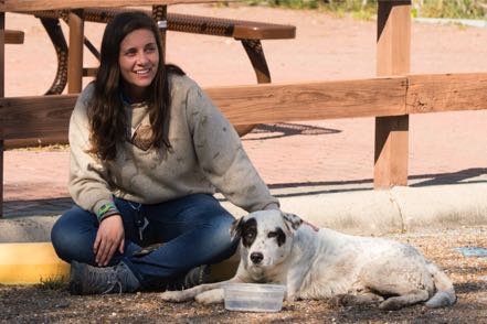
Stray Dogs
We like this area a lot—beautiful area populated with lots of good people. However, on a sad note, too many people discard their pets like trash into a bin—dropping them off in the country to fend for themselves. Often they link up with other strays for comraderie and protection. Our friends here at the Refuge have taken the lead in supporting the dogs’ survival: daily feeding the strays and also paying the vet bills on one pup and making it adoptable. The county constable also feeds this crew and we carry a 50-pound bag of whatever-is-on-sale dog food in the back of our Jeep. Guess it does take a village.
One worn down, tail-dragging, blind-in-one-eye pup wandered into the Refuge. Nikki quickly provided food, water, and comfort. On a strong note, John Harvey’s family adopted this pup. He is in good hands.
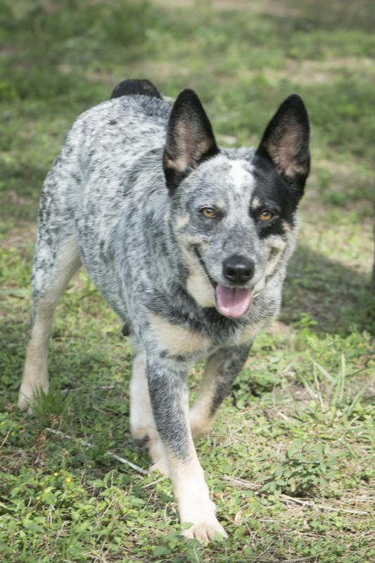
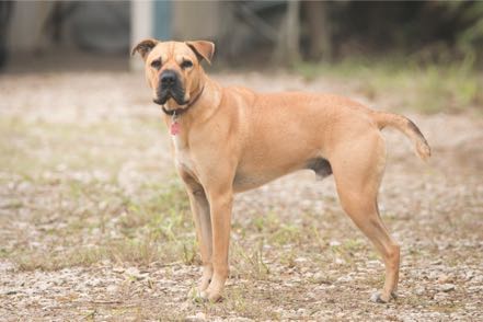
Speaking of pups, here is a shot of a brown dog (well taken care of) that daily guards the entrance to its master’s ranch.
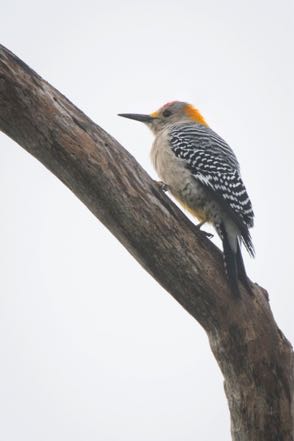
Birds and Critters
Here are more animal pics taken at the Refuge—Jan’s favorite is the close up of the Caracara—she says he looks like the Shah of Iran!

Old Trucks
Here are three old trucks from the Old Truck Reserve.
See you next time.
With lots of help from our young neighbor, John Harvey, we got our Christmas tree up, trimmed, and lighted. In South Texas, snow is something youngsters only see on TV—except for this year! Only the third snow in 125 years fell and, combined with the famous Texas wind, blew down our Monument to the Seasons. Oh well, it quickly warmed and the tree was restored (and bolstered by the addition of more bricks).


BRRRRRRRRR!
I took a short trip to the north country—visiting the Detroit area for work. Great client, but the weather was dreary, cold, and snowy—had an unexpected weather stayover in Dallas, but made it back to Brownsville eventually. Great to be back.
Stray Dogs
We like this area a lot—beautiful area populated with lots of good people. However, on a sad note, too many people discard their pets like trash into a bin—dropping them off in the country to fend for themselves. Often they link up with other strays for comraderie and protection. Our friends here at the Refuge have taken the lead in supporting the dogs’ survival: daily feeding the strays and also paying the vet bills on one pup and making it adoptable. The county constable also feeds this crew and we carry a 50-pound bag of whatever-is-on-sale dog food in the back of our Jeep. Guess it does take a village.
One worn down, tail-dragging, blind-in-one-eye pup wandered into the Refuge. Nikki quickly provided food, water, and comfort. On a strong note, John Harvey’s family adopted this pup. He is in good hands.
Speaking of pups, here is a shot of a brown dog (well taken care of) that daily guards the entrance to its master’s ranch.

Birds and Critters
Here are more animal pics taken at the Refuge—Jan’s favorite is the close up of the Caracara—she says he looks like the Shah of Iran!


Old Trucks
Here are three old trucks from the Old Truck Reserve.


See you next time.
Blog 294: Casino Royale

Loveland, CO
From Cherry Creek State Park, we took the short trip north to Boyd Lake State Park. As the name implies, the main attraction at this state park is the lake. We had a nice lake view from our site and enjoyed the many paths on which we walked the pups.
Day Trip: RMNP
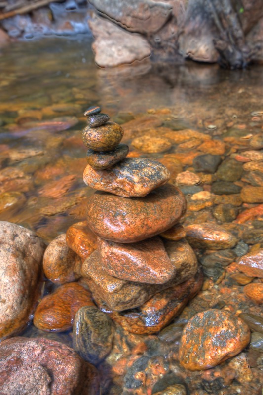
Being this close, we couldn’t resist the opportunity of visiting Rocky Mountain National Park. We have been there many times, but every time is worthwhile. We took the one-way, dirt road up to the Alpine Visitor Center, and then circled back on the main drag. On the way up, we stopped by a stream and Jan built (I helped) a cairn in memory of her cousin Harlan.
Ft. Collins, CO
Another short drive north put us into the Ft. Collins KOA on the northwest part of the town by a major reservoir. On Labor Day, we hooked up with old Pine Island friends who have a house in Ft. Collins for a nice lunch.
Day Trip: State Forest State Park
We took scenic Highway 14 north and west bordering the Cache la Poudre along the way to State Forest State Park. North and west of Rocky Mountain National Park this isolated area is one of the prettiest places in one of the prettiest states. As we approached the park we saw three really big moose in the exact spot we viewed them several years earlier (hey, they might have been the same ones!). After a nice lunch at Walden, we worked our way back to camp.
McCook, NE
From Ft. Collins, we took 14 east to 6 east and found a “city” park in McCook. The small park has sites big enough for big rigs and 50-amp power. They do this as a public service—camping is free except for tips. You certainly could tell you were in the Midwest, because about every fourth vehicle you meet is a tractor, combine, or other motorized farm implement.
Fairbury, NE
Continuing east across the plains, we camped overnight at the Rock Creek Station Recreation Area. Another isolated but very pretty setting.
Osceola Iowa: Casino #1
Continuing east and north we spent a night south of Des Moines, at the Waterside Casino campground. Clean and easy to navigate—good one-nighter.
Coralville, Iowa
Our next stop in eastern Iowa was the Coralville Dam, another Corp of Engineer campground built along Coralville Lake. Huge sites, great views—very relaxing…we spent several days there and will come back again.
Day Trip: Casino #2
We drove south for an easy half hour to meet my two sisters for lunch outside of the town of Riverside at the Riverside Casino. Great catching up on families and a pretty good buffet!
Joliet Illinois: Casino #3
There are relatively few RV parks or campgrounds in this area, and the Hollywood Casino is probably the best.
Kalamazoo, Michigan
From Joliet, we headed east and dropped the coach off at the Thor factory service center in Wakarusa, Indiana, on a Friday mid-day. With our two pups and a loaded jeep, we drove an hour-and-a-half mainly north to spend time with a longtime friend. We had the chance to enjoy beautiful weather and reconnect with many old friends.
Trip to South Haven
Other good friends had recently built a house in South Haven, a two-minute walk to Lake Michigan. We timed dinner right so that we took in a beautiful sunset from their private beach.

Dog Park
As always, we enjoy a dog park whenever we get the chance.
Goshen, Indiana
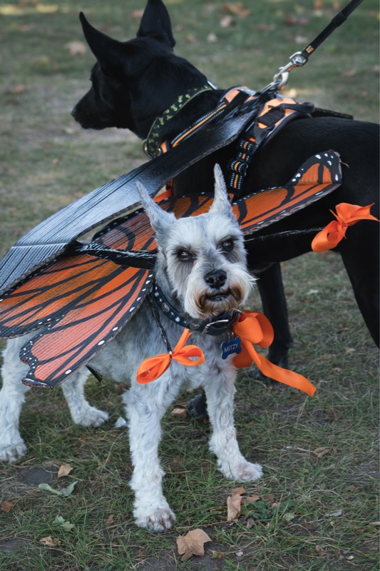
We drove back down to Wakarusa, picked up the coach, and drove the 30 minutes into Elkhart for the yearly chassis service. After checking out this town for three hours during the servicing, we picked up the coach and headed south and east to Goshen. Here we set up camp at the Elkhart County Fairgrounds to attend a five-day Thor Diesel Rally of 135 coaches similar to ours. Lots of seminars, get-togethers, and group meals. They had a dog parade in which Jan made costumes for both Mitzy and Jack. I think the judging was rigged, as it was apparent to anyone with class that Mitzy should have won the best costume, with Jack a close second. Oh, well, we didn’t like the prizes anyway.
Old Trucks
Here is an old truck shot in Michigan.
See you next time.
Blog 284: Deep in the Heart of Texas
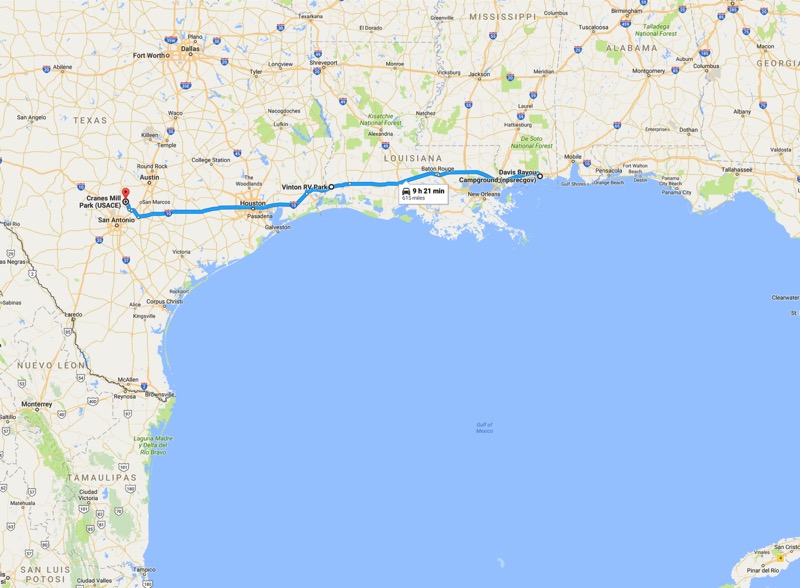
From our Ocean Springs campground, we once again strode on to I-10 West and traveled across Mississippi and most all of Louisiana, stopping close to the Texas border at Vinton RV in Vinton, LA. This was just an easy-on, easy-off location for the night—just a place to rest up, and then go.
The next morning, we again pointed the coach west on I-10, scooting through the very light traffic of Houston, and then to exit 604 in Segun, Texas. After about an hour of taking Texas 46 to 2722 East to 2673 North, we arrived at our campground on Canyon Lake, Texas. Canyon Lake is strategically located, about 35 miles NE of San Antonio and 45 miles SW of Austin. It is a big, manmade lake created and managed by the Army Corp of Engineers.
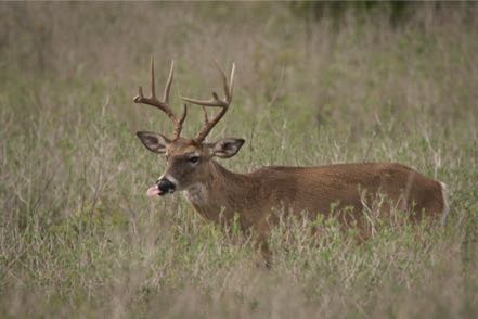
This place is our kind of park…small (just 30 sites), big sites, covered picnic tables, scrub country behind us, and lake views up front. Deer everywhere and lots of birds.

For many hours over our stay, we stalked the scissor-tailed flycatcher (also known as the Texas bird-of-paradise or the swallow-tailed flycatcher) and were fortunate to get a photo or two (in reality, I probably shot 400 or more).
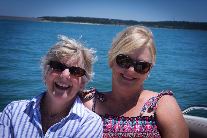
Our RV-really-good-friends from Oregon were in the area visiting family, and we spent time with this crew doing a little sightseeing, and then they took us out boating on the Caribbean-hued waters of the lake. Here are a couple of hot chicks on the boat.
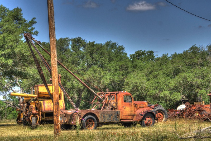
Old Trucks
Here is one old well-digging truck from the Texas heartland.
See you next time.
Travel Blog 270: Young Brews and Fast Critters
Up to Wyoming
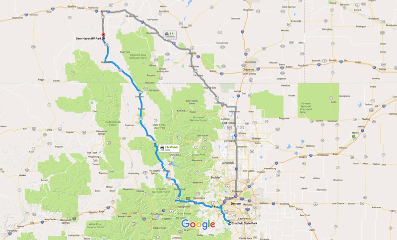
From our campground in Chatfield State Park, we decided to take the scenic route up to southern Wyoming instead of taking major roads and interstates. We took 121 north to I-70 west, US 40 west, CO 125 north, and as we passed into Wyoming, we continued onto 230 west and 130 west to the Deer Haven RV Park just north of Saratoga. It was only 216 miles, but much of the trip was steep and winding, affording wonderful views by requiring Jan’s full attention driving the bus.
Saratoga
The literature says that Saratoga is an interesting place, and it is correct. Although only 1,600 inhabitants, it has a lot to offer. It attracts hunters and fisherman (mainly fishing for trout) from all over the country and the world. They have an airport with a runway that can handle B-52s, and in the fall they say there may be a dozen or more big corporate jets transporting the rich (don’t know about the famous part.)
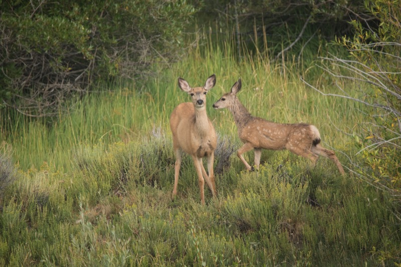
In sharp contrast to the high-density, heavy-traffic, go-go of the Denver area, this sparse, lightly populated area was a nice, slow change of pace. Deer wandered everywhere, and hundreds and hundreds of pronghorns populate the surrounding countryside. Our pup, Jack, feels that there is nothing more fun to watch than running pronghorn.
Dog Park
I was quite surprised that this small town had an off-leash dog park, and very pleased at how nice it was. It quickly became the cornerstone of our morning.
Microbrew Fest
Saratoga hosts the Steinley Cup (pronounced “Stanley” like the hockey version), Wyoming’s microbrew fest in which most all the microbreweries in Wyoming compete for honors. The 21st annual happened the Saturday we were staying in Saratoga, so we felt obliged to participate. Pleasant day, friendly people, good beer.

Battle Pass Scenic Byway
One afternoon we drove south to Encampment, then took Highway 70 up into the Medicine Bow National Forest, up over Battle Pass, and west on toward Baggs. Scarce traffic and great scenery. By the way, the name came from the numerous battles fought between the Indians and the trappers.
Snowy Range Scenic Byway
Another time we headed south for about ten miles, and then went east on highway 130 once again into the Medicine Bow National Forest, stopping at Centennial for a nice lunch, and then on to Laramie. Once again, beautiful scenery and light traffic.
More Colorado Pups
Here are more pup pics from Colorado that I didn’t have ready for my last blog.

Old Trucks
Since an individual from Pine Island complained about my lack of truck shots, here are three old trucks from the Old Truck Reserve.


See you next time.
Travel Blog 268: Beautiful Colorado
Buena Vista
The trip from Ridgway State Park to the Buena Vista KOA was gorgeous. However, whoever was driving had to concentrate on the steep inclines and declines and pay close attention to curves and drop offs. Gladly the weather at our destination was wonderful—in the low to mid-80s instead of the high 90s. Although a dusty park, the views were beautiful. A nice feature was that there was a trail that started in the campground and continued up into the forest. Perfect place to let Jack off-leash and let the crazy canine run wild.
Fort Collins
We had intended camping in the Denver area, but every campground within 60 miles of Denver was booked! Never seen anything like this before. So we had to drive all the way to Fort Collins, and then we could only stay five nights instead of the ten we wanted. I guess cheap fuel and a slightly improved economy is having its impact! However, our campground (Fort Collins KOA) was a gem—great place for dogs and for grandkids. We will remember it for future family ventures.
Quick Trip to Southern California
I didn’t get a chance to experience much of the campground or the area, though, as I had a business trip to Southern California. Good client, great food, and just awesome weather made the trip a success.
Loveland
Our next campground was off of Highway 34 in Loveland, only 30 minutes away from Fort Collins. Highway 34 is one of the main drives into Estes Park and on to Rocky Mountain National Park.
Rocky Mountain National Park
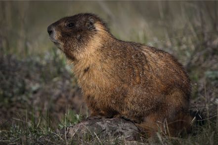
One day we violated all our rules about visiting national parks, as we visited in the middle of the day on a weekend in the summer. Telling ourselves to be patient with all the traffic, we drove into RMNP, and finding it was re-opened after washing out many months ago, we took the Old River Road, the 14-mile, one-way dirt road up to the backside of the Alpine Visitor Center. There were wildflowers all along the way, and we saw a herd of elk and a brute of a marmot at exactly the same place I saw one last year.
On our way home outside of the park we saw some bighorn sheep overlooking the highway. Here is a pic of Momma and Baby.
Afternoon Trip

One afternoon we decided to check out the Poudre River area. We headed back up and past the Fort Collins KOA, picking up the Scenic Byway Highway 14. Just a gorgeous trip along the Poudre River. At Road 27 we angled back south and east around curvy roads and 12 percent grades.
Pup Strolls
Close to our campground was an off-leash dog park and a big nature area complete with miles of paths and several ponds. Each morning we started the day off enjoying this wonderful area.
Old Trucks
See you soon.
Travel Blog 264: Sawtooth
From Challis we headed west on Idaho 75, the pretty but winding road that parallels the Salmon River, passing by Sunbeam all the way through Lower Stanley, and then turning north on Idaho 21 at Stanley for six miles to our campground, Elk Mountain RV Resort. Another gorgeous setting with the jutting and dramatic Sawtooth Mountain Range dominating the view. Our campground was full of chipmunks and whistlepigs (that’s what folks call groundhogs or woodchucks in this area).

Morning Trip to Lowman
Just after sunrise we headed north on 21 for a mile, and then turned onto Stanley Lake Road. There we took a loop tour on Forest Road 455 that took us through a dense portion of the Sawtooth National Forest. After spotting a young buck deer and a large, well-fed coyote, we exited the lake area and again went north on 21 for about five miles before exiting on Forest Road 203 that took us through the Cape Horn Wetland—moose country. Alas, we saw no moose, but did see a pronghorn, more deer, some whistlepigs, a variety of birds, and many wildflowers that Jan enjoyed identifying.

After about a dozen miles, our dirt road reconnected with 21 that took us up and around, down over Banner Summit, and south, all the way down the mountains into the little burg of Lowman, where we stopped for a late breakfast at a roadside restaurant. For about 15 miles the highway was side-by-side the South Fork of the Payette River, whose rushing emerald green waters produced dozens of oohs , lots of ahs, and a continuous stream of wows.
Redfish Lake
Late afternoon we gassed up at Stanley, and then drove south to check out the very popular Redfish Lake. With paved roads and lots of amenities it reminded us a little of Estes Park. After our initial exploration, we decide to get off the beaten path, turning southeast on Forest Road 210. I envisioned in my mind that this rocky path would take us above the congestion of the lake, providing a quiet location with magnificent vistas that we alone would share…well, good luck on that! The rocky road got really rocky, and my planned mountaintop view never materialized. After investing a half hour of bumpy travel, we decided to just keep going, as this path eventually connected with the highway. Just as I figured we were close, a fallen tree across our path brought us to a halt. After confirming that the tree could not be easily moved nor could we drive around it, we blew the bugle of retreat, completed a 26-point turn of the Jeep, and limped back to camp.
Pettit Lake
Early one morning we again headed south on ID 75 stopping by the side of the road to shoot the Sawtooth Range with cattle and fog in the foreground. We then turned west on Forest Road 208 due to Pettit Lake. Without a soul in sight we took a few pics in the brisk morning air. From there we headed south again to check out Alturas Lake. South of the lake we went off-road again taking Forest Road 204 south and west past the (very little) remains of the original Sawtooth City and on down to the end of the road at the Pilgrim Mine.


A Day at the Beach (sort of)
After exploring both Stanley and Lower Stanley, touring the local museum, and taking a short drive on the highway (where Jan spotted a couple river otters playing in the Salmon River), we decided to hang out by the water. There are many, many choices within a few miles of our campground that fit that criteria, but we decided to find some solitude and headed down a gravel road to a spot along Kelly Creek. Here we pulled out our picnic supplies, set up our gear, and sat by the edge of the running creek with dozens of varieties of wildflowers all around us and the mountains in the background.
Sunrise Shoot at Stanley Lake
We left the coach at 5:15 a.m. leaving in plenty of time for pre-dawn set up on the east side of Stanley Lake just 10 minutes from camp. The moon was full, the air was calm, and as we waited we saw the gradual transitions of sky colors from grays to pinks to golds. Just beautiful.
This Sawtooth area is magnificent.
See you next week.
Travel Blog 262: Very Sweet at Cherry Creek
We said farewell to Nathrop and headed north again on 285 through the mountains. Near Denver we picked up I-70 East via I-470 West and stopped at a truck stop for a fuel-up and a wash. A short jag east, and then a few miles south on I-225 to Parker Road and our next camping location, Cherry Creek State Park.
Denver’s Central Park
We’ve stayed here many times and always enjoyed the nature. As it was Black Jack’s first time, he quickly learned to appreciate the vast quantities of rabbits, squirrels, chippers, prairie dogs, coyotes, deer, and birds of all variety.

Bark Park
Another really nice thing about Cherry Creek State Park is their marvelous dog park. Many trails, lots of creek access, and over a four-mile jaunt around the perimeter. We were out there by 6:15 most mornings, but were never the first ones there.

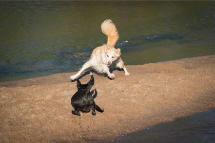
Jack just loves to play, especially in the water--nothing more fun than chasing a big canine or a big canine chasing him.
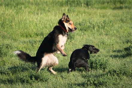
He has also learned to play fetch and brings the ball back…most of the time :’>>

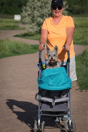
Mitzy thinks she is hot spit as she now has new wheels--whenever she gets tired of walking she has a chauffeured buggy from where she can direct the action of both dogs and people from a higher altitude.
Jan’s Art
Interested in seeing Jan’s latest painting? Go to www.janalexanderart.com/portfolio.html and check out “Skyward” under “Acrylic Paintings and Murals” (the last painting).
See you soon.

Denver’s Central Park
We’ve stayed here many times and always enjoyed the nature. As it was Black Jack’s first time, he quickly learned to appreciate the vast quantities of rabbits, squirrels, chippers, prairie dogs, coyotes, deer, and birds of all variety.
Bark Park
Another really nice thing about Cherry Creek State Park is their marvelous dog park. Many trails, lots of creek access, and over a four-mile jaunt around the perimeter. We were out there by 6:15 most mornings, but were never the first ones there.

Jack just loves to play, especially in the water--nothing more fun than chasing a big canine or a big canine chasing him.


He has also learned to play fetch and brings the ball back…most of the time :’>>

Mitzy thinks she is hot spit as she now has new wheels--whenever she gets tired of walking she has a chauffeured buggy from where she can direct the action of both dogs and people from a higher altitude.

Jan’s Art
Interested in seeing Jan’s latest painting? Go to www.janalexanderart.com/portfolio.html and check out “Skyward” under “Acrylic Paintings and Murals” (the last painting).
See you soon.
Travel Blog 260: Great Sand Dunes
San Luis State Park
We left our Conejos campground late morning, heading east to Antonito, and then north on 285 past La Jara. At Alamosa, we picked up 17 North, and then turned east at Mosca on the county road that led us to San Luis State Park. The views here are incredible, with mountains on three sides and the huge light brown sand dunes of Great Sand Dune National Park adding texture and contrast to the dark browns, greens, and whites of the snow-capped peaks.
After settling in, we drove the 12 miles into the park and were soon on the Medano Pass Primitive Road. This single lane, four-wheel-drive road is flanked by the Sangre de Cristo Mountains to the east, paralleled by the Medano Creek on the west, with dunes immediately behind the creek. Narrow at parts, often quite rough, and usually steep, and always a fairly high pace required to avoid getting stuck in the thick sand. Behind the wheel, Jan’s persona transformed from the friendly, easygoing gal we all know, to the focused, determined air of the race professional. Jaw tight, hands firm on the steering wheel, and right foot cemented to the floor, she drove the course like a virtuoso violinist on speed. I calmly gave her encouragement, occasionally gasped, and grabbed hold of my schnauzer.
Sandy Webcast
Since the phone reception at our campground was spotty, I drove to a hill overlooking the dunes the next morning to do a webcast from our Jeep. With charged MiFi and MacBook, I spoke to a group of 100-plus people who probably thought I was sitting in a cubicle somewhere. The only challenge was that every time I looked up at the mountains or the dunes, I momentarily lost my train of thought. Nice way to do business, however!
Medano Creek
The morning before we left the area, we got up early and drove the Pups down to a very popular section of Medano Creek in the national park. Every midday there are hundreds of people climbing up or sledding down the dunes, and many leashed pups playing in the water. At 6:45 a.m., however, we had the place to ourselves and let Jack and Mitzy off leash to follow the tracks and the sniffs in and around the creek. Great fun.


See you soon.
Travel Blog 259: Day Trips and Early Morning Jaunts
Leaving Elephant Butte State Park, we travelled 148 miles north on I-25 to our American RV Park destination just east of Albuquerque. Nice, easy trip.
Side Trip to Sandia Peaks
After settling in we left the 5,000-or-so-foot altitude of Albuquerque and wound our way up to 8,500 feet at Sandia Peaks in the Cibola Forest. As the altitude rose, the temperature dropped, changing our mind about doing a hike at the top. Comfortable drive with great scenery.
Dog Park
In our continued attempt to socialize our new pup Jackson (aka Captain Jack Black) we took him to the dog park where he quickly learned the rules of multiple canine behavior. Here is a pic of Jack (lower left) learning it is sometimes better to observe than to be actually engaged.

Quick Trip to Chicago
I made a quick trip to Chicago to facilitate a workshop, lead a panel, and give a keynote speech at a symposium. Great group of people and lots of fun. Chance to talk and catch up with folks I’ve known for decades. Hope to do it again next year.
Day Trip
After returning from my work trip, we had one full day before heading out. We loaded up and did a three-mile, high-desert hike at Petroglyphs National Monument. During our trek we saw a brightly colored roadrunner pass and numerous, really big jackrabbits. In fact, one looked about the size of a Great Dane--before I fully recognized that the creature coming at us wasn’t a big coyote, I was chastising myself for not bringing pepper spray!
From there we decided to take the Abo Pass Trail that followed the Salt Missions Trail Scenic Byway for around seventy miles. It follows old trade routes and rail beds through the center of New Mexico. So from I-40 East we took 387 South through Escabosa and Chilili. We picked up 55 South and went through Tajique and Manzano to our first stop--the Quarai Mission Ruins just outside Mountain.
With the pups we walked around and through what was left of the old Spanish mission from the 1600s. From there we continued southwest on 60, going through the spot on the map marked Abo to the Abo Ruins Salinas National Monument Historical Marker, another interesting site along the mission trail. From there we picked up 47 headed north, diagonaled over at Los Lunas to I-25 and then I-40, ending our 150-mile loop.
On to Antonitos
After our good stay at Albuquerque, we took I-40 West to I-25 North. About 20 miles from Santa Fe, Jan said, “Today is the Santa Fe Farmer’s Market!” This is no ordinary farmer’s market--the chili selection is celestial, the baked bread is off the planet, and the cheeses are made just south of Heaven. After a two-minute conversation, we decided to make this detour. Salivary glands had already engaged, and I could taste the bread and cheese for our mobile lunch. We got off US 285, no problem as we knew where to go…however, finding a place to park our 62 feet of motor-home-plus-car turned out to be challenging. We found a space within a couple of blocks of the market, but it took up six parking spaces, and I quickly calculated the possible fine this might bring and suggested we postpone our visit. Reluctantly, we pulled out, got back on 285, and continued north through New Mexico.
About 50 miles from the Colorado border with a perfect high-60s temperature, sunny skies, and light traffic, the hills and snow-topped mountains surrounded us, taking in 270 degrees of our view. Absolutely inspiring vistas.

Conejos River RV Park
Six miles after crossing into Colorado, we turned west on Colorado 17 at the village of Antonito for the 12 miles to our Conejos River RV Park. At 8,500 feet of elevation, the air was naturally thinner, but so was the fly and mosquito population. This park had just opened May 1, and very few souls were in the camp that bordered the Conejos River and was within six miles from two national forests.
Over our three days at this campground we saw scores of birds of many shapes and variety: bluebirds, several kinds of finches, Western Tanagers. Great people, great vistas, and wonderful solitude when you wanted it.

Early Morning Jaunt
Before sunrise on day one of our stay, we drove up Forest Road 101 into the Rio Grande National Forest. Alone on the dirt road we saw deer and a nice size herd of good-looking elk.
Another Early Morning Jaunt
With the temperature just over 30 degrees on day two, we headed west on Colorado 17, then headed northwest at the town of Horca, and were again moving into the Rio Grande National Forest on Forest Road 250. This dirt road paralleled the Conejo River high in its banks. We again saw deer and elk, prairie dogs, yellow-bellied marmots, desert bighorn sheep, chipmunks on every rock (well, almost every rock), a coyote, and scores of hummingbirds feeding on the bushes by the road.
And Another Early Morning Jaunt
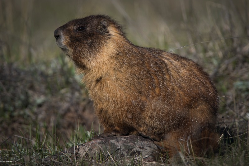
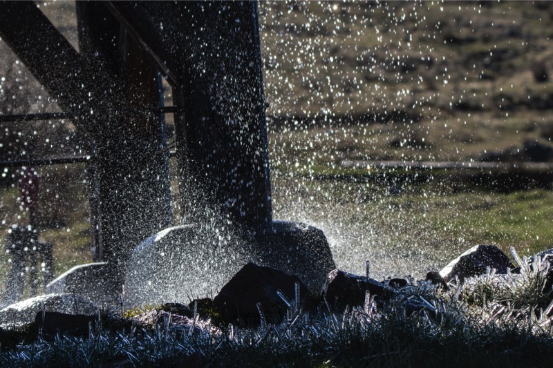
On our last morning, we were again up and out at 6:00 a.m. into the chilly but calm 30-degree morning. This time we headed east on 17, and then quickly turned south on Road D.5, which led us into the Rio Grande Forest of Forest Road 103 that paralleled Big Horn Creek southwest into New Mexico and the Carson National Forest. We wound through forests of Ponderosa Pine laced with trees just starting to bud. In the distance we saw several herds of elk, obviously skittish of hunters. We saw pronghorn along the way and deer, and of course, more chippers. After passing Sublette, Toltec, and Osier Mountains, we came to the end of the road, Osier, at 9,624 feet. It is the watering station for the Cumbres and Toltec Scenic Railroad. At this wayside along the mountain we ran across a marmot sentinel, who was not happy about our arrival. Standing erect as a Queen’s guard on his rock pile, he loudly told me that I did not belong there.
The railroad water tank was continually dripping and the whole locale was thick with swallows. In hopes it might connect with Highway 17, we took a narrow, steep, muddy path but it ended at the Rio de Los Pinos, much too deep to cross (six feet of fast-moving water). So we retraced our journey with mountain, valley, stream, and forest views along the way. During our three-hour trip, we saw only one vehicle and one person. Here are a few pics from the early morning jaunts.


Side Trip to Sandia Peaks
After settling in we left the 5,000-or-so-foot altitude of Albuquerque and wound our way up to 8,500 feet at Sandia Peaks in the Cibola Forest. As the altitude rose, the temperature dropped, changing our mind about doing a hike at the top. Comfortable drive with great scenery.
Dog Park
In our continued attempt to socialize our new pup Jackson (aka Captain Jack Black) we took him to the dog park where he quickly learned the rules of multiple canine behavior. Here is a pic of Jack (lower left) learning it is sometimes better to observe than to be actually engaged.
Quick Trip to Chicago
I made a quick trip to Chicago to facilitate a workshop, lead a panel, and give a keynote speech at a symposium. Great group of people and lots of fun. Chance to talk and catch up with folks I’ve known for decades. Hope to do it again next year.
Day Trip
After returning from my work trip, we had one full day before heading out. We loaded up and did a three-mile, high-desert hike at Petroglyphs National Monument. During our trek we saw a brightly colored roadrunner pass and numerous, really big jackrabbits. In fact, one looked about the size of a Great Dane--before I fully recognized that the creature coming at us wasn’t a big coyote, I was chastising myself for not bringing pepper spray!

From there we decided to take the Abo Pass Trail that followed the Salt Missions Trail Scenic Byway for around seventy miles. It follows old trade routes and rail beds through the center of New Mexico. So from I-40 East we took 387 South through Escabosa and Chilili. We picked up 55 South and went through Tajique and Manzano to our first stop--the Quarai Mission Ruins just outside Mountain.
With the pups we walked around and through what was left of the old Spanish mission from the 1600s. From there we continued southwest on 60, going through the spot on the map marked Abo to the Abo Ruins Salinas National Monument Historical Marker, another interesting site along the mission trail. From there we picked up 47 headed north, diagonaled over at Los Lunas to I-25 and then I-40, ending our 150-mile loop.

On to Antonitos
After our good stay at Albuquerque, we took I-40 West to I-25 North. About 20 miles from Santa Fe, Jan said, “Today is the Santa Fe Farmer’s Market!” This is no ordinary farmer’s market--the chili selection is celestial, the baked bread is off the planet, and the cheeses are made just south of Heaven. After a two-minute conversation, we decided to make this detour. Salivary glands had already engaged, and I could taste the bread and cheese for our mobile lunch. We got off US 285, no problem as we knew where to go…however, finding a place to park our 62 feet of motor-home-plus-car turned out to be challenging. We found a space within a couple of blocks of the market, but it took up six parking spaces, and I quickly calculated the possible fine this might bring and suggested we postpone our visit. Reluctantly, we pulled out, got back on 285, and continued north through New Mexico.

About 50 miles from the Colorado border with a perfect high-60s temperature, sunny skies, and light traffic, the hills and snow-topped mountains surrounded us, taking in 270 degrees of our view. Absolutely inspiring vistas.
Conejos River RV Park
Six miles after crossing into Colorado, we turned west on Colorado 17 at the village of Antonito for the 12 miles to our Conejos River RV Park. At 8,500 feet of elevation, the air was naturally thinner, but so was the fly and mosquito population. This park had just opened May 1, and very few souls were in the camp that bordered the Conejos River and was within six miles from two national forests.
Over our three days at this campground we saw scores of birds of many shapes and variety: bluebirds, several kinds of finches, Western Tanagers. Great people, great vistas, and wonderful solitude when you wanted it.

Early Morning Jaunt
Before sunrise on day one of our stay, we drove up Forest Road 101 into the Rio Grande National Forest. Alone on the dirt road we saw deer and a nice size herd of good-looking elk.
Another Early Morning Jaunt
With the temperature just over 30 degrees on day two, we headed west on Colorado 17, then headed northwest at the town of Horca, and were again moving into the Rio Grande National Forest on Forest Road 250. This dirt road paralleled the Conejo River high in its banks. We again saw deer and elk, prairie dogs, yellow-bellied marmots, desert bighorn sheep, chipmunks on every rock (well, almost every rock), a coyote, and scores of hummingbirds feeding on the bushes by the road.
And Another Early Morning Jaunt
On our last morning, we were again up and out at 6:00 a.m. into the chilly but calm 30-degree morning. This time we headed east on 17, and then quickly turned south on Road D.5, which led us into the Rio Grande Forest of Forest Road 103 that paralleled Big Horn Creek southwest into New Mexico and the Carson National Forest. We wound through forests of Ponderosa Pine laced with trees just starting to bud. In the distance we saw several herds of elk, obviously skittish of hunters. We saw pronghorn along the way and deer, and of course, more chippers. After passing Sublette, Toltec, and Osier Mountains, we came to the end of the road, Osier, at 9,624 feet. It is the watering station for the Cumbres and Toltec Scenic Railroad. At this wayside along the mountain we ran across a marmot sentinel, who was not happy about our arrival. Standing erect as a Queen’s guard on his rock pile, he loudly told me that I did not belong there.

The railroad water tank was continually dripping and the whole locale was thick with swallows. In hopes it might connect with Highway 17, we took a narrow, steep, muddy path but it ended at the Rio de Los Pinos, much too deep to cross (six feet of fast-moving water). So we retraced our journey with mountain, valley, stream, and forest views along the way. During our three-hour trip, we saw only one vehicle and one person. Here are a few pics from the early morning jaunts.


Travel Blog 258: White Dunes, Brown Sand, Black Jack
We left the Carlsbad KOA and headed out on 285 North to Artesia, took US 82 West through Mayville and Cloudcroft, and then headed on to Boot Hill RV Resort in Alamogordo. The last 26 miles of the 129-mile journey was traveling up, over, and down on a 6% slope through the Lincoln National Forest--beautiful drive. The temperature went from hot to mild to warm all in a three-hour span. We set up camp at Boot Hill RV Resort on the outskirts of Alamogordo.
White Sands National Monument
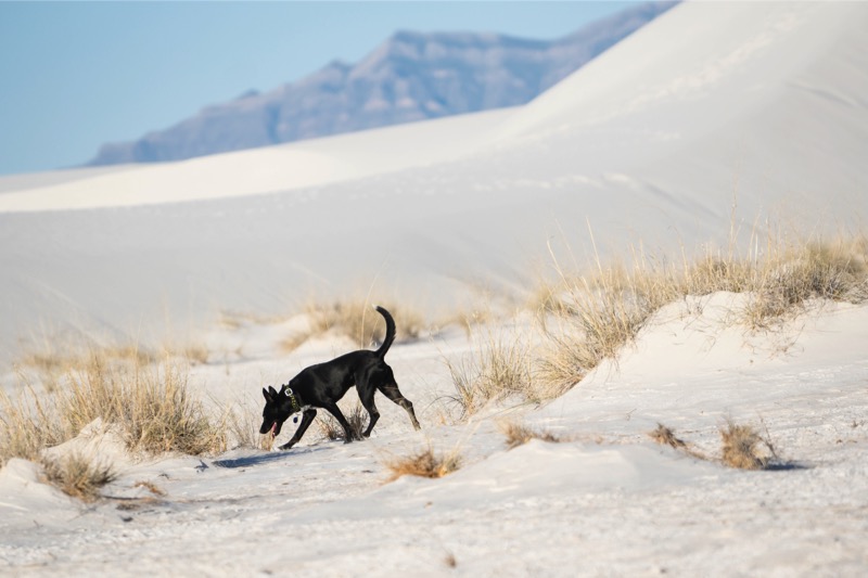
We timed our 25-minute drive from Boot Hill to arrive precisely at 7:00 a.m. when the gate to the park drive opened. We drove about two-thirds of the way into the dunes finding just the right spot. We all got out of the car, walked around a series of dunes, then let dogs do what they love to do—run like maniacs in the sand.
Mitzy enjoyed it but Jackson totally loved it, sprinting like a possessed thoroughbred, he leapt, raced, cornered, turned up, and ran down the white dunes for at least 15 minutes full out. Eyes bugging, tongue dragging, his legs pumped like the pistons of a drag racer in high gear…just a pleasure to watch.
It was interesting, though, at this early hour we heard loud voices and laughter not far away--we assumed it was a large family gathering or a big group get together. However, we were wrong…atop some large dunes was a video set-up complete with satellite uplinks, big camera crews, and thirty or more people standing around. Al Roker, Matt Lauer, and their support team had just completed another video shoot on the National Parks! Maybe we will see them again soon.
Elephant Butte
We took 70 West to I-25 North to camp at Elephant Butte Lakes State Park. Elephant Butte boasts the largest lake in New Mexico and they have beautiful campgrounds that overlook the water.
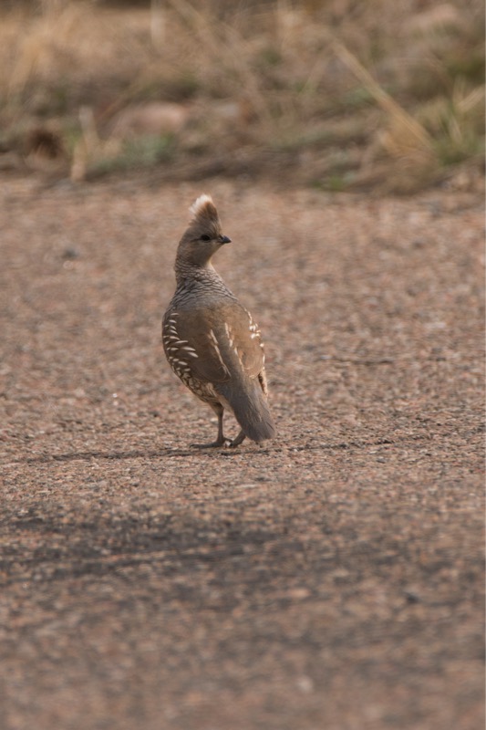
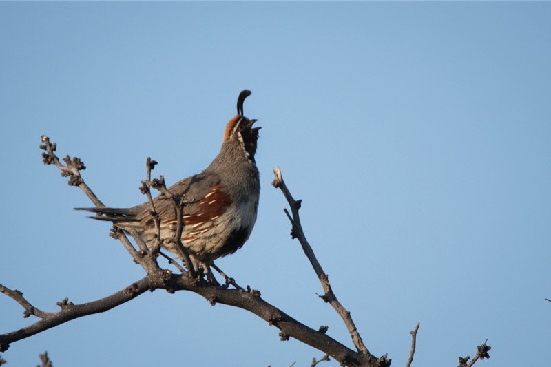
Critters
The campground supports lots of critters with many rabbits (including the big, long-eared jackrabbits), a few squirrels, lots of doves, wrens, Bullock orioles and numerous coveys of Gambel’s quail--a beautiful bird. I was fortunate to capture one calling a few minutes after dawn.

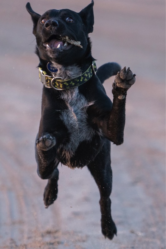
The Beach
However, everyone’s favorite campground activity was our morning walk on the beach. Every day we arrived before dawn and walked along the water. The brown sand between Jack’s toes acted like a volt of electricity, turning the mild-mannered pup into a wild-eyed canine. Here is a shot of Black Jack in full action.
Great stay…we will come back here again.
Blog 256: Gatorland
Gatorland is a classic tourist destination…zip line over alligator infested waters…walk-in aviary full of Amazon-colored avians…petting farm with cute goats, alligator wrestling lessons, bugs and snakes on display, albino gators, and all the hoopla of a night at the Big Top.
But what sets Gatorland apart is its rookery. For a fee, on Thursdays through Sundays during season, photographers can come in at 7:30 a.m., two-and-a-half hours before the family cars and school buses roll in. With nests of eggs and youngsters so close you can almost touch them, bellowing alligators patrolling the waters and puffing up like pro cage fighters, and constant flights of birds coming and going like planes at O’Hare on a holiday, the sights and sounds almost overwhelm.
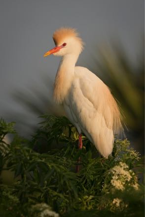
In other words, if you like to shoot birds (photograph, that is) this is the place to be. Pics include a cattle egret, cow bird, cormorant, flamingo, great egret (and children), snowy egret, tricolored heron, and a wood stork. Jan shot the two gator photos.


Old Trucks
Here are three old trucks from the Old Truck Reserve.

See ya’ soon!
But what sets Gatorland apart is its rookery. For a fee, on Thursdays through Sundays during season, photographers can come in at 7:30 a.m., two-and-a-half hours before the family cars and school buses roll in. With nests of eggs and youngsters so close you can almost touch them, bellowing alligators patrolling the waters and puffing up like pro cage fighters, and constant flights of birds coming and going like planes at O’Hare on a holiday, the sights and sounds almost overwhelm.
In other words, if you like to shoot birds (photograph, that is) this is the place to be. Pics include a cattle egret, cow bird, cormorant, flamingo, great egret (and children), snowy egret, tricolored heron, and a wood stork. Jan shot the two gator photos.


Old Trucks
Here are three old trucks from the Old Truck Reserve.

See ya’ soon!
Blog 255: Another Quick Trip to New Jersey
This week I flew back to Jersey to work again with my client. This week was much better--flights on time...sunny skies (mostly)…and temperatures in the 50s and 60s.
Apopka Lake Wildlife Trail
We can’t seem to get enough of this loop, and we drive it most mornings when it is open (Friday-Saturday-Sunday) and I am around. The most exciting event this week was watching an alligator chomp down on an unsuspecting anhinga. Pleased to get a picture off in time before the big guy submerged to drown the surprised bird.


Old Trucks
Here are three old trucks from my Old Truck Reserve.

See you soon!
Blog 254: Quick Trip to New Jersey
The week did not start out the best--fire at the Newark airport…cancelled flight...dark skies and light snow…26 degrees.
However, my sessions with a new client went extremely well--big need and smart people, and at the end of the week I was safe and sound back in Florida.
Apopka Lake Wildlife Trail
Once again we loaded into the Jeep before dawn with Jan driving, me riding shotgun with my lens on a bean bag on top of the open passenger door, and Mitzy and Jackson alternating between windows, seats, and laps. Saw some beautiful birds in full breeding plumage. (Note that if you click on the photo, you will see a larger version plus the title of the pic.) We were blown away to sight and watch the Purple Gallinule--as boldly colored as anything from the Amazon.


Bird Hunters
Just like Jan and me, our Pups are easily entertained, with heads out the windows, sharp eyes scanning the water and brush, and distinguished ears listening to the cacophony of the wild. Here is a pic of Jackson and one of Mitzy.
See you soon.
However, my sessions with a new client went extremely well--big need and smart people, and at the end of the week I was safe and sound back in Florida.
Apopka Lake Wildlife Trail
Once again we loaded into the Jeep before dawn with Jan driving, me riding shotgun with my lens on a bean bag on top of the open passenger door, and Mitzy and Jackson alternating between windows, seats, and laps. Saw some beautiful birds in full breeding plumage. (Note that if you click on the photo, you will see a larger version plus the title of the pic.) We were blown away to sight and watch the Purple Gallinule--as boldly colored as anything from the Amazon.


Bird Hunters
Just like Jan and me, our Pups are easily entertained, with heads out the windows, sharp eyes scanning the water and brush, and distinguished ears listening to the cacophony of the wild. Here is a pic of Jackson and one of Mitzy.

See you soon.
Travel Blog 253: Marvelous Marble Music Machine
Marvelous Marble Music Machine
You gotta check out this short video—amazing: http://www.wintergatan.net/# m.m.machine
Lake Apopka Loop Wildlife Trail
We are camping five miles away from this amazing preserve. The drive is eight miles of critters everywhere. With birds in full breeding plumage, it is a trek of bright colors and loud calls.

Old Trucks
Here are three old trucks from the Old Truck Reserve.

See you soon.
You gotta check out this short video—amazing: http://www.wintergatan.net/# m.m.machine
Lake Apopka Loop Wildlife Trail
We are camping five miles away from this amazing preserve. The drive is eight miles of critters everywhere. With birds in full breeding plumage, it is a trek of bright colors and loud calls.


Old Trucks
Here are three old trucks from the Old Truck Reserve.


See you soon.
Blog 248: Wet and Wild
Lake Apopka Wildlife Loop Trail
While staying in the Apopka, Florida, area we came across a wonderful surprise--less than 10 minutes from our campground is an eight-mile wildlife drive full of bald eagles, red-shouldered hawks, ospreys, great blue herons, blue herons, green herons, tri-colored herons, night herons, great egrets, snowy egrets, cattle egrets, anhingas, cormorants, gallinules, phoebes, Wlson’s snipes, and on and on…also lots of gators.
Here are some pics from our wildlife tours.


If you like nature, this is an awesome tour. Can’t wait to come back in late March when the birds are in full plumage.
We also stopped at the dog park in Mt. Dora and saw this pair of troublemakers.
Recent Old Trucks
Old Signs
See you soon.
While staying in the Apopka, Florida, area we came across a wonderful surprise--less than 10 minutes from our campground is an eight-mile wildlife drive full of bald eagles, red-shouldered hawks, ospreys, great blue herons, blue herons, green herons, tri-colored herons, night herons, great egrets, snowy egrets, cattle egrets, anhingas, cormorants, gallinules, phoebes, Wlson’s snipes, and on and on…also lots of gators.
Here are some pics from our wildlife tours.


If you like nature, this is an awesome tour. Can’t wait to come back in late March when the birds are in full plumage.
We also stopped at the dog park in Mt. Dora and saw this pair of troublemakers.
Recent Old Trucks


Old Signs

See you soon.

Blog 247: Dash to Denmark and Bosque Birds
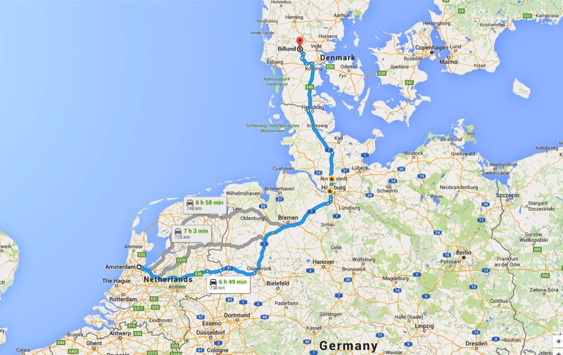
Jan and Mitzy drove me the hour trip from our Santa Fe campground to the Albuquerque airport. From there I flew to Minneapolis, then on to Amsterdam, then on to Billund, Denmark. Another hour drive brought me to my hotel in Aarhus, the second largest city in the country. A long, but uneventful trip.
After a shower and a couple-hour nap, I met my client for a six-course, four-hour meal. The conversation was fun and the food was outstanding. The next day I presented to and facilitated a group represented by folks from Denmark, Sweden, USA, Singapore, UAE, China, Brazil, France, and Germany. Things went great.
I was looking forward to the photo ops of the evening itinerary, as it was to start with a walking tour of a village created by bringing in actual structures from the 15th and 16th century. What I didn’t count on was that it was pitch black as we walked the unlit streets, and the houses and shops we entered barely glowed by the light of a few candles. My camera never left my bag, but it was an interesting tour followed by another outstanding meal.
Up at 4 a.m., I was in a car by 5:15 heading back to Billund to take a flight to Paris, then one to Salt Lake City, and then Albuqurque, where Jan and Mitzy picked me up and drove me back to Santa Fe, arriving around 7:30 p.m.
Chilly Santa Fe
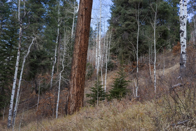
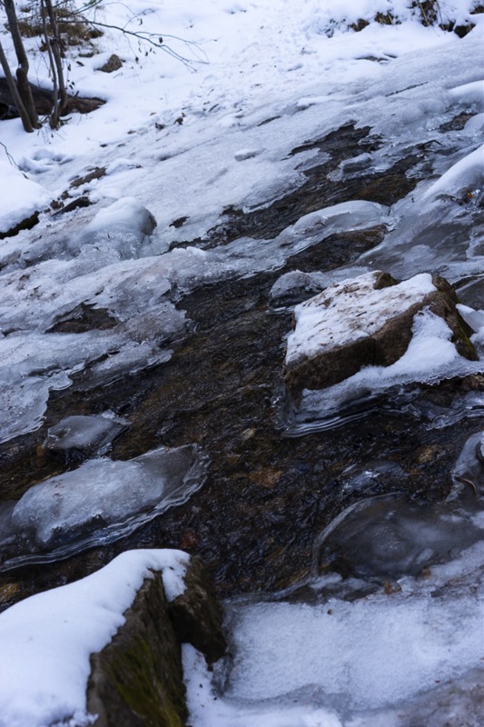
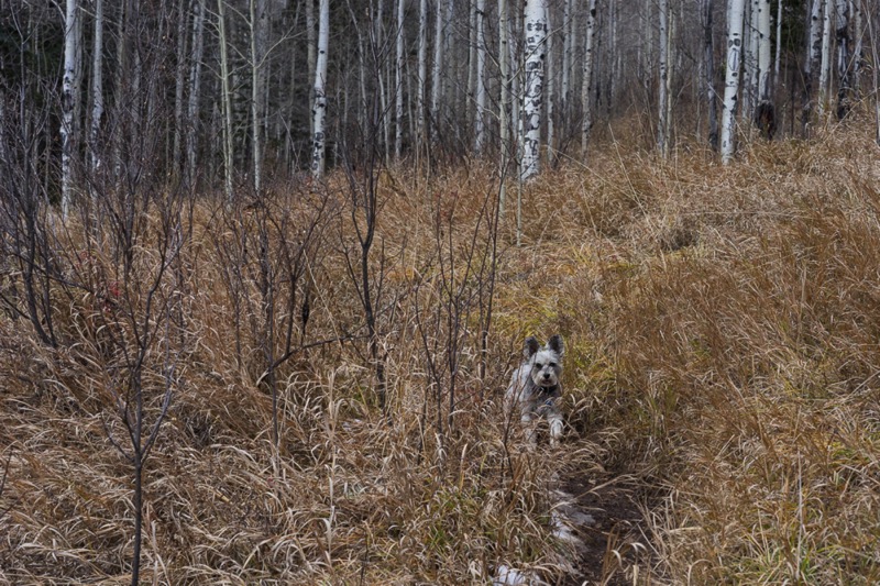
It was cold in Santa Fe, getting down into the 20s. Mid-morning one day after my return we took a beautiful drive up into the mountains into the Santa Fe National Forest and Pecos Wilderness. We took a wonderful hike through the snow and mud up the mountain with a tributary of the Pecos River flowing alongside our trek.
Festival of the Cranes
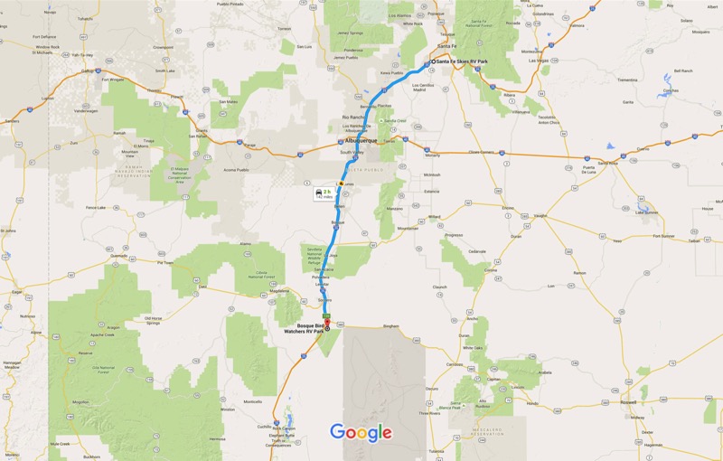
After a three-week stay (at least for Jan and Mitzy) we departed Santa Fe traveling the 140 miles south on I-25, skirting over to the little town of San Antonio, and then south six miles to Bosque Bird Watchers RV Park. After settling in and after “world famous” green chili cheeseburgers at The Owl Bar and Grill, we drove into the Bosque Del Apache Refuge. Our arrival was in the heart of their annual Festival of the Cranes. As you might have guessed, Bosque is famous for its cranes (and snow geese), as tens of thousand of each species fly south from the North country to eat the corn and hay and rest and relax at this protected sanctuary. If you like birds, this place is heaven. We drove the circuit, scoping out locations worthy of sunrise shots.
We were lucky enough to spot two roadrunners up close and very fortunate that one of the usually skittish birds allowed me to take some pics (my first).
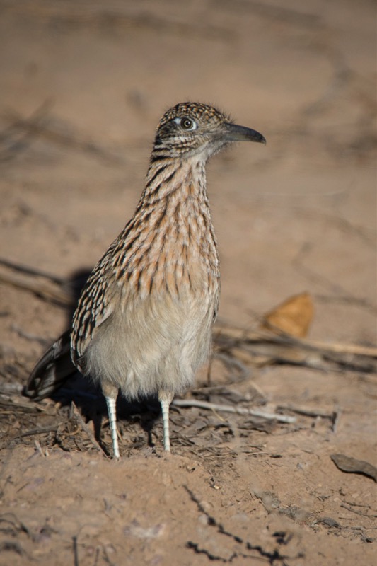
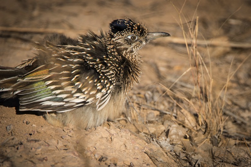
As sunset approached we stopped just south of the Coyote Viewing Platform, listened to the commotion, and viewed the interesting behavior of lots of birds in really close proximity.
Next morning we left in the dark, with me carrying coffee in one hand and a flashlight in the other. About 40 minutes before sunrise I was in position on the Coyote Viewing Platform. After setting up my tripod, most of my actions consisted of walking in place, rubbing my hands together trying to keep warm--I later found out it was only 19 degrees! As the light finally fell, first on the mountains, then on the hills, and finally on the birds on the water, I shot for a solid hour as birds squawked and blasted off into the skies as the morning colors shifted from grays to pinks, and then oranges and reds.
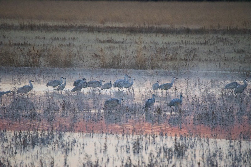
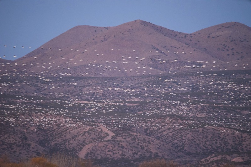
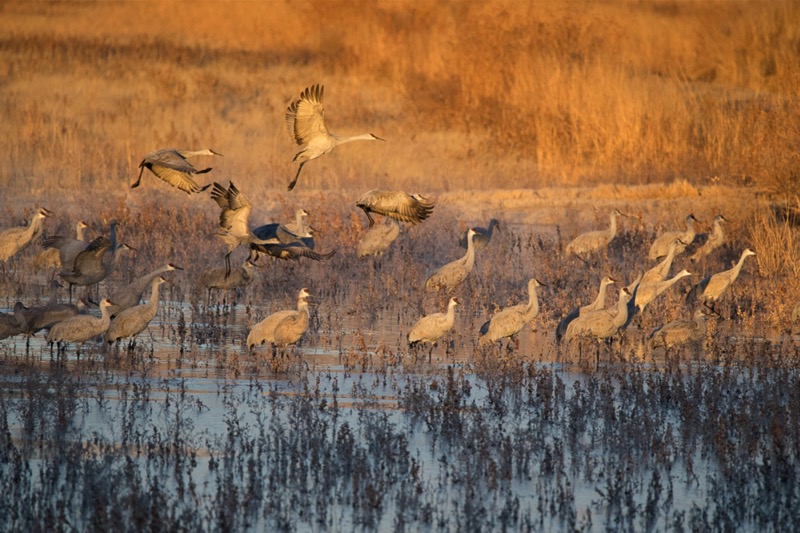
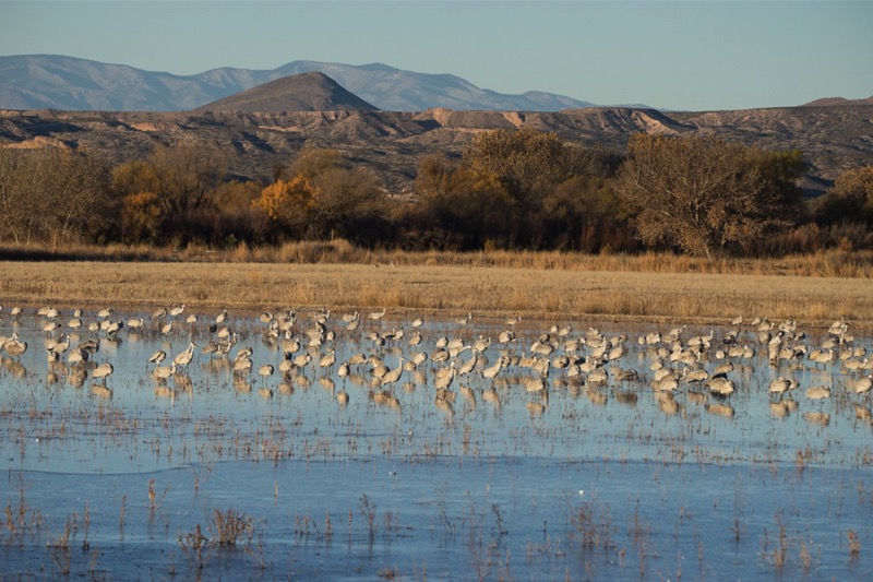
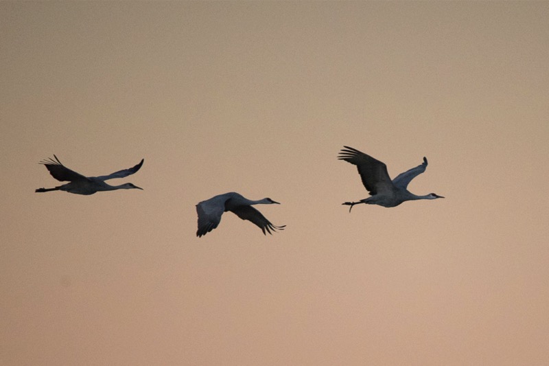
Blurry Cranes, Cub Scouts
We drove through the refuge one last time, spotting a couple of Big Blues out hunting for breakfast. Here is one a little perturbed that a fellow photographer moved a little too close.
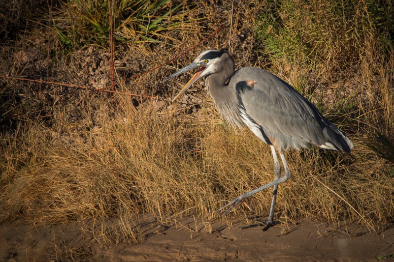
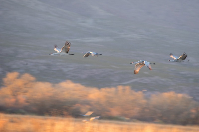
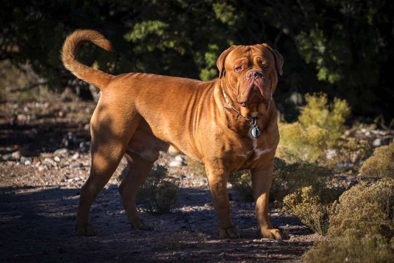
See you soon.
Blog 246: Rutting Bulls and Vortex Clouds
To my readers: Please note that this blog entry was intended to go before the last one but got out of order.
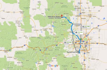
Chatfield State Park is a wonderful place to stay, with miles of trails, lots of water, and a great dog park. The campground is loaded with rabbits, and our Mitzy took it upon herself to help the management get rid of the bunnies (or at least make them move a few feet).
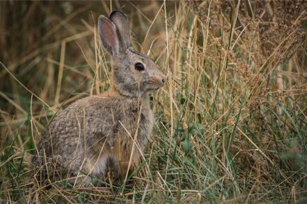
RMNP
From Chatfield State Park we drove north and a little west to Estes Park, and then on to Rocky Mountain National Park. We had been in the Park in late spring and it was beautiful as always. However, lots of snow on the mountains provided a graphic contrast to the blue of the sky, the granite color of the mountains, and the brilliant yellow of the remaining aspen. We drove up Trail Ridge Road as high as we could go (ended at Many Parks Curves) because the large snowfall closed the pass.

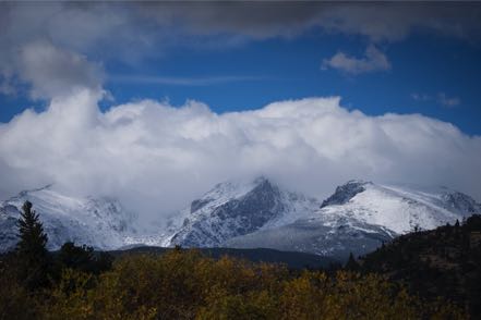
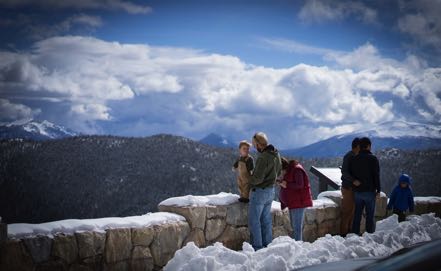
In a Rut
We were quite fortunate that the elk rut was still taking place. We spent hours watching the big bulls round up their herd, fend off challengers, and listening to the Big Guys bugling--no sound like it!

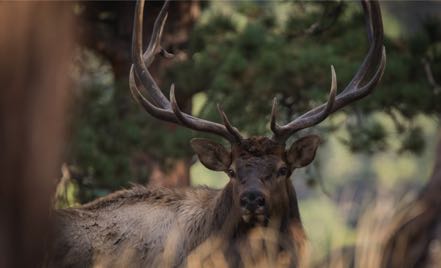
Hikes
During our stay at the park, we took several hikes. Here is a sunrise that started our day, some aspens along the way, a chipper chomping on the side of the trail, and a pine marten sticking his head out of his retreat (this was the first one of these cute fellows I’d ever seen).
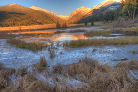
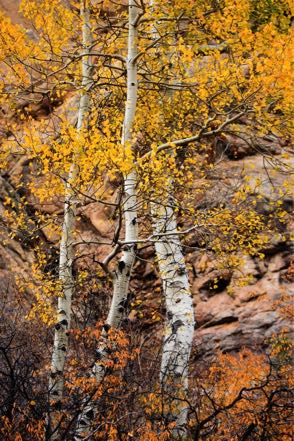


The Vortex
On our return trip to Chatfield, we came across a strange cloud that reminded me of a vortex. Take a look.
Great to be back in Colorado.
Pups
Here are a couple of pup pics.

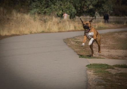
Old Signs
Here is an old sign
Old Trucks
Here are three old trucks.
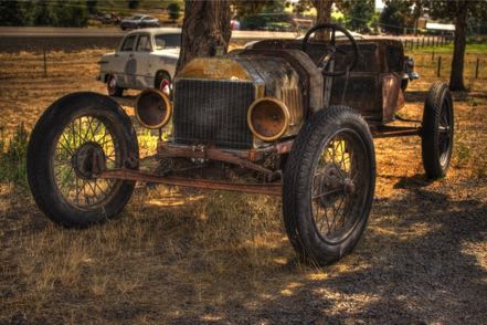
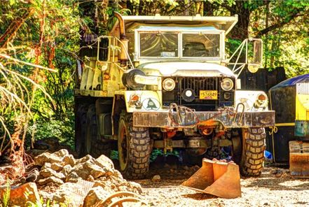
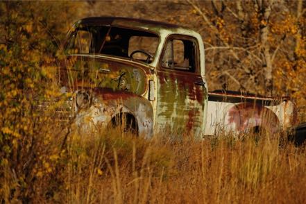
See you soon.
Chatfield State Park is a wonderful place to stay, with miles of trails, lots of water, and a great dog park. The campground is loaded with rabbits, and our Mitzy took it upon herself to help the management get rid of the bunnies (or at least make them move a few feet).
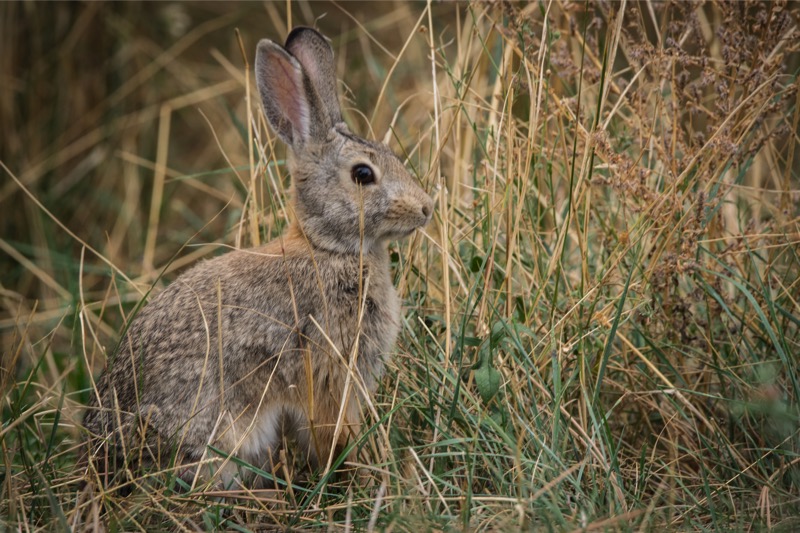
RMNP
From Chatfield State Park we drove north and a little west to Estes Park, and then on to Rocky Mountain National Park. We had been in the Park in late spring and it was beautiful as always. However, lots of snow on the mountains provided a graphic contrast to the blue of the sky, the granite color of the mountains, and the brilliant yellow of the remaining aspen. We drove up Trail Ridge Road as high as we could go (ended at Many Parks Curves) because the large snowfall closed the pass.
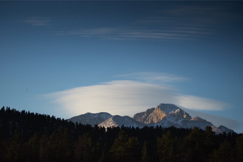
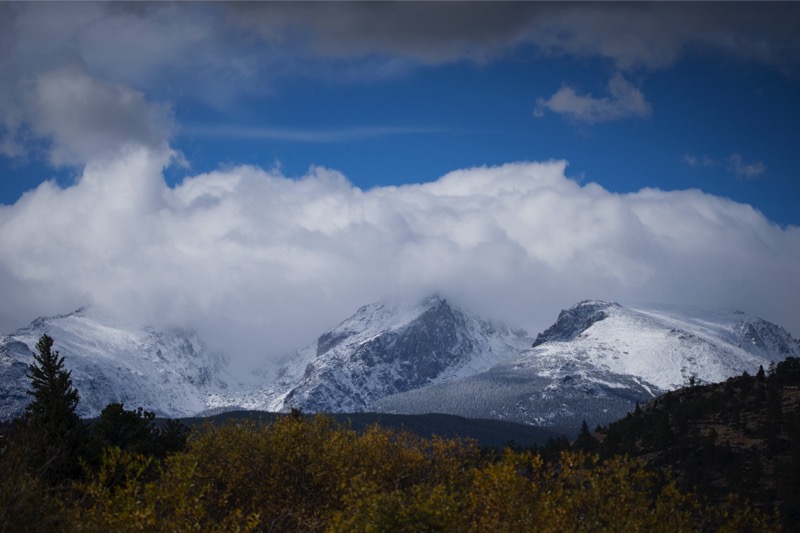

In a Rut
We were quite fortunate that the elk rut was still taking place. We spent hours watching the big bulls round up their herd, fend off challengers, and listening to the Big Guys bugling--no sound like it!
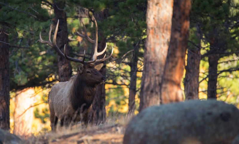

Hikes
During our stay at the park, we took several hikes. Here is a sunrise that started our day, some aspens along the way, a chipper chomping on the side of the trail, and a pine marten sticking his head out of his retreat (this was the first one of these cute fellows I’d ever seen).


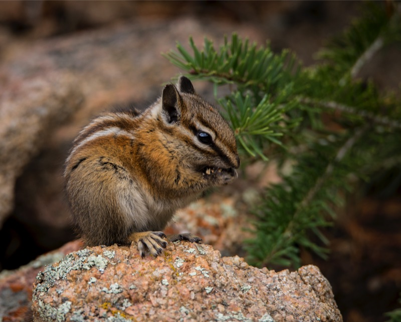
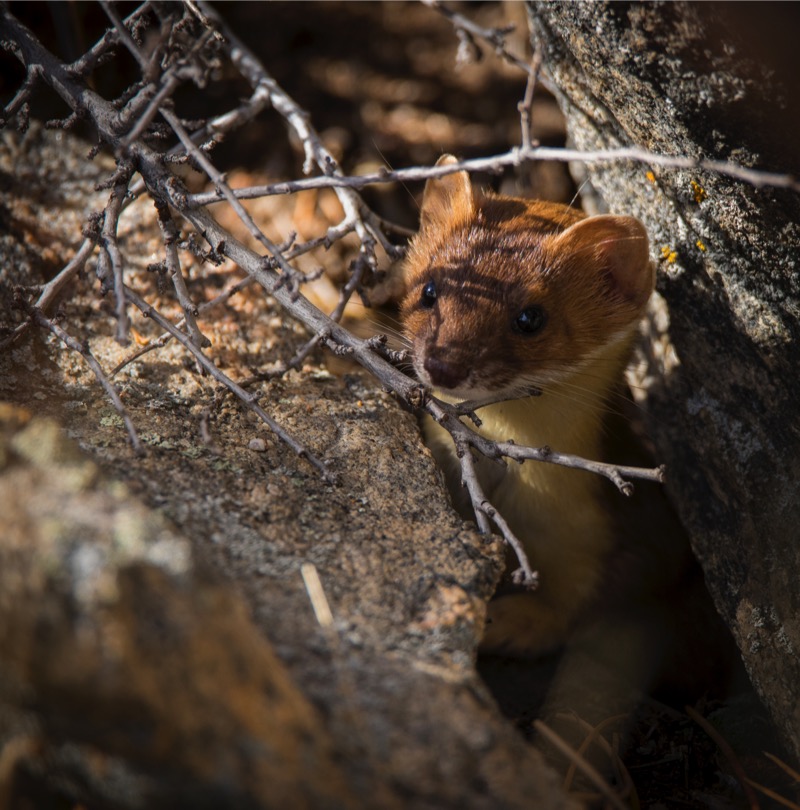
The Vortex
On our return trip to Chatfield, we came across a strange cloud that reminded me of a vortex. Take a look.
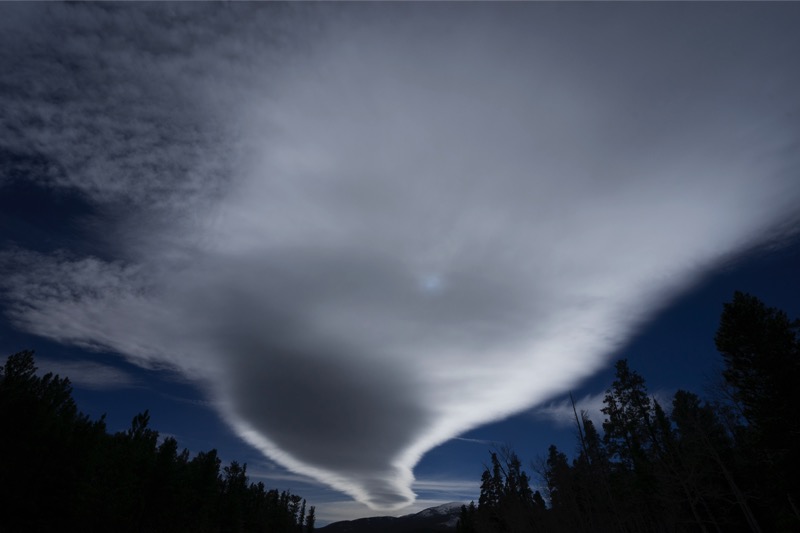
Great to be back in Colorado.
Pups
Here are a couple of pup pics.
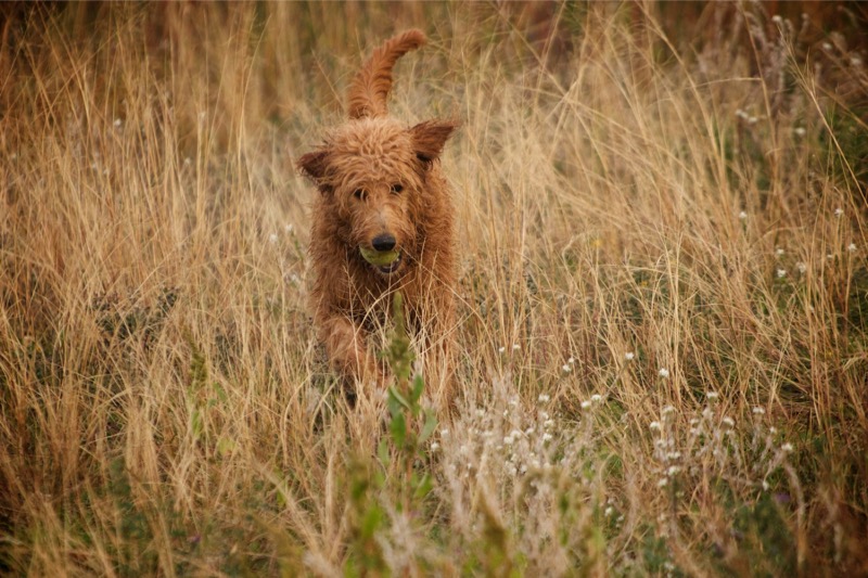
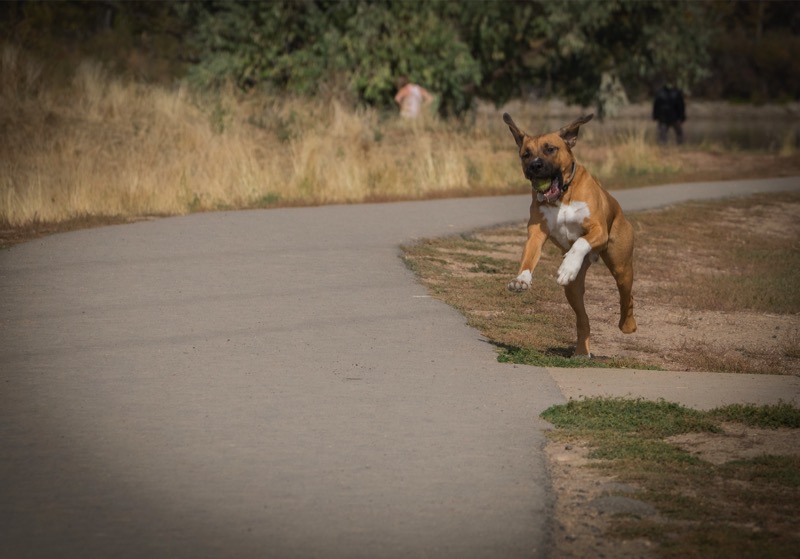
Old Signs
Here is an old sign

Old Trucks
Here are three old trucks.
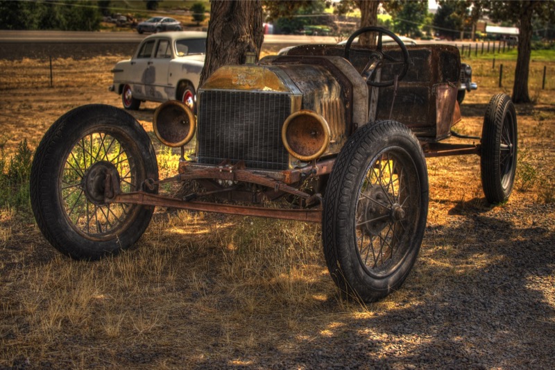
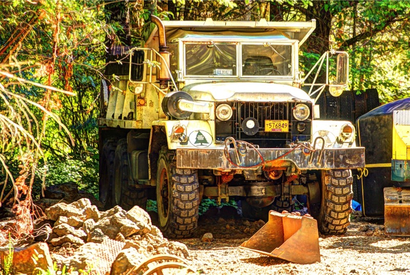

See you soon.
Blog 241: To Hell and Back
We took 95 South to Weiser, Idaho, then took the 201 shortcut into Oregon, then on to I-84 West. The day was clear and the traffic was light as we rolled along the eastern side of the home of the Ducks. At Baker City we set up camp at Mountain View RV Park and settled in for a few days.
Baker City to Hells Canyon Trip
We had visited Hells Canyon from the Oregon side a few years back, but were thwarted from getting the full impact of the region as Highway 39, the Wallowa Mountain Loop, had been washed out by flooding.
Our intent was to take Highway 86 east to Oxbow, on to the dam at the end of Hells Canyon Road, then backtrack and go up Wallowa Mountain Loop to Joseph, then back north, west, and south to our campground.
However, less than three miles eastbound into our journey in our Jeep was a sign stating that 86 was closed ahead due to a new fire. Therefore, we backtracked a little before heading north to La Grande, then north and east on Highway 82, the first leg of the Hells Canyon Scenic Byway. We passed through Elgin, then Wallowa, stopped for a latte at the Blue Banana Coffee Shop in Lostine, then on to Enterprise, then Joseph. The further east we got, the prettier the scenery, as the prairies and rivers turned to mountains and streams.
We headed south at Joseph, down and around Wallowa Lake, then stopped at Wallowa State Park for a hike then a stroll. At the Park we saw a Pileated Woodpecker hunting for lunch and spawning Kokanee Salmons in the stream, the landlocked version of the Sockeye Salmon.
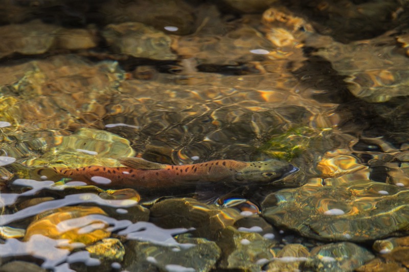
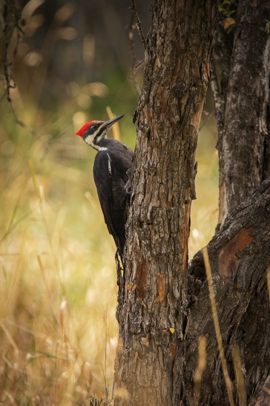
Driving back to Joseph, we headed east on the Wallowa Mountain Loop through forests and along streams past Salt Lick Summit, ending up at Hells Canyon Overlook. Alas, the supposed-to-be-magnificent view was shrouded in a blanket of smoke. Oh, well, it was a magnificent ride.
Joseph
Because of the size of our excursion, we spent the night at a delightful motel and RV park (no we did not drive the rig--we stayed at the motel) less than a mile north of town. The next morning the smoke had cleared, the snow had fallen, and the view of Ruby Peak sparkled among the snow and clouds and fog. Joseph also has a half dozen or so bronze statues lining the main drag. Really cool place.
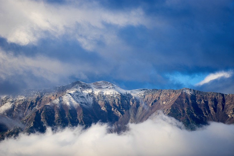
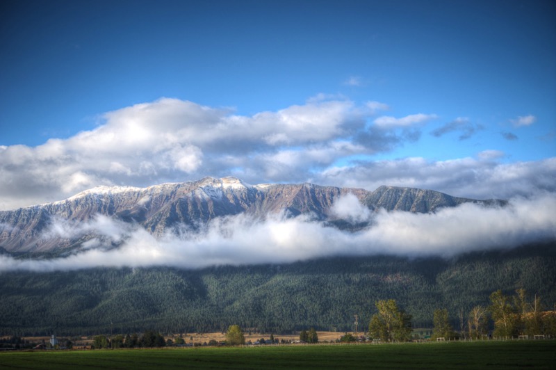
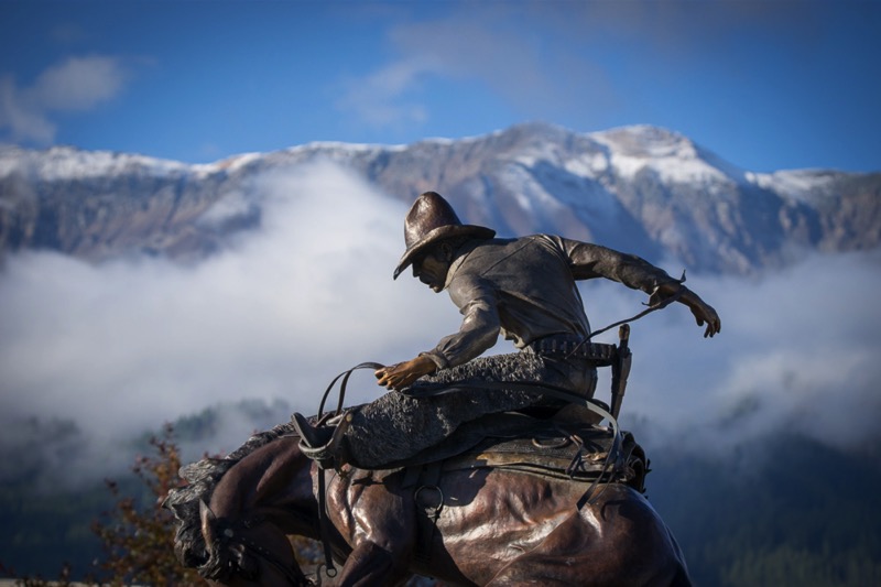
Return Home
For a little variety, instead of exactly backtracking, we headed north and west at Elgin on Highway 204 up into the Umatilla Wilderness. We turned southwest, but instead of passing through Pendleton, we took the back roads to Mission, and then on to the Old Emigrant Trail that eventually lead back to I-84 that we took back to our campground in Baker City.
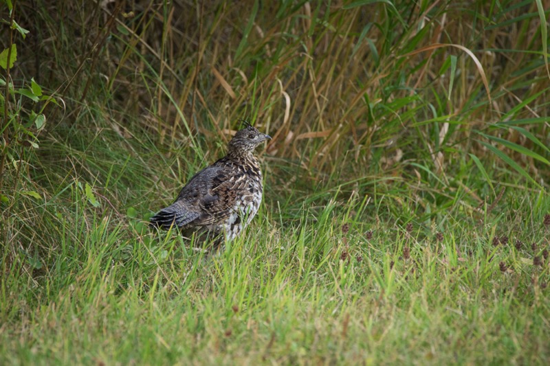

To Hell and Back
What a difference a few days make! We awoke to a cold but clear day with not a trace of smoke in the air. We headed out east in the early morning chill on Highway 86 determined to complete our travel goals of a few mornings earlier. At Mile Marker 44 we found the reason the road had been closed--the earth on both sides of the road for several miles was scorched like land along the path of Sherman’s March to the Sea. We passed through Richland and drove by Halfway on to the Oxbow Dam, where we had stayed at an RV park several years ago.
Our original intent was to continue on the east side of the Canyon and go to the end of the road at Hells Canyon Dam. Instead, we took the dirt road on the west side of the water, 13 miles until the road ended at Copper Creek. Since we had decided we wanted to go see what the Hells Canyon Overlook had to offer in clear light, we were faced with retracing our steps to Oxbow Dam, heading back west on 86, and then going north and east on Forest Road 39. I estimated that this 42-mile trip would take us at least an hour and a half. However, my handy Oregon atlas of back roads showed another option: Hess Road was an 8.3-mile shortcut that would take us within five miles of the Overlook--a no brainer. Yet, there was a price to pay for this “convenience” of shorter distance.
True to the sign’s warning, this national forest road was not for the faint of heart--narrow, rocky, curvy, and steep, it rose over 3,800 feet in the short trip. We were rewarded with wonderful views (many straight down), especially along the hairpin curves that held us over the canyon. Actually, it was a lot of fun, especially since we met no other vehicles.
Here is a photo from our Hess Road journey, and one from the Overlook. After lunch we took a hike then returned back to camp. Great trip.
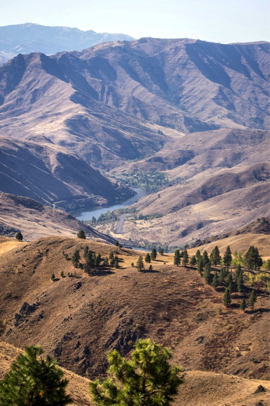
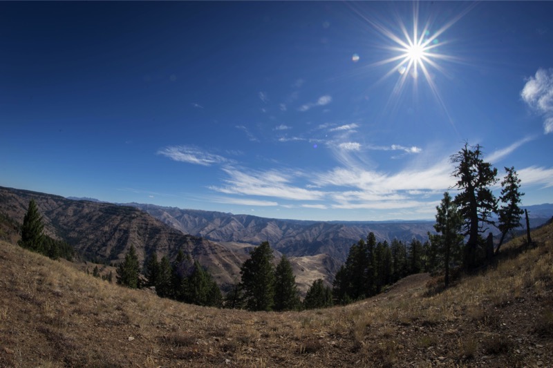
Pups
Here are two pups from the reserve.
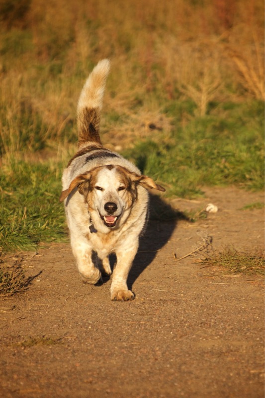
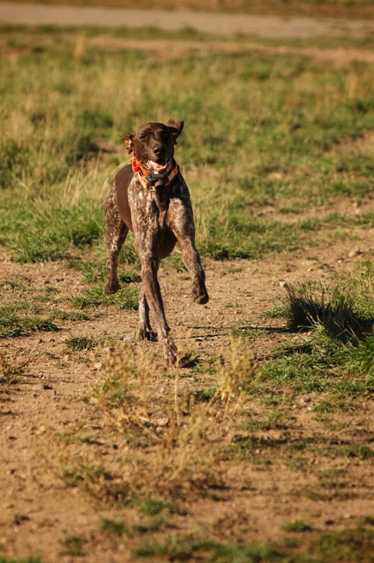
Old Sign
Here is an old sign.
Old Trucks
Here are three old trucks.
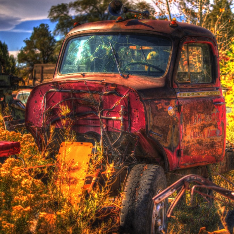
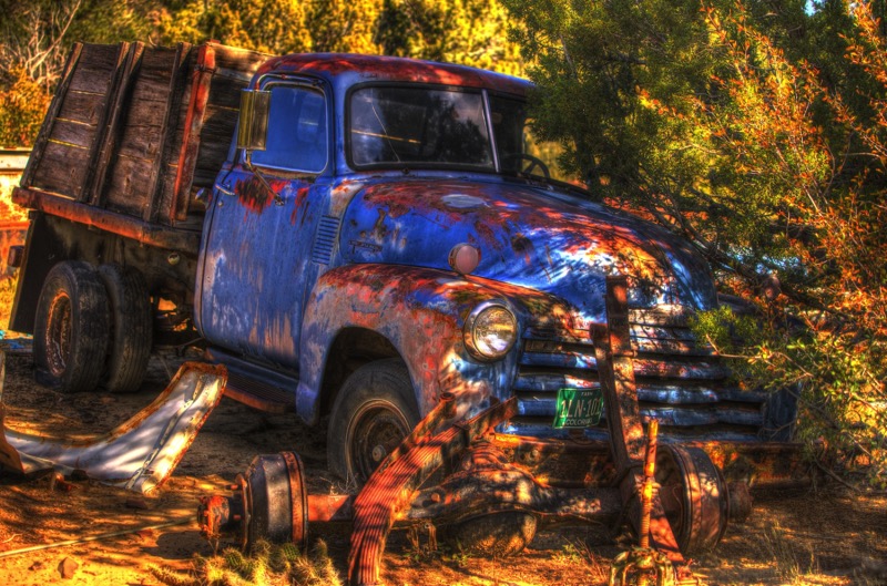

See you soon.
Blog 239: Smoke Gets In Your Eyes
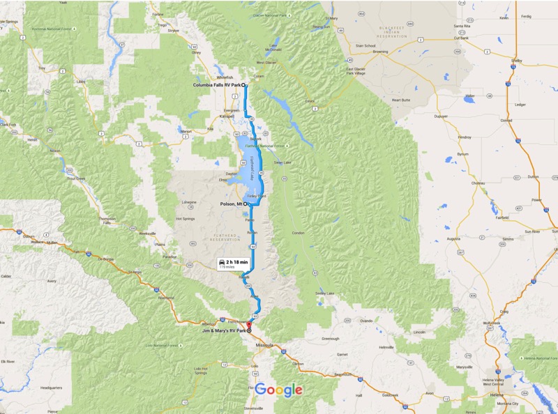
After a great month in the Glacier area, we headed south trying to project regions where there might be little or no smoke from the surrounding fires. We took 206 South, connected to 35 South, which took us around big Flathead Lake. At Polson we jumped on 93 South, which took us all the way down to Missoula, MT. Pleasant and pretty journey.
Bitterroot Road Trip
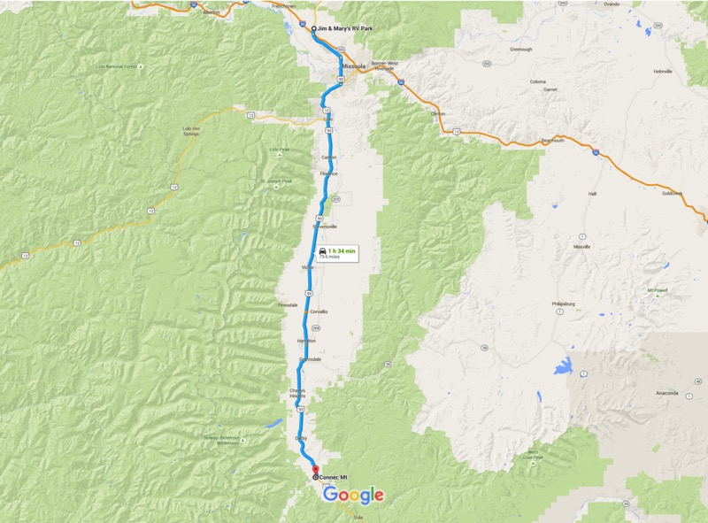
With the Bitterroot Mountains on the west paralleling our journey, we headed south avoiding Highway 93, taking back country roads most of the way, down past Lolo, Stevensville, Hamilton, and Darby, to the little town of Conner. Along the way we took valley roads and mountain trails to check out places like Lake Como and Lost Horse Creek.
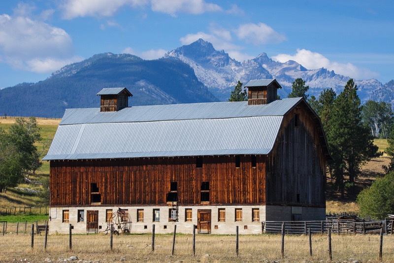
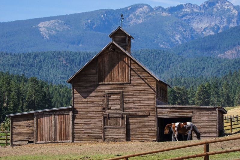
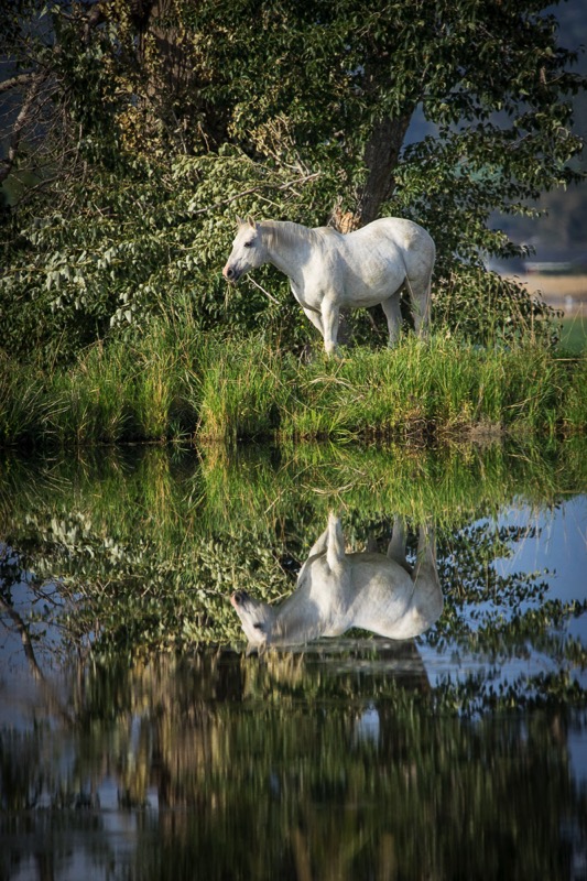
Garnet Ghost Town
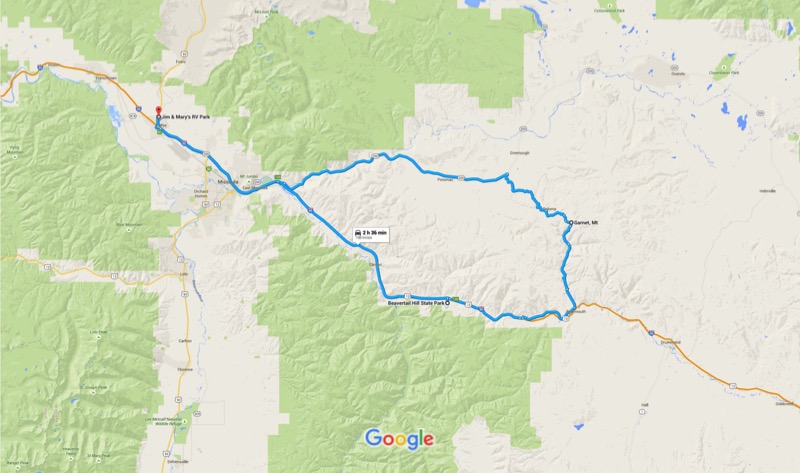
One afternoon we took a gorgeous drive heading east on Highway 200 for about 30 minutes. There we turned onto the Garnet Forest Road (also known as the Garnet Backcountry Byway) heading up and around on gravel for 11 miles. Here we viewed the well-kept Garnet ghost town before heading southish on another path. Bear Gulch Road was a one-way, seriously winding trail of sorts, composed mostly of rocks, holes, and bumps. After an hour-and-a-half or so we covered the 16 miles to civilization and returned back to camp via the Interstate.
National Bison Range
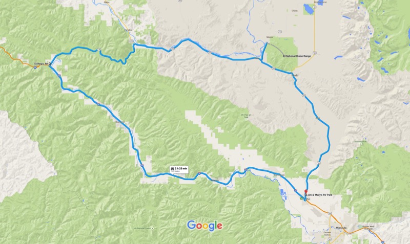
We drove north on 93, and then west on 200 to the National Bison Range. I was a little hesitant to go there, as the hard copy and online publicity about this destination was secondary or tertiary to other NW Montana “must do’s” and usually verbiage was limited to one or two lines. Boy, was I happily surprised to find this awesome 19,000-acre national wildlife refuge.
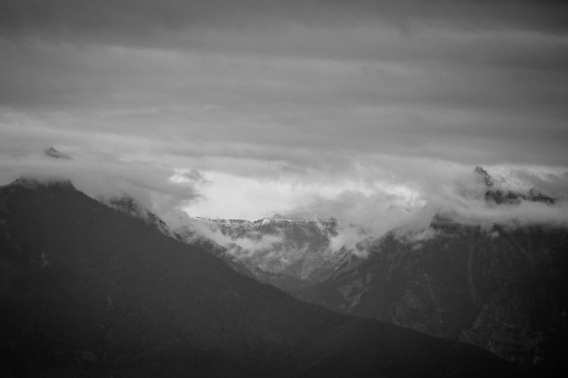
As a light rain drizzled, we drove the 21-mile loop up along the mountains and through the valleys, constantly being serenaded by meadowlarks. We saw only a half dozen cars over our two-and-a-half-hour journey, allowing ample time for photos and gawking. Along with bison of course, we saw several pronghorn, a coyote, a flock of ruffed grouse, small herds of mule deer, and a black bear devouring berries.
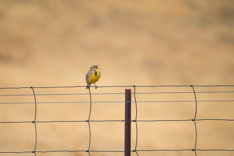
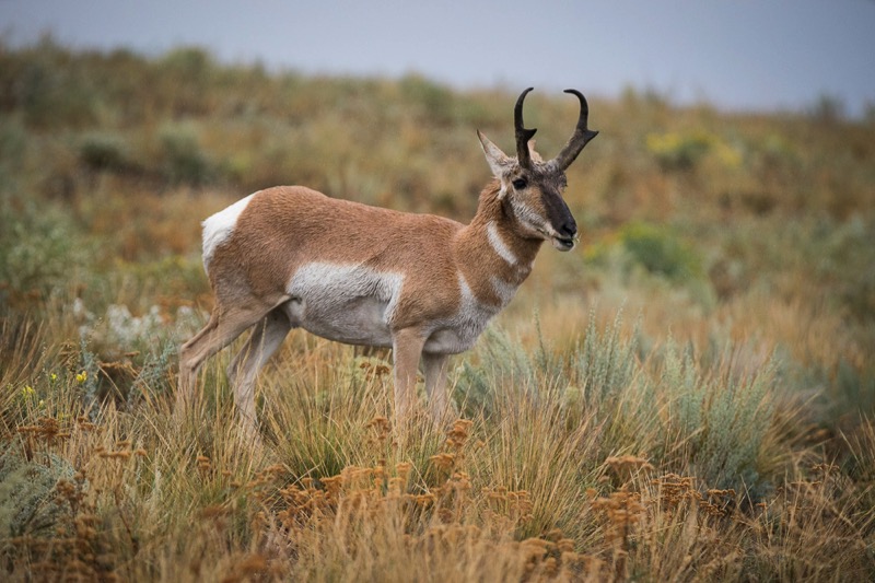
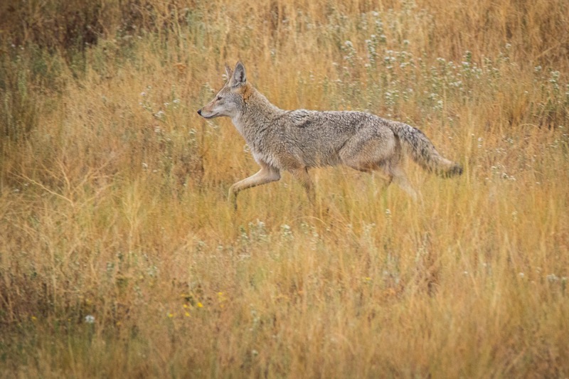
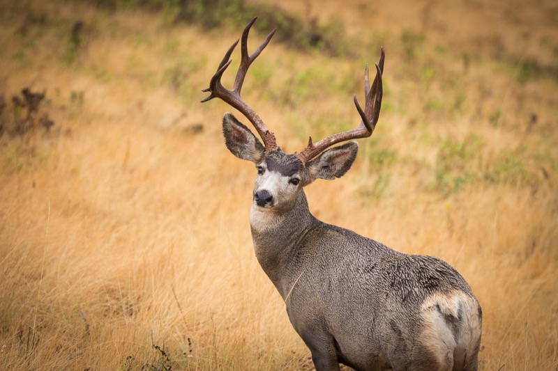
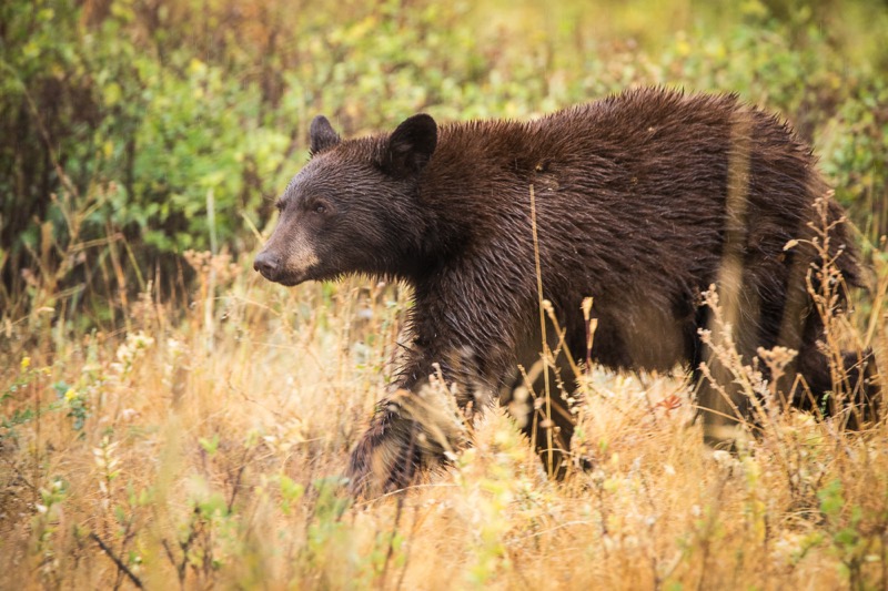
I’d highly recommend this place to all nature lovers. It made our last day in Montana a memorable one.
St. Regis Paradise Scenic Byway
After the National Bison Range we continued west on scenic 200 West, until just south of Paradise the highway turned into an “official” scenic byway, the St. Regis Paradise Scenic Byway--tall, treelined mountains, rolling rivers…you know the schtick. Hard to describe, but worth trying.
Pups
Here is a Dog Fight shot and a Happy Boston from Columbia Falls Bark Park, a brown dog from the Missoula Pup Park, and a Truck Pup from a parking lot.
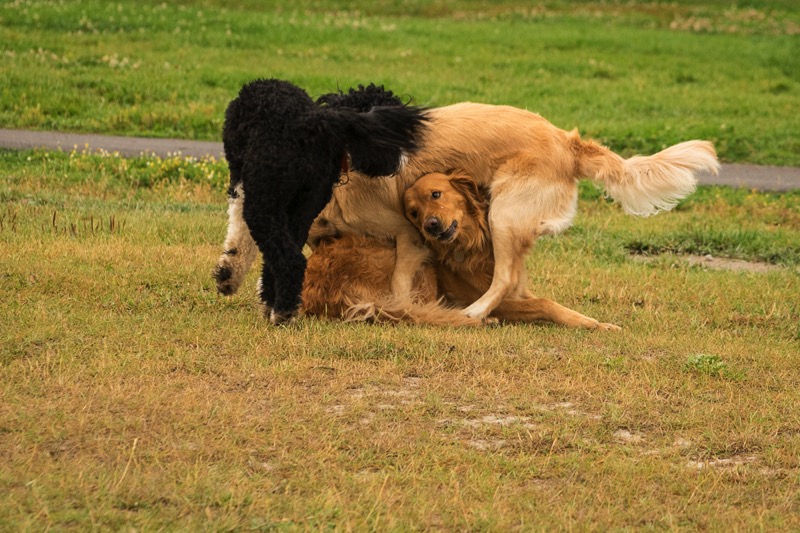
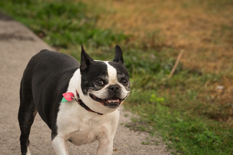
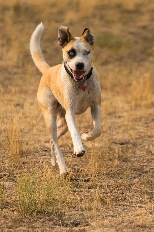
Old Sign
Here is an old sign from the Old Sign Reserve.
Old Trucks
Here are three old Montana trucks.
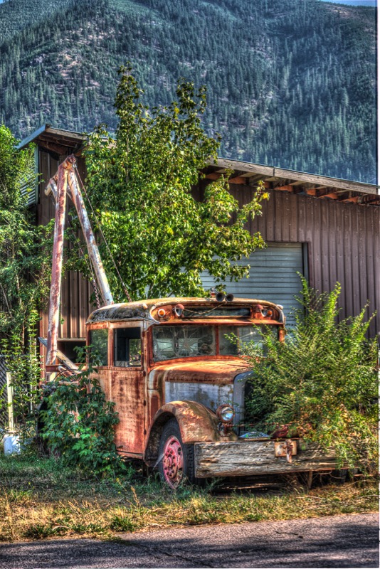
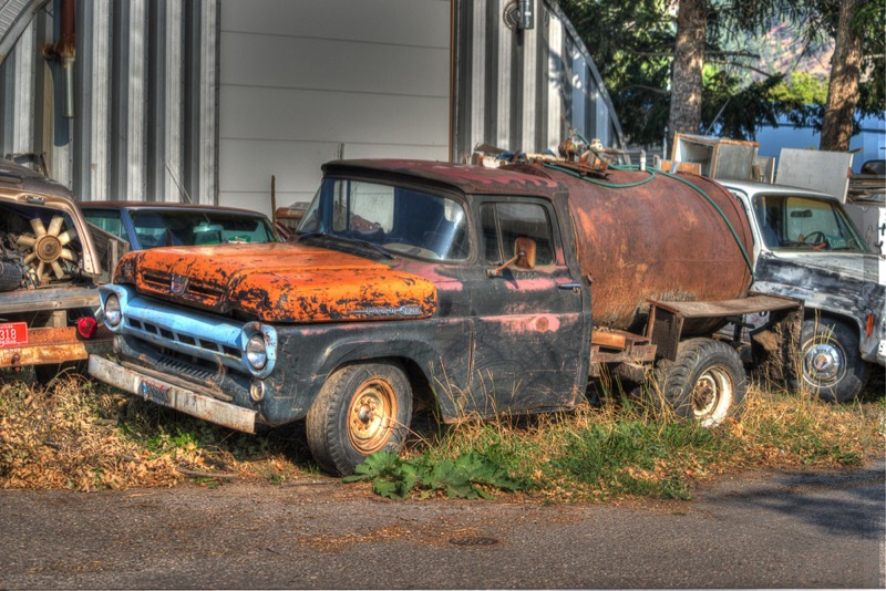
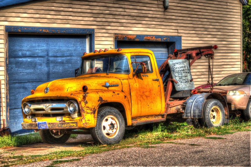
See you next time.
Blog 238: Fire on the Mountain
Since my last blog, we have been exploring the million-acre Glacier National Park and the surrounding northwest Montana area with friends. Small fires in the eastern part of the park initially burning 1,500 acres have expanded into larger fires burning over tens of thousands of acres. Firefighters from all over the country armed with explosives, water-dumping helicopters, and lots of guts have worked round the clock trying to control damage. With over 100 fires burning now in the west, depending on wind direction, the air quality ranges from slightly irritating to difficult to breath.
On the negative side, the fires stress the wildlife, put people and man-made structures at danger, and are a bummer for sightseeing tourists. On the positive side, the fires (at least in the park) are removing old, often diseased trees and planting the seeds (literally) for new, healthy growth. It will be a few years, but the change continues.
Going to the Sun Road
In spite of the fires and smoke, we had several nice drives on the spectacular 50-mile Going to the Sun Road that crosses the park east to west.
Right before Logan Pass, we watched a family of mountain goats forage and play.
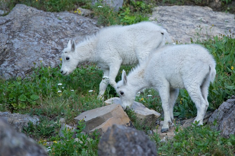
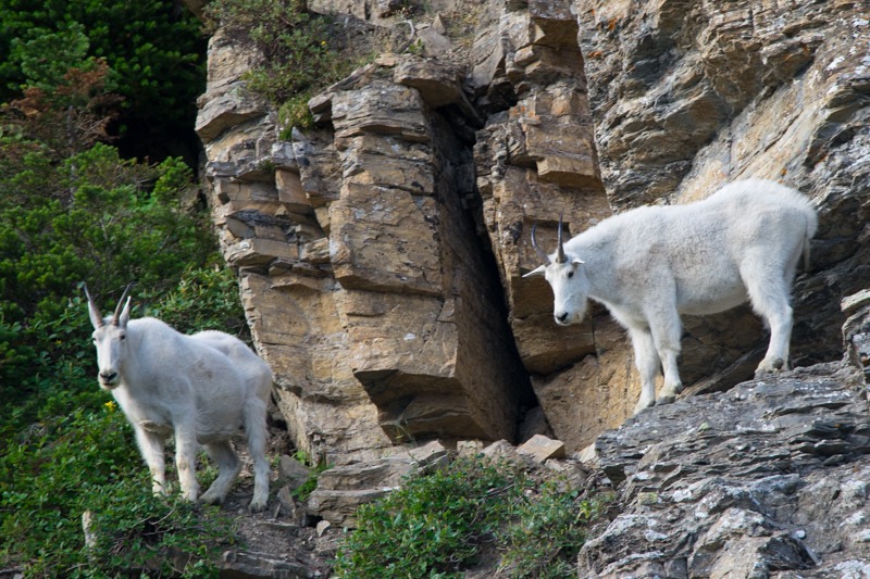
Later, in the same location, we saw a herd of Bighorn sheep troop down the slope in single file.
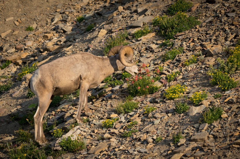
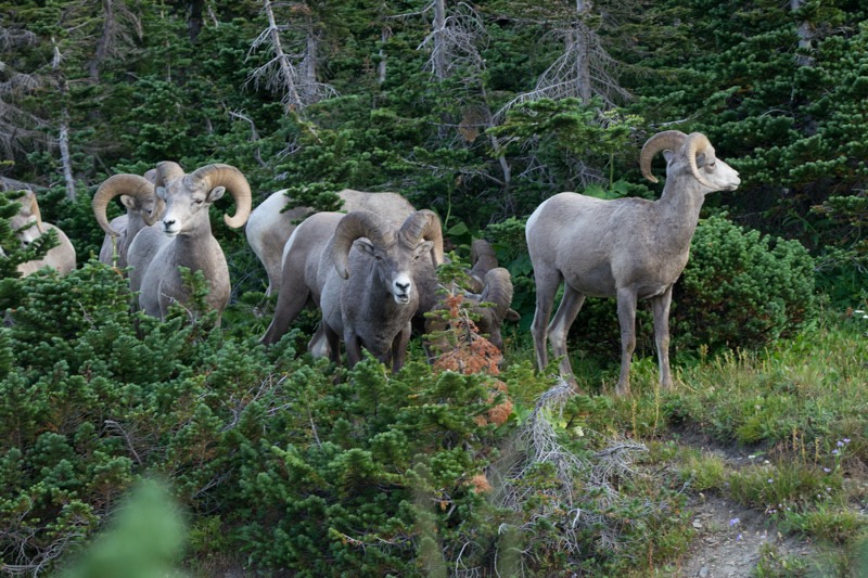
Hidden Lake Trail
Right at Logan Pass we took a gorgeous hike on Hidden Lake Trail, which coincidentally ends at Hidden Lake. With Clements Mountain imposing upward, we walked through the wildflowers of the alpine meadows (named the Hanging Gardens), stopping often for the photo opps that kept getting better.
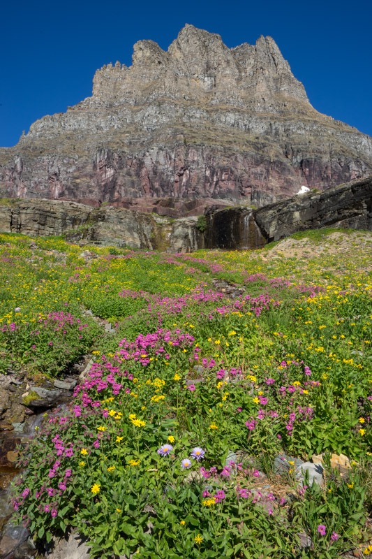
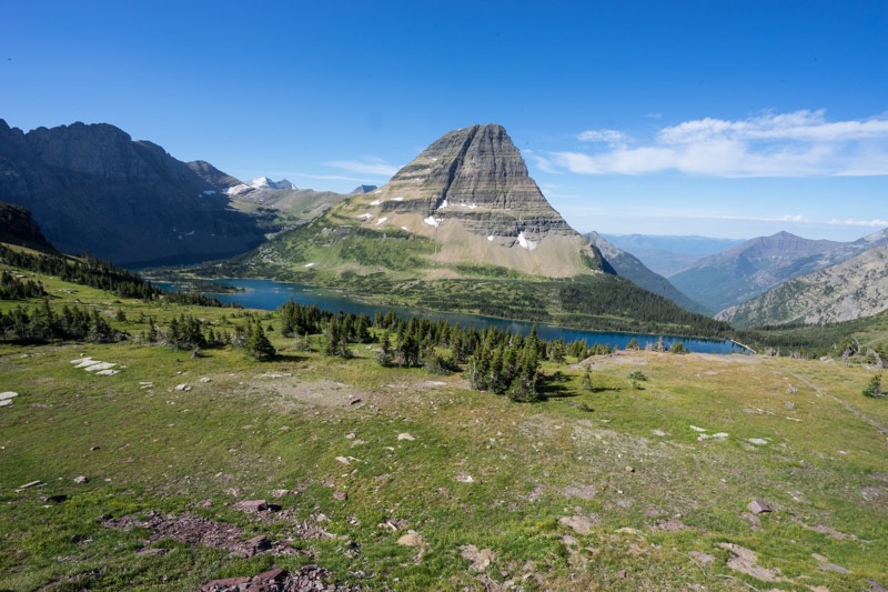
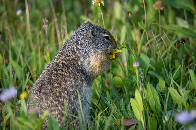
Past Logan Pass we drove through the blackened tree trunks and charred earth of recent fires on down to St. Mary’s. From there we drove north and then west into Many Glacier, where we hiked the Swiftcurrent Trail around the lake and by the lodge.
Also Within the Park
Also within the park, we took drives on Camas Road up toward Polebridge, once taking a National Forest road up the mountain. On another drive, we saw this young bear outside of Fish Creek Campground.

We hiked along the shore of Lake MacDonald and also took a cruise of the lake. Another time we took the Trail of the Cedars as a break from hunting for critters.
We took several short full-day trips outside the park.
Hungry Horse Dam
We drove past Hungry Horse Dam and saw this impressive cloud from the eastern fire in the park.
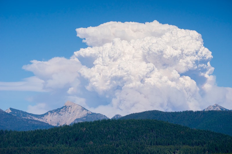
Big Loop
Another time, instead of returning to our camp from St. Mary via the Going to the Sun road, we looped around the park first on 89, then 49, and then on Highway 2, following the hairpin curves into East Glacier Park and back around through Walton into the small town of West Glacier, and then back to Columbia Falls.
Flathead Lake
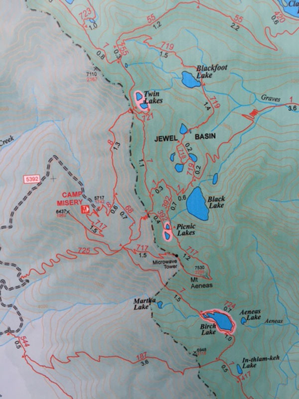
Our hike to Twin Lakes in the Jewel Basin was cut short about two-thirds of the way up the mountain by a sizable streak of lightning followed immediately by an attention-getting boom of thunder. Being fast learners, we quickly turned around eyeing the boisterous skies while we steadily moved through the rain. (Mitzy chose to make the journey in my arms instead of walking.)
We moved to Plan B, driving to and then exploring the town of Bigfork at the northeast corner of Flathead Lake. From there we circled this very big lake, heading south to Polson, and then back up the western side.
Kootenai Falls
On yet another day, we took a big day trip, first heading west on Highway 2, taking our time enjoying the scenery of this sparsely traveled road. Right outside of Libby we stopped at a museum and wandered among the old cars, trucks, railroad equipment, etc. Stopping from their restorative work, three volunteers gave us the past history and the future plans of this old locomotive.
Traveling past Libby we stopped at the Kootenai Falls trailhead for a picnic in the woods. From there we took the short but pretty hike to both the Kootenai Walking Bridge and then the Kootenai Falls. We are fortunate to have visited many waterfalls in the West, but this one ranks right toward the top.
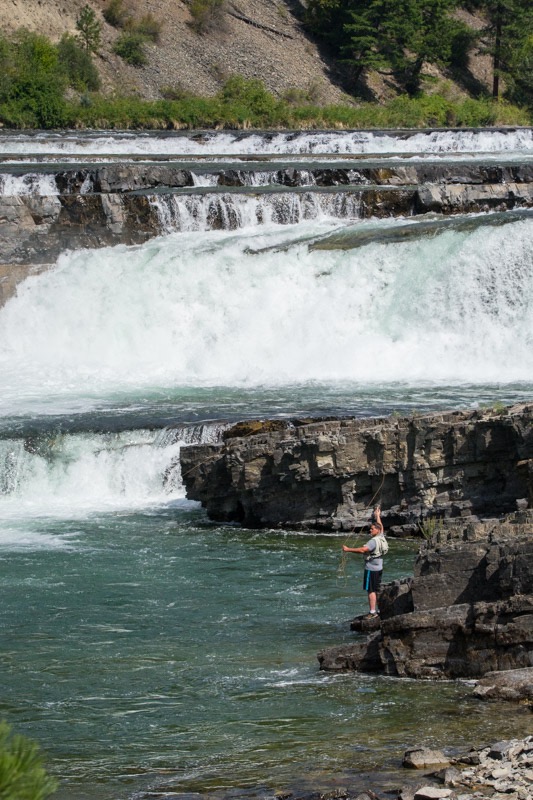
From there we backtracked to Libby, and then picked up highway 37, a scenic byway that hugged the eastern coast of the Lake Koocanusa all the way to Rexford then to Eureka. Just southeast of Eureka we spotted more fires.
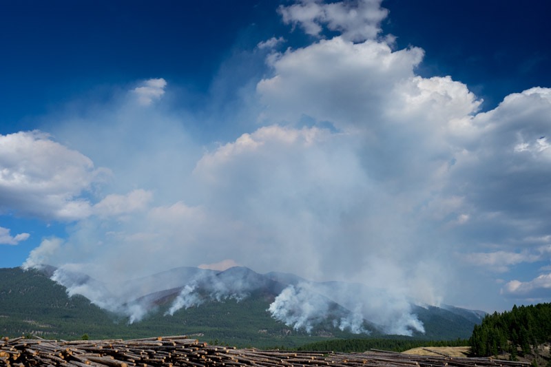
Pups
Here are two pups from the reserve.
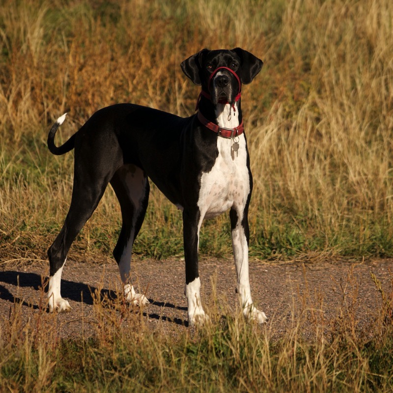
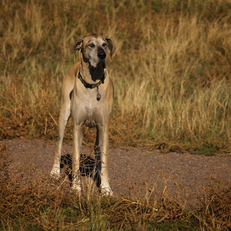
Old Sign
Here is an old sign.
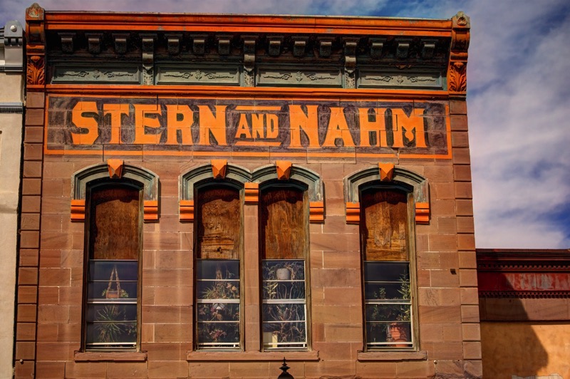
Old Trucks
Here are four old trucks.


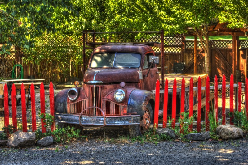

Closing Comments
Glacier National Park is an awesome hunk of the United States. If you are interested in visiting, I suggest you come soon--all the glaciers are predicted to be gone within 20 years.
Blog 235: Wild Week in the Wild West

Buffalo Bill Rides Again
From our (almost) cosmopolitan park in Denver, we traveled among very light traffic north and west to Cody, Wyoming, with an overnight stop in Casper. Along the way, between Shoshoni and Thermopolis, we passed through the Wind River Canyon, a spectacular trek through a steep, colorful canyon adjoining roaring waters. It definitely deserves its “scenic” designation.
Our campground was within the city limits of Cody. Its claim to fame is Wild Bill Cody, and the town celebrates its Wild West heritage with daily shootouts and a nightly rodeo. Cowboy boots, hats, and smart bandanas are the appropriate attire for this gateway to yesteryears.
Yellowstone Loop

One early morning we traveled west from Cody the 50-plus miles to the eastern entrance into Yellowstone. We made our way to Lake Yellowstone, north through the Hayden Valley to Tower Junction, west through the Lamar Valley, and out through the Silver gate close to Cooke City. Within Yellowstone we saw (from a distance) a momma black bear and her two cubs, and (very up-front and personal) hundreds of bison in the Lamar Valley crossing the road within spitting distance.
Medicine Wheel
We took a road trip into the Bighorn Mountains, sighting a male moose in a flower-laden meadow having his lunch. We stopped for a hike up to the Medicine Wheel, a culturally important site to many Native American tribes, and a religiously significant location for some. Below is a nice pick of the wheel that Janny took. Throughout the year, hundreds of ceremonies of all kinds take place there. Along the path upward to the Wheel, we saw a really large harem of marmots standing up like meerkats sounding their alarm to warn of our coming, scurrying to their holes seeking cover, or just laying on rocks studying our behavior.
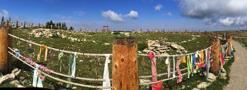
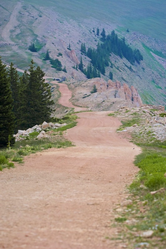

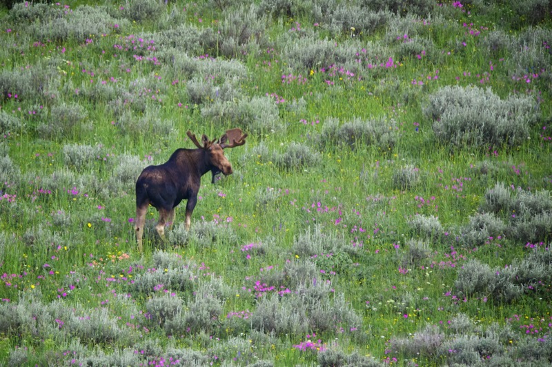
We stopped at a lodge in the woods for a tasty lunch (we were the only guests). On our return we took a road less traveled, passing by a dinosaur dig, moving by ourselves up and around on gravel, dirt, and rocks. About a quarter mile from the end of the earth, we spotted a group of pronghorn with the painted mountains in the background. They were kind enough to pose for me. Finding our way back to paved roads, we returned to Cody. Gorgeous trip.
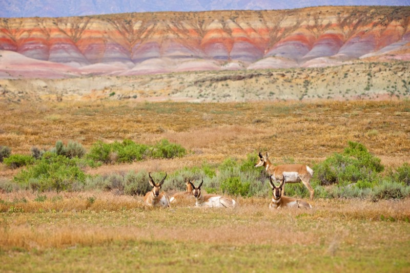
Beartooth Highway
After packing up our gear we drove the short 70-mile trip north to our campground seven miles north of Red Lodge, Montana.
Just outside of Red Lodge is yet another scenic byway, the Beartooth Highway, that leads to the Northeast entrance to Yellowstone. Five minutes into our early morning journey west, we spotted a slow-moving procession…cattle? No too small…sheep? Could be, but wait…a herd of goats. We slowed to a crawl with Mitzy at full alert as we passed four goat herders and their four, proud-looking, goat-herding dogs, as they guided their four-legged cargo along the way. Check out Janny’s short video clip.
Yes, the scenic highway was scenic with mountains and valleys, meadows and wildflowers, streams and lakes.
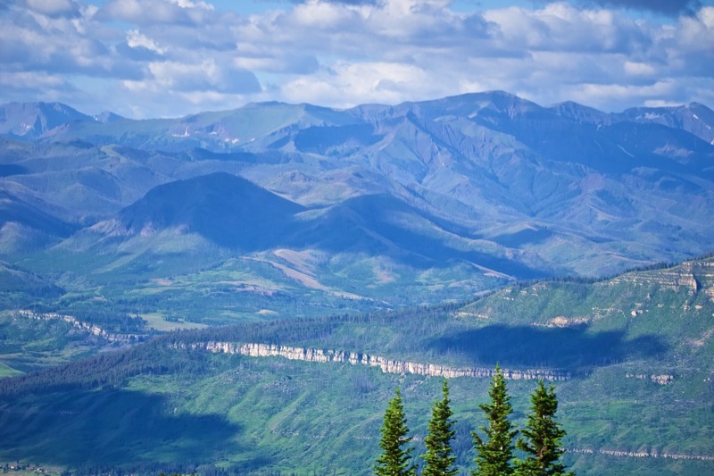

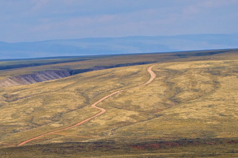
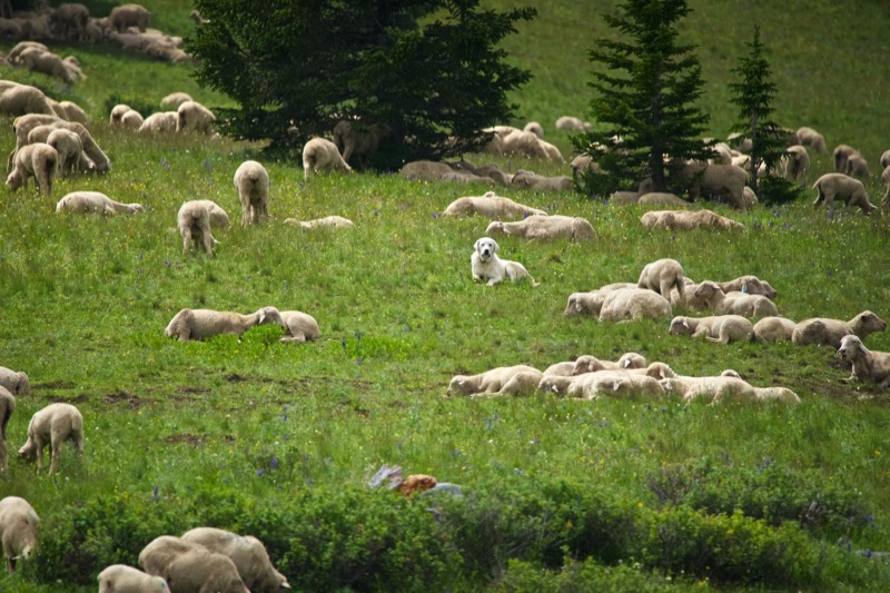
Our final stop was a fire tower that commanded vistas from all four directions. The blues and reds and yellows of wild flowers were magnificent, the finest display I have ever seen. However, the harsh light and strong breeze didn’t make my photos worthy of publishing. Yet, I did catch a decent pic of this Clarks Nutcracker.
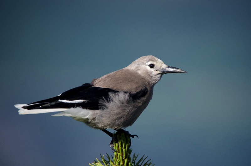
We returned the same way, admiring the sights from a different point of view.
Pups
Here is a marmot-sniffing Madeline, plus one other pup from the Pup Reserve.
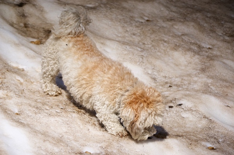
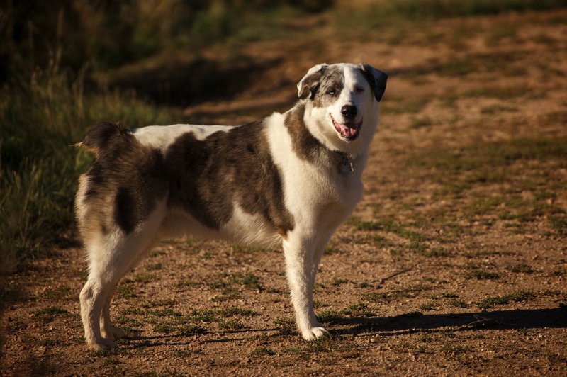
Old Signs
Here is an old sign from Wyoming and one from Montana.
Old Trucks
Here are six old trucks from Wyoming and Montana.
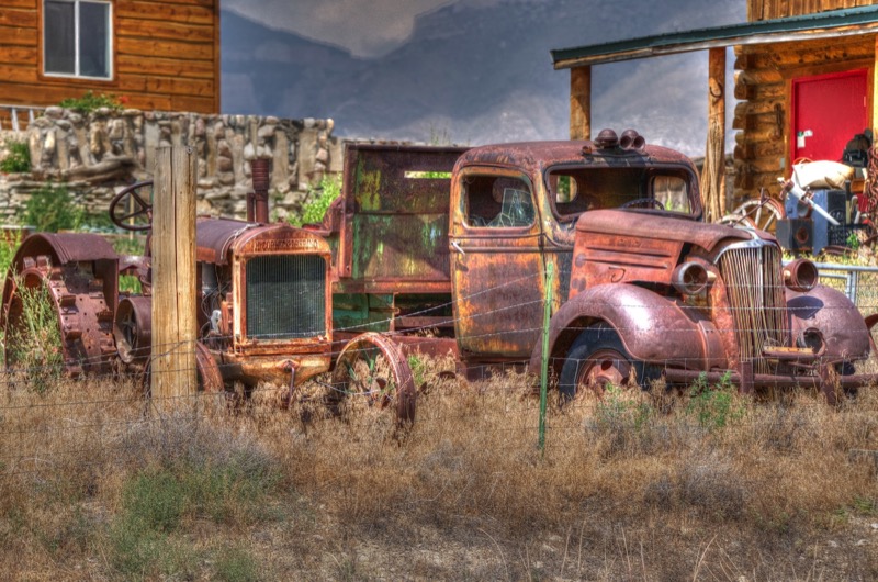
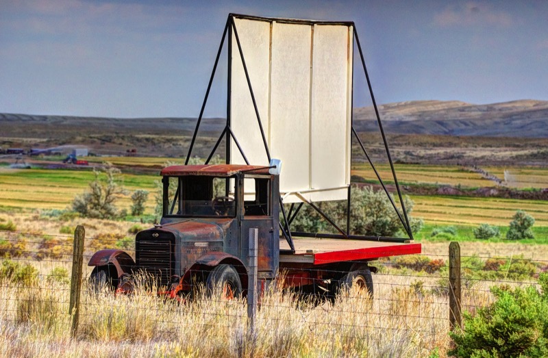
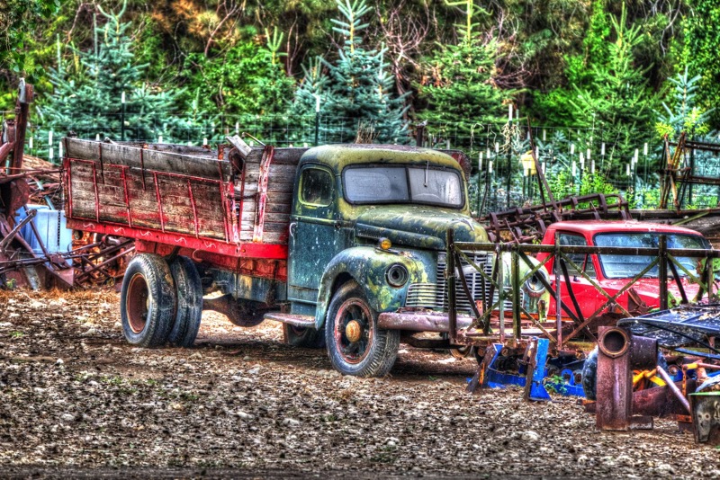
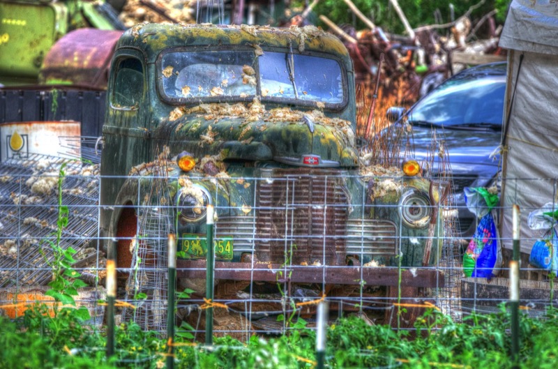
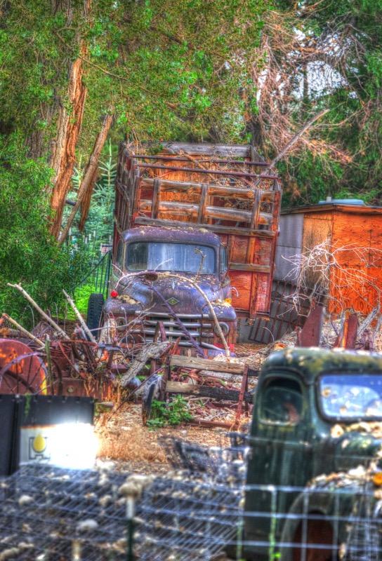

Slightly exhausting, but wonderful week.
See you soon.
Blog 233: Mountain Mitzy: Elk Hunter
On to RMNP
From Cheyenne we strolled south and west making the transition from the plains to the mountains. For the last 30 miles our constant companion was the roar of rushing water from the Big Thompson River that paralleled our trek up around curves as we climbed up to 7,500 feet. Our campground adjoined Rocky Mountain National Park with the appropriate snowcapped mountain vistas.
Mountain Mitzy: Elk Hunter
Interestingly, a metamorphisis occurred as the air got thinner and the mountains got closer. Mitzy, our sweet, refined, laid-back lap-pup transformed into an intense canine, a focused tracker of wild beasts. Maybe it was the change in the air, maybe it was the haunt of ancient ancestors, maybe it was the odor of primitive beasts. Whatever the genesis, you could feel the concentration ooze from her pores as her heightened sense of smell and eyesight sought out the majestic elk. Every nerve cell was on alert, every muscle was attuned--even her eyebrows were set to full readiness. It was all I could do to constrain her from leaping from our vehicle and ripping her prey to shreds.

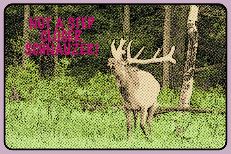

Touring and Hiking
Over our week stay, we toured most all the main roads and a few of the non-main paths north and south, east and west. Along with a multitude of elk, from our car and the side of the road we were fortunate to see moose and bighorn sheep. In early morning we started most days on the trails. Working to gain our stamina at altitude, we started with short, level strolls building up to medium-intensity hikes. Over the week we hiked Bear Lake, Sprague Lake, Cub Lake, Lily Lake, Fern Lake, and Coyote Valley. Sometimes we saw critters, almost always we were in the presence of spring flowers of multiple shapes and colors. Here is a shot of Morraine Valley and a panorama that Jan shot.
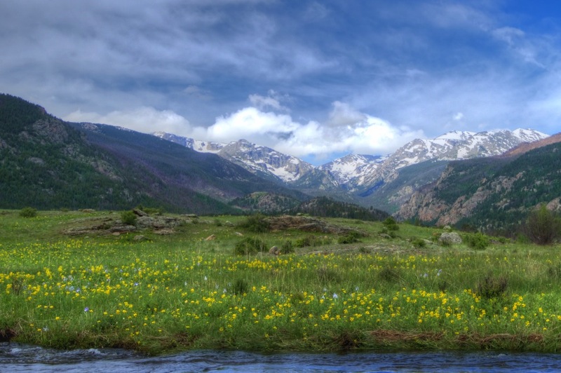
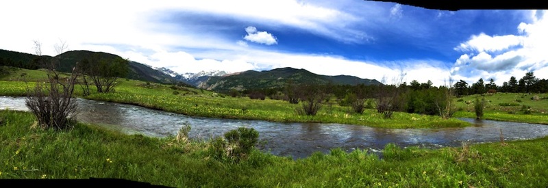
Critters
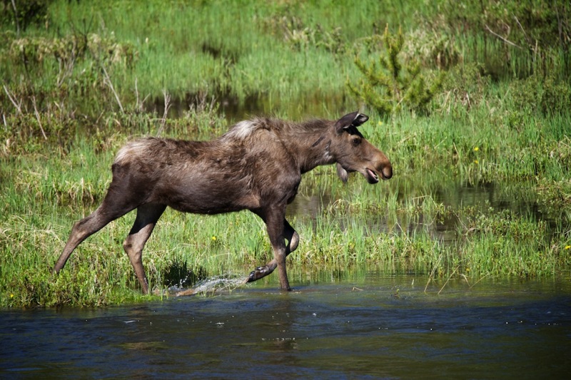
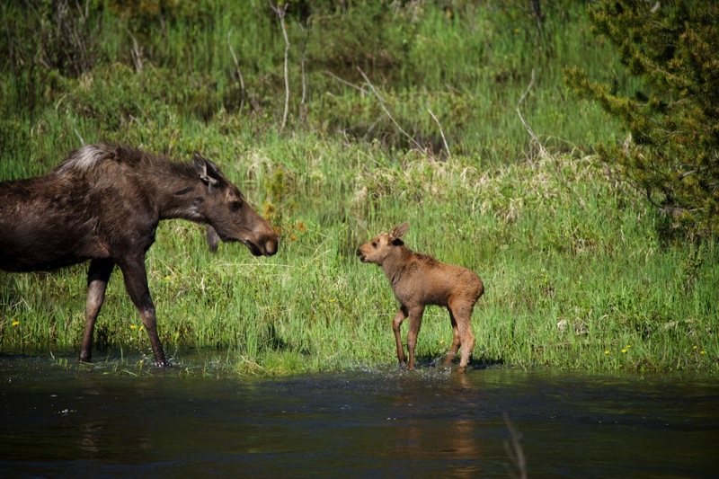
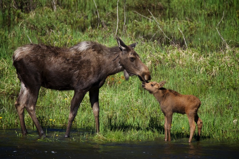
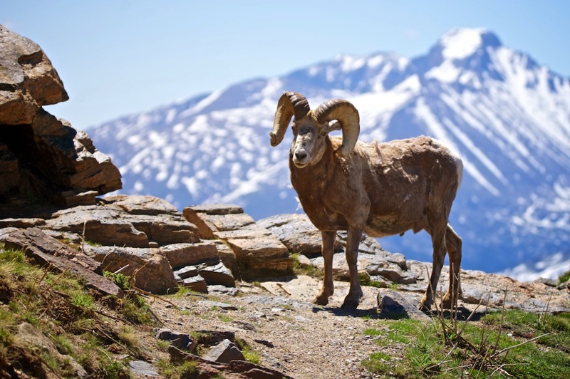
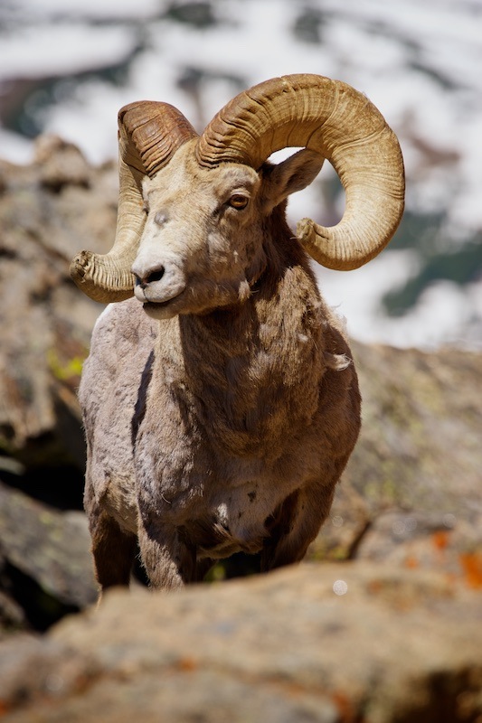
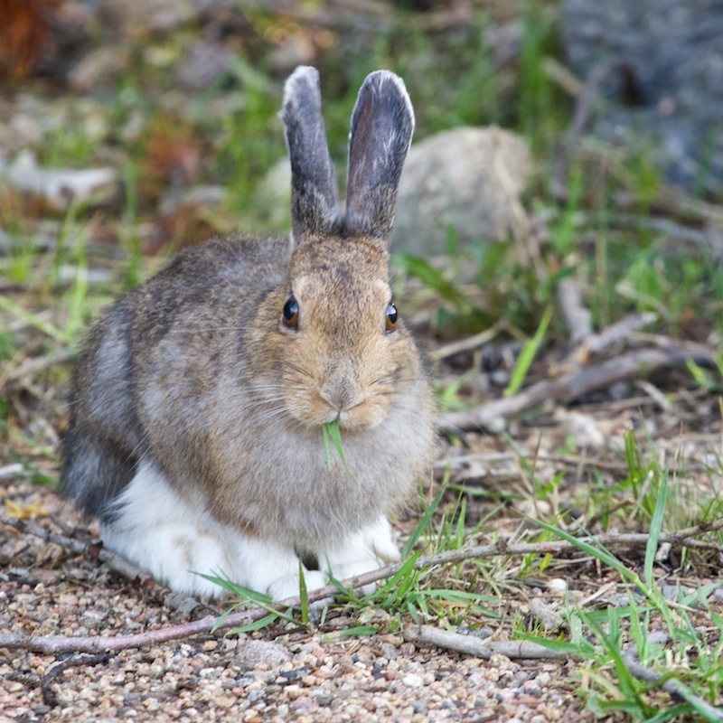
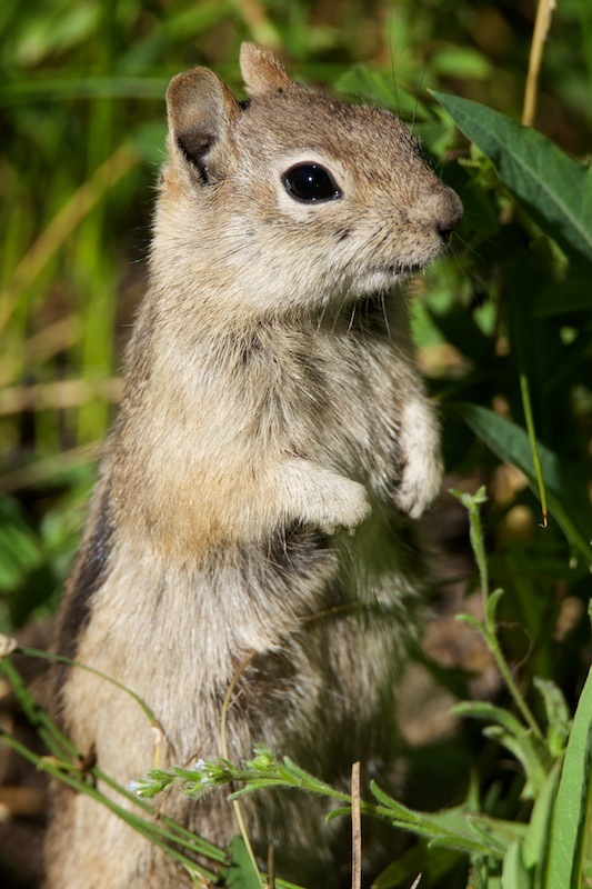
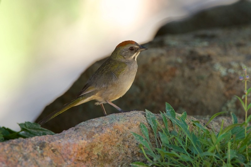
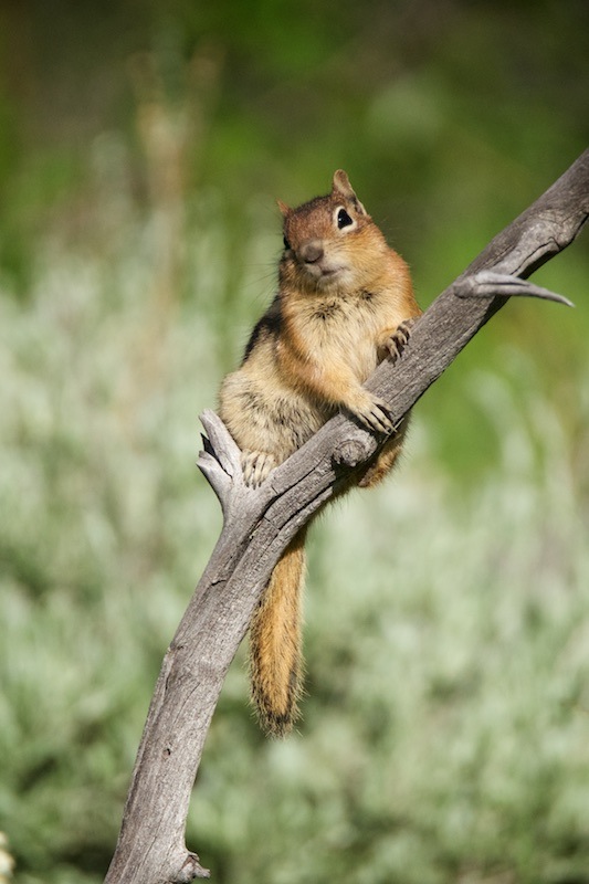
Pups
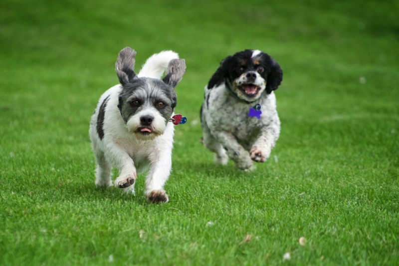


Old Signs
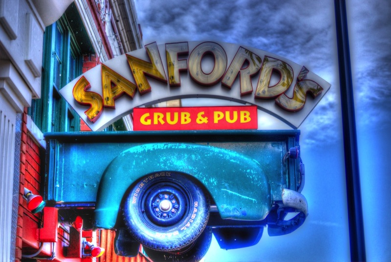
Old Trucks
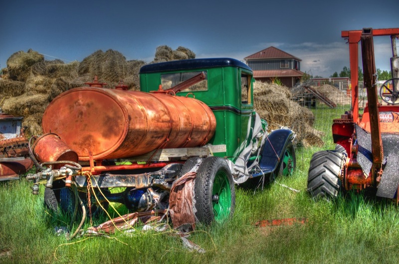
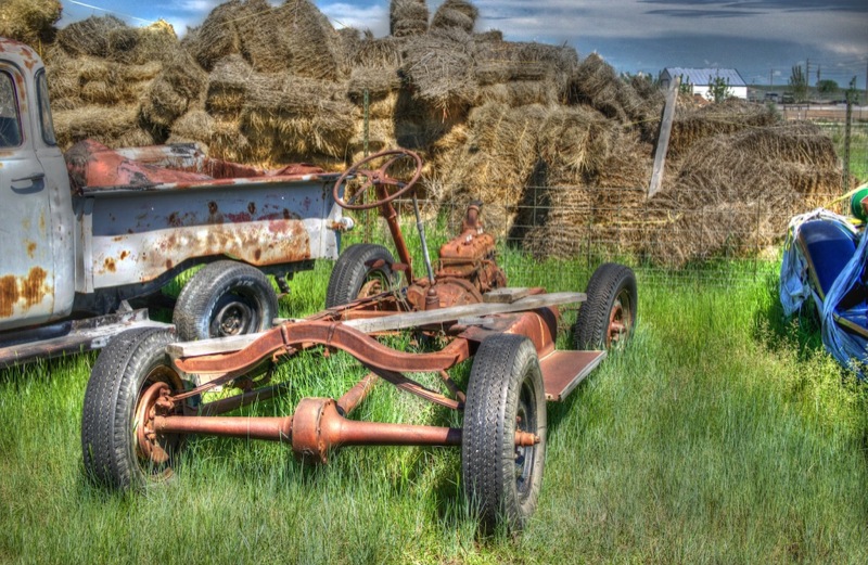
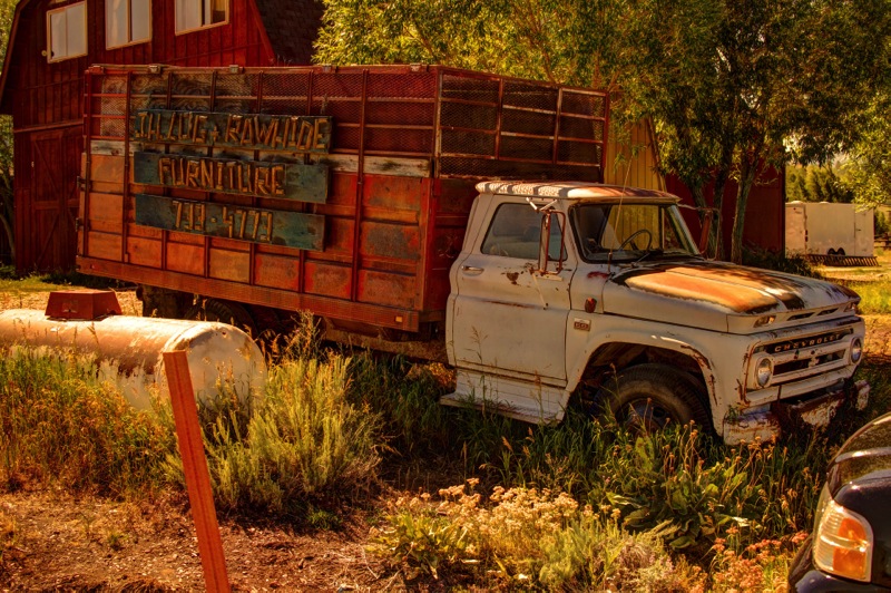
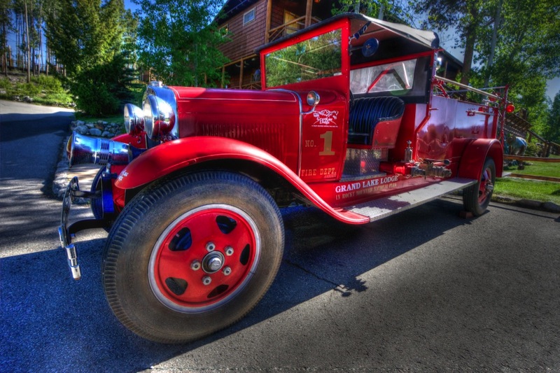
Magnificent week--just hard to beat our national parks.
See you soon.