Sandia Peaks
Travel Blog 259: Day Trips and Early Morning Jaunts
Leaving Elephant Butte State Park, we travelled 148 miles north on I-25 to our American RV Park destination just east of Albuquerque. Nice, easy trip.
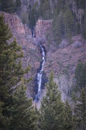
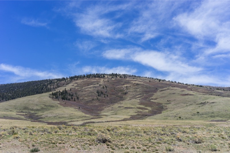
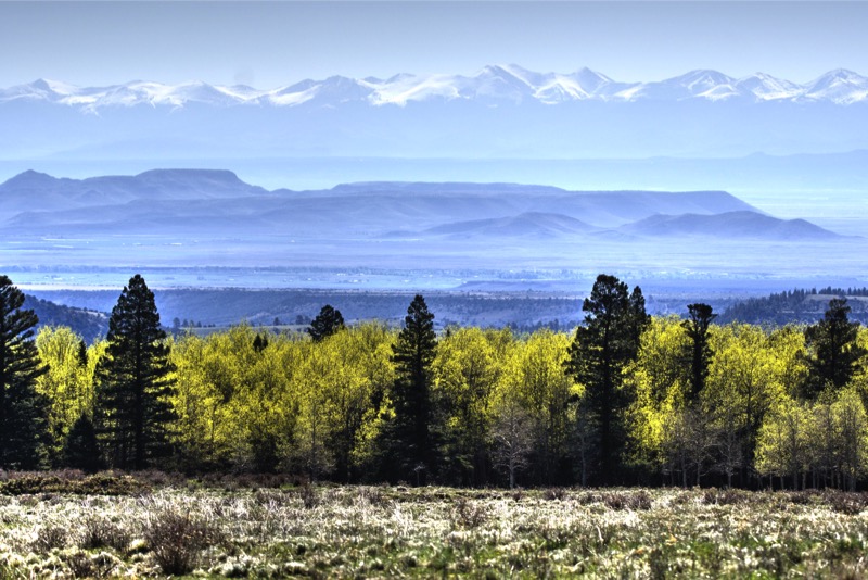
Side Trip to Sandia Peaks
After settling in we left the 5,000-or-so-foot altitude of Albuquerque and wound our way up to 8,500 feet at Sandia Peaks in the Cibola Forest. As the altitude rose, the temperature dropped, changing our mind about doing a hike at the top. Comfortable drive with great scenery.
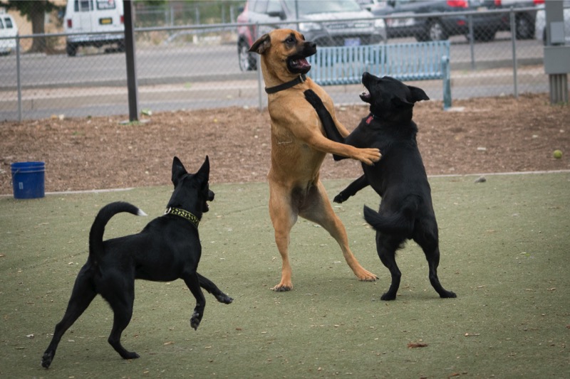
Dog Park
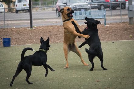
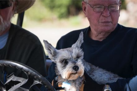
In our continued attempt to socialize our new pup Jackson (aka Captain Jack Black) we took him to the dog park where he quickly learned the rules of multiple canine behavior. Here is a pic of Jack (lower left) learning it is sometimes better to observe than to be actually engaged.

Quick Trip to Chicago
I made a quick trip to Chicago to facilitate a workshop, lead a panel, and give a keynote speech at a symposium. Great group of people and lots of fun. Chance to talk and catch up with folks I’ve known for decades. Hope to do it again next year.
Day Trip
After returning from my work trip, we had one full day before heading out. We loaded up and did a three-mile, high-desert hike at Petroglyphs National Monument. During our trek we saw a brightly colored roadrunner pass and numerous, really big jackrabbits. In fact, one looked about the size of a Great Dane--before I fully recognized that the creature coming at us wasn’t a big coyote, I was chastising myself for not bringing pepper spray!
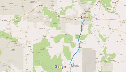
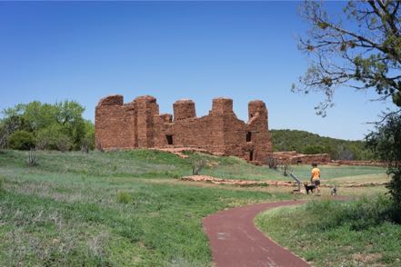
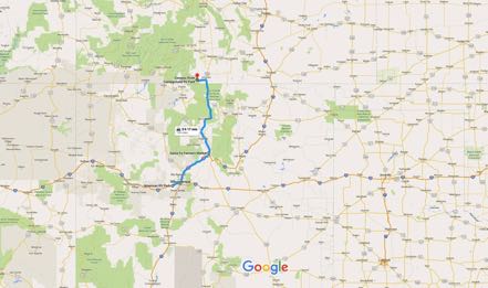
From there we decided to take the Abo Pass Trail that followed the Salt Missions Trail Scenic Byway for around seventy miles. It follows old trade routes and rail beds through the center of New Mexico. So from I-40 East we took 387 South through Escabosa and Chilili. We picked up 55 South and went through Tajique and Manzano to our first stop--the Quarai Mission Ruins just outside Mountain.
With the pups we walked around and through what was left of the old Spanish mission from the 1600s. From there we continued southwest on 60, going through the spot on the map marked Abo to the Abo Ruins Salinas National Monument Historical Marker, another interesting site along the mission trail. From there we picked up 47 headed north, diagonaled over at Los Lunas to I-25 and then I-40, ending our 150-mile loop.
On to Antonitos
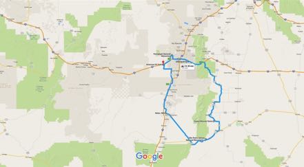
After our good stay at Albuquerque, we took I-40 West to I-25 North. About 20 miles from Santa Fe, Jan said, “Today is the Santa Fe Farmer’s Market!” This is no ordinary farmer’s market--the chili selection is celestial, the baked bread is off the planet, and the cheeses are made just south of Heaven. After a two-minute conversation, we decided to make this detour. Salivary glands had already engaged, and I could taste the bread and cheese for our mobile lunch. We got off US 285, no problem as we knew where to go…however, finding a place to park our 62 feet of motor-home-plus-car turned out to be challenging. We found a space within a couple of blocks of the market, but it took up six parking spaces, and I quickly calculated the possible fine this might bring and suggested we postpone our visit. Reluctantly, we pulled out, got back on 285, and continued north through New Mexico.
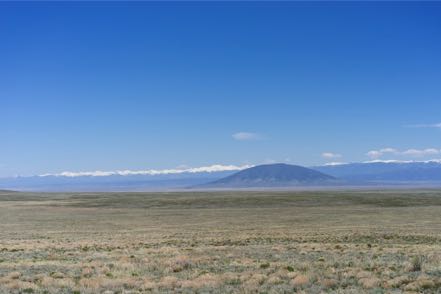
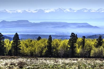
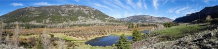
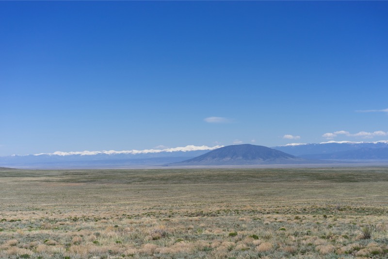
About 50 miles from the Colorado border with a perfect high-60s temperature, sunny skies, and light traffic, the hills and snow-topped mountains surrounded us, taking in 270 degrees of our view. Absolutely inspiring vistas.

Conejos River RV Park
Six miles after crossing into Colorado, we turned west on Colorado 17 at the village of Antonito for the 12 miles to our Conejos River RV Park. At 8,500 feet of elevation, the air was naturally thinner, but so was the fly and mosquito population. This park had just opened May 1, and very few souls were in the camp that bordered the Conejos River and was within six miles from two national forests.
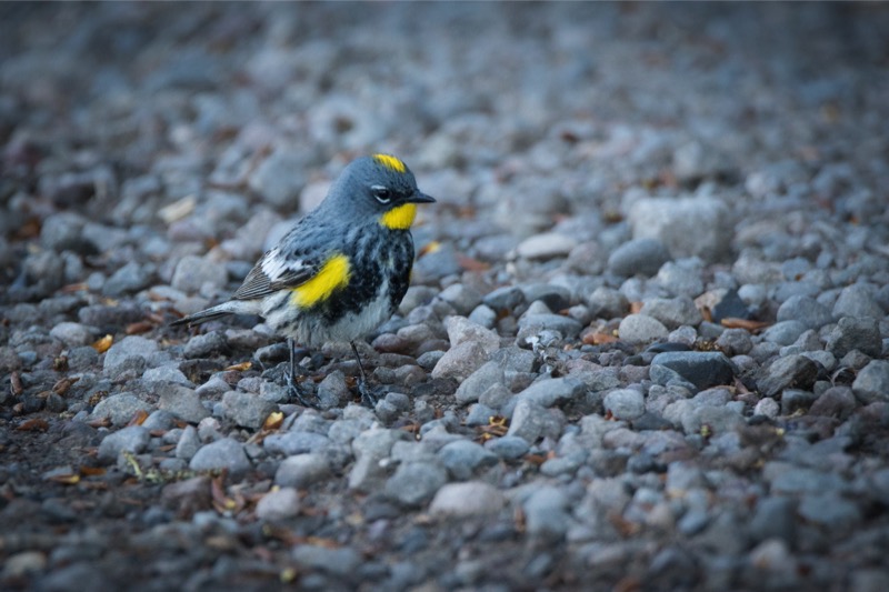
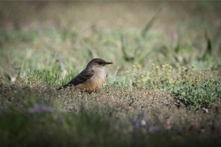
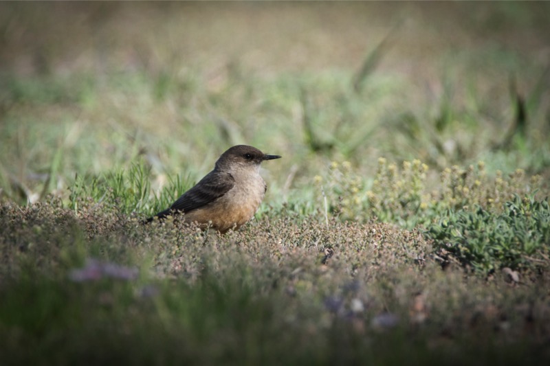
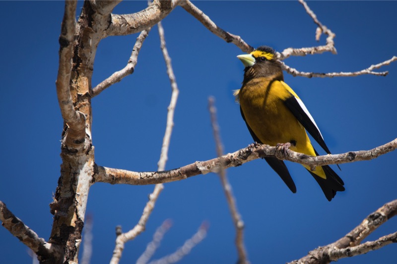
Over our three days at this campground we saw scores of birds of many shapes and variety: bluebirds, several kinds of finches, Western Tanagers. Great people, great vistas, and wonderful solitude when you wanted it.

Early Morning Jaunt
Before sunrise on day one of our stay, we drove up Forest Road 101 into the Rio Grande National Forest. Alone on the dirt road we saw deer and a nice size herd of good-looking elk.
Another Early Morning Jaunt
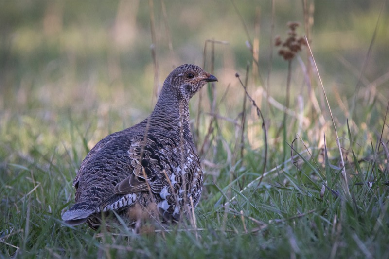
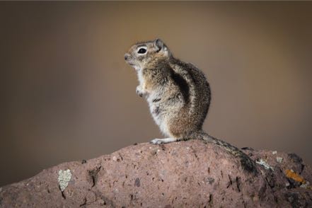
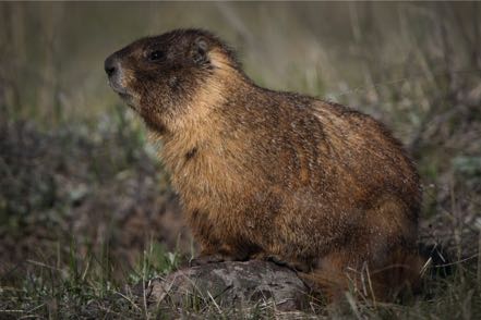
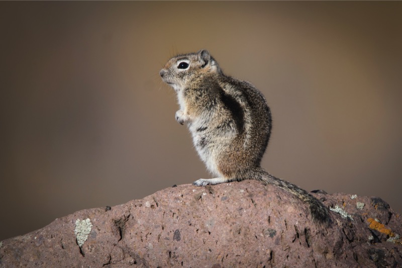
With the temperature just over 30 degrees on day two, we headed west on Colorado 17, then headed northwest at the town of Horca, and were again moving into the Rio Grande National Forest on Forest Road 250. This dirt road paralleled the Conejo River high in its banks. We again saw deer and elk, prairie dogs, yellow-bellied marmots, desert bighorn sheep, chipmunks on every rock (well, almost every rock), a coyote, and scores of hummingbirds feeding on the bushes by the road.
And Another Early Morning Jaunt
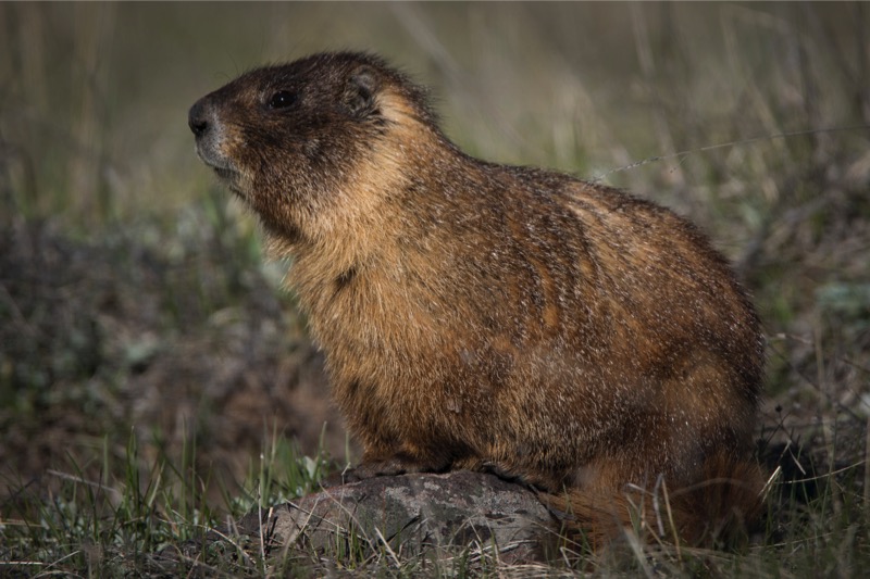
On our last morning, we were again up and out at 6:00 a.m. into the chilly but calm 30-degree morning. This time we headed east on 17, and then quickly turned south on Road D.5, which led us into the Rio Grande Forest of Forest Road 103 that paralleled Big Horn Creek southwest into New Mexico and the Carson National Forest. We wound through forests of Ponderosa Pine laced with trees just starting to bud. In the distance we saw several herds of elk, obviously skittish of hunters. We saw pronghorn along the way and deer, and of course, more chippers. After passing Sublette, Toltec, and Osier Mountains, we came to the end of the road, Osier, at 9,624 feet. It is the watering station for the Cumbres and Toltec Scenic Railroad. At this wayside along the mountain we ran across a marmot sentinel, who was not happy about our arrival. Standing erect as a Queen’s guard on his rock pile, he loudly told me that I did not belong there.
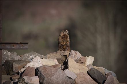
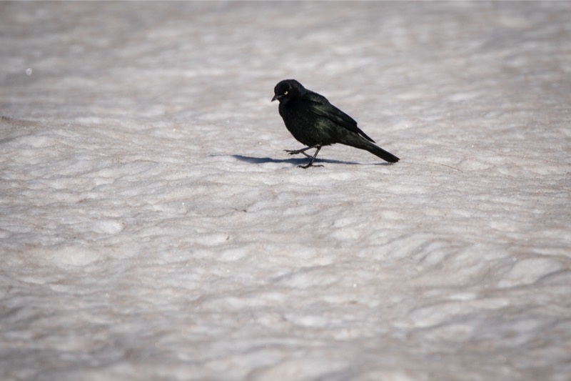
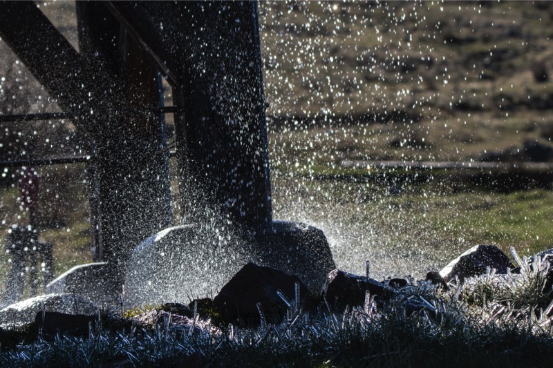
The railroad water tank was continually dripping and the whole locale was thick with swallows. In hopes it might connect with Highway 17, we took a narrow, steep, muddy path but it ended at the Rio de Los Pinos, much too deep to cross (six feet of fast-moving water). So we retraced our journey with mountain, valley, stream, and forest views along the way. During our three-hour trip, we saw only one vehicle and one person. Here are a few pics from the early morning jaunts.


Side Trip to Sandia Peaks
After settling in we left the 5,000-or-so-foot altitude of Albuquerque and wound our way up to 8,500 feet at Sandia Peaks in the Cibola Forest. As the altitude rose, the temperature dropped, changing our mind about doing a hike at the top. Comfortable drive with great scenery.
Dog Park
In our continued attempt to socialize our new pup Jackson (aka Captain Jack Black) we took him to the dog park where he quickly learned the rules of multiple canine behavior. Here is a pic of Jack (lower left) learning it is sometimes better to observe than to be actually engaged.
Quick Trip to Chicago
I made a quick trip to Chicago to facilitate a workshop, lead a panel, and give a keynote speech at a symposium. Great group of people and lots of fun. Chance to talk and catch up with folks I’ve known for decades. Hope to do it again next year.
Day Trip
After returning from my work trip, we had one full day before heading out. We loaded up and did a three-mile, high-desert hike at Petroglyphs National Monument. During our trek we saw a brightly colored roadrunner pass and numerous, really big jackrabbits. In fact, one looked about the size of a Great Dane--before I fully recognized that the creature coming at us wasn’t a big coyote, I was chastising myself for not bringing pepper spray!

From there we decided to take the Abo Pass Trail that followed the Salt Missions Trail Scenic Byway for around seventy miles. It follows old trade routes and rail beds through the center of New Mexico. So from I-40 East we took 387 South through Escabosa and Chilili. We picked up 55 South and went through Tajique and Manzano to our first stop--the Quarai Mission Ruins just outside Mountain.
With the pups we walked around and through what was left of the old Spanish mission from the 1600s. From there we continued southwest on 60, going through the spot on the map marked Abo to the Abo Ruins Salinas National Monument Historical Marker, another interesting site along the mission trail. From there we picked up 47 headed north, diagonaled over at Los Lunas to I-25 and then I-40, ending our 150-mile loop.

On to Antonitos
After our good stay at Albuquerque, we took I-40 West to I-25 North. About 20 miles from Santa Fe, Jan said, “Today is the Santa Fe Farmer’s Market!” This is no ordinary farmer’s market--the chili selection is celestial, the baked bread is off the planet, and the cheeses are made just south of Heaven. After a two-minute conversation, we decided to make this detour. Salivary glands had already engaged, and I could taste the bread and cheese for our mobile lunch. We got off US 285, no problem as we knew where to go…however, finding a place to park our 62 feet of motor-home-plus-car turned out to be challenging. We found a space within a couple of blocks of the market, but it took up six parking spaces, and I quickly calculated the possible fine this might bring and suggested we postpone our visit. Reluctantly, we pulled out, got back on 285, and continued north through New Mexico.

About 50 miles from the Colorado border with a perfect high-60s temperature, sunny skies, and light traffic, the hills and snow-topped mountains surrounded us, taking in 270 degrees of our view. Absolutely inspiring vistas.
Conejos River RV Park
Six miles after crossing into Colorado, we turned west on Colorado 17 at the village of Antonito for the 12 miles to our Conejos River RV Park. At 8,500 feet of elevation, the air was naturally thinner, but so was the fly and mosquito population. This park had just opened May 1, and very few souls were in the camp that bordered the Conejos River and was within six miles from two national forests.
Over our three days at this campground we saw scores of birds of many shapes and variety: bluebirds, several kinds of finches, Western Tanagers. Great people, great vistas, and wonderful solitude when you wanted it.

Early Morning Jaunt
Before sunrise on day one of our stay, we drove up Forest Road 101 into the Rio Grande National Forest. Alone on the dirt road we saw deer and a nice size herd of good-looking elk.
Another Early Morning Jaunt
With the temperature just over 30 degrees on day two, we headed west on Colorado 17, then headed northwest at the town of Horca, and were again moving into the Rio Grande National Forest on Forest Road 250. This dirt road paralleled the Conejo River high in its banks. We again saw deer and elk, prairie dogs, yellow-bellied marmots, desert bighorn sheep, chipmunks on every rock (well, almost every rock), a coyote, and scores of hummingbirds feeding on the bushes by the road.
And Another Early Morning Jaunt
On our last morning, we were again up and out at 6:00 a.m. into the chilly but calm 30-degree morning. This time we headed east on 17, and then quickly turned south on Road D.5, which led us into the Rio Grande Forest of Forest Road 103 that paralleled Big Horn Creek southwest into New Mexico and the Carson National Forest. We wound through forests of Ponderosa Pine laced with trees just starting to bud. In the distance we saw several herds of elk, obviously skittish of hunters. We saw pronghorn along the way and deer, and of course, more chippers. After passing Sublette, Toltec, and Osier Mountains, we came to the end of the road, Osier, at 9,624 feet. It is the watering station for the Cumbres and Toltec Scenic Railroad. At this wayside along the mountain we ran across a marmot sentinel, who was not happy about our arrival. Standing erect as a Queen’s guard on his rock pile, he loudly told me that I did not belong there.

The railroad water tank was continually dripping and the whole locale was thick with swallows. In hopes it might connect with Highway 17, we took a narrow, steep, muddy path but it ended at the Rio de Los Pinos, much too deep to cross (six feet of fast-moving water). So we retraced our journey with mountain, valley, stream, and forest views along the way. During our three-hour trip, we saw only one vehicle and one person. Here are a few pics from the early morning jaunts.