
New Mexico
Blog 286: White Sands and Green Chili Cheeseburgers

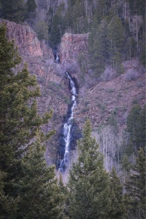
From Brantley Lake State Park we took 285 North to Artesia, and then went west on Highway 82. At Mayhill we entered the Sacramento Mountains and traveled several 6 percent grades and reached over 9,500 feet at Cloudcroft. Really pretty. Entering Almogordo, we headed north a few miles on Highway 54 to our campground.
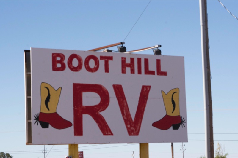
Boot Hill RV Park, Alamagordo, NM
We have stayed at this park before. A good place for a night or two, sites are level and long and the place is quite clean.
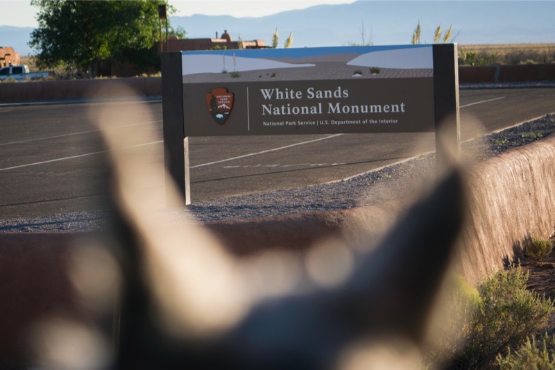
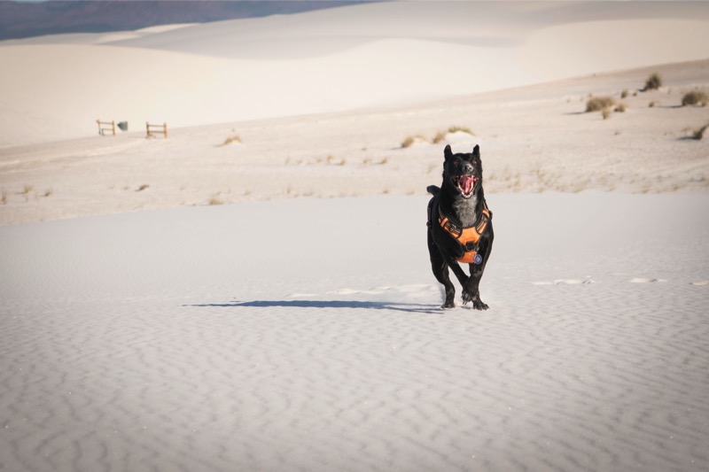
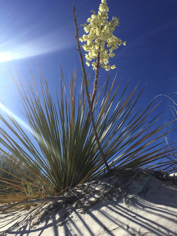
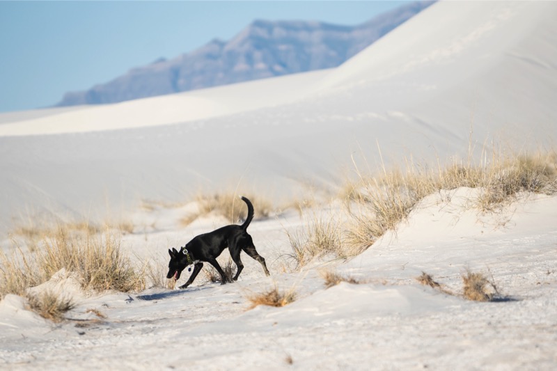
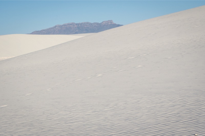
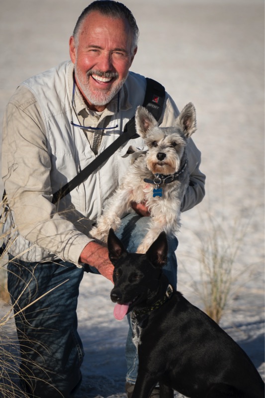
White Sands National Monument
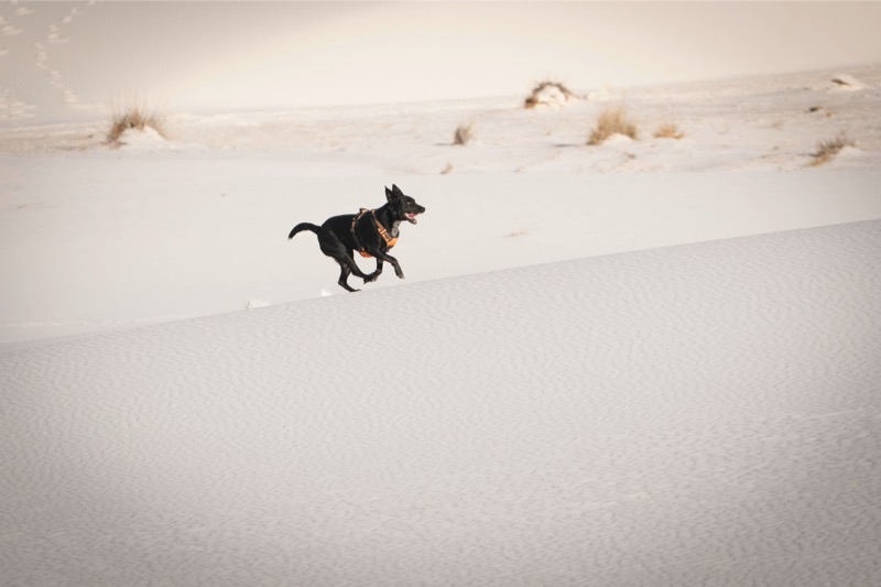
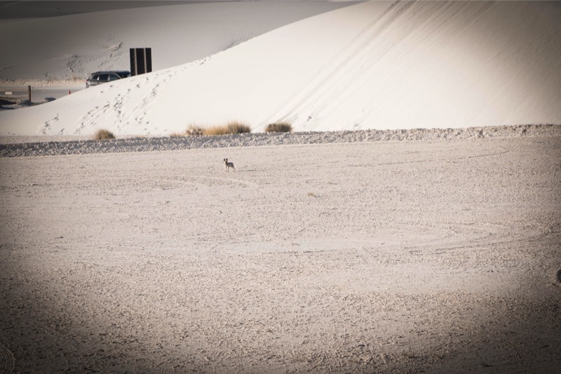
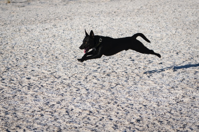
At 6:30 the next morning we took the 35-minute drive to White Sands National Monument. Jack had been pestering me all spring as to when we would go back there, and I was glad to get him off my case. We were the second car entering the monument at 7:03, and we drove about two-thirds through the park until we found the spot we wanted. I took Jack and Mitzy off their leashes and the fun began. Jack bolted through the white gypsum sand running at full speed in big circles like an asteroid going hot. I spent about an hour shooting this black blast blur with the wide grin up and down the dunes.
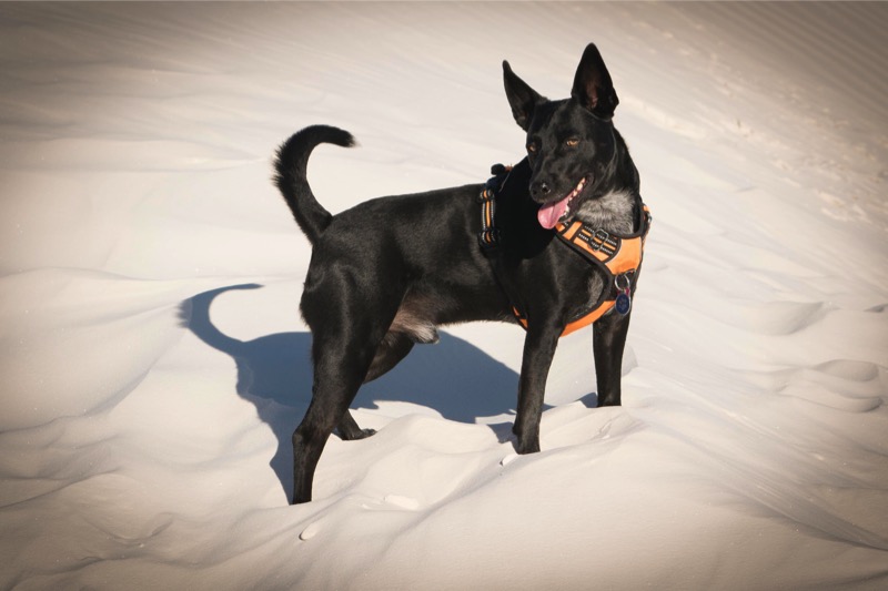

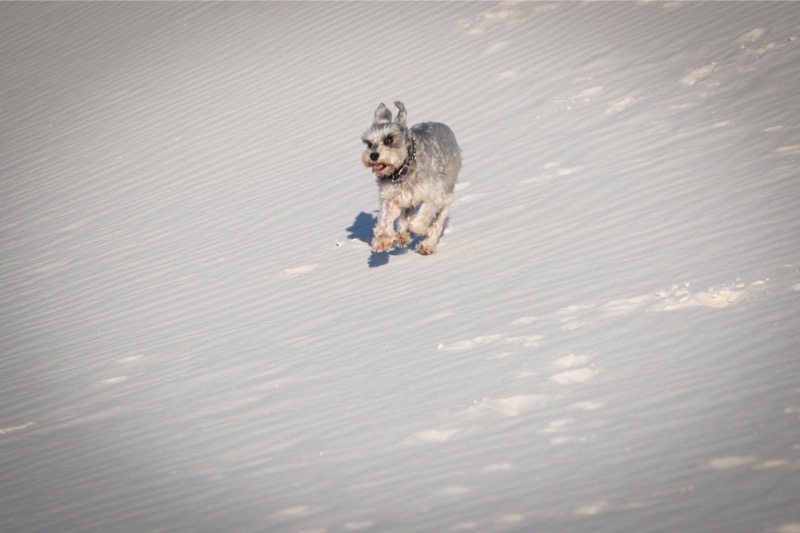
Mitzy, though, tired of the excitement and wandered back to the car. She had had enough fun.
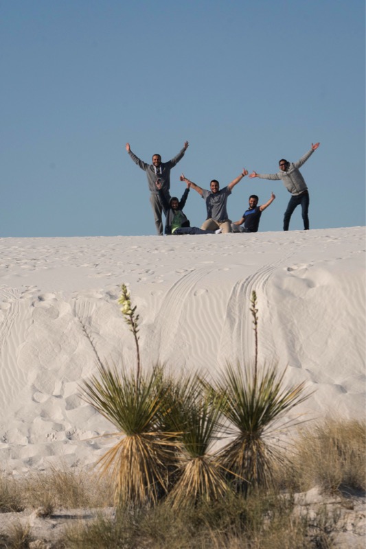
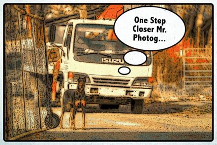
We then took our time driving back slowly, stopping several times to shoot the yucca. Also, I found a fun photo opportunity of some guys having breakfast.
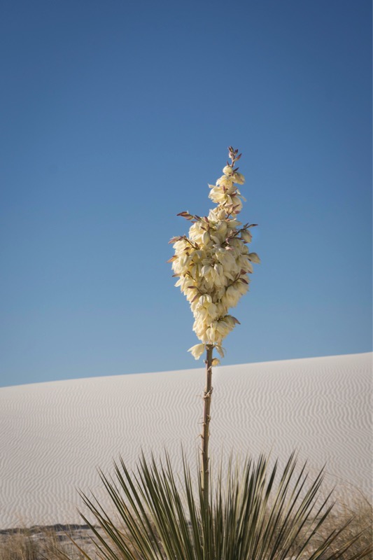

Here is a yucca that Janny shot.
After stopping by the visitor center for Jan to get her passport stamped, we bought a tee shirt and a burrito to share on the drive back to Boot Hill.
We hooked up the car and took 54 north then west on NM 3. We then took 285 north to I-25 south where we hung a right. At exit 264 we took NM 16 and followed the signs past the Cochiti Lake Dam.
Cochiti Lake COE
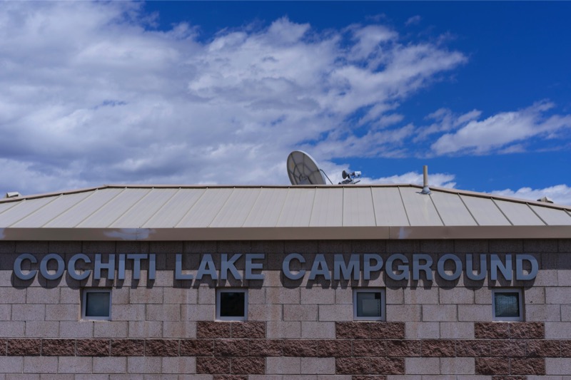
Cochiti Lake Campground is another Corps of Engineers project. This secluded area west of Santa Fe featured very big sites with private areas. We were up on top of a hill with a view of the lake and the mountains.
Cochiti is within the boundaries of the Cochiti Reservation, which borders other reservations on all sides. Each has their own Pueblo, a Governor, and a ruling council.
Day Trip to Bandelier National Monument
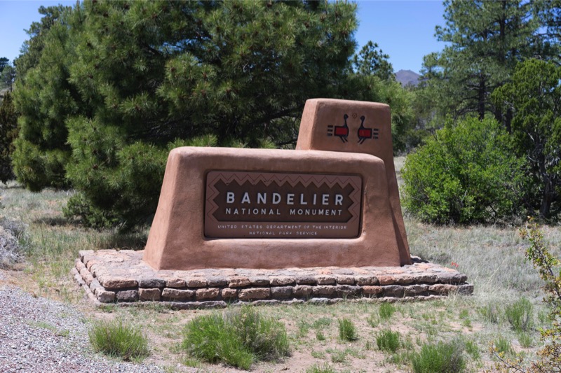
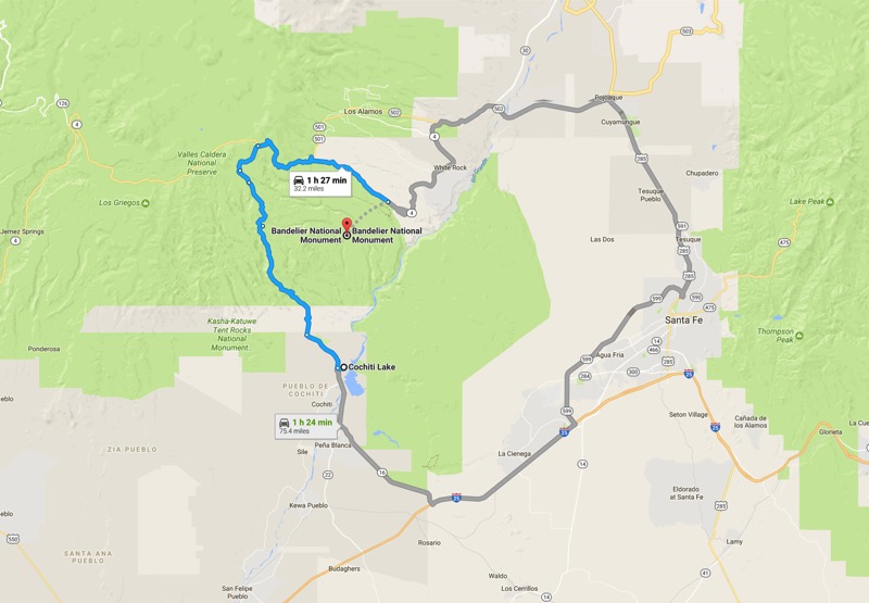
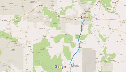
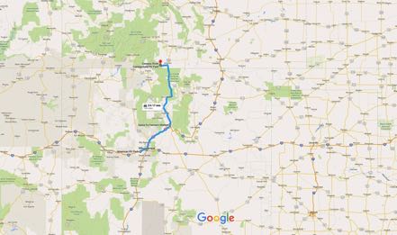
We decided to take a side trip to Bandelier National Monument. As the crow flies, it is only 12 miles from Cochiti Lake to Bandelier. However, as Google Maps points out, the best route is a 75-mile jaunt, south, east, north, and then west. Yet, when I studied my New Mexico Road and Recreation Atlas, the trip would be only 32 miles if one was willing to take 14 miles of non-paved road. Confident in our off-road ability, we set out on National Forest Road 268 planning on taking Bland Canyon through the Jemez Mountains, connecting with Highway 4 east to the monument.
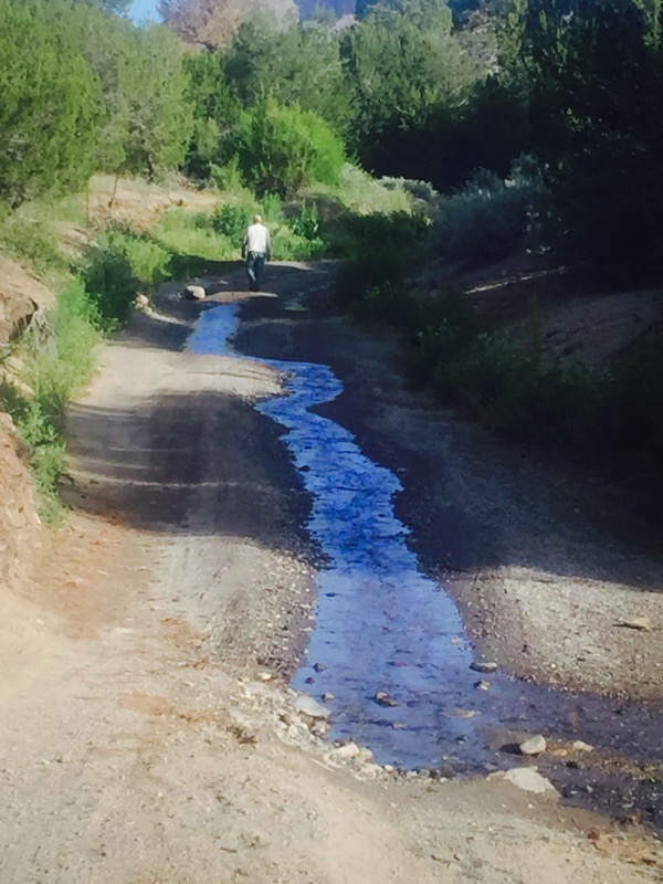
We quickly learned that road 268 was basically a riverbed covered with rocks and rutted tire tracks with a stream running through the middle. The rough going was really slow for about three miles and continued to get more challenging. As things continued to worsen Jack and I got out of the Jeep to scout ahead by foot. Turning a corner, our “road” was blocked off by a farmer’s fence, making further progress nonnegotiable. Sadly, we backtracked, but started developing a plan B.
Plan B
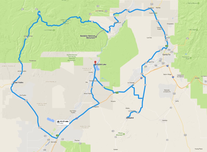
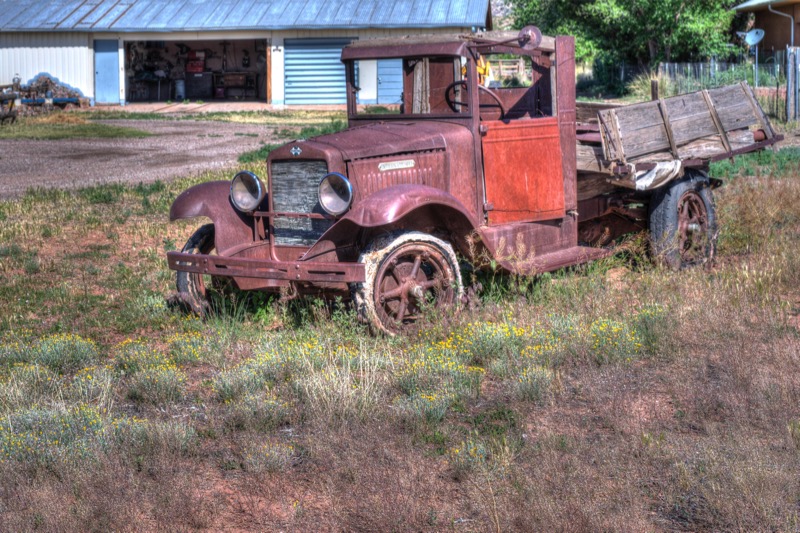
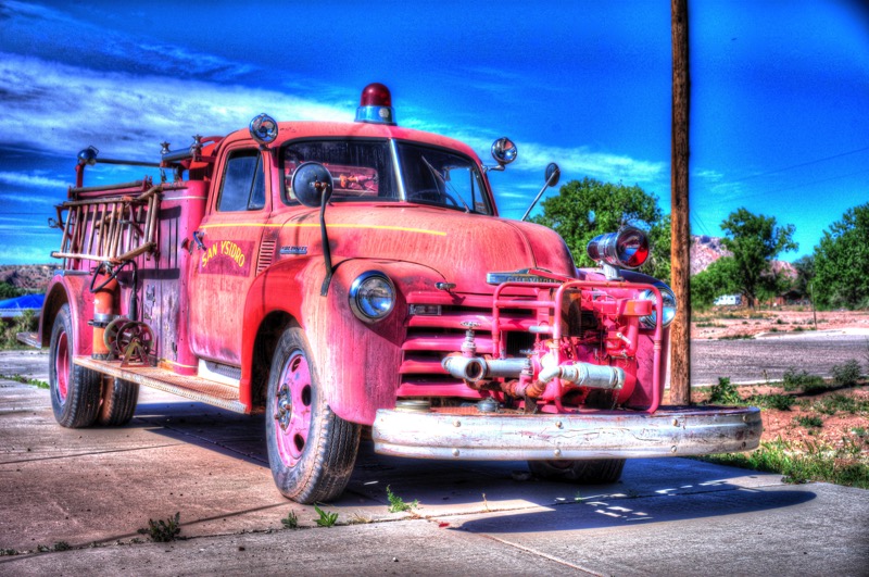
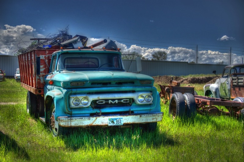
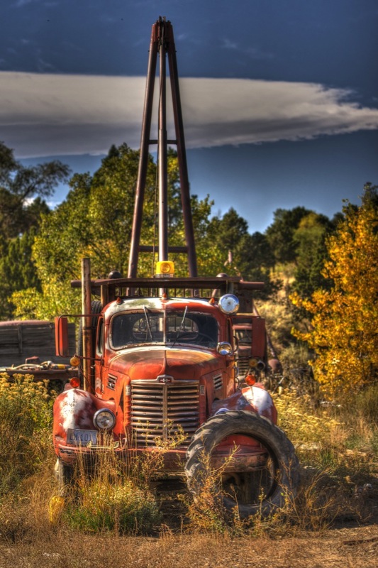
We drove south on 22, went south on I-25 for a few miles exiting at San Felipe Pueblo onto historic Route 66. At Bernalillo we turned northwest on 550 all the way to San Ysidro where we headed north then east. Here we found three nice old trucks (see below).
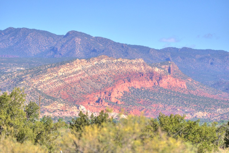
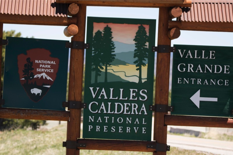
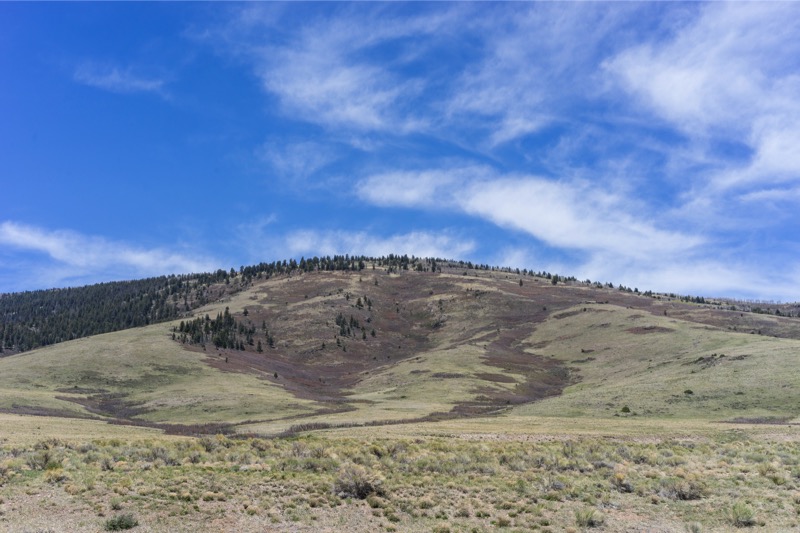
Each mile the scenery became more beautiful as we slowly went upward climbing the Jemez Mountains through the Santa Fe National Forest peaking at over 9,000 feet. Jemez Springs is gorgeous, and as we continued we had the Valles Caldera National Reserve on our left, a huge region of ancient volcanic activity--some of the prettiest scenery we have seen. After a short stop at Bandelier, we continued on the White Rock, then took 502 east, and then 285 south.
Green Chili Cheeseburgers
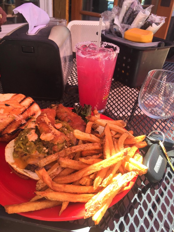
By then it was early afternoon and we were quite hungry, but decided it was worth a few more miles and a few more minutes to drive to one of our favorite towns in New Mexico, Madrid. So instead of getting back on I-25 south to return to our campground, we took NM 14 (the Turquoise Trail) south to this old hippy, artsy town. We parked and took the steps up to the deck of the dog-friendly Mineshaft Cantina. They specialize in craft draft beers and homemade margaritas, and green chili cheeseburgers.
Jan and I are green chili cheeseburger fanciers, having tasted several versions all over New Mexico, including those from the much-touted Buckhorn Tavern and the Owl Bar and Grill in San Antonio. However, we both agreed that our favorite is the version served at the Mineshaft Cantina—a huge burger of beef cooked exactly how you order it with cheese, salsa, deep-fried hatch chilies on the bun, and a mound of French fries on the side. Enough spice to add a little zing to the already mouth-drooling taste. Here is Jan’s pic of her plate. Great place to hang…then back to camp. All in all, a 214-mile road trip—a little longer than intended, but much better than expected. Wow!
Old Trucks
Here are three old trucks from San Ysidro.

See you next time.
Blog 285: Hot and Windy, Dry and Dusty

Heading north and east for 30 miles, we then hooked up again with I-10 West on our journey into West Texas. I-10 is like a friend that you enjoy for a couple-day visit, but then you start to yearn to move on—we were reaching the yearning point.
When you hear the words “West Texas” what thoughts come to mind? What feelings? What images? For me it is simple: “hot and windy, dry and dusty.” We traveled for 317 miles in mid- to high-90s temperature before stopping in Fort Stockton for the evening
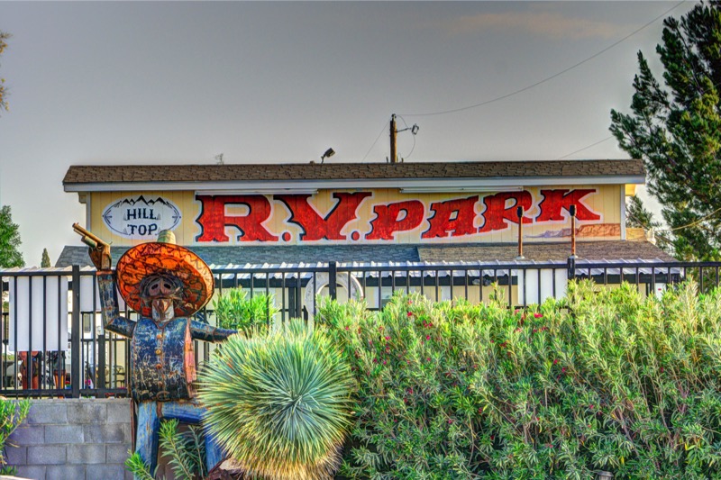
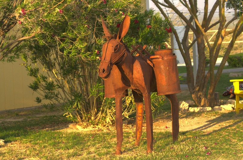
Hilltop RV Park, Fort Stockton
For one night, this was a good choice (I can’t imagine spending more than one night in Ft. Stockton, though). The place was well run and adorned with metal art throughout the park.

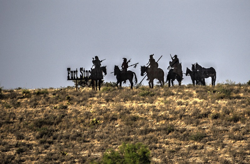
There was also a cool sign on a hill across from the campground.
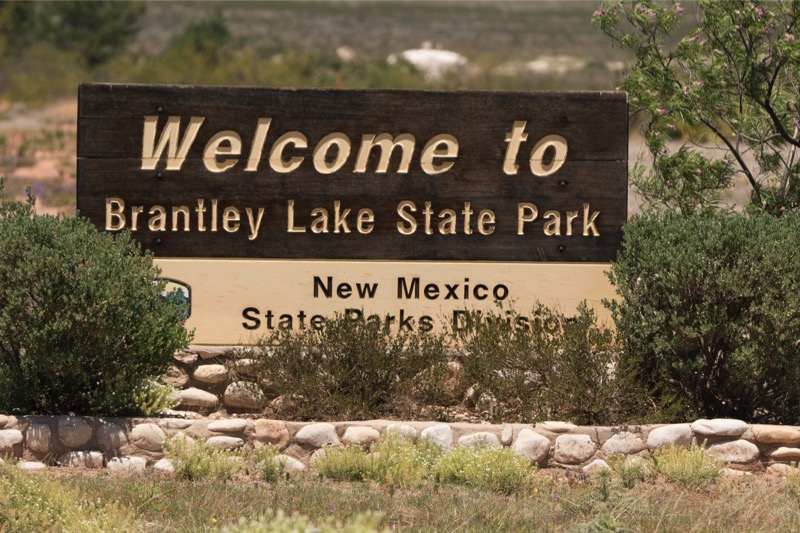
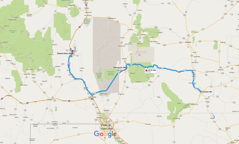
Brantley Lake State Park, Carlsbad, NM
From Stockton, we headed west on 285 all the way to the New Mexico border. The entire way through Texas the west wind whirled, sending streams of orange-ish red dust across a highway worn out by thousands of trucks, mostly hauling oil pipeline equipment and supplies. It seemed like every fifth truck was adorned with an “oversized load” sign on its grill with hunks of machines or metals or materials hanging over the side and out the rear. The trash on the side of the road reminded one of the littered streets in bad Detroit neighborhoods. Not pleasant. However, once we hit the state line, the road improved, the traffic lightened, and the roadside looked as New Mexico had a little more pride in appearances. We continued on 285 North through Carlsbad and up to our campsite in Brantley Lake State Park north of town.
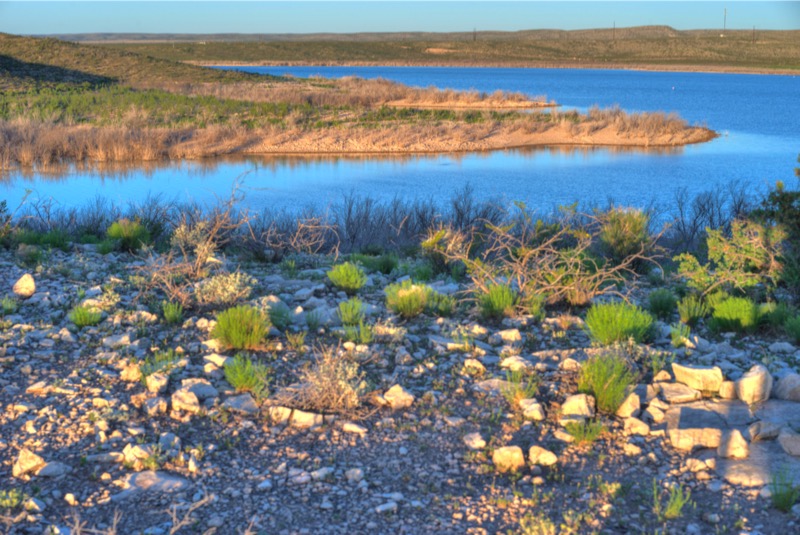
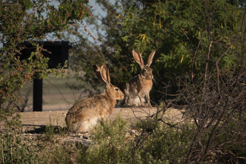
We thoroughly enjoyed this isolated area out in the desert of New Mexico. There were lots of bunnies and hundreds of those long-eared, long-legged Texas jack rabbits. Of course, Jack and Mitzy loved them.
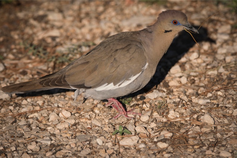
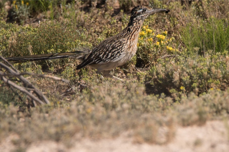
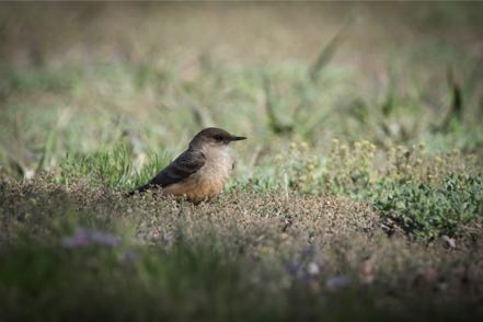
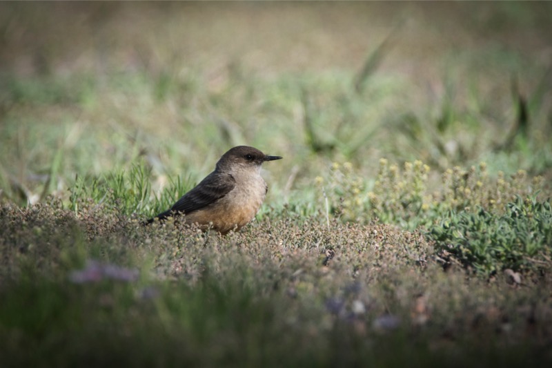
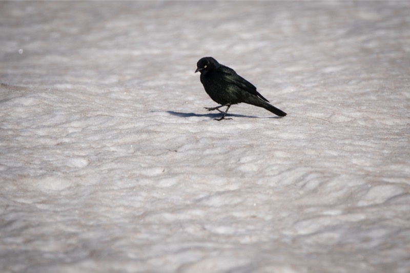
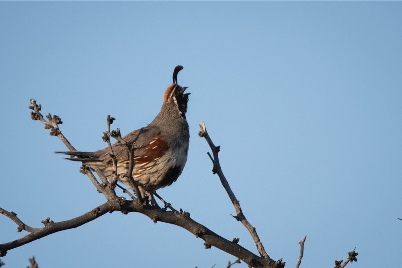
Along with other critters there were lots of scaled quail, mockingbirds, grackles, roadrunners, and lizards.
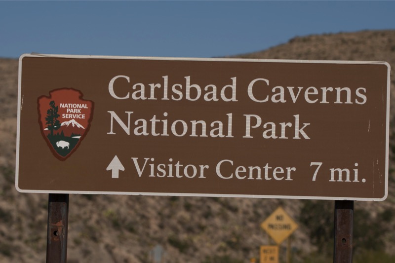
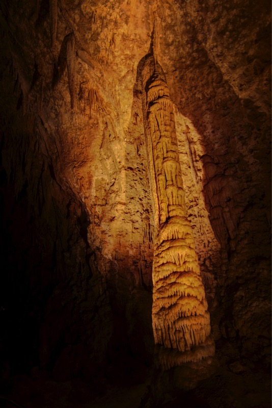
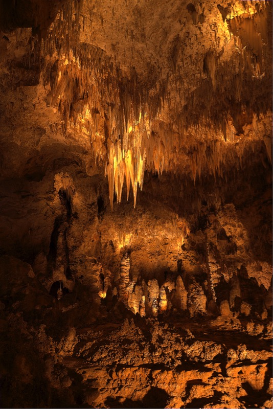
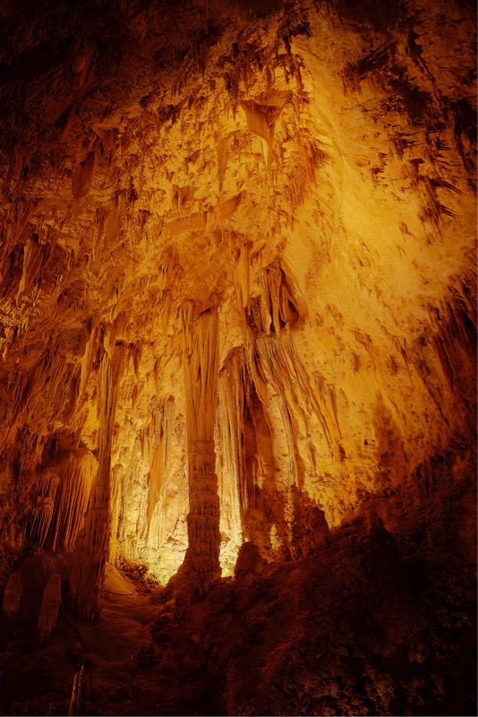
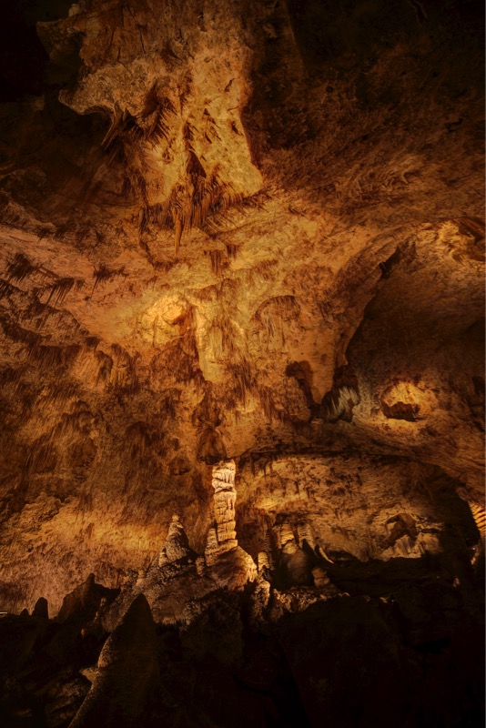
Carlsbad Caverns
Of course the most famous attraction in the Carlsbad area is the Carlsbad Caverns. Several years ago we wanted to tour them but arrived too late in the day. Last year I had put a plan together for Jan to drop me off for two hours while she and the Pups took the drive through the park (Jan is not crazy about caves). When I went to get my ticket, I was informed the elevators were broken. Yes, I could walk, but that would extend my visit to five hours. Hence, we put it off another year.
There was one upside though, Al Roker and an NBC camera crew was at the visitor center when we arrived. They were shooting sessions for their 100 Years of National Park series. Jan greeted Al, and he responded with a big smile, and I spent some time talking to the crew.
This year, however, I learned from my past mistake—like a senior checking out final exam results, I monitored the NPS Carlsbad Caverns website daily to make sure that all was a go. I learned that elevator maintenance was planned for the days prior to my trip, so no worries. However, the night before, I found that the maintenance had been extended one day! Oh, brother—I thought I was jinxed.
Luckily, we had a little flexibility in our schedule so I set back my trip one day.
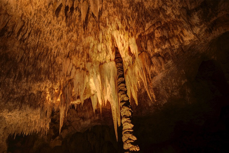
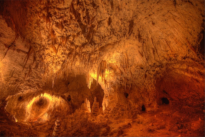
I arrive 8:26 a.m., got my ticket, and at 8:29 I was in line for the first elevator (8:30) to take me to the Big Room, 850 feet below. A cool thing for me was, unlike most caves, they did not require being chaperoned in a tour group, and you could not only take pictures but also use a tripod. I spent two hours walking and photographing this immense cave, only seeing a few people along the way. Crazy impressive. Here a few shots.


Note to future visitors of the caverns: Go early. When I exited the caves, people where in long lines to get in. There were six buses parked with hundreds of school kids streaming, screaming, and scampering to take the tours.
Can’t Pass a Food Truck
Jan and I love food truck cuisine, especially Southwest food truck cuisine. We stop as much as we can. On my return to camp, I stopped at the La Patrona food truck to bring home their special burrito and a torta for our lunch. We sat outside, alert pups at our feet, desert before us, and tasting some of the best food in the world. It just doesn’t get any better.
Old Trucks
Here are two old trucks from the Old Truck Reserve.

See you soon.
Travel Blog 259: Day Trips and Early Morning Jaunts
Leaving Elephant Butte State Park, we travelled 148 miles north on I-25 to our American RV Park destination just east of Albuquerque. Nice, easy trip.
Side Trip to Sandia Peaks
After settling in we left the 5,000-or-so-foot altitude of Albuquerque and wound our way up to 8,500 feet at Sandia Peaks in the Cibola Forest. As the altitude rose, the temperature dropped, changing our mind about doing a hike at the top. Comfortable drive with great scenery.
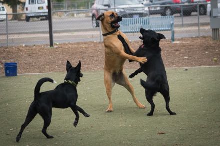
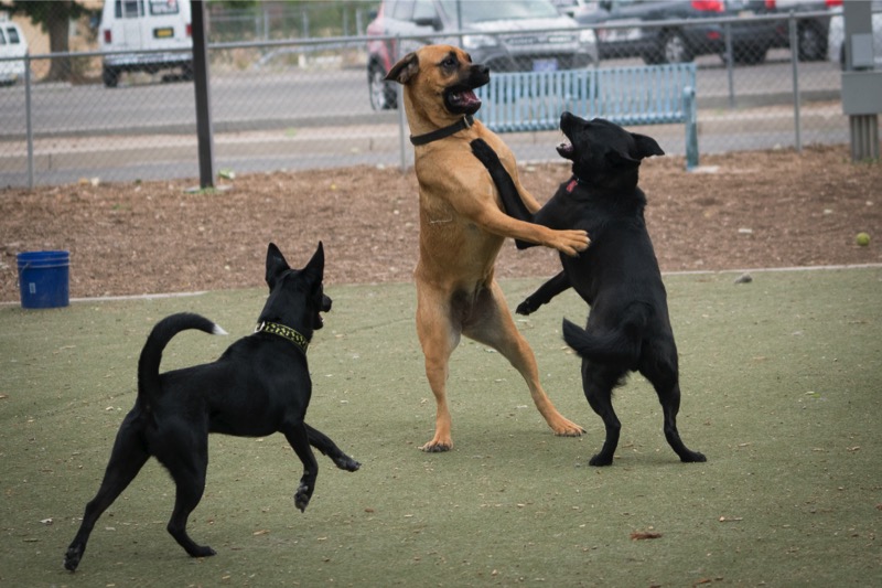
Dog Park
In our continued attempt to socialize our new pup Jackson (aka Captain Jack Black) we took him to the dog park where he quickly learned the rules of multiple canine behavior. Here is a pic of Jack (lower left) learning it is sometimes better to observe than to be actually engaged.

Quick Trip to Chicago
I made a quick trip to Chicago to facilitate a workshop, lead a panel, and give a keynote speech at a symposium. Great group of people and lots of fun. Chance to talk and catch up with folks I’ve known for decades. Hope to do it again next year.
Day Trip
After returning from my work trip, we had one full day before heading out. We loaded up and did a three-mile, high-desert hike at Petroglyphs National Monument. During our trek we saw a brightly colored roadrunner pass and numerous, really big jackrabbits. In fact, one looked about the size of a Great Dane--before I fully recognized that the creature coming at us wasn’t a big coyote, I was chastising myself for not bringing pepper spray!
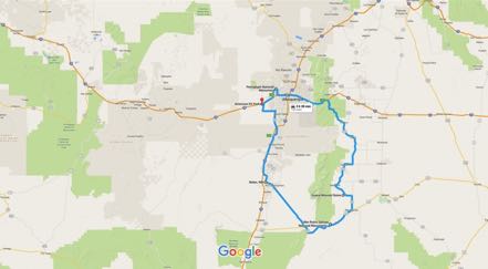
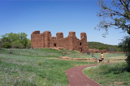
From there we decided to take the Abo Pass Trail that followed the Salt Missions Trail Scenic Byway for around seventy miles. It follows old trade routes and rail beds through the center of New Mexico. So from I-40 East we took 387 South through Escabosa and Chilili. We picked up 55 South and went through Tajique and Manzano to our first stop--the Quarai Mission Ruins just outside Mountain.
With the pups we walked around and through what was left of the old Spanish mission from the 1600s. From there we continued southwest on 60, going through the spot on the map marked Abo to the Abo Ruins Salinas National Monument Historical Marker, another interesting site along the mission trail. From there we picked up 47 headed north, diagonaled over at Los Lunas to I-25 and then I-40, ending our 150-mile loop.
On to Antonitos
After our good stay at Albuquerque, we took I-40 West to I-25 North. About 20 miles from Santa Fe, Jan said, “Today is the Santa Fe Farmer’s Market!” This is no ordinary farmer’s market--the chili selection is celestial, the baked bread is off the planet, and the cheeses are made just south of Heaven. After a two-minute conversation, we decided to make this detour. Salivary glands had already engaged, and I could taste the bread and cheese for our mobile lunch. We got off US 285, no problem as we knew where to go…however, finding a place to park our 62 feet of motor-home-plus-car turned out to be challenging. We found a space within a couple of blocks of the market, but it took up six parking spaces, and I quickly calculated the possible fine this might bring and suggested we postpone our visit. Reluctantly, we pulled out, got back on 285, and continued north through New Mexico.
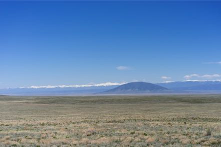
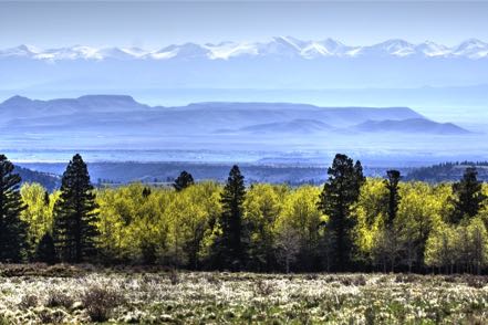
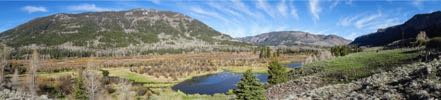
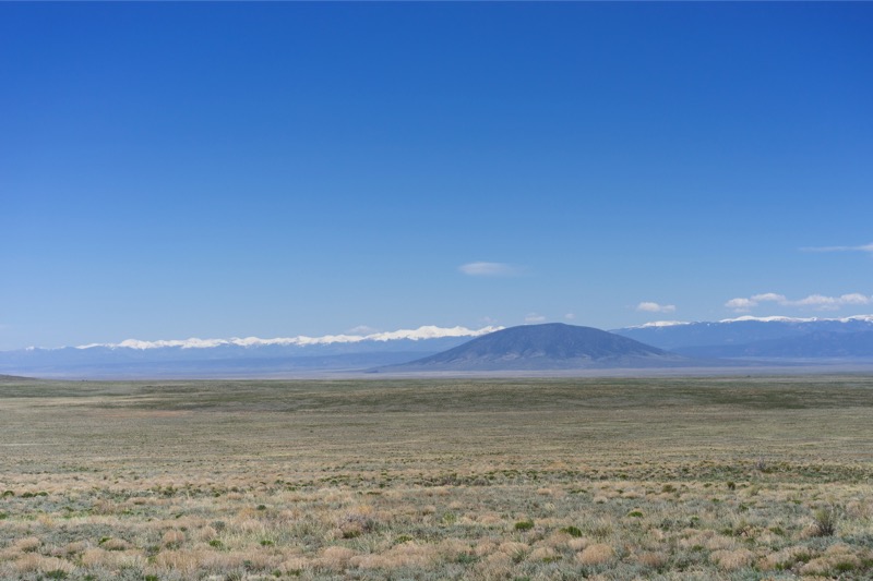
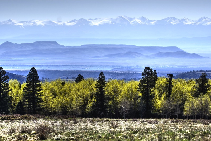
About 50 miles from the Colorado border with a perfect high-60s temperature, sunny skies, and light traffic, the hills and snow-topped mountains surrounded us, taking in 270 degrees of our view. Absolutely inspiring vistas.

Conejos River RV Park
Six miles after crossing into Colorado, we turned west on Colorado 17 at the village of Antonito for the 12 miles to our Conejos River RV Park. At 8,500 feet of elevation, the air was naturally thinner, but so was the fly and mosquito population. This park had just opened May 1, and very few souls were in the camp that bordered the Conejos River and was within six miles from two national forests.
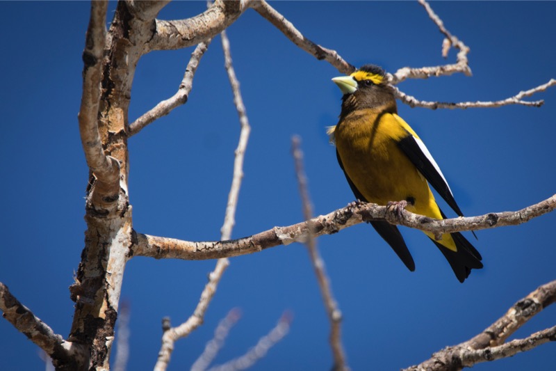
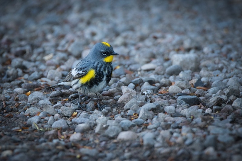
Over our three days at this campground we saw scores of birds of many shapes and variety: bluebirds, several kinds of finches, Western Tanagers. Great people, great vistas, and wonderful solitude when you wanted it.

Early Morning Jaunt
Before sunrise on day one of our stay, we drove up Forest Road 101 into the Rio Grande National Forest. Alone on the dirt road we saw deer and a nice size herd of good-looking elk.
Another Early Morning Jaunt
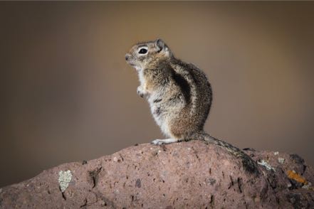
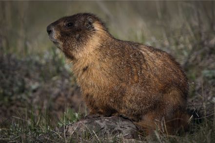
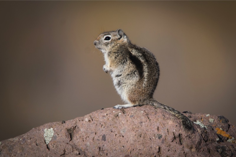
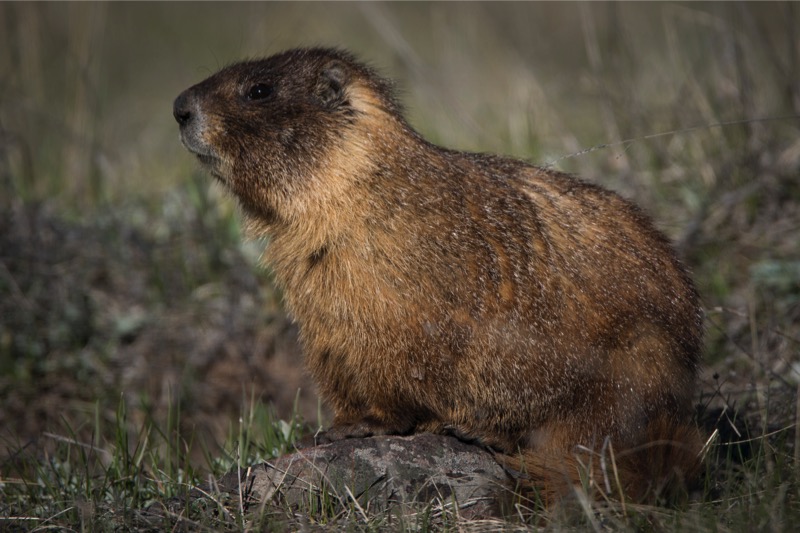
With the temperature just over 30 degrees on day two, we headed west on Colorado 17, then headed northwest at the town of Horca, and were again moving into the Rio Grande National Forest on Forest Road 250. This dirt road paralleled the Conejo River high in its banks. We again saw deer and elk, prairie dogs, yellow-bellied marmots, desert bighorn sheep, chipmunks on every rock (well, almost every rock), a coyote, and scores of hummingbirds feeding on the bushes by the road.
And Another Early Morning Jaunt
On our last morning, we were again up and out at 6:00 a.m. into the chilly but calm 30-degree morning. This time we headed east on 17, and then quickly turned south on Road D.5, which led us into the Rio Grande Forest of Forest Road 103 that paralleled Big Horn Creek southwest into New Mexico and the Carson National Forest. We wound through forests of Ponderosa Pine laced with trees just starting to bud. In the distance we saw several herds of elk, obviously skittish of hunters. We saw pronghorn along the way and deer, and of course, more chippers. After passing Sublette, Toltec, and Osier Mountains, we came to the end of the road, Osier, at 9,624 feet. It is the watering station for the Cumbres and Toltec Scenic Railroad. At this wayside along the mountain we ran across a marmot sentinel, who was not happy about our arrival. Standing erect as a Queen’s guard on his rock pile, he loudly told me that I did not belong there.
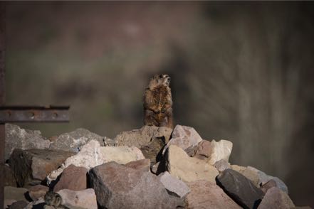
The railroad water tank was continually dripping and the whole locale was thick with swallows. In hopes it might connect with Highway 17, we took a narrow, steep, muddy path but it ended at the Rio de Los Pinos, much too deep to cross (six feet of fast-moving water). So we retraced our journey with mountain, valley, stream, and forest views along the way. During our three-hour trip, we saw only one vehicle and one person. Here are a few pics from the early morning jaunts.


Side Trip to Sandia Peaks
After settling in we left the 5,000-or-so-foot altitude of Albuquerque and wound our way up to 8,500 feet at Sandia Peaks in the Cibola Forest. As the altitude rose, the temperature dropped, changing our mind about doing a hike at the top. Comfortable drive with great scenery.
Dog Park
In our continued attempt to socialize our new pup Jackson (aka Captain Jack Black) we took him to the dog park where he quickly learned the rules of multiple canine behavior. Here is a pic of Jack (lower left) learning it is sometimes better to observe than to be actually engaged.
Quick Trip to Chicago
I made a quick trip to Chicago to facilitate a workshop, lead a panel, and give a keynote speech at a symposium. Great group of people and lots of fun. Chance to talk and catch up with folks I’ve known for decades. Hope to do it again next year.
Day Trip
After returning from my work trip, we had one full day before heading out. We loaded up and did a three-mile, high-desert hike at Petroglyphs National Monument. During our trek we saw a brightly colored roadrunner pass and numerous, really big jackrabbits. In fact, one looked about the size of a Great Dane--before I fully recognized that the creature coming at us wasn’t a big coyote, I was chastising myself for not bringing pepper spray!

From there we decided to take the Abo Pass Trail that followed the Salt Missions Trail Scenic Byway for around seventy miles. It follows old trade routes and rail beds through the center of New Mexico. So from I-40 East we took 387 South through Escabosa and Chilili. We picked up 55 South and went through Tajique and Manzano to our first stop--the Quarai Mission Ruins just outside Mountain.
With the pups we walked around and through what was left of the old Spanish mission from the 1600s. From there we continued southwest on 60, going through the spot on the map marked Abo to the Abo Ruins Salinas National Monument Historical Marker, another interesting site along the mission trail. From there we picked up 47 headed north, diagonaled over at Los Lunas to I-25 and then I-40, ending our 150-mile loop.

On to Antonitos
After our good stay at Albuquerque, we took I-40 West to I-25 North. About 20 miles from Santa Fe, Jan said, “Today is the Santa Fe Farmer’s Market!” This is no ordinary farmer’s market--the chili selection is celestial, the baked bread is off the planet, and the cheeses are made just south of Heaven. After a two-minute conversation, we decided to make this detour. Salivary glands had already engaged, and I could taste the bread and cheese for our mobile lunch. We got off US 285, no problem as we knew where to go…however, finding a place to park our 62 feet of motor-home-plus-car turned out to be challenging. We found a space within a couple of blocks of the market, but it took up six parking spaces, and I quickly calculated the possible fine this might bring and suggested we postpone our visit. Reluctantly, we pulled out, got back on 285, and continued north through New Mexico.

About 50 miles from the Colorado border with a perfect high-60s temperature, sunny skies, and light traffic, the hills and snow-topped mountains surrounded us, taking in 270 degrees of our view. Absolutely inspiring vistas.
Conejos River RV Park
Six miles after crossing into Colorado, we turned west on Colorado 17 at the village of Antonito for the 12 miles to our Conejos River RV Park. At 8,500 feet of elevation, the air was naturally thinner, but so was the fly and mosquito population. This park had just opened May 1, and very few souls were in the camp that bordered the Conejos River and was within six miles from two national forests.
Over our three days at this campground we saw scores of birds of many shapes and variety: bluebirds, several kinds of finches, Western Tanagers. Great people, great vistas, and wonderful solitude when you wanted it.

Early Morning Jaunt
Before sunrise on day one of our stay, we drove up Forest Road 101 into the Rio Grande National Forest. Alone on the dirt road we saw deer and a nice size herd of good-looking elk.
Another Early Morning Jaunt
With the temperature just over 30 degrees on day two, we headed west on Colorado 17, then headed northwest at the town of Horca, and were again moving into the Rio Grande National Forest on Forest Road 250. This dirt road paralleled the Conejo River high in its banks. We again saw deer and elk, prairie dogs, yellow-bellied marmots, desert bighorn sheep, chipmunks on every rock (well, almost every rock), a coyote, and scores of hummingbirds feeding on the bushes by the road.
And Another Early Morning Jaunt
On our last morning, we were again up and out at 6:00 a.m. into the chilly but calm 30-degree morning. This time we headed east on 17, and then quickly turned south on Road D.5, which led us into the Rio Grande Forest of Forest Road 103 that paralleled Big Horn Creek southwest into New Mexico and the Carson National Forest. We wound through forests of Ponderosa Pine laced with trees just starting to bud. In the distance we saw several herds of elk, obviously skittish of hunters. We saw pronghorn along the way and deer, and of course, more chippers. After passing Sublette, Toltec, and Osier Mountains, we came to the end of the road, Osier, at 9,624 feet. It is the watering station for the Cumbres and Toltec Scenic Railroad. At this wayside along the mountain we ran across a marmot sentinel, who was not happy about our arrival. Standing erect as a Queen’s guard on his rock pile, he loudly told me that I did not belong there.

The railroad water tank was continually dripping and the whole locale was thick with swallows. In hopes it might connect with Highway 17, we took a narrow, steep, muddy path but it ended at the Rio de Los Pinos, much too deep to cross (six feet of fast-moving water). So we retraced our journey with mountain, valley, stream, and forest views along the way. During our three-hour trip, we saw only one vehicle and one person. Here are a few pics from the early morning jaunts.


Travel Blog 258: White Dunes, Brown Sand, Black Jack
We left the Carlsbad KOA and headed out on 285 North to Artesia, took US 82 West through Mayville and Cloudcroft, and then headed on to Boot Hill RV Resort in Alamogordo. The last 26 miles of the 129-mile journey was traveling up, over, and down on a 6% slope through the Lincoln National Forest--beautiful drive. The temperature went from hot to mild to warm all in a three-hour span. We set up camp at Boot Hill RV Resort on the outskirts of Alamogordo.
White Sands National Monument
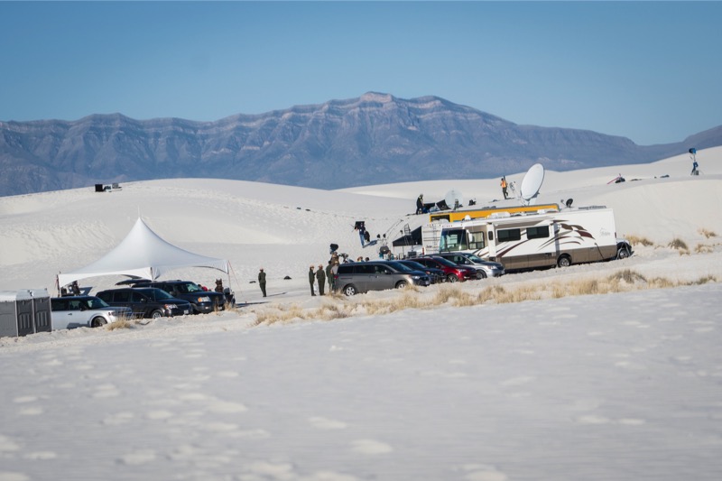
We timed our 25-minute drive from Boot Hill to arrive precisely at 7:00 a.m. when the gate to the park drive opened. We drove about two-thirds of the way into the dunes finding just the right spot. We all got out of the car, walked around a series of dunes, then let dogs do what they love to do—run like maniacs in the sand.
Mitzy enjoyed it but Jackson totally loved it, sprinting like a possessed thoroughbred, he leapt, raced, cornered, turned up, and ran down the white dunes for at least 15 minutes full out. Eyes bugging, tongue dragging, his legs pumped like the pistons of a drag racer in high gear…just a pleasure to watch.
It was interesting, though, at this early hour we heard loud voices and laughter not far away--we assumed it was a large family gathering or a big group get together. However, we were wrong…atop some large dunes was a video set-up complete with satellite uplinks, big camera crews, and thirty or more people standing around. Al Roker, Matt Lauer, and their support team had just completed another video shoot on the National Parks! Maybe we will see them again soon.
Elephant Butte
We took 70 West to I-25 North to camp at Elephant Butte Lakes State Park. Elephant Butte boasts the largest lake in New Mexico and they have beautiful campgrounds that overlook the water.
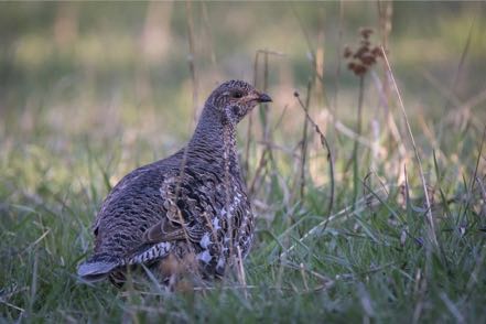
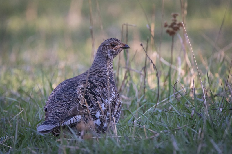
Critters
The campground supports lots of critters with many rabbits (including the big, long-eared jackrabbits), a few squirrels, lots of doves, wrens, Bullock orioles and numerous coveys of Gambel’s quail--a beautiful bird. I was fortunate to capture one calling a few minutes after dawn.

The Beach
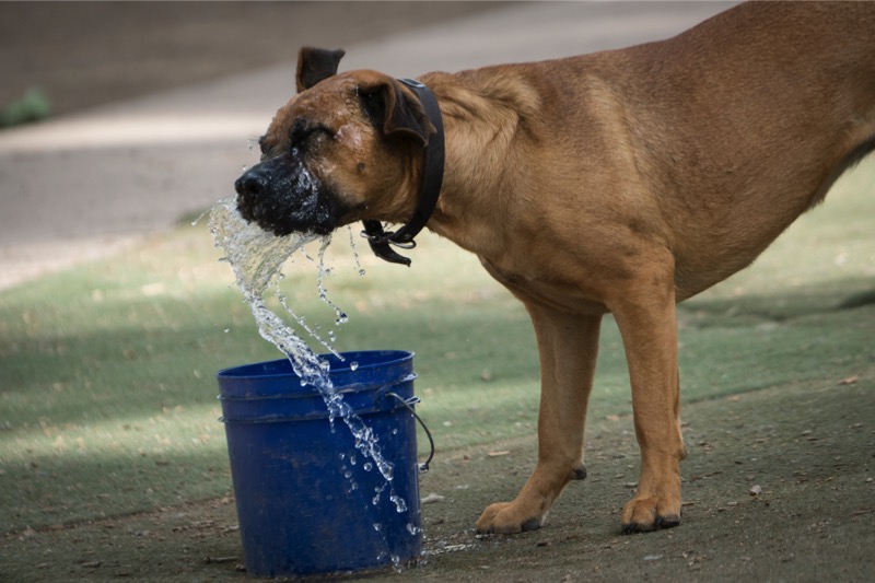
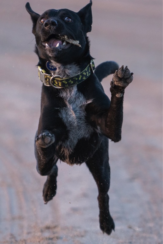
However, everyone’s favorite campground activity was our morning walk on the beach. Every day we arrived before dawn and walked along the water. The brown sand between Jack’s toes acted like a volt of electricity, turning the mild-mannered pup into a wild-eyed canine. Here is a shot of Black Jack in full action.
Great stay…we will come back here again.
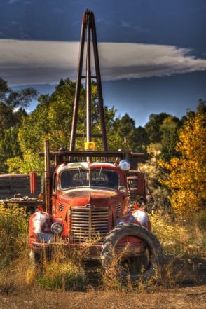
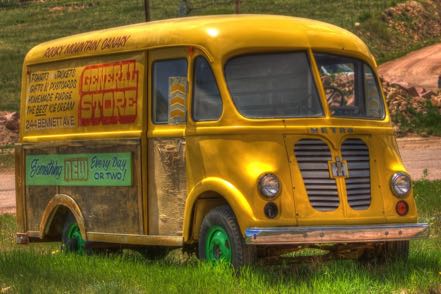
Blog 214: Most Awesome-ist Old Truck Day Ever!
Sunday was our last full day in Trinidad, Colorado, and we took full advantage of this fruitful location. As we headed out in our Jeep mid-morning, you could smell the rust and peeling paint from old trucks as they waited to be discovered, and discovered them we did. We hunted, located, and shot 67 trucks in just one day! It doesn’t get much better than this for an Old Truck Photographer, his Trusted Assistant, and two Canine Colleagues.
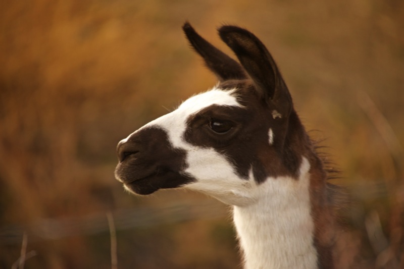
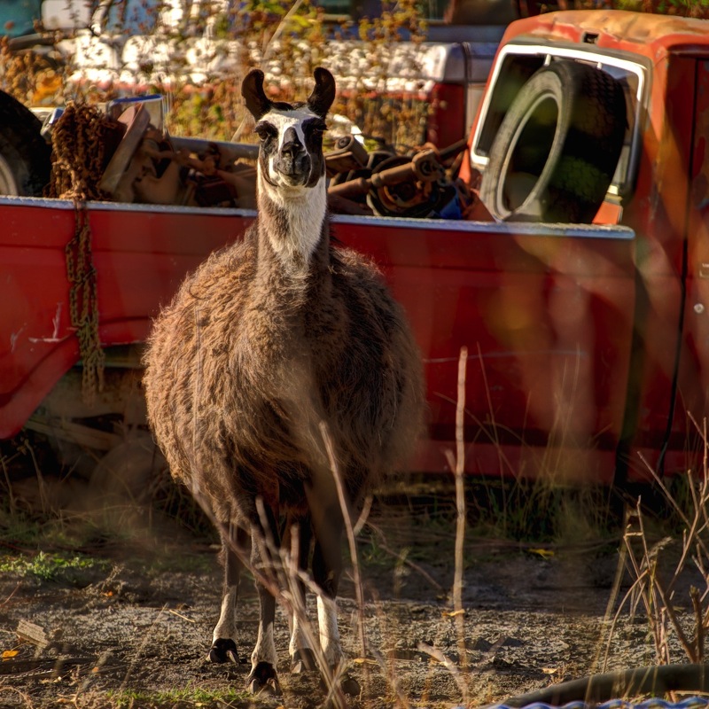
Of course, this profession does not come without peril, as this pic demonstrates.
Furthermore, athletic prowess is sometimes required to get the shot. Here are a couple shots of a llama “guarding” a junkyard--I took these and others standing up through the sky roof of our Jeep handholding a 500mm lens while Jan drove (slowly) forward.


Note: I put most of those pics in my Old Truck Reserve to be parceled out in future blogs, as the old truck hunting is not the best in some of the places we frequent.
On to Taos
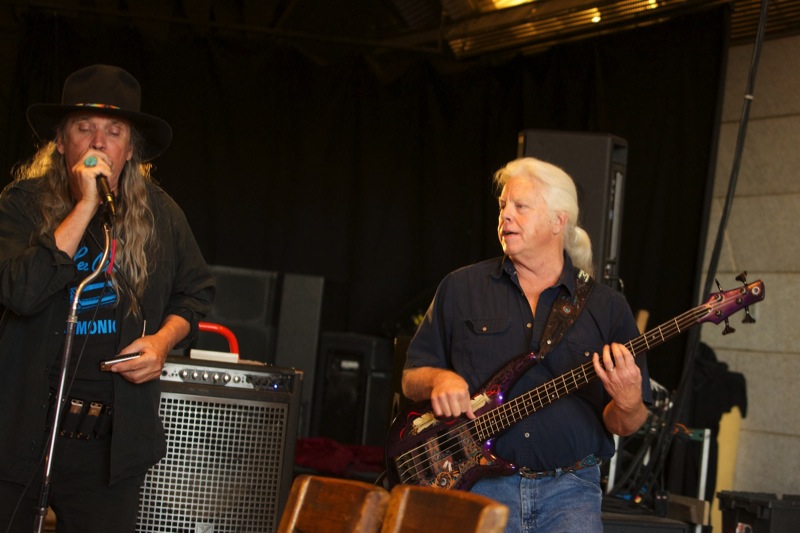
Midday Monday we packed up and headed out south on I-25 taking Highway 64 westerly across the plains and through the zig-zaggy route of the Santa Fe National Forest. Our campground was located on the west side of Taos, conveniently located about a mile from the Taos Brewing Company. We stopped by a couple of late afternoons and here are a few pics.


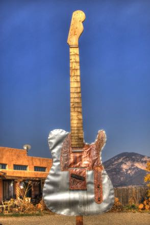
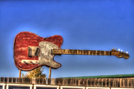
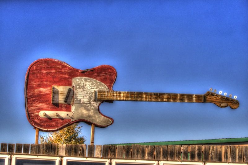
Guitar Signs
Just a half mile away in the opposite direction of the brewery was a guitar manufacturer. Here are a couple of fun signs outside the business.
Day Trips
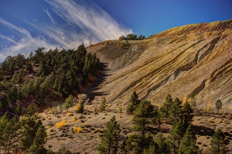
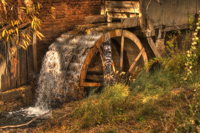
One afternoon we drove the “Enchanted Circle,” driving an 84-mile loop through Questa, Red River, Eagle Nest, and Angel Fire before returning to Taos. Another day we drove 79 miles down and back to the historic town of Las Vegas, New Mexico. Here is a scenic shot by the side of a road, an old mill, and a fun/sad sign hanging from a very old building in the town of Mora.


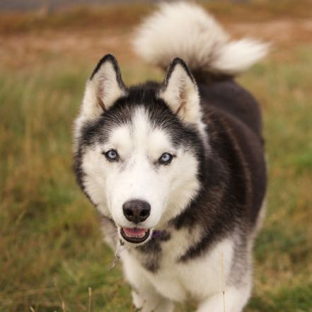
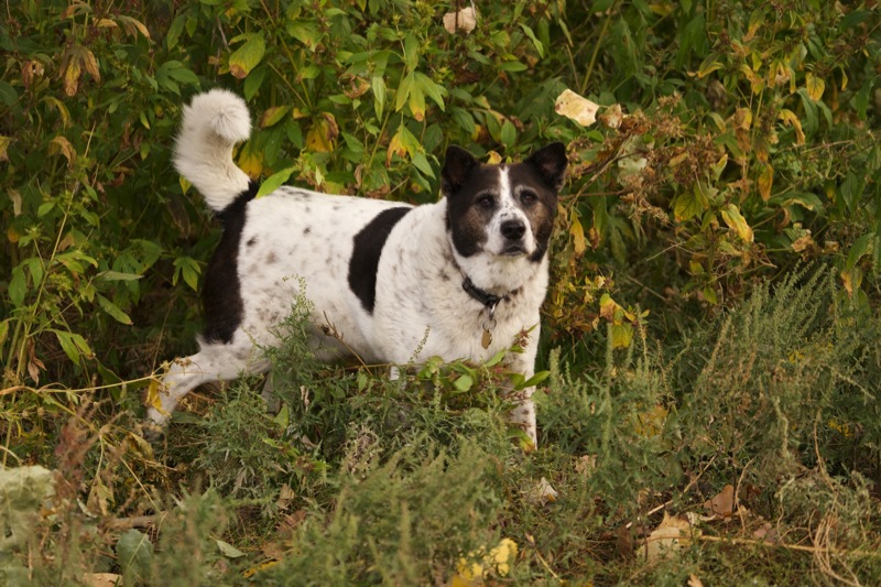
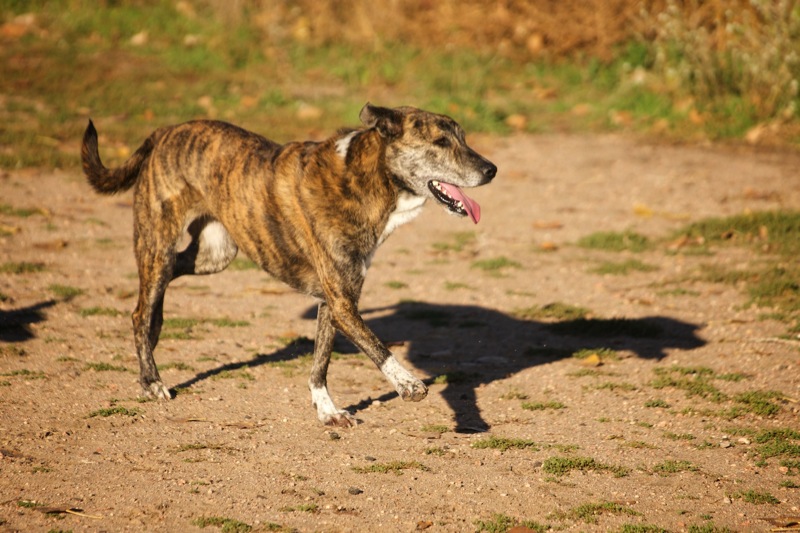
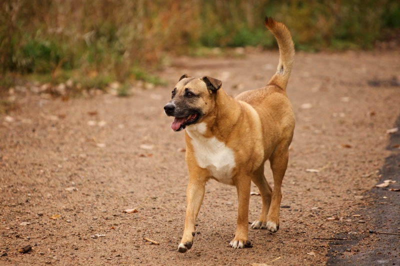
More Pups
Here are four more pup pics from the Denver bark park.


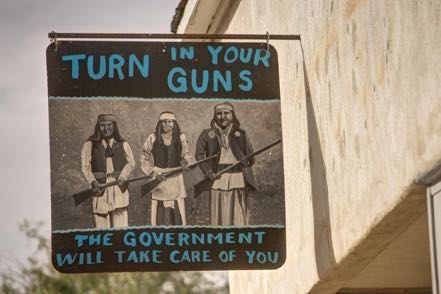
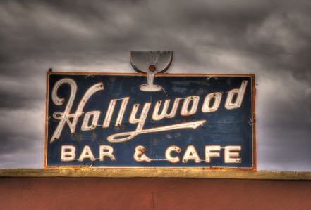
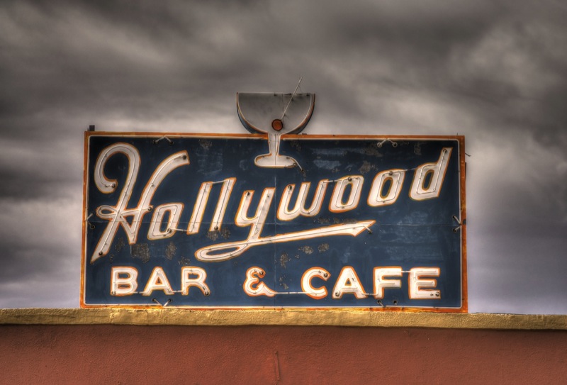
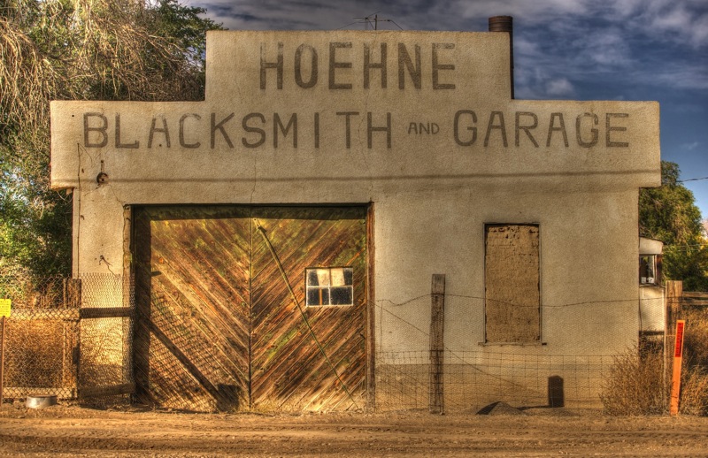
Old Sign
Here are two old signs.

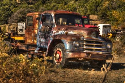
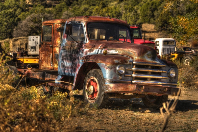
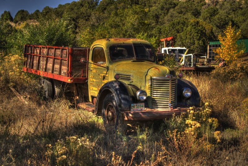
Old Trucks
Here are four old trucks.

See you next week!
Of course, this profession does not come without peril, as this pic demonstrates.

Furthermore, athletic prowess is sometimes required to get the shot. Here are a couple shots of a llama “guarding” a junkyard--I took these and others standing up through the sky roof of our Jeep handholding a 500mm lens while Jan drove (slowly) forward.
Note: I put most of those pics in my Old Truck Reserve to be parceled out in future blogs, as the old truck hunting is not the best in some of the places we frequent.
On to Taos
Midday Monday we packed up and headed out south on I-25 taking Highway 64 westerly across the plains and through the zig-zaggy route of the Santa Fe National Forest. Our campground was located on the west side of Taos, conveniently located about a mile from the Taos Brewing Company. We stopped by a couple of late afternoons and here are a few pics.

Guitar Signs
Just a half mile away in the opposite direction of the brewery was a guitar manufacturer. Here are a couple of fun signs outside the business.

Day Trips
One afternoon we drove the “Enchanted Circle,” driving an 84-mile loop through Questa, Red River, Eagle Nest, and Angel Fire before returning to Taos. Another day we drove 79 miles down and back to the historic town of Las Vegas, New Mexico. Here is a scenic shot by the side of a road, an old mill, and a fun/sad sign hanging from a very old building in the town of Mora.

More Pups
Here are four more pup pics from the Denver bark park.

Old Sign
Here are two old signs.
Old Trucks
Here are four old trucks.

See you next week!